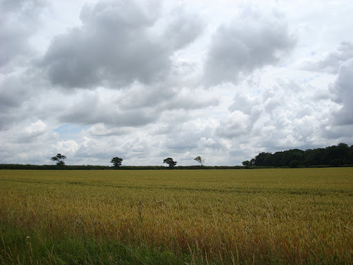
Friday, July 31, 2009

Getting Back Into the Zone - well cycling in the wet!

As I said in my last post - the change in weather, from sunny and summery to changeable, showery, blustery and colder has dampened my cycling enthusiasm. Finally after 3 days on non-cycling I resolved to pop out around the Fens. It was not too warm and shower after shower was sweeping through. The last picture taken whilst cycling before this ride was at the weekend - it must be getting frustrating for the farmers as "Combining" is not possible when the weather is too wet. My son has been on stand-by over the last few weekends but each time it has been too wet to go out and harvest. So here is one Farmer making the best of a slightly less wet weekend.


DSC09303.JPG


In order to get myself out on the bike despite the weather I ended up putting a once rain-proof cycling jacket and leggings over my Lycra! I did not take my waterproof cycling boots though - I stuck with my cycling sandals. Getting wet was an unpleasant prospect when I set off although it was warm enough not to mind rain on my feet. The clouds were dark in the skies and as I reached the outskirts of the Fens there were very few blue gaps in the clouds. The was on the left as I cycled out.


DSC09307.JPG


This was on the right and I was heading out towards the pylons just where it was darkest.


DSC09309.JPG


It did rain and it rained hard, but as is normally the case once you it starts it is not really that bad - with my leggings and coat on I was, if anything, slightly too warm - but enjoying being out in the fresh air. The clouds were still there but not quite as dark - although it looked gloomy everywhere I looked.


DSC09312.JPG


Mind you a few miles further along the rain stopped and then some blue patches appeared in the sky and before you know it the blue patches outnumber the cloudy patches.


DSC09325.JPG


By the time I had cycled through Wicken Fen it was starting to get warm in the sun and I had to stop and take of my waterproof leggings - the warmth of the sun on my legs was wonderful - it is amazing how fast the weather went from being rainy and blustery to glorious warm sunshine. At the rate it was going I would have to stop and put on some suntan lotion as well.


DSC09331.JPG


The evidence of recent rain was everywhere though - in parts of Wicken Fen the track is a mud track and quite slippery after the rain. There were loads of puddles along the Fen roads - as the Fens shrink because of the peat drying out it causes the roads to undulate and water collects in the smaller dips - quite nice for splashing through though as the puddle water is warm from sitting on the tarmac road. Here by one of the Lodes is more evidence of recent rain.


DSC09338.JPG


Mind you easy come easy go, just as it did not take long for the clouds to disappear it did not take to long for new clouds to appear. The very unpredictability of the rain means that the farmers must set up irrigation for some of the crops as they cannot depend upon the showers which can be quite local. Here is what smelt like and onion field (but could be leaks) being irrigated. There were two of these jets pumping water out.


DSC09356.JPG


Yes there were a few drops of rain before I got home. The clouds in the foreground of this picture made sure I had not escaped all of the rain. Mind you I got home thoroughly refreshed after a few hours cycling - I know I always return from a trip wondering why on earth I was so reluctant to go out. I must remember that feeling and bottle it later. I think this is similar to Mark Beaumont's point about needing to be in the zone. Mind you he was having to cycle around 100miles/160Km a day - day after day which takes more than just popping out for 30miles/50Km at the end of an afternoon. Cycling is a very simple, almost pure activity though - which is I guess what "drives" me to cycle.

More Book Reviews - "Boy Racer" and the "Man Who Cycled the World"

The changeable weather is taking its toll on my cycling - I'm finding it easier to make excuses not to go out. I think it is a combination of the rain, colder temperatures, blustery wind and the sheer disappointment if the promised BBQ Summer here in the UK turns out to be a damp squib. It does seem as if the folks at the Meteorological Office are back-tracking on their original predictions.


I am not a racer, I enjoy social cycling but have never really been that interested in either watching or participating in competitive cycling. A few years ago they held a Kellogs-sponsored cycle race around the streets of Cambridge which was fun to watch though and I do like to keep up with Le Tour. It annoys me how little coverage you get on the Television or in Newspapers on the race - but with the Internet I found that the Yahoo coverage had a moving graphic showing where the breaks/peloton were which you could leave open as a browser window whilst "working".


I enjoyed the Tour this year, partly because of the Armstrong drama, but also because a couple of Brits did remarkably well. Despite Armstrong not winning I think it was pretty amazing to come third. I also liked Mark Cavendish's approach - he ended up winning 6 stages of the race and does seem to be a pretty awesome sprinter. I also liked the fact that he spoke like a sprinter - letting all the motion out before coming back and apologising. In the end I bought his book - Boy Racer. It was a good book to so close to the Tour and gives an interesting insight to what it takes, both to be a racer but perhaps also what sets Sprinters apart from the other cyclists.


DSC09370.JPG


One of the cycle authors who has inspired me is Josie Dew - and when I bought this book - "The Man Who Cycled the World" I had assumed that it would be similar. In some senses there are similarities in terms of the almost single-mindedness that long-distance cyclists need to have. It seems also that whilst in the main there are many kind people out there willing to helped a cycling stranger there are some not so kind people. Both Josie Dew and Mark Cavendish had to deal with some unsavoury people.


The difference with this book (compared with Josie's travels) is that Mark Beaumont was also in a race - a race to cycle around the world faster than the existing holder of the record. I remember reading snippets of Mark's travels in the press when he was actually doing the race - so I knew the outcome, however I found the book almost compulsive reading. It gave a fascinating insight into his motivation, but more importantly the methods he used to get into the zone. Indeed both Marks highlight the need to focus almost selfishly to achieve their goals. I thoroughly enjoy cycling in other parts of the world for the pleasure of seeing new sights, meeting new people and challenging myself - however Mark B went way beyond and had to drive himself though inhospitable, uncharitable places in his attempt.


For those interested in mark B's current adventures check out this BBC web page - he is cycling from the top of North America to the bottom of South America - 15,000 miles.


DSC09369.JPG


I thoroughly enjoyed both books - because of the insights into the authors. I also understood the challenges Mark B describes of getting into the "zone" in order to ride mile after mile day after day. with the change in the weather I have been cycling less, partly work, but mainly I fell out of my "zone". Yet yesterday when I forced myself on a cycle ride out in the rain I returned exhilarated wondering what was stopping me from getting out there.

Thursday, July 23, 2009

Beer, Books and CDs

As I mention in my profile I like to read, listen to music and drink beer, although not precisely all at the same time. I find there is too much potential for spillage if I do not pay attention to the drinking bit. I do tend to listen to my MP3 player when cycling - I know that there are people who frown upon such a dangerous thing to do. However I would imagine that many of those no-sayers are motorists who frankly are trying to off-load their responsibility for scaring cyclists off the road. It is a form of risk compensation by proxy. They implicitly believe that cyclists need to do anything and everything so that they can carry on driving their lethal machines without any guilt. Of course they must be allowed to listen to the radio and CDs in the car and woe betide the suggestion that they should not be allowed to hold hands-free telephone conversations. Mind you I do find that there are quite a few motorists who don't bother with the hands-free bit when having a phone conversation whilst driving.


I think that many motorists just do not realise how noisy and unpleasant the roads can be (for pedestrians and cyclists), as they sit in their air-conditioned, sound-insulated boxes. Even when listening to music it is pretty difficult not to hear a car whizz by, inches away. Just a couple of days ago several major accidents in the region caused a lot of traffic to be re-routed along some lesser roads. So what was normally quite a pleasant cycle ride became anything but. I turned off as soon as possible but not before an articulated lorry passed me with around 6 inches to spare. I am not sure if he/she saw my gesticulations in his mirrors but I was both really shocked and angry that he was willing to gamble with my life. We all get annoyed when delayed in traffic and I know that lorry drivers have restrictions on the hours they can drive in a day, but still none of that excuses murder - which in my mind is what it would be.


So time to lighten up a bit and to review some of most recent CDs. I am still of the old school and prefer to buy a CD and then rip it rather than buy music through a download service. I have used iTunes and Amazon but I like to certainty that if my computer crashes I can still play my CD - though I almost never do play CDs. I listen through an Amp which has an Ethernet connection or my desktop when in the house.


My tastes are fairly eclectic, code for disorganised. I have recently bought Far - Regina Spektor, It's Blitz - Yeah Yeah Yeahs, Lungs - Florence and the Machine and Horehound - The Dead Weather. Once again Regina Spektor delivers a great album, some might think her kooky, but for me she had a wonderful voice, way with words and tunes. This sounded fantastic when listening and cycling the purity of her voice through earphones was superb- 5/5 Current favourite track - Dance Anthem of the 80's


Next up is Horehound from The Death Weather - yet another of Jack White's bands. This took a little time to grow on me - and it was not one of the longest albums, but powerful performances none the less. - 4/4


I've been waiting for Florence and the Machine album for a while - in fact before it had a title - a great first album, quite a range of tracks, which I like - 4/5


last but not least - It's Blitz from the Yeah Yeah Yeahs was better than I had expected. It was a CD that I found myself playing over and over - a lively CD - again good for cycling - not quite in the league of heavy metal which I think best goes with cycling but very good all the same. - 4/5


DSC09240.JPG


I am not really a great fan of Crime Fiction, I find it too formulaic. They are like Crossword puzzles for readers - throwing out clues along the way to invite the reader to solve them as a result I think that they miss out on the development of the story and the humanity within the story. I am not sure why I bought this one - it popped up on Amazon I think - in the end I bought it because it can be interesting to read foreign authors and to see if how that foreignness comes though. My brother lived in Sweden for quite a few years as well so as Stieg Larsson is Swedish and this is set in Sweden that was reason enough to overcome my Crime Thriller prejudice. I also like stories that develop over several books - these two books are part of a trilogy - the third is yet to be published.


Well all I can say is that this had story and humanity as well as being a Crime Thriller. I found myself constantly picking the book up to read some more - was really pleased that I had bought two of the three in the series so my reading was not interrupted . I will not say what happens - that's for the reader, but the second book ends on a "cliff" and I almost ordered the third book twice fortunately Amazon flagged up to let me know I had already pre-ordered the third at the same time as the first two. Roll on October.


DSC09237.JPG


As to beer - one of my favourite local watering holes is the Dyke's End at Reach. the food is excellent and I often find myself wanting several of the specials - they also have their own (draft) beer and there is nothing more delightful than sitting in their garden on a Summer lunchtime in the sun drinking beer and eating delicious food. Which brings me onto this beer - I find flavoured beers can be a bit pretentious but this stuff does what it says, a lovely summer beer with a lovely aroma and not too strong!


DSC09242.JPG


I've probably mentioned this one before, but I like Morland's Speckled Hen - I even had the glass to go with it - but after numerous cycles in the dish washer the glass gave up the ghost. Well they have a slightly darker, raisiny version called "Old Crafty Hen", quite strong but an excellent flavour.


DSC09243.JPG


As I sit here I am hoping that it is not going to rain it was sunny earlier but now I am thinking of a quick spin on my bike the clouds are darkening. (And no I have not had any beer.I did have a bit of a twinge in my back which for me is a sure sign of not enough cycling - that's my excuse anyway. Cycling on a properly set up bike is good for my back.


Monday, July 20, 2009

Paths and Clouds and Storms

One thing is for certain the weather has become much more uncertain recently. I have been writing a lecture that I am due to give shortly. The challenge I have is that I find it quite easy to create far more than I need and then spend ages agonising about what to cut out and how to sharpen the talk. As usual I also had to send the material over ahead of time so that the students can review it and be prepared. When I was ready to send my slides I realised that at 50Mb the file was too large for my email gateway - yes I know you think I would have realised sooner! Then we had some massive Thunderstorms and had a long power cut (about 5 hours). It is not unusual as quite a few of the power transmission lines in the Fens run overground and so are prone to lightening strikes. What made it worse was the fact that the storm seemed to hang around. Apparently the equipment can cope with a strike - but when several strikes occur in a short space of time it is almost impossible to deal with. We had several power glitches and then the power cut completely. Fortunately I had saved my presentation and my machine was backed up - but when power was restored I had problems getting it up and running again. Modern operating systems are a bit more resilient though and I was able to revert to a previous good state. Then I had to go through the recent Microsoft update again and of course re-update my anti-virus software.


The good thing was that I converted my slides to PDF which got the file size down to 6Mb which I was able to email.


In order to force myself to complete the slide set I have had to use the prospect of cycling as a treat to look forward on completion of the lecture and so have not been out much. The weather has changed quite a lot and heavy showers seem to be quite frequent - certainly there are more clouds in the sky and I have not had to bother with sun-tan lotion recently


When I did go out I headed for the Fens to get some peace and quiet. At first I thought this car was parked - but no it had broken down and obviously it just would not do to block the path of other cars on the road - much better to invade the foot/cycle path and leave a small gap.


DSC09151.JPG


Moaning over - I have been impressed with the signage and forewarning on White Fen Drove, one of the news paths through the Fens courtesy of the Millennium Fund. There is nothing like regressive taxation - but at least this is more accessible than Opera! This drove is a road that passes one farm and heads towards fields. Advance notice of roadworks were given well in advance and here are the before and after pictures. This one is actually a during picture - they pulverised the existing road.


DSC09158.JPG


This is the after picture. Not only did they lay a super smooth surface - just the sort of thing that cyclists love, they also apologised for the inconvenience.


DSC09175.JPG


Look at that for a great surface and see the Power Transmission pylons in the distance. Just before I took this picture I had to swerve to avoid a snake basking on the road in the sun. I was too busy avoiding it to notice what it was and by the time I stopped it had disappeared into the grass verge. I would guess either a slow worm or grass snake.


DSC09178.JPG


This is a view of the National Trust land that the White Fen Drove leads to. The cycle/waling path is to the right of the picture. They had been busy here as the grass had been cut short. .


DSC09160.JPG


My eye was caught by these balloons - which I had to check out in case there was a prize - no.


DSC09163.JPG


Not all the pictures were taken on the same day - but you get the picture - quite changeable weather.


DSC09190.JPG


The crops will soon be ready for harvesting. My son is currently on standby for weekend combining (as in Combine Harvester) duties although it has been a bit too wet of late.


DSC09154.JPG


Same bridge as before - just different clouds.


DSC09165.JPG


Every now and then the blue skies peep through - in this case over Ely Cathedral


DSC09179.JPG


But in the other direction they look just as menacing


DSC09185.JPG


On the way back I got caught in a torrential (for these parts) downpour. I passed quite a few cyclists in the same boat, metaphorically speaking that is. fortunately the rain was not cold and apart from washing sweat into my eyes, which makes them sting, it was quite refreshing cycling in the rain.

Thursday, July 9, 2009

Sustrans 11 Cambridge to Bishops Stortford and Back (with a bit of Sustrans 16)

I had to work over the weekend so decided to plan a slightly longer mid-week ride, a pity the weather is not so nice. Here you can see rain in the distance. The weather is not too cold though so I have generally been wearing shorts, sandals, t-shirt and a rainproof cycling jacket. It works well when the rain is heavy, but I do tend to get a bit too hot when there is no rain. Here you can see the rain clouds with rain in the distance - I got soaked several times on this journey.
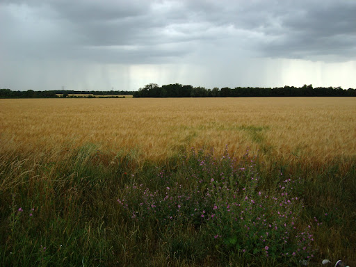

DSC09109.JPG


One of the great things about using the Garmin GPS is that it allows me to explore areas that I do not know, without the hassle of carrying maps. Normally I would plan a route without too many turns and yet would still end up frequently checking on the way with the map in my pocket. I have managed to lose my way quite a few times because stopping to check is a nuisance and the roads do not always look like they do on Google Maps!. The GPS allows me to quickly string a route together and even if I stray en-route from the plan it is quite easy to find my way back again it definitely makes longer exploratory cycle rides more pleasant.


The route I chose was to take Sustrans 11 down to Bishops Stortford and then take in interesting route I saw on the Sustrans map - Sustrans 16 to Braintree and then back to Cambridge using the smaller roads.


I used BikeHike to plan the route as it has an OS map window alongside the Google or OSM map window. Sustrans Route 11 is not as complete as some other routes and stops short of Bishops Stortford. I quickly strung the route together, for off-road sections you can map the route on the OS window otherwise the auto-route software would select roads. One challenge when mapping a route that follows the path of a road, but is not on the road is that the routing software will "assume" the route is following the road. The BikeHike website allows you to create either a Course or Track and in the end I created three different formats as I could not quite remember what I had used for the Hull to Cambridge ride.


Almost from the start I found that my GPS route had deviated by a few tens of metres from the actual cycle path alongside the route. I also had inadvertently selected the navigation features of the GPS unit, where it would bleep and show close-ups of the junctions. Whilst it is something that I find useful in the car I think that it is over the top for a bike ride. The other nuisance was that after showing a close-up it reverted to a "random" scale map depending I presume upon the twists and turns of the immediate route. I find this a little confusing until I realised that I had to check the scale each time. At this stage I was not sure whether the differences were due to the type of file I had created, or the Website I had used to create the route with.


After a while I also realised that the GPS unit was re-routing me whenever I drifted off - so I stopped and selected another the the file formats, which then crashed the GPS, so I went back to the first file and found that it had also kept the log up to that point and turned off auto-routing and prompting.


Here is Sustrans 11 - billed as an off-road path - alongside the A1301. Although it looks a bit like a bike road it is a shared path, one side for cyclists the other for pedestrians. Be careful if you go by on a penny-farthing.
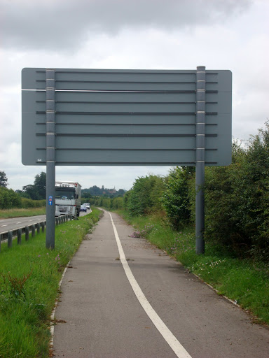

DSC09114.JPG


The route quickly moved away from the main roads to follow some lovely country lanes as it passed through villages such as Ikcleton. As I cycled along I also wondered why the GPS was showing a detour, in the interests of science (actually I had not cycled up those roads before) I followed the detour up 30m in height , down 60m and then back up 60m through a village called Littlebury when I was re-united with the Sustrans route (and markers). Checking later on the route when I got home I noticed that on the Google map used by BikeHike the Sustrans route followed a road (shown as yellow with dotted lines either side) of less than 4m in width and the BikeHike routing software had neatly avoided it. In my haste to plot the route I had not noticed, not a problem in this case but something to watch out for and check on the BikeHike settings.


The detour took me over the M11 and back again along quite a small lane, here is one of the bridges.
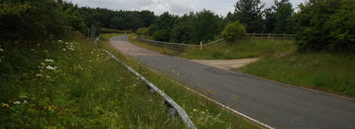

DSC09117.JPG


Alongside the bridge three Base-stations. There are several reasons why they are here. This was a high piece of ground at 110m, but the more obvious reason is that it is close to the M11 and the Cambridge to London railway line. I had not realised before but I think that quite a few Base-stations are sited near main roads, because that is where many phone calls were made from. I guess they still are - lets hope they are to/from the passengers in those cars.
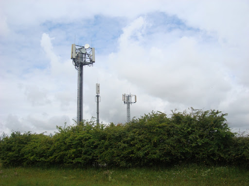

DSC09116.JPG


Normally I am quite slowsie when cycling up hills.
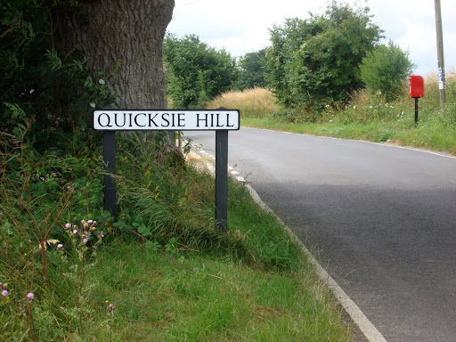

DSC09118.JPG


I am not sure whether it was a name for the village of named after one of the nearby hills - such as this one (a later check on the OS map and I am still not sure). Although the sky had been pretty cloudy I had only felt a few spots of rain so far.
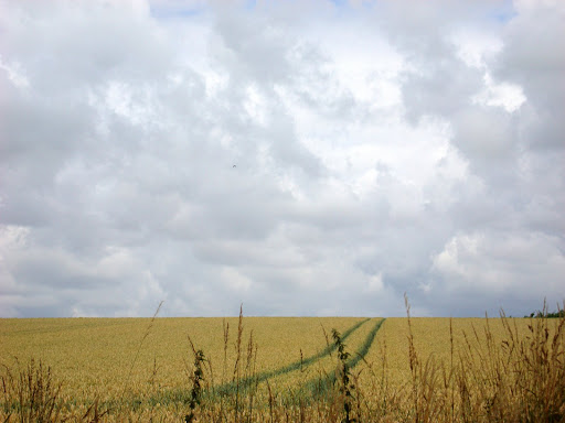

DSC09121.JPG


Brooding skies - no rain!


DSC09125.JPG


Before reaching the town of Stansted Mountfitchet I passed through a small village called Rickling - here is All Saints Church, Rickling.
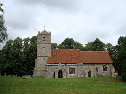

DSC09130.JPG


The Sustrans route ended in Stansted Mountfitchet and I had plotted a route, not very carefully over the M11 to the Sustrans 16 route which followed a disused railway line. I had not realised quite how large the junction over the M11 was. It is this junction where you turn off for Stansted airport on one side and Motorway Services on the other. Most of it was controlled by traffic lights and I used the footpaths around it though.


Once on the other side I set off expecting to see some Sustrans signs, but after cycling 500m up the road could see that I was still not that close to the route plotted on the GPS so I backtracked to a smaller B-road. Still no signs but I passed under a railway bridge and realised that this must be where the cycle path was. It was a bit of a scramble up to the path and I found myself on Sustrans 16 to Braintree. I did not see any blue Sustrans signs at all, but Essex County council had signs showing that cyclists were welcome in these parts.


When I checked later on the Sustrans website I saw that I could have saved myself some problems as their map showed an easier way to cross the motorway. Still in the spirit of adventure I should not really complain that the OS, Google, Sustrans and OSM maps are all different!
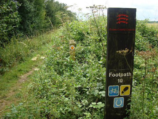

DSC09133.JPG


The bike had a brief stop at Takely Station and I had some jelly babies, lemon juice and a rest.
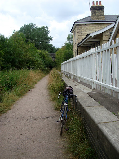

DSC09139.JPG


The path was pretty good for cycling, although in places I got stung as the stinging nettles encroached. fortunately I do not get much of a reaction and I had passed the nettles before I realised that I had been stung. If you look closely you can also see that obstacles had been set up for the adventurous mountain biker - not an easy path to cycle along at night I would have thought.
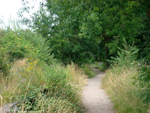

DSC09136.JPG


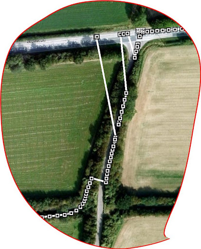
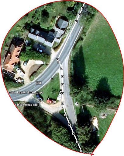
Whilst cycling along the path I noticed that the GPS trace showing on the Garmin Edge had deviated away. When I checked it on Google Earth that evening this is what I saw. You can see that the trace the GPS unit recorded seems to deviate off the Cycle path onto the nearby road and back. Now I know that I did not do that, I wonder if there was some form of interference from the nearby airport which you can see at the top of the picture. The GPS signals are pretty weak and I wonder if they got swamped by the airport radar or communication transmitters.
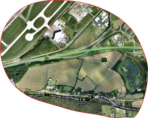

Flitch way - GPS glitch.JPG


As I came to the end of the Flitch Cycle Way I pulled off before getting to Braintree as I had picked a route to return to Cambridge through some small roads. However again on Google Earth I noticed that the recorded trace seems to have picked the road as my route and then bounced back. I must check to see whether the GPS was in a road-following mode. I have not see this before and assume that it had been re-set to track to the nearest road (or footpath) when I uploaded the later version of the GPS OS (2.8) a couple of weeks ago.

Flitch way GPS glictch 2.JPG


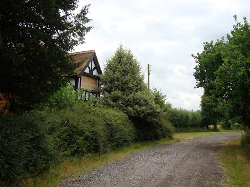
I had picked the route using Google maps and had inadvertently chosen a "footpath" but one with a gravel road and pretty large bridge over the A120. Actually it was only on checking my route later that I realised that I had not actually reached Braintree but had left the route earlier close to Great Dunmow. That's what happens when you plan a route too quickly trying to compare several sources of data. I was a bit wary of cycling along a footpath but carried on and past this house which had been boarded up. So hopefully I was not going to encroach on anyones garden, I could always start walking my bike in any case.

DSC09140.JPG


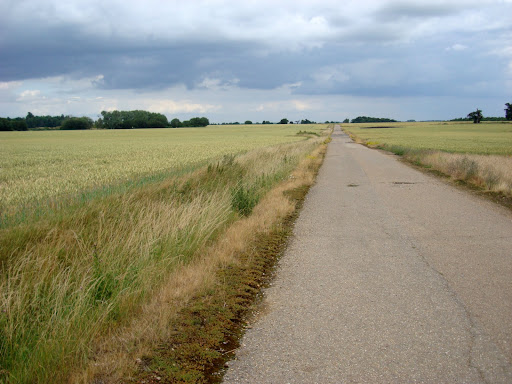
The route carried on to some very flat farm lands with roads going nowhere through them. I guessed it must have been an old airfield - later "research" showed that it was RAF Great Dunmow. After it was abandoned the concrete runways were used for aggregate for the A12 a major nearby road. The picture below is a composite of five pictures, it seems that there are quite a few of the airfield's periphery roads still around. Although unintentional it was a great place to cycle away from civilisation (apart from the airport and nearby towns!).


Gt Dunmow airfield panorama.jpg


Not all the track was quite as good as this, but some of it was signed as a Bridleway so I did not feel so bad about cycling along it.

DSC09146.JPG


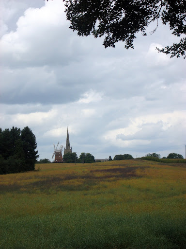
On the other side of the old airfield was Easton Lodge , there was a sign indicating that the Gardens were no longer open due to funding constraints and the path showing on the GPS screen was along a road with a "Strictly Private" sign. It turns out that there was a footpath that I could have walked along - but checking out the area I could see a road that linked up on the other side of Easton Lodge with my planned route so I took that instead. On the other side where I would have emerged I could see that the path would have been quite challenging to cycle along so not a bad detour. I must check my routes a bit more carefully before setting off. I guess that Google maps omit "right of way" information because it minimises a legal issues - it makes their maps slightly less useful though. I rather liked this picture of a church alongside a windmill on the horizon, but I am not sure where it was.

DSC09149.JPG


The rest of the route back was uneventful, however I did find that when comparing the GPS recorded route with Google earth there were quite a few places where the trace had "gaps". In this picture you expect to see the white rectangles at regular intervals. The GPS records at second intervals. However in quite a few places there was this effect with a larger gap and no this was not caused by me speeding up suddenly. My guess is that the additional computational load on the GPS as it tracks and compares the planned and actual routes causes it to briefly stop recording leaving a gap.

BishpS GPS glitch.JPG


So next time I must remember not to use the GPS to navigate for me and I must go back and try out the cycle path from Great Dunmow to Braintree. I am also amazed at just how many disused railway lines there are still around.

Tuesday, July 7, 2009

Was That the Summer?

It is said that British people like to talk about the weather - it is definitely true, perhaps because we get a lot of weather and it varies from one minute to the next. In many other countries they build appropriately. For instance in Sweden the houses are well insulated. The US pioneered Air conditioning to cope with the hot, muggy Summers. What do the Brits do - talk about it. Our houses aren't well insulated, we rarely have air-conditioning (a good thing - not very eco-friendly), except in cars. Our weather is quite changeable though, due in part to being an Island. When I used to travel frequently to Japan weather was always a good starting topic of conversation in a business meeting. Mind you their weather seems to be a bit more extreme than ours it can get very hot in the Summer and the typhoons can be quite amazing.


We have just had some really hot weather (25+C-ish), but as a typical Brit you have to complain when it gets too hot, but as I reminded myself it was nowhere near as hot as when I was cycling from Bangkok to Saigon last November. It is great to be able to pop out in t-shirt, shorts and sandals weather for a ride into the countryside or to pop into town to do some chores.


The weather has changed though, we have had windier weather along with some torrential (for the UK) downpours and thunderstorms. We do need some rain because it is quite noticeable how much irrigation is needed in the fields. I do find it that little bit more difficult to get out when the weather can be sunny one minute and wet the next. I got caught in a downpour yesterday and sheltered at the side of the road under some trees. Unfortunately the road started flooding and the cars and buses whizzing caused huge splashes. Car drivers just do not give a thought for the pedestrians, perhaps they think they are wet enough. Actually they just don't give a thought. Whilst standing in the relative shelter several ambulances came by. It amazed me how dozy some drivers are - this was at a set of traffic lights and car drivers would drive into the middle of the junction and then freeze causing maximum problems for the ambulance drivers. I also found myself being overtake by cars just to have them pull in across me because the road ahead was slightly blocked by parked cars. I think that they need to explicitly teach and test drivers ability to read the road ahead and PLAN accordingly.


Enough ranting whilst out in the Fens - near Wicken Fen I came across some Delphiniums (I think) growing in a field.


DSC09077.JPG


As you can see the crops in the fields are ripening well - let's hope that the rains don't batter them down too much and make harvesting difficult.


DSC09084.JPG


One advantage of the changed weather is that skies are a little more interesting in photographs.


DSC09093.JPG


I rather like blue skies and wispy clouds.


DSC09102.JPG


When out cycling one thing that annoys me is when road works do not take into account the needs of cyclists. Well I was amazed when cycling along White Fen Drove along one of the Wicken Fen Vision routes to see the following signs. Now this is a road that has one farm-house along it and the traffic consists of a small number of walkers, cyclists and dog owners driving along it as they walk their dogs. It is less than 1 Km/ 0.75 miles long well this sign went up around 7 days before giving plenty of advance notice, followed by the smaller white pages with specific advice for cyclists and walkers. It is good to see an understanding that roads are not exclusively the territory of cars, lorries and buses.


DSC09074.JPG


A week later I cycled out to see if the road works had started. They had and I can see why the signs were put up - the road-mending machines were as wide as the little road. Perhaps they see this as a sort of bicycle-way (like a motor-way for bikes!) and have decided to deploy the heavy duty equipment - I look forward to cycling along this bit of road when it is finished.


Friday, July 3, 2009

Cycling from Hull to Cambridge - the summary

If you find the four blogs of the trip a bit much too plough through - then here is the summary:


Day 1 Day 2 Total
Dist (Mls) 100 108 208
Dist Km 160.02 173.32 333.3
Time 7h 44m 8h 6m 15h 50m
Predicted Dist Km 158.4 170.1 328.5
Elevation gain m 514 233 747
No. photographs 304 116 420
Sustrans 1 1,11 & 51


I could also add some information on the train journey to get there I suppose:

  • Number of trains caught 3 (should have been two)


  • Number of trains cancelled 1


  • Number of trains late (40m) 1


  • Number of changes 2 (should have been one)


  • Packets of Jelly Babies 2

I would certainly recommend it as a fairly straightforward two-day tour of the credit card variety. The route was pretty much traffic free apart from the towns. It was not at all hilly and some of the scenery was delightful. I took the Summer off-road routes - which were fine as it was dry, but I would think twice if they were very wet. The bit I enjoyed most was the Water Rail Way from Lincoln to Boston. As it followed a disused railway line it was pretty flat and there were lots of interesting snippets of information along the route as well as interesting pieces of art. I think that is one of the reasons I took more photographs on the first day, I seemed to stop every few hundred metres. Also on the second day the route returned to areas I have cycled through many times and so I tended to take fewer photographs.


As this part of England tends to be drier than the West Coast I had no problems with rain - but sun tan lotion was a must. I used my Keen Commuter Sandals, without socks. I know I was letting the tradition of the sock wearing sandal'd image English down. They were great, stiff enough for cycling, open enough to get some aeration to my feet and they were a snug fit for my feet (which differ in size as it happens - but only by a 1/2 size - based on the English method of shoe sizing). I had no foot problems either with chafing or numbness or cramp. When cycling I sometimes unintentionally tense my toes which can sometimes cause cramp. I did not do a lot of walking, but they were fine for the walking I did do - perhaps around half a mile (0.8Km)


The Garmin EDGE GPS was great and it was easy to create courses using Bike Route Toaster. Although the route and the actual roads did not always agree it was not difficult working around those differences. It was slightly annoying when the GPS unit kept bleeping to indicate I was off-course when in fact I was on the course it was just the route data must have been very slightly inaccurate. I assume that was probably when I was using the OSM data to automatically route the course. Next time I will spend a bit more time comparing my route against the OS map data. Although I have noticed that the OS map does not always reflect the later Sustrans routing. Not of these things were issues, just having the GPS Unit made the cycle ride much less stressful. In fact impromptu sight-seeing was made easier because it was so much easier to return to the planned route. When doing this sort of trip before I have used maps and bits of paper in a map-holder clamped to the handlebars and have always found assembling the information before hand a bit tedious. I am sold on using a GPS unit, with the advantage it is easier to check out the route on Google Earth. The Garmin software will do this automatically. I use this when writing my posts to check out exactly what churches I took photographs of.


One last comment, I have a Brooks leather saddle on my custom Longstaff touring bicycle. They together make for a very comfortable ride. On the second day there were no problems getting right back onto the bike and setting off. (I took the Brooks saddle with me to use on my Bangkok to Saigon cycle ride). I had no mechanical issues or punctures. Although as luck would have it I did get a puncture when riding to the pub on the day after the tour. Only the second using the Schwalbe Marathon plus tyres. The cause - a huge thorn I should have known better but a followed a shared path where the had hedge was been trimmed by a tractor which also was helpfully spreading the thorns all over the pavement. It was not my worst experience. On the same path several years ago my son and I got 3 punctures when riding on the tandem.


DSC08782.JPG


DSC08920.JPG