Good Friday, 18th April 2014: I enjoyed my ride along the Peddars Way so much that I felt I had to return to Norfolk at the earliest opportunity. Fortunately we are at the time of year when Bank Holidays come thick and fast slightly more often that at some other times of year. Even better, the weather forecast didn’t look too bad and my wife had arranged to go walking with her walking buddies. Which meant I could have a guilt-free, day-ride under the matrimonial law of reciprocal hobbies.
So where to ride? I have ridden on NCN11 (Cambridge to Kings Lynn) and beyond on NCN1 /NCN30 to Cromer. I’ve also ridden from Cambridge to Thetford to Norwich (NCN13/NCN1) and from Cambridge to Thetford to Cromer (NCN13/NCN1/NCN30). A while ago my son and I rode from Norwich to Cromer (I chose the route – there are loads of country lanes). I have also ridden from Cambridge to Norwich over a few different routes.
Choices, Choices! In the end I decided go for a seaside ride. I have not ridden from Cromer to Kings Lynn (NCN30/NCN1) before and the route has changed since the last time I cycled the other way.
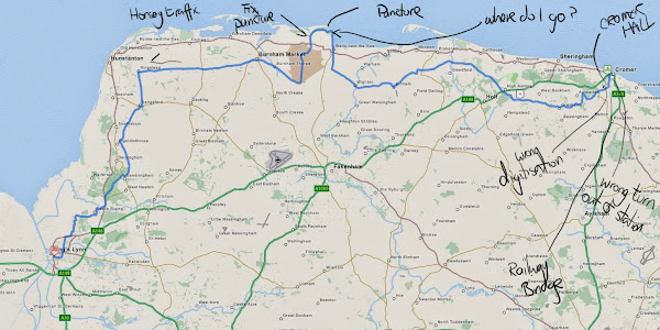
So I created a map on Bike route Toaster (Cromer to King’s Lynn) – just under 100Km/60miles, it was lumpier than a ride around the flatlands – but pleasantly so. My general rule of thumb is to estimate an average speed of 20Km/h. Sometimes I am faster, sometimes I am slower – but I do want to be able to stop and look around (and take pictures). I sometimes I lose my way, even when following my GPS, when I am too busy looking around and not paying attention to the route – or rather assume I know where I am going. I also occasionally enter the route incorrectly when using Bike Route Toaster, again through not paying close attention.
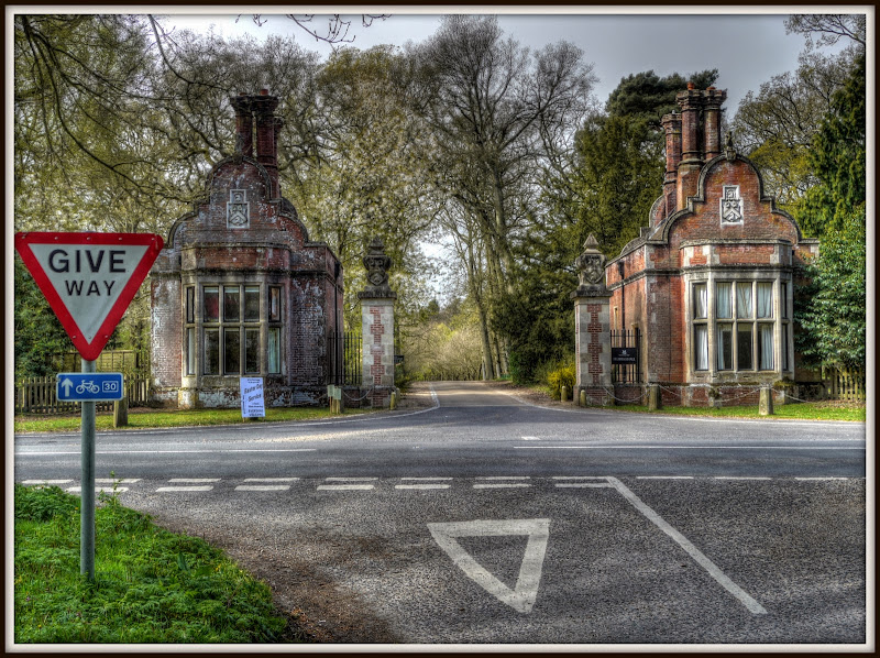
When plotting a route I generally go for the detours and scenic routes. In this case I chose to cycle through Felbrigg (recommended). (The numbering seems to go a little awry on the OSM Cycle map – 30 and 33.) I also chose the detour through Wells-next-the-sea – which was a mistake on a bank Holiday. I did enjoy riding through the Holkham Hall Estate though.
But the ride will come later, the next thing to do was check out train times after all it was a Bank Holiday and trains have a nasty habit of turning into buses on bank holidays and apparently then not able to take bicycles. I say apparently because on a previous ride to Cromer I caught the train to Norwich to find that because of Engineering Works on the line there was a bus link to Thetford. As it happened two of us prospective passengers had bicycles – the bus driver was actually driving a coach and slid them into the luggage bays without any hesitation.
I knew there was to be a change of trains at Norwich, the real question was how long would it take? The answer – 2 hours and 18 minutes, with trains from Cambridge running every hour at 12 minutes past. The “additional info” confirmed that they took bicycles and the gap between arriving at Norwich and leaving Norwich was 15 minutes – not too bad. So if I caught the 8.12am train I would reach Cromer by 10.30am. I did think about catching the earlier train – but by starting slightly later in the day I hoped the weather would be slightly warmer and it was a Bank Holiday after all.
Here are a few links to Websites for those wishing to explore Norfolk by bicycle:
- Visit Norfolk
- Norfolk Coast Partnership
- Broads by Bike (PDF map)
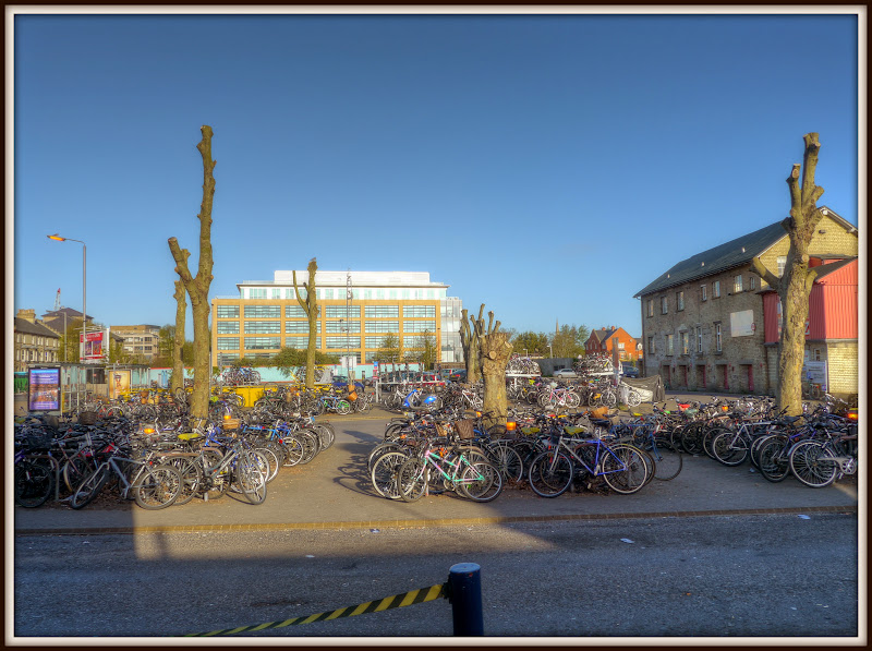
On the morning of Good Friday the air temperature was cool, but the skies were blue. the sun was shining and it wasn’t windy. It was a wonderful ride into the station – being a Bank Holiday there weren’t many cars around. When I arrived at Cambridge Station, as most people would expect, except the powers that be, there were loads of bicycles around. It was sad to see that the trees around the cycle parking area have been massively cut back.
Cambridge Railway Station – as was
I don’t know whether it was because the trees needed it or as part of the overall re-development – but sad none the less..
Cambridge Railway Station – as is
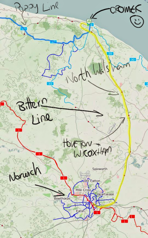
.Here is a map of my train-ride – well from Cambridge to Norwich – which is known as the Breckland Line. According to Wikipedia the line is getting some investment with modernisation of the signalling and sections of the rail being replaced and capable of 90mph running! There are quite a few stations on the line – but the regular Cambridge to Norwich train does not stop at all of them – I would have to had caught an earlier train - the 7.04am it seems to call at a few of the smaller stations – such as Eccles Road and Shippea Hill.
I have marked the stations that the train stopped at – journey time – 1 hour 18 minutes.
Route of the Cambridge to Norwich Railway Line
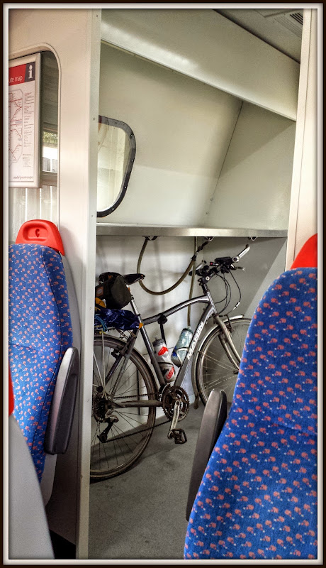
I have taken my bike on the train down to Penzance and from Inverness to Cambridge and up to Hull and down to London. The one thing you do know is that you never know quite what is in store for you. When I went to Hull I booked a seat and space for my bike – only for the train to be cancelled, fortunately a Virgin Train (I think) let me on. Some trains are forbidden during the rush hour, others have special areas. When going long distance I generally try to book a space, well in advance. For these day rides and I tend to turn up and hope.
The best plan is to turn up early – which is what I did (and bought a bacon roll). At the moment the Cambridge-Norwich trains have a dedicated space for bicycles – although only one of the carriages. It is usually marked on the door – but I tend to recognise it from looking through the windows. As the Cambridge – Norwich train originates from Cambridge – which means it hangs around for a while rather that doing a stop and pick-up it is less of an issue. Catching a train at an intermediate station can be a lot more stressful, I usually ask a guard and sometimes they point me at the right on the platform to stand with my bicycle.
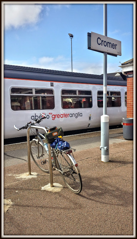
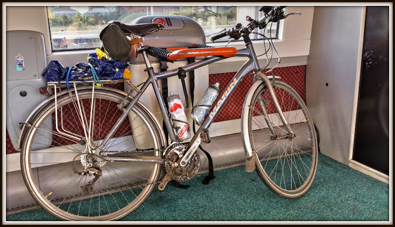
As you can see I generally travel light. The drinks bottles have some insulation, so I generally fill them with crushed ice, lemon squash and topped up with water. They won’t last all day but it keeps the water cool for a few hours.
My Carradice Saddle bag is a Zipped Roll in Green with Honey Straps. It goes with the Green Leather Brooks Saddle. I can’t actually remember which one it is – but I’d definitely recommend it. It contains the things I reckon are necessary for running repairs. In my case there is a set of tyre levers, puncture repair kit, two spare inner tubes, a multi-tool, zip-ties of various sizes. The multi-tool includes a chain tool. I have just added some cord – thanks to MikeC. (I borrowed some from him a while back to tie my jacket onto my rack, now I have some of my own.
Although in this case I have use a plastic bag and a couple of bungee cords to carry some additional items – Jelly babies, sun screen, and space for my waterproof jacket – which I hope not to have to wear.
Maisie, my Bicycle on the Cambridge to Norwich Train
The first stop after Cambridge is Ely with the Bike and Go bikes ready and waiting on the platform. There are 10 bikes there – I wonder how many they have. The concept seems to have been rolled out at quite a few railway stations – Stowmarket and Ipswich are to more in the region.
I quite like the Ely Railway Station – it has a convenient layout with a tunnel under the platform so it is convenient for cyclists and luggage-luggers and wheelchair users alike.
It is open to the winds but sheltered, there is a shop and you can get food and drink there. Also the railway station is just off NCN11.
Red Bike & Go at Ely
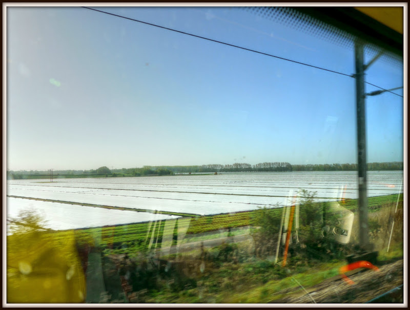
As we headed out some of the fen fields were covered in swathes of fleece. You can see why I call this the flatlands.
Fleece-covered Fields of the Fens
The next stop was Brandon, where the railway station conveniently lies next to the local Sustrans Route 30. This station looks a little down at heel, but it does have Friends. The station is mode from Victorian Flint built in 1845 – but apart from a single signalman there have been no staff since 1967.
What there are though are murals. Clearly the murals all have some local relevance – now I recognise some of the relevance – but not all. So I will leave it to you to consider.
Brandon Railway Station Mural
I have seen a red squirrel in Thetford Forest.
Brandon Railway Station Mural
The next stop was Thetford. Did I mention that another cyclist joined the train at Cambridge – he wasn’t a trusting sort and locked his bike to the frame – I hope he remembers his bike when we all get to Norwich.
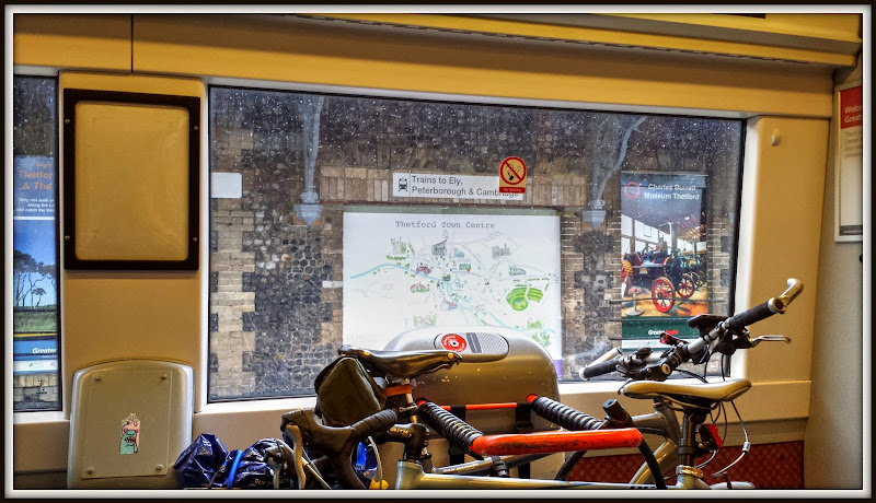
Another of my guilty secrets – I really enjoy watching Dad’s Army and will be first in the queue to see the new film that is rumoured to be happening. A lot of the filming was done in the area and there is a Captain Mainwaring Statue in Thetford. If you look closely you will see him on the map of Thetford. (I probably also ought to mention that NCN13 runs through Thetford.) However I haven’t been to the Charles Burrell Museum which is just around the corner from the Dad’s Army Museum.
Thetford is hardly any distance from Centre Parcs, Thetford and yet I bet hardly any folk use the train to get there. Those that do are probably dispirited when they arrive at the station.
Thetford Railway Station – You are here
The next station that the train stops at is Attleborough, The Sustrans network doesn’t seem to have made it near here!
What I should have mentioned is that the Breckland Line runs through Thetford Forest – I saw deer grazing – they didn’t seem to bothered by the train passing.
Apparently a new Ticket Office opened in 2008 as part of a re-staffing of rural stations! Although I didn’t check and according to the National Rail Website there is no ticket office and no ticket machines and I think the customer services and Information is via a phone (help point).
It was opened in July 1845 with a brick Station Building and now the Station Master’s (as was) house is rendered.
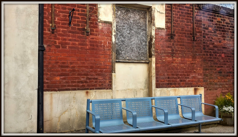
Attleborough Railway Station
It isn’t the sort of station you would want to spend much time hanging around though. It looks dilapidated. Someone has put up a bracket for a hanging basket – perhaps the Health and Safety Police wouldn’t allow the hanging basket though.
I didn’t see this Memorial plaque to the men of 452ND Bomb Group (H) either.
The seats look robust, but (IMHO) out of place and promise little comfort.
Attleborough Railway Station
Across the track the view is no more attractive – although you could just imagine that window and brick surround in an Art Gallery somewhere as part of an installation.
I guess that the way railways are funded it is cheaper, at least in the short-term to allow buildings to slowly dilapidate. This is a former goods shed. The station looks worse when sitting on the train the in some of the pictures on the net. This Wikipedia one looks more open. The platform canopy looks pretty scruffy in it though.
Attleborough Railway Station – Former Goods Shed
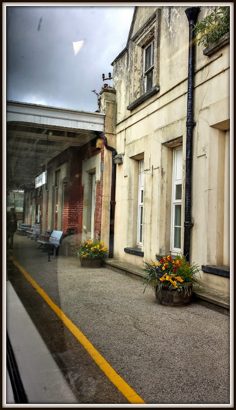
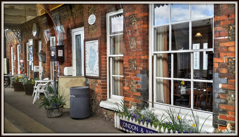
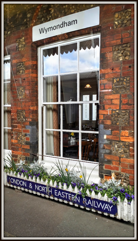
The next station along the line was Wymondham – pronounced as “Wind-ham”. This station as friends and its own website. It also has a Bistro – which is through the windows, it made me feel as if I had gone back in time to the golden age of steam.
Wymondham Railway Station
There is definitely a touch of history about this station with the old London & North Eastern Railway signage.
Wymondham Railway Station
After that we slowed down and just as I was thinking how we had plenty of time for me to catch my next train we stopped. Apparently there used to be three railway stations in Norwich – now down to one.
The stop was because the line crosses the River Yare and the two tracks are reduced to one. Trains end up “reversing” out of the railway station area. The railway station was also the scene of a train crash in July 2013!
Fortunately the chap who had locked his bike up didn’t forget it and came back and unlocked it,so freeing mine in the process.
The Wikipedia entry for the Station is rather too heavy on train technical data. The station also provided the scene for the opening of a Swallows and Amazons novel – humm I don’t remember that, I must check if we still have the books (It was Coot Club which makes sense).
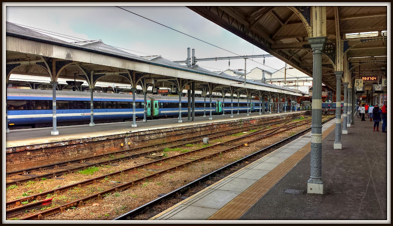
The station befits the city and is quite large and opening although the dreaded ticket gates have made it. Fortunately it is possible to move from platform to platform without popping in and out of the gates – a blessing when you have a bicycle and don’t quite know where you are heading. However, as the station is the “end of the line” you can easily move from, platform to platform without having to use bridges.
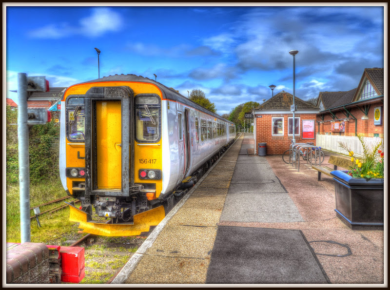
A few minutes later and I was lined up waiting to get on the Cromer train - it was there but not open. It did give me time to work out which door to stand by though.
Norwich Railway Station
What struck me about the Norwich to Cambridge line is how distressed some of the stations are. Maybe I have over-romanticised the idea of train travel and should consider railway stations as being little more than glorified bus stops. The Norfolk area is a wonderful place to visit, there is some beautiful countryside (the Broads to the Brecks), beautiful coastline and some great history and yet there is a hodge-podge of in some cases, tatty railway stations. Despite the branding of the Breckland Line even the nicer stations are a bit business-like (Cambridge and Norwich).
As you might expect there is an alliance looking to improve East Anglia’s rail network – NewAnglia. They have published a prospectus – “Once in a generation – A rail prospectus for East Anglia”.
It seems to me that the rail-network should be an important part of catalysing economic growth. Probably the most hype benefit comes from Silicon Fen and interconnecting places like Norwich, Cambridge, Colchester as well as ensuring good connections with London. However we must also consider the importance of Tourism and Agriculture as well as better ways of dealing with the freight that passes from the ports through to the Midlands.
Whilst I am not a great fan of commuting an important strand has to be that of providing fast and convenient services between where people live and where people work at the times they want to go to and from work. This means increasing the speed of the railway lines as well as the number of trains. One hour 18 minutes from Cambridge to Norwich is not fast.
As for tourism, well the speed of the trains is not perhaps the biggest challenge. However I reckon that those that plan the rail networks have to some extent given up on tourists – dilapidated stations and tired rolling stock don’t add anything to a holiday trip that ought to have a touch of glamour. There are green shoots – The Bittern Line Community Partnership, Norfolk Rail Prospectus, The Norfolk Orbital Railway, The Poppy Line
I have travelled by train fairly extensively in Japan, it is clean, punctual, fast and in places tailored to tourists. It builds on the holiday experience rather than subtracts from it.
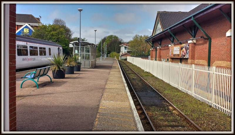
Ah well – next stop Cromer.


