
Saturday, 6th November: After yesterday's soggy ride the weather had changed completely, well quite a lot. It was sunny and quite cool and no wind. Ideal weather for letting off fireworks going for a cycle ride. I also had some unfinished business, after having visited several of the new cycleways in the county yesterday, but been unable (unwilling) to take pictures because it was so wet I had another chance.
As it was a much nicer day I also planned a slightly longer ride. I headed a bit further out along the NCN51 from Cambridge to Bottisham before heading through the Wilbrahams to Fulbourn and then on to Worsted Street (Roman Road). I also decided to give the new, but rather soft cycle path, that I hope is unfinished alongside Wandlebury, and headed the other way down towards Worsted Lodge. This meant I would only need to cycle along the Sawston Babraham Cycleway in one direction. The route I took then followed the same route as yesterday, but on getting back to Cambridge I added a loop around Coton just to top up the distance.
This time around the distance was further, at 55Km/ 35 miles but the maximum height reached was less, at 45m above sea level, overall there was the same amount of ascent/descent though. The BikeRouteToaster map is shown below and here is the link. Although the distance I cycled along the Roman Road was a bit further than yesterday the track surface was pretty good except for one or two places. Also the fine weather and the fact that it was a Saturday meant there were more people out walking - I passed around 20 people on the Roman Road.
Saturday is also a chore day for me, when amongst other things the weekly shopping gets done. That morning as we were walking through the Tesco car park an older lady parking her car misjudged the room available in a parking space (or lack of it) and scraped a car already parked there. She then reversed out and looked as if she was going to scarper - but no that was just my suspicious mind. Later, in Tesco we heard a call out for the owner of the car that had been damaged. By coincidence we were just next to the owner who hadn't quite heard what was being announced. She was rather shocked when she realised it was her car. We think there was more damage to the bashing car than the bashed car though. it wasn't as bad as this example of supermarket dodgems where around 8 cars were damaged by a 19-year old man, who was held on suspicion of criminal damage and later bailed.
Did I mention that my Sigma Speedometer stopped working yesterday. I had my Garmin GPS (Edge 605) so still had a record of the distance, speed, time. Before I set off I replaced the batteries but could still not get it to work reliably so I think it must have succumbed to the wet weather. The question is whether to replace it with the same model, or a new model since it has been superseded. In the end I got the newer model as it had a better specification and barely cost any more. For the time being though I really must remember to start my GPS recording when I go out cycling. (Having them both provided some back up.)
")
It was amazing how different the weather was and the only challenge was keeping warm - although that is not too difficult on a bicycle. I didn't bother taking pictures until I reached the Sawston Babraham Cycleway. The road it runs alongside has never been that busy when I have used it, but it is not that wide and I would imagine that one of the problems is that people using their cars during the school run put off cyclists and walkers. Hopefully this will redress the balance. What I like about this is that it is set a little way away from the road which helps insulate cyclists from splashing motorists and nasty gusts of wind from passing lorries. It also has lights and painted white lines. If you look at the lower white line on the right hand side of the path you can see one of the lights set into the surface. It appears to be similar to the ones used on the NCN51 along Newmarket Road. I assume that grass will grow along the verges which will stop soil washing onto the path. It is quite wide as well huh!

This is where the cycleway crosses the road - where Sawston Road meets Babraham High Street. The cycleway continues a little way along the field to the left of the High Street. It is nicely set back from the junction but with plenty of visibility. It is also good to see that the cycleway has bobbled bits at the point where it crosses the road rather than longitudinal ridges - which on a wet day are just plain horrible on a bike with thinnish tyres. The lazy chap who took this picture couldn't even be bothered getting of his bike!

This is the view north from the Cycleway - the hill in the distance Wandlebury, I think. I rather like cycle routes that have good views - especially on nice, sunny days.

Once again as I was cycling through Sawston I was struck (not literally) by how discourteous most motorists are to cyclists. This road that passes Sawston Village College has quite a few cars parked along the right hand side and cars coming the other way rarely give way, they just expect oncoming cyclists to jump out of the way. Mind you it is not just cyclists who have problems. The Cambridge News reports on "Motorists 'abusing' lollipop patrols". Apparently motorists are failing to stop for Lollipop patrols and last year in the UK there were 7,000 reported incidents. With 18 reports in this county, since April, of motorists failing to stop at patrols. Stopping is not optional, road users have a legal duty to stop under the 1984 Road Traffic Act. I'd be interested to know whether this illegal and discourteous behaviour is getting worse, I guess it must be if the issue is needing to be raised.
Whilst on the subject of drivers failing in their duty to other road users two girls also got hit on a pedestrian crossing in Godmanchester and yes you've guessed it the driver scarpered. My daughter also had a lorry run a red light at a pedestrian crossing on Friday - she was too shocked and just managed to get out of the way. Apparently the driver mouthed sorry as he whizzed though, presumably having completely failed to realise that he was running a red light. Whenever there is gun tragedy as happened in Cumbria there are calls to to make it tougher to get a gun license - yet we seem "accept" deaths on the road as the acceptable consequences of freedom. I guess a lot of people drive and only a few people want/need guns so society acts as a hypocritical majority. Actually I am not so sure that stricter driving tests would necessarily help since bad driving is as much about attitude as skill level.
After Sawston you then have to cross a dual-carriageway - I assume this was built in the days of yore when ordinary roads had bits of dual-carriageway every now and then to allow cars to overtake slower traffic (such as lorries and caravans) to help reduce driver frustration. I think that approach to "road safety" is somewhat out of date now. Actually it is not really a dual-carriageway, more a multi-lane junction with lanes for vehicles turning left or right so as not to slow those carrying straight on. So you don't actually get (or shouldn't get) mass over-taking - just cars refusing to be slowed down. Fortunately for cyclists there is a wide island in the middle so you don't need to dash across in one go. It does look a little intimidating though - although it wasn't a problem for me to cross the road (at least on a Saturday mid-afternoon).

After I crossed the road I then had to wait at the level crossing, as a railway line runs parallel to the main road. The cycleway was then to the left of the level crossing running for a short way alongside the railway line. watch out for the random posts used to nobble unwary cyclists stop cars being driven down the track.

Then immediately after a right turn was a brand new blue bridge which crosses a large stream that on the map looks rather straight and drain like (That is drain as in drainage ditch.)

There is then a second new blue and larger bridge which crosses a river - which on the map is called the River Cam or Granta. Further up stream is another tributary which is called the River Cam or Rhee, both tributaries join.
What I really liked was that one minute I was cycling along a road with anti-social (to cyclists) drivers then I crossed a busy road and railway and then whoosh I was in the countryside. well technically there was no whoosh - my bike is not jet-propelled. Although pulse jets are not that hard to build - but starting them can be tricky apparently and they are loud and certainly anti-social if you are foolish enough to stand behind them.

This is what the path looks like looking forwards in the Whittlesford direction. White lines and flat tarmac running through the middle of fields - idyllic.

The path passes through an "avenue" of trees again rather nice when you are on a bike. You just have to watch out for the leaves on the path - although they weren't too bad when I went through.

Whilst the area is not the most secluded bit of countryside around Cambridgeshire it is surprising how secluded it felt -in amongst the hedgerows and fields.

Unfortunately Whittlesford is not that far from Sawston so the pleasant route soon came to an end, but not before Whittlesford Church came into view. it is the Church of St Mary and St Michael where I discovered there is a Sheela Na Gig carved into a window arch directly below the clock on the tower. Sheela Na Gigs are quasi-erotic stone carvings of a female figure found on some Romanesque churches apparently. I will have to check it out next time I am down that way.

That last picture was taken at quite a high zoom level - this is the Cycleway route as it approaches the church without much zoom. Once you get to the tree at the end there are two possible routes, either along a short path onto Church Lane or along a footpath to the right, which leads to the North Road which heads to the Shelfords.

If you go back to the closeup picture of the Church you can see a Beech tree just behind it - here it is in all its Autumn Glory - that is quite a tree, nicely illuminated by the late afternoon sun. (Copper beeches are my favourite tree - there was a huge one near where I grew up that I used to climb as a boy.)

A lot of the trees around and about have lost their leaves though. Here is the Whittlesford village sign some way down the road from the village centre - perhaps they are trying to grab a bit more territory. Or perhaps this village is somewhat more spread out than I thought - well looking at the map it is.They have an "interesting" website but there is also Wikipedia however neither website seems to give much information on the village sign. There is a bit more on their Sustainable Whittlesford website (but not about the sign). the sign appears to have three archways along the top and stepping stones across a river "the Cam?) and underneath it says "Stick to the trothe". An article in the Cantab Rambler indicates that the village originally lay as a crossing place of the Cam - hence the river and stepping stones on the sign.

The road in the picture is the road from Whittlesford up to the Shelfords and to be honest I am not quite sure why I went along the Middlemoor turn and round the triangle and then back onto the road I was originally heading along. However because I did I noticed that the road from Whittlesford to the Shelford is part of the secret National Byways route. Normally there are only signs where the cyclist has to deviate from the natural route - so if you aren't paying attention you can easily get lost. In this case the signs are not that visible from the route itself, only if you are approaching from the east. A while back I did take a picture of this route as it passed through Duxford though - so I will slowly but surely work out where it goes. The thing is that the route details haven't been published so you can only get lost if you start following it randomly.

Although it doesn't look it in this picture it was getting quite dark towards the end of my ride. This shows the cycle route around New Bit - which is also on the NCN11 route. Cars have dual carriage-ways cyclists have dual-cattle grids. A simple innovation - but welcome none the less. Although it looks bright the camera shutter speed had to be quite slow to get enough light - which is why the cars are quite blurred.

This path takes you up to Coe Fen, this has also been improved and widened - as a busy cycle route the widening is also most welcome.

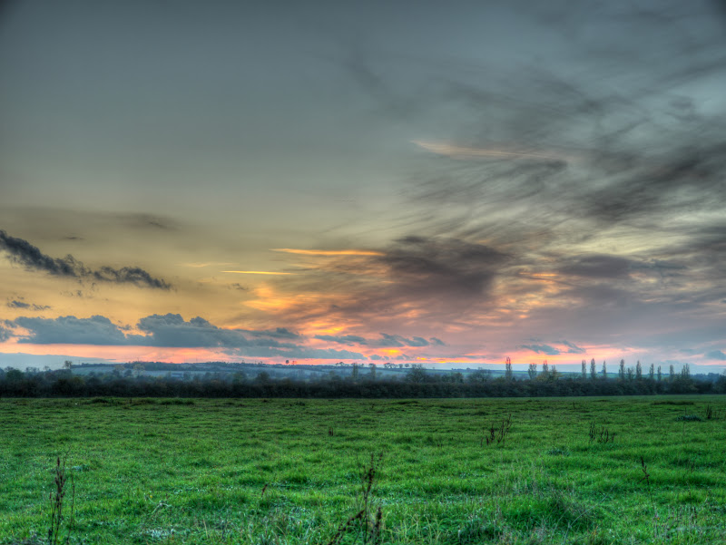
After that, although it was getting dark I cycled up the Lammas land access road and up to Grange Road- the scene of cycle lane carnage. (even if I say it myself I rather like that little pun.) I then popped up the Coton path towards - well Coton, stopping to plop my camera on a fence post to take a picture of the sun setting.
I also took pictures of some of the more modern University buildings nearby.

What a difference a day makes - from one day when I got saturated to next when it was all blue skies and sunshine. One thing that did bug me a little though - cyclists without lights on shared paths - you aren't doing anyone any favours you know. I did see a few dogs with led lights on their collars - which I think is a great idea. Although at first I wondered what the strange blinking lights were in the middle of the field. I do wonder whether pedestrians should have a duty to carry some form of light on shared use path - I know it will never happen - but if cyclists have to have lights at night on roads - so that motorists can see them - then why shouldn't pedestrians have them on unlit shared use paths so that they can be seen by cyclists. It doesn't seem quite fair to me.
So back in time for a quick shower and then bangers and bangers - well fireworks and sausages anyway.
The Cantab Rambler I referred to can now be found here:
ReplyDeletehttp://cambridgeramblers.org/2009/02/28/cantab50-february-2009/