Showing posts with label Burwell. Show all posts

Sunday, May 23, 2010

Blues Skies and Dusty Soham by-ways

Last year the Weather Forecast for the Summer was predicted to be a good one in fact it was predicted to be a "BBQ Summer". If you looked closely there was a probability associated with the prediction. The trouble we tend to look at the headlines and ignore the fine print so when the "BBQ Summer" did not happen (and I seem to remember there was a 20% probability or 1 in 5 chance it would not) there was a lot of grumbling about the weather forecasters.


This weekend has been predicted to be an "Ice-cream weekend" and you know what; they've got it right. Of course there were a number of factors in favour of the forecasters. The forecast was both short-term and near-term making it much easier to get right. We sat in the garden to have breakfast - I can see why people move to sunnier places like Spain to live - it is so nice to be able to potter around in a t-shirt and shorts with some glorious sunshine and blue skies.


Being a Saturday various chores had to be done first including popping into the Supermarket for the weekly shop. With the World Cup coming up it seems that multi-packs of beer are being pushed - we ignored those and got a few bottles of a light sparkling rose - just the thing to drink on a warm summer's afternoon. A few bottles of Theakston's Old Peculier, Badger's Golden Glory and Henney's Dry Cider also sneaked into the shopping trolley as well - don't know how that happened. We started drinking this cider because my son had been working at the Farm where the apple orchards are and had brought a few bottles back one weekend - after that we were hooked. They have four different types of cider and the operation only started in '96 - they are delicious though.


I love cycling in the sun - but tend to like to potter rather than head out to clock up the miles. So after lunch on Saturday I sat down to look at the map - actually Where's the path and had a look to see what areas I could potter around, especially off-road places where I had not been before. The Fens off towards Wicken Fen are always good for a potter - but that tends to be my default direction for cycling so I thought I might head off around Soham as, to the North-East, there looked to be some interesting by-ways with a route back to Burwell and Sustrans 51 by heading down to the B1102 and then taking to a by-way at Ness Farm which by-passes the B1102 - a fast road - not the most pleasant to cycle along (although not the worst!)


So that is what I did - as it was a route I did not know (around Soham) I printed out some crib sheets and marked up the paths I thought I would take. I have since marked up the route on an Open Street Map, OSM and included it in this post. It turns out that the OSM is incomplete around the North-east of Soham there are missing roads as well by-ways. When I have some time I must investigate how to contribute to the excellent work done to create the OSM. So if you follow this map forgive me if it is not quite accurate - the main problem areas are where the route crosses the A142.


When out cycling I generally try to ensure I have some tools and pump. This was the first time of the year I also took some sun-screen after using it first of course - remembering my feet - sandals are no protection - and the backs of my legs. I also took two water bottles (CamelbaK Chilljacket) filled with crushed ice then orange and mango squash and filled with water. Just before I set off, on the spur of the moment we also decided to get a take-away curry and invite some friends around and eat it in the garden. A prospect my daughter thought was good and instead of eating in Cambridge with a friend stayed at home invited her friend along.


Soham.jpg


The skies were so blue with the only clouds visible being contrails as the jets fly of to the US. I am not sure why - it seemed that there were more passenger jets flying high - at one point three seemed to be chasing each other across the skies. Here "X" marks the spot. These pictures was taken on Fen Road, just out of Lode alongside Bottisham Lode.


P1100745_39_40_41_42_43_44_tonemapped.jpg


A stream of water vapour left behind as the plane soars through the skies. Judging by how the "lower" contrail has stayed together there can't be much wind about at that altitude (or the wind flow is uniform). In any case the contrail does not seem to be dispersing very quickly.


P1100753.jpg


This is the same plane as in the picture above - there are three other contrails in the sky.


P1100754.jpg


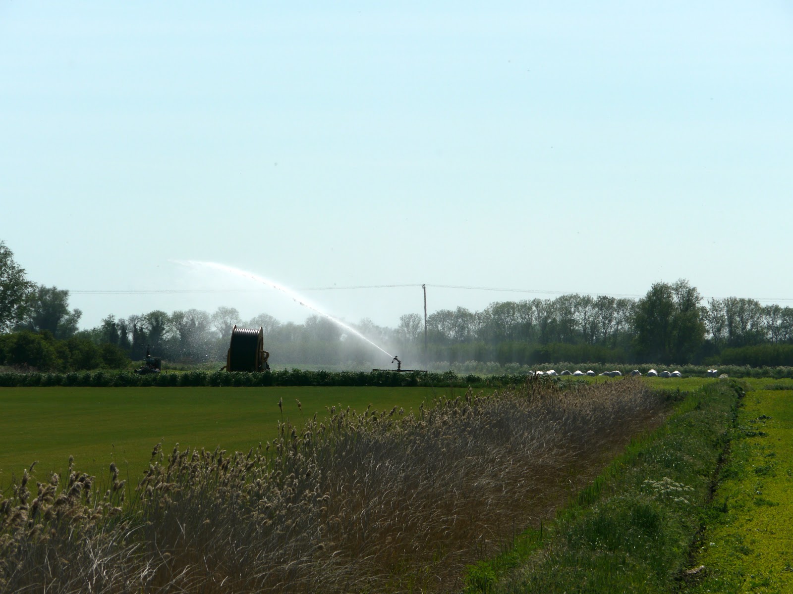
It does not take much of a dry spell before the fields need irrigation. This picture was taken from Whiteway Drove on the way to Upware.


P1100755.jpg


A different field from the one in a previous Post - I used to think the crops were dying - I now think they are grown to plough back in to improve the soil - nitrogen-fixing perhaps.


P1100762_56_57_58_59_60_61_tonemapped.jpg


After Upware the soil is browner (compared to the black peaty soil). There are small shoots appearing - hence the need to irrigate.


P1100769_3_4_5_6_7_8_tonemapped.jpg


Along Padney Drove (Sustrans 51 between Wicken and Ely) this looks like a field of two different types of lettuce being grown.


P1100776_0_1_2_3_4_5_tonemapped.jpg


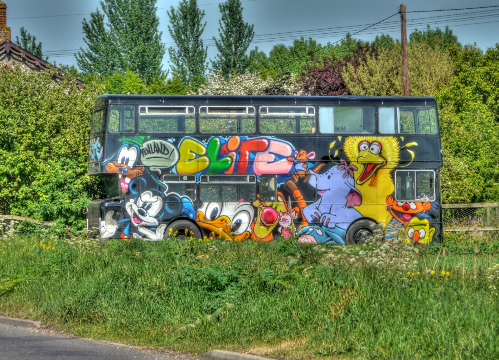
My route turned away from Sustrans 51 at Barway Corner. This bus caught my eye - it would have been difficult not to notice it really! At this point I started having to pay more attention to the crib sheets. I zig-zagged on the A142, just outside Soham and cycled along Eye Hill drove alongside what seems to be an extensive tree nursery before turning right down Barcham drove past Barcham Farm - a large farm complex on each side of the road with a large house being developed on one side of the road and a large lake on the other.


P1100783_77_78_79_80_81_82_tonemapped.jpg


The route then took to the by-ways heading out towards Broad Hill. It has been so dry that most tracks are ok to cycle along - the biggest problem is the shaking as you cycle along in the tractor tyre tracks. You feel as if you are being shaken to bits. On this bit of the track there were huge deep ruts though - solid - but too deep to cycle in as my pedals kept catching the edge. So I ended up walking through three places where the ruts were extreme. As this was the first bit of the unknown off-road I did wonder what I had let myself in for. There were country roads around that I could cycle along if I bailed out - but for pottering it was not too bad. If I had been in the middle of a 160Km/100mile ride then I probably would had taken to the roads - but for pottering it was interesting.


The by-ways at this point were fairly narrow with hedges each side and so that probably constrained the farm traffic. At Broad Hill the route "opened" up and the tracks became a little less rutted. As you might expect from this part of the world the fields were flat and there was a lot of Oilseed rape growing. Farmers do seem to like having sheds around though and most look a little dilapidated.


P1100804_798_799_800_801_802_803_tonemapped.jpg


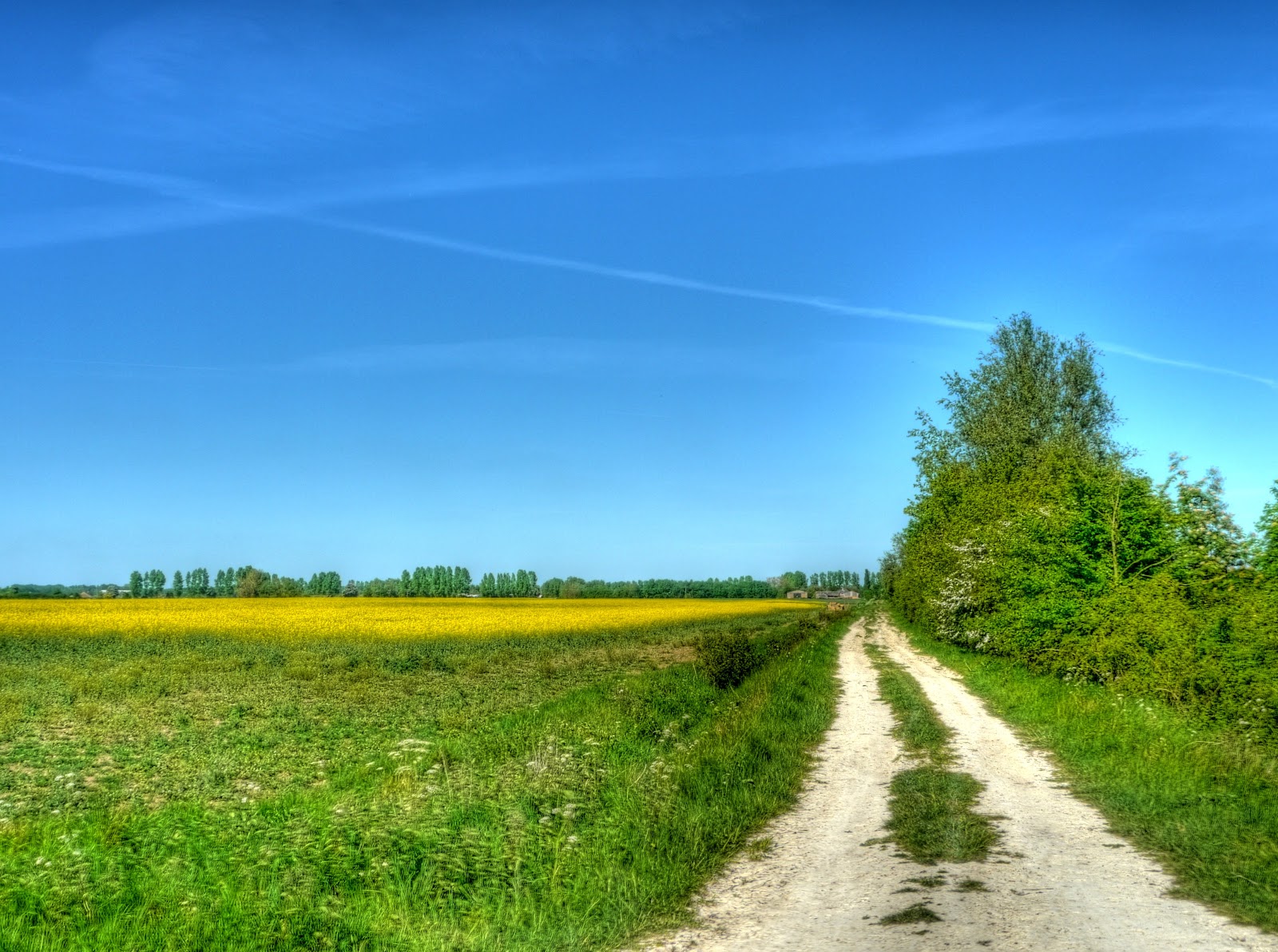
This is the type of track - white hard-packed mud which also seems to stand up to the tractor traffic better. Cycling along this type of track is easier and you can spend more time looking around. This was not actually the route I took - it is not marked as a by-way on the map - it is why a take a crib sheet. It meant I could stop and take the route I had planned rather than the one that looked obvious. (I also got into the habit of having a drink whenever I stopped as well - there was still ice in the water bottles.) The "X" contrails seem to have followed me.


P1100825_19_20_21_22_23_24_tonemapped.jpg


The route I took - large hedges with blossom along a similar track. The challenge is keeping an eye out for ruts that can suddenly seem to appear as the bright sun and dappled shadow confuse the eye. This track heads to Saxon Farm where it briefly joins a road before another by-way.


P1100832_26_27_28_29_30_31_tonemapped.jpg


After Saxon Farm the track opened up completely - it is a little surreal cycling along the middle of a large green field. The horizon seems to stretch on for ever. So far I not met anyone else whilst cycling - that's what I like about these by-ways not far from towns and villages but secluded.


P1100835_3_4_tonemapped.jpg


Despite the pressures on farmers to maximise yield in order to scrape a living and the resultant mono-culture appearance of the countryside there are still some wild flowers around - I think these are moon daisies. (Don't get me wrong - I do not blame the farmers - they are under huge pressure from the supermarkets to deliver.)


P1100848.jpg


The track became even grassier - there was a ditch alongside which helped to ensure a bit of biodiversity. When cycling I listen to pod-casts on my MP3 player. The general staple is the Archers, Science programs and documentaries - and at the moment three Hole albums (with Courtney Love). It turns out (well the first I knew of it anyway) is that 2010 is biodiversity year. I do think that we tamper with the diversity on this planet rather too much, with 6 billion people on the planet we compete for the natural resources and significantly impact those resources. The radio interview was a little too generic though - the issue is being pulicised to raise the importance of biodiversity - but there were very generic statements about how we the listeners might do something. (For what it is worth we have sown a bit of our garden with a bunch of meadow flowers.)


P1100856_0_1_2_3_4_5_tonemapped.jpg


Wheat (I think) growing in the field - according to my son the last couple of weeks have seen a huge acceleration of crop growth in the fields. (I should check with him whether it is wheat!) The route then zig-zagged back almost the way I had come, past what looked like an abandoned (and stolen) car in the field, but it turned out to be owned by three lads who set off up a track after it struggled to start.


Another track - this time gravelled, along Qua Fen common which turned into a road - although it had an unlocked gate and after looking at the OS map I am not sure whether it was a right of way or not - sorry if it wasn't. Mind you it looked as if a bunch of people had driven their cars along it to Qua Fen common for a picnic.


P1100864.jpg


Heading South out of Soham I avoided the A1123 ( a road I consider to be very dangerous for cyclists - cars/lorries speed along and some overtake with inches/cms to spare.) A by-way brought me out onto a road leading over the Ely/Bury St Edmunds railway line and then onto the B1102. This is a B road but reasonably wide and so although cars speed along it it is not as busy as the A1123, cars also seem to give more room to cyclists. As I headed towards Burwell I wanted to take a by-way just near Ness Farm. There is a little road loop of the B1102 to Ness Farm and the first bit of the "loop" is signed as a Private Road. (Now that can be true whilst still being a right of way. Bu I could not see any By-way sign. I cycled along the second entrance of the loop and found the by-way sign leading of down a flattish, open farm track. This then turned left to head towards Burwell. Looking back along the track you can see how open it as.


P1100871_65_66_67_68_69_70_tonemapped.jpg


Looking forwards it passed through a copse before joining/becoming Broads Road and joining Sustrans 51 at Dyson's Drove. At this time of year this is a great route for cyclists wanting to avoid (much of) the B1102 - I passed nothing until I got into Burwell on this route.


P1100874_2_3_tonemapped.jpg


I then cycled along to Reach and a short by-way linking Little Fen Drove (Road) with Whiteway Drove (Road). The track is called Black Droveway and appears to be well used by farm traffic (and the occasional traveller family) but is wide enough that you can avoid the ruts on a bicycle. I then cycled up to the Lodes Way Bridge over Swaffham Bulbeck Lode and back through White Fen and Lode. Although I did stop to take a picture of the unidentified tree just by the bridge. It is no in leaf.


P1100901_895_896_897_898_899_900_tonemapped.jpg


That is a route I would definitely take again. Having done it once I can ditch the crib sheet - but if you do cycle it many of the by-ways around Soham are not signed I guess that they are well used by the local farmers but perhaps not so much by walkers. Now there may be a chicken and egg problem there - put signs up and you might get more walkers - but I am not complaining - it made of a great bit of cycling.


After a quick bath (showers are ok but I prefer a hot bath after cycling) we popped into the garden drank some sparkling rose and ordered our takeaway - I couldn't stop smiling it just felt so good - sunny cycling, warm evening and a curry!


Sunday, April 11, 2010

The noisy off-road route to Exning and Burwell

As the weather gets nicer it becomes more appealing to venture off-road, both for a change and to get away from traffic. Although this route only achieves that in part! One of features of the Flatlands of England (East Anglia) is that it is well - flat and also one of the drier parts of the UK. This means that even on a conventional hybrid bicycle you can use byways, bridleways and BOATs (otherwise known as byways open to all traffic) without to much difficulty. The only real problems occur when the paths become churned up with huge ruts. They are worse when wet though, when they are dry you can at least push/carry the bike around them. Normally though they tend to consist of slightly bumpy tracks and as I have come to find there are loads of them. Sometimes I have a look on the map to see what is interesting and sometimes I just venture down a track to see where it goes.


To get to this route I headed out from Cambridge towards Swaffham Bulbeck on the Sustrans 51 route, where after climbing up around the back of Swaffham Bulbeck I set out along the Swaffham Heath road (signed towards Newmarket). As I was cycling along the road I had to stop to take a few pictures of the wide-open skies - blue with puffy clouds floating along. As you can see the soil looks chalky around here - only a couple of miles from the black peaty soil of the Fens.


P1070603_597_598_599_600_601_602_tonemapped.jpg


This is a picture made up of 3 x 7 sets of pictures. (I use 7 exposures to create one HDR picture and then in this case 3 HDR images to create the picture. As I was taking pictures a chap came by in an open-topped sports car to admire the same scene. He wished he had got his camera with him.


SWaff Heath Rd Panorama.jpg


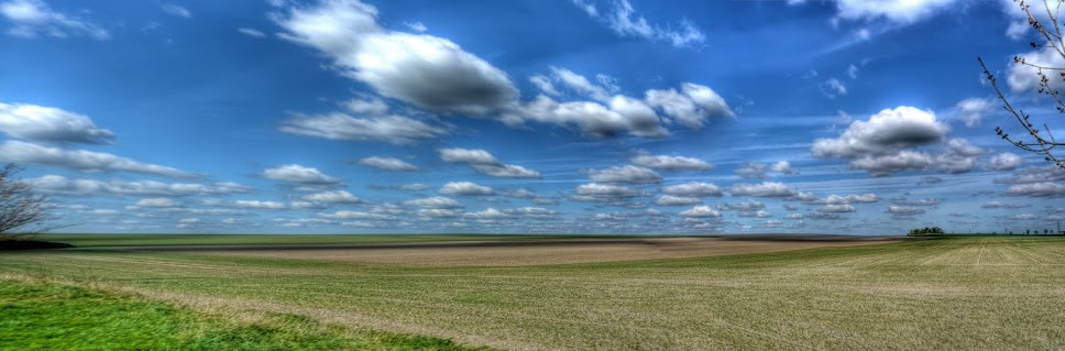
The same clouds in the sky - and crops growing in the fields.


P1070638_2_3_4_5_6_7_tonemapped.jpg


Then just before the Heath Road rises to cross over the A14 dual carriageway there is a turn to the left that takes you down a track which runs parallel to the A14. (This is actually where the A11 and A14 combine so technically it runs alongside the A11 which quickly becomes the A14.) In the main it has hedgerows each side - now showing quite a bit of leaf. The surface is not too bad but the ruts can cause the bike to go a bit unstable. Normally I would wear a helmet, protection from both falling and brambles in the face - just in case - but I had forgotten!


P1070645_39_40_41_42_43_44_tonemapped.jpg


Heading down the track there are fields to the left and a very busy road to the right. I am sure that motor vehicles have become noisier - of perhaps we now get more noise generated from the roads due to heavier traffic (both more and larger vehicles). However because cars and other vehicles have become more luxurious, with more sound-proofing, most motorists do not realise how much noise pollution they create. This is the A14 - it looks like the digger is trying to escape! The ghost images of cars result from the way in which several different pictures are combined to create the final image.


P1070652_46_47_48_49_50_51_tonemapped.jpg


The much nicer view the other way - fields, clouds and a slight hill!


P1070659_3_4_5_6_7_8_tonemapped.jpg


The ridge running along the middle of the picture is called the Devil's Dyke part of a set of several Anglo-Saxon earthworks (Fleam Dyke, Devil's Dyke, Brent Ditch and Bran Ditch.) The Devil's Dyke stretches from Reach to Woodditton and is 7.5miles long. I have walked along it with a bunch of scouts or cubs - it was a while ago!


P1070666_0_1_2_3_4_5_tonemapped.jpg


The path I was on passed under a bridge, built to allow those walking on the dyke to cross over the A14 safely. Here is the view of the devil's Dyke looking towards Reach.


P1070687_1_2_3_4_5_6_tonemapped.jpg


The view of the bridge over the A14 - looking towards the WoodDitton end.


P1070694_88_89_90_91_92_93_tonemapped.jpg


The track I had just cycled down from the Swaffham Heath Road. The A14 is to the left of the track - but I deliberately left it out of the picture. Roads get too much space as it is.


P1070701_695_696_697_698_699_700_tonemapped.jpg


The track towards Exning - the direction I am going - where I will pass into Suffolk. Again you can see that there are ghost cars.


P1070722_16_17_18_19_20_21_tonemapped.jpg


The route then leaves the byway to join the Sustrans 51 between Burwell and Exning on the Heath Road same heath another road.) If you follow the link you will see the point (on Google Maps) where the path emerges - from this direction it hardly looks as if there is a path there. The Heath Road continues to run parallel to the A14 until Exning. To the left some crops in the fields and blossom in the hedgerows.


P1070743_37_38_39_40_41_42_tonemapped.jpg


A closeup of the blossom - which I think is Hawthorn and has a slightly perfumed smell.


P1070757_1_2_3_4_5_6_tonemapped.jpg


I cycled past this pub and then passed another pub incorrectly though both were called the White Horse. In fact this one is the White Horse and the other one...


P1070764_58_59_60_61_62_63_tonemapped.jpg


Is this pub - the White Swan. It does not look too white though.


P1070771_65_66_67_68_69_70_tonemapped.jpg


After Exning I headed back along the main street before turning off down a "No Through Road" - North end. The road leads to a Byway through to Burwell - which can be followed over the B1102 through to North Road in Burwell which then, if you turn left, joins up with Sustrans 11 - I took the Wicken Fen direction and whilst in the village took this picture of the Maids head in Wicken since there was a slight Pub theme to the photographs.


P1070792_86_87_88_89_90_91_tonemapped.jpg


It is quite pleasant heading the "wrong" way around a familiar route, roll on Summer - I will have to take out my MTB (the one which I took to India) and venture further afield. I can't wait for the "shorts" weather to turn to "t-shirt" weather as well.


Sunday, April 4, 2010

Lode and Leeks, Buildings and Burwell - yet another cycle through the Flatlands (Fens)

After my cycle up to St Ives and back on the route of the Cambridge Guided Busway (CGB) I felt absolutely knackered - admittedly I have had 9 days of from cycling, but I did go out walking most of the non-cycling days. As I set off late i also maintained a reasonable pace, for me, both into the wind and with the wind behind me as I had set off late and did not want to be out for too long. I felt so tired that I thought I might be sickening and rested on Friday, after a slightly uncomfortable night. Fortunately rest was all I needed, on Saturday I felt fine and although I went for my routine cycle ride around Wicken Fen my cycling pace was good and I also did a fair amount of cycling up and down dead-ends just for the fun of it. Mind you it was probably helped by the weather - it was a lovely still day and the temperature was up to around 10/11C. As it gets warmed you need to wear fewer layers of clothing - when I returned from my CGB run my t-shirt was soaked with sweat and in hindsight I probably suffered a little from forced dehydration. This time around I wore less and thinner clothing and did not have any over-heating problems.


The onset of Spring seems to have slowed down a little as the weather had changed from unseasonably warm to unseasonably cold. I'll be great to see the leaves back on the trees. Closer to Cambridge the trees and hedges have more green tinging them but out in the Fens I guess as it is a little less sheltered the temperature is a little lower. There are lots of daffodils around though in the villages.


When you know an area you tend to take it for granted, however when my Mum was staying she was surprised how little litter there was around the villages and how many thatched cottages there still are - and there are. I am not sure I would ever want a house with a thatched roof but they do look picturesque. As I cycled through Lode adjacent to the National Trust anglesey Abbey estate you don't just see one or two you see clusters of them. Actually it should not really be a surprise - you expect to see older buildings constructed from local materials and in the Fens Sedge is pretty common. Here are some of the Lode Thatched cottages.


P1060616_2_3_1_4_0_5_tonemapped.jpg


These all seem to have a protective covering of wire mesh - presumably to stop birds nesting in it? Although I do not have a picture, there is a similar cottage on the Wicken Fen estate with information describing how such cottages were constructed.


P1060623_19_20_18_22_17_21_tonemapped.jpg


Another Thatched Cottage in Lode - this one is opposite the church with a yellow wash to match the daffodils growing in the grass in front.


P1060630_24_25_26_27_28_29_tonemapped.jpg


This drainage ditch does not have a name, but is adjacent to Swaffham Poor's Fen and is at the end of White Fen Droveway. Normally I would have turned off to cycle along the "new" route through White Fen (part of the Lodes Way Sustrans/NT Connect2 route). You can see Spring is on its way from the green in this clump of trees and bushes.


P1060658_2_3_4_5_6_7_tonemapped.jpg


I did pop up to see whether there was any more progress on the new Lodes Way bridge across Reach Lode. For a no through road this route (Split Drove) gets a fair bit of traffic at the moment. What with construction traffic and farm traffic at a busy time of year. The field on the left is full of leaks.


P1060665_59_60_61_62_63_64_tonemapped.jpg


The leak locusts have been busy - it is a bit like brining the factory to the field. Probably quite a tough and monotonous job though


P1060679_3_4_5_6_7_8_tonemapped.jpg


Most of the fields around here are on to the next stage of cultivation and having "plastic" sheeting to warm the soil in order to accelerate the growth of whatever has been sown. This particular piece of farm machinery has been busy - it was on the other side of the road the last time I saw it.


P1060700_694_695_696_697_698_699_tonemapped.jpg


In fact the last fields that I saw the red "plough" on were these - now they have been covered in strips of material which apparently warms the soil but is biodegradable and degrades as the crops start to come through.


P1060714_08_09_10_11_12_13_tonemapped.jpg


No pictures of Wicken Fen, I am trying to look afresh at other aspects of my route. Here is Burwell Baptist Chapel, now a listed building, Grade II, it was built after 1842.


P1060728_2_3_4_5_6_7_tonemapped.jpg


I could not resist taking a few more pictures of Swan lake Grain Store on the outskirts of Reach. I am intrigued as to how it got the name - do Swan's roost nearby? A quick search on the web only highlighted concern about young people "burning rubber" on the site.


P1060742_36_37_38_39_40_41_tonemapped.jpg


Looking back up towards Barston Bridge I liked the juxtaposition of this Warning Sign and the Plough/Seed Drilling machine just of the road. The warning actually applies to a bit of the road in Reach where it runs through ninety degrees in between two cottages.


P1060756_0_1_2_3_4_5_tonemapped.jpg


No leaves on the trees along Swaffham Bulbeck Lode on the edge of White Fen.


P1060777_1_2_3_4_5_6_tonemapped.jpg


A remnant of the disused Cambridge to Mildenhall railway in a field just down the road from the old Bottisham and Lode Railway Station. It is not that unusual to see old carriages like this around old railway lines - did they just get abandoned - I guess so many lines were closed down that there was a surfeit of rolling stock and it was not worth collecting them all up.


P1060819_3_4_5_6_7_8_tonemapped.jpg


A footpath joins this track which is marked as Lodemoor Drove (track) on the map. The lode in front is Bottisham Lode.


P1060833_27_28_29_30_31_32_tonemapped.jpg


This is a more natural form of traffic calming - a wibbly and bumpy road alongside a wibbly lode - cars tend not to speed along here.


P1060834.jpg


That cycle ride was quite a relief - it was quite fast, certainly faster than the CGB ride the day before, the day before (intentional repeat there) and I felt OK at the end of it - looks like I am not sickening - just unfit!