Showing posts with label Sustrans 11. Show all posts

Thursday, May 13, 2010

The Cambridge Guided Busway - finally, almost clear for cyclists

There has been quite a bit in the news recently of interest to cyclists. The Cambridge News reports on "Who will win fight for Gilbert Road". I've written about this before; "Is the CGB Passable by Bike?", this is a road in Cambridge with some rather interesting advisory cycle lanes that vehicles frequently park in - legally. Consequently it puts of parents from allowing their children to cycle to the nearby schools and is dangerous for the cyclists who use this route as they are intimidated by motor vehicles as they cycle around the parked vehicles.


The County Council has proposed a scheme of changes to improve the situation - but apparently some of the inhabitants of the road are complaining about a loss of parking space. If you follow this Google Streetview Map link you can see this is quite an affluent street with many residents having parking in their garden. This link demonstrates the issue - a van, parked in the cycle lane opposite a bus stop. The News report discusses an invitation by the Cambridge Cycling Campaign for councillors see for themselves what the issue is about on Tuesday 18th May. Personally I would like to see made perceptibly safer to encourage more cycling to replace unnecessary polluting motor vehicle journeys - but I have a garden in which I can park my car - so it is easy for me to say.


The other cycling issue - no surprise really - the Cambridge (mis) Guided Busway (CGB). I use the term "mis" not to indicate whether the decision to build a Guided Busway versus re-opening the railway (or a road?) was right or wrong - but because this seems to have been dragging on for a long time. As is common - success has many father and failure but one mother - at the moment there seems to be finger pointing. The bottom line is that here is a project that has cost the tax-payer over £100M and it is still not in operation over a year late. Where is the accountability? Mind you to put the cost into context there are plans to widen the A14 between Fen Drayton and Fen Ditton and to create a new Dual Carriageway between Fen Drayton and the A1 - the cost is expected to be more than £1billion - yes 10 times the cost of the CGB. The Cambridge News reports that the Campaign for Better Transport has ".. urged to scrap A14 upgrade".


The trouble is that it is always easy to spend other people's money (tax payers) on projects like this - but given the deficit this country has I believe we really do need to starting to balance the books. You cannot continue to spend money you don't have and so difficult choices have to be made. Continually popping in new roads and upgrades is not a long-term solution nor a substitute for proper long-term planning - land is a scarce resource - let's use it wisely.


Back to the CGB that too is continuing "to make slow progress" (almost an oxymoron), a deadline was set to produce a plan to analyse and propose a solution for "six" faults. That seems to have come and gone. The message conciliatory. The next day positions seemed more adversarial: "Long wait for bus gets even longer as deadlines pass".


With that in the news - well it seemed I should perhaps have another ride along the CGB to see for myself what was happening. My news: "I cycled the CGB without using the concrete tracks at all!". That was the good news - the bad news is that I only just made it and took some risks to do so.


I took the Sustrans Route 11 up to St Ives - I prefer not to cycle there and back along the same route. This time around I detoured through Fen Drayton Lakes. After Swavesey you turn right into the Lakes and then rejoin the Sustrans 11 route in Fen Drayton. Interestingly the lakes on the Fen Drayton side look as if they are running low on water! This looked hopeful - with any luck the track would be clear of any flood water on the CGB cycle/maintenance path. The sign on the gate indicates it is a "Conservation Area" - conservation of water perhaps.


P1100123_17_18_19_20_21_22_tonemapped.jpg


Once in St Ives I joined the CGB and had to take this picture of the lily pads on one of the lakes before the CGB crosses the River Great Ouse. Again this did not look too bad. The challenge is that where the paths have been flooded the cycle path tends to be uneven and in places new unpacked gravel has been laid down. This makes it tricky on a bicycle and you need to have your wits about you. You need momentum to get through the soft gravel, but not be going too fast that you can't avoid the odd rock sticking up in the path. This is ok in daylight - but not something I would be quite so happy doing at night with a cycle light to show me the way.


P1100137_1_2_3_4_5_6_tonemapped.jpg


Just when I though it was going to be quite passable I came up to this bit of flooding - I did cycle though it. I kept to the edge where it was likely to be slightly more shallow and I could jump of onto the bank if necessary. The problem was that there were also deep wheel ruts under the surface and a very soft quick-mud (like quick-sand only mud) and at one point as my wheels sunk down I leapt onto the bank. I hauled my bike out and found some harder ground and carried on cycling. I also had to resort to half-pedalling - so neither pedal reached the bottom of the pedal stroke to avoid getting my feet wet. (You push on the pedals and then do a half back-pedal and then push forward again - tricky on a soft surface.)


You can see my wheel track on the right causing a small rut where I emerged from the flood water. Was this ok for fun - yes - would I do this as a regular commute - no way. Here we are months after the paths were flooded and they are still impassable really. I would be interested in knowing what the cock-up was. Is the path lower than planned or did the estimates for the expected flooding miscalculate the levels of water to be expected. Having seen how the lakes themselves seem to be low my suspicion is that the paths were either designed or built with no thought about drainage - in fact it seems that water drains and stays in the paths.


P1100151_45_46_47_48_49_50_tonemapped.jpg


This is Hale Windmill, currently a Kennels and Cattery near Swavesey - it is quite a striking landmark in the area. I bet the views are good from the top.


P1100154_2_3_tonemapped.jpg


One of the other things to be aware of as you cycle along the CGB at the moment is that, as you might expect, there are lots of flying insects at this time of year. I passed quite a few cyclists with buffs as face masks, I tried to keep my mouth shut - but did end up swallowing my first flying thing of the season.


Yellow seems to be in season at the moment for flowers though. Here is a field (Near Ditton Meadows) full of buttercups and dandelions.


P1100165_59_60_61_62_63_64_tonemapped.jpg


Of course we have fields and fields full of Oilseed rape - at the moment it is bright yellow and has quite a pungent smell - I don't mind the smell, some people find it too much though.


P1100179_3_4_5_6_7_8_tonemapped.jpg


On my journey there and back I did encounter some interesting driving (mainly going) - so see my next post - A Quiz for Cyclists helping to illuminate my feelings about the road features designed to manage traffic!


On the CGB - I was cycling from St Ives to Cambridge between 4pm and 5pm. In that time I passed 22 cyclists (in both directions) 13 (two female) using the concrete track and 9 (three female) not using the concrete track. I was expecting a higher proportion would be using the concrete track.

Tuesday, May 4, 2010

As I was going to St Ives I ended up in Ely

As I was going to be spending some time in the US on business I decided to go for a longer ride on Friday (the flight out was on Saturday - cheaper tickets!). After checking the wind direction I had planned to cycle to St Ives and then wend my way up to Kings Lynn and then catch a train back. According to the BBC Weather information I would have the wind behind me for the route from St Ives up to Kings Lynn. I had not checked the distance though and the weather forecast also suggested rain showers - so instead of plotting a map and printing it out I decided to be a bit more flexible and see what lay ahead.


I was originally going to take the Sustrans 51 (non CGB route) but in the end after seeing some press suggesting that there might be further Cambridge Guided Busway delays (CBG delays) thought I would pop up the CGB way and see how much work was taking place and whether the route was finally passable by bicycle without resorting to cycling along the concrete tracks.


I also happened (deliberately) along the Sustrans 51 route between Cambridge and Bottisham, it seems that the potholes along the Quy Mill Hotel road near the A14 have been filled. The Cambridge Cycling Campaign run a cycle ride from Cambridge through to Reach Fair on May day (May 1st) am I being to cynical to think that might be why the potholes got filled. To be fair there is quite a bit of work around Cambridgeshire at the moment that is beneficial to cyclists so I should not be too harsh - it is great to see - lets hope it does the job and gets more people out of their cars and onto their bikes and enjoying a bit of fresh air.


Here is the road to the Quy Mill Hotel which helps cyclists bypass the Newmarket Road/A14 intersection. One of the biggest potholes has been filled. This one was definitely a trap for the unwary. Mind you I would always take this "off-road" route rather than take the Intersection route. I don't think I have cycled along the road way for years.


See the clouds in the sky - they definitely looked as if there could be rain - lets hope the weather forecast was correct and it was showers and not rain.


P1090376_0_1_2_3_4_5_tonemapped.jpg

One feature of the CGB is the way it deals with the various roads that cross it. Apart from a bridge under the A14 and one near the Windmill/Communication tower under the Over to Longstanton road the rest of the time there are light-controlled crossings. Such as the one shown in the picture. The cyclist/pedestrian.horse route has barriers, large enough I would hope for cyclists (towing trailers/tandems etc) and horses - but small enough to stop cars finding their way onto the path. I would imagine that another justification for the barriers is that it prevents cyclists from speeding across the roads. The crossings do appear to have sensors mounted on top of the posts - but at the moment they do not seem to influence the lights at all. I also found that the lights were slow to change when the buttons were pushed - in the case of the crossing near Longstanton/Willingham I gave up waiting for the lights and crossed during a gap in the traffic.


Next time I cycle along the CGB I must check to see how maintenance vehicles will "get around" the barriers, it is not that clear in the picture - I assume the barriers will rotate out of the way? The sign prohibiting motor vehicles seems to be partially obscured by the post with the light control switches. See how there are a set of buttons at horse-rider height.


During my ride up the CGB I did seem a few groups of workers - but also noticed an inspection team near the Milton Road end of the CGB, they seemed to be looking at the vegetation alongside the CGB. There are gardens adjacent to the CGB and some of their tees overhang a little - at one point the CGB tracks do seem quite close to the overhanging trees.


P1090383_77_78_79_80_81_82_tonemapped.jpg

Although the weather forecast indicated showers, so far so good, the clouds looked less threatening than they had in Cambridge. The bus passengers will have some pleasant views across the Cambridgeshire countryside.


P1090390_84_85_86_87_88_89_tonemapped.jpg

A closeup of the maintenance track along which cyclists, walkers and horses will also be allowed. At the moment it is being compacted by the maintenance vehicles - I cycled in the left "rut" which was pretty good. I noticed some pitting (mini-potholes) where the CGB goes around the Oakington Immigration Centre though - my concern is that the pits will get bigger and never get fixed so the track will deteriorate significantly and then it becomes much less pleasant to cycle on, especially in the dark.


P1090397_1_2_3_4_5_6_tonemapped.jpg

The track also switches the side it runs along as it crosses roads - not every time, but occasionally. At the crossing near Swavesey the crossing splits into two tracks - one for horses/riders and I assume cyclists, the other track is for walkers. I don't refer to them as pedestrians - I think walkers is more apt description. I wonder why the decision was made to make this crossing different to the others - are more horse and riders expected, or perhaps more walkers. It does look as if it might actually cause uncertainty - cyclists tend to take the path the maintains momentum.


P1090411_05_06_07_08_09_10_tonemapped.jpg

This is how the Swavesey stop looks at the moment. It seems finished, the ticket machine is protected by some wood - but I have seen one in the open and it looked ready to sell tickets.


The building in the background is the MG Owners Club HQ.


P1090418_2_3_4_5_6_7_tonemapped.jpg

Look at all these bike racks lined up and ready to encourage more people to cycle and ride (rather than park and ride). Let's hope that there is a good uptake for regular cyclists. I must check the next time I visit to see whether the CCTV covers the bike racks.


P1090425_19_20_21_22_23_24_tonemapped.jpg

After St Ives, I changed my mind and decided rather than cycle over to Kings Lynn that I would head over to Ely and then cycle back to Cambridge - although it broke the golden rule of the return journey being against the wind it meant I could visit some places I had not been to for a while.


On the map my route from St Ives through to Somersham looked straightforward - a B road, the B1086 - I was hoping it would not be too unpleasant, my hopes faded once I started cycling along it it turned to out to be a fast, busy, straight and undulating road. The general advice for cyclists is to cycle in the road rather than in the gutter. In fact the Institute of Advanced Motorists has recently published a guide on "How to be a better cyclist" which extols the benefits of "claiming the road" - well let me tell you that was a tough thing to do on the B1086. Too often a car would whizz past with inches to spare before swerving in front of me to avoid a car coming the other way. The real problem is that motorist travelling a 60mph find it difficult to assess and deal with low speed (15-20mph) vehicles - throw in some hills and non-overtaking white lines. I can't say I really enjoyed it.


Visiting Somersham was like going back in time - look at this garage selling petrol (gas) unusually it supplies both Shell and Esso fuel. I have never used pumps this old in my driving lifetime. Actually they are not really in use - despite the open sign.


P1090439_3_4_5_6_7_8_tonemapped.jpg

If Shell is not to your liking then try Esso!


P1090446_0_1_2_3_4_5_tonemapped.jpg

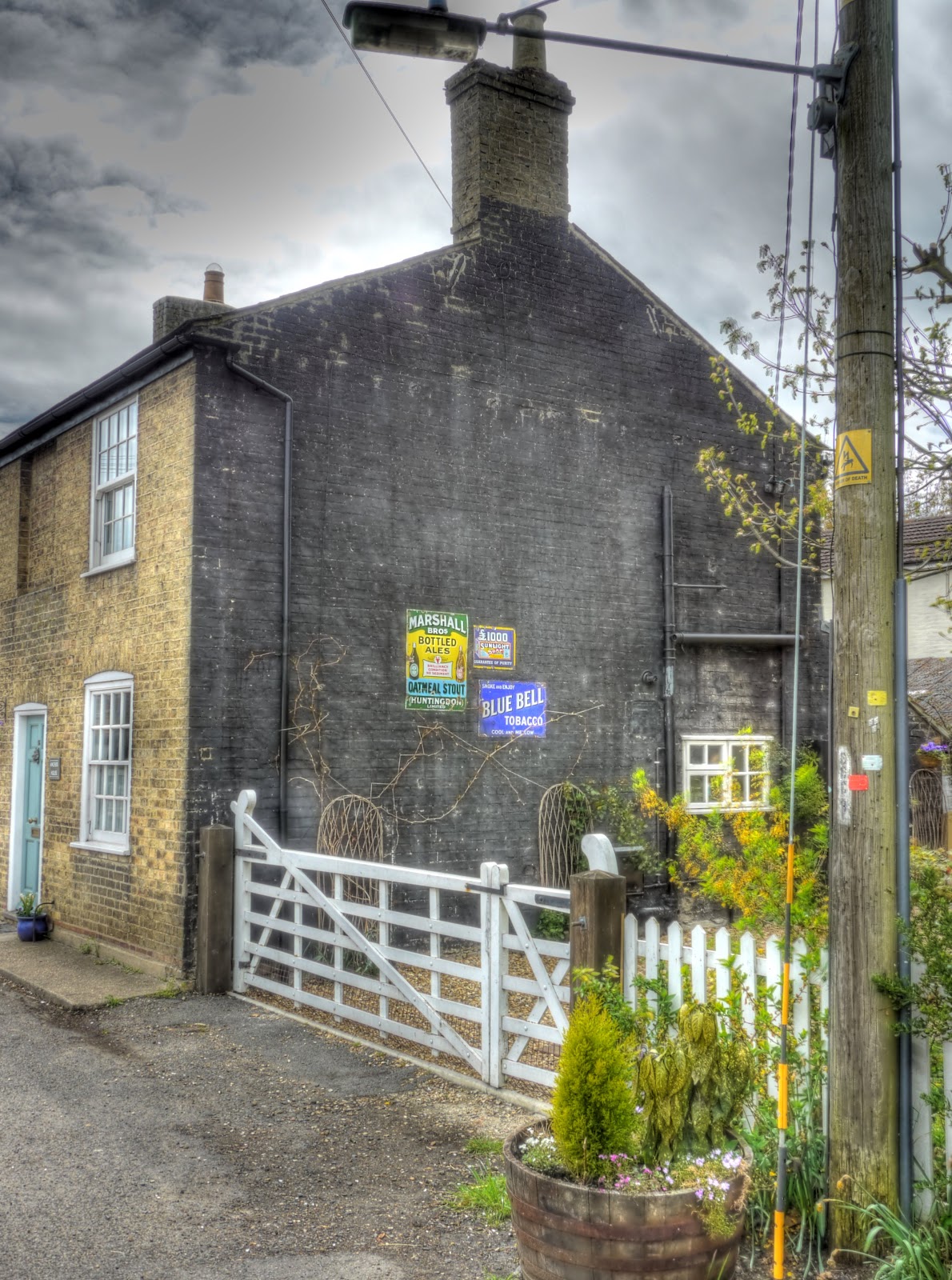
After Somersham I headed south towards Earith where there was some more nostalgia in the form of these old advertisements.


P1090453_47_48_49_50_51_52_tonemapped.jpg

Opposite the adverts was this rather quaint Thatched Cottage looking good in the sun with the bright colours in the strip of garden at the front. Did I also mention that the road from Somersham was much more pleasant to cycle along, although still the same road number it was less straight and not so busy. Consequently cars tended to give more space and pass me with more room.


P1090460_54_55_56_57_58_59_tonemapped.jpg

Just in case you could not see the adverts here they are again in close-up. Until I saw the sign I had never heard of Marshall Oatmeal Stout.


P1090461.jpg

After Earith I ended up heading north again, towards Sutton. in the Isle - a village a little like Ely in the sense that it is situated on a hill with lower level land surrounding it - a little like an island. Sutton lies just off the very busy (and to be avoided) Ely to Chatteris (A142) main road - but it looked as though there was a by-way that meant I could avoid the busy main road, the byway then came out on the Haddenham Road with although an A road was not busy and apart from having to cross the A142 - which was tricky, it was a very pleasant route.


The byway ended up passing between fields of Oilseed Rape - although the clouds did look a little ominous.


P1090482_76_77_78_79_80_81_tonemapped.jpg

I took this picture looking back at Sutton to try to convey the idea that the Village was an island surrounded by a sea of yellow. You can see the church tower but the ridge is not as high compared with the surrounding land compared with Ely.


P1090496_0_1_2_3_4_5_tonemapped.jpg

Just where the Sutton byway joined the A1421 there was an interesting path that I took a picture of as a possible future route to explore. (Both on the map and on the bike.)


P1090503_497_498_499_500_501_502_tonemapped.jpg

Once I was on the main road (A1421) heading north I stopped to take a picture of the church in Sutton using a convenient lamp-post to steady the camera.


P1090524_18_19_20_21_22_23_tonemapped.jpg

Where the A1421 joined the A142 it is shown as Witcham Toll on the map. My plan was to cycle into Witcham and follow one of the many by-ways to Coveney.


P1090527_5_6_tonemapped.jpg

There was a convenient plaque showing the area, but although I went over to several different byways, but either I was too tired or they really were too bumpy but after a short trip up each of them I found them way too bumpy on my hybrid bike and took the road route instead.


P1090532.jpg

Then after Coveney I popped over to Ely and followed Sustrans 11 back to Burwell. A quick stop to admire the neatly planted rows in this field with a sprinkler in the background. Whilst passing one of these fields I am also sure I heard a "rookie". When I was a boy farmers used a string of fireworks (bangers on steroids) which as the string smouldered would explode from time to time to scare birds. The name rookie derives from the name Rook Scarers We used to pretend we were buying them, for our farmer Dads, because they were more powerful the normal fireworks - we were lucky no-one got hurt.


P1090540_34_35_36_37_38_39_tonemapped.jpg


Through the back of Wicken a nice piece of targeted marketing - this is a Sustrans route - so why not appeal to Cyclists - who generally are happy to take any opportunity for a cake stop.


P1090541.jpg

After cycling through Wicken Fen I saw this "abandoned" tractor and rollers - kind of strange - was the farmer abducted by aliens.


P1090548_2_3_4_5_6_7_tonemapped.jpg

In the end I cycled around 100Km/60miles and despite breaking my rules about cycling home into the wind it was not too challenging. I found also some new byways to cycle on. The only niggle was the battery in the transmitter on my speedometer went flat so about halfway round it stopped showing my speed and recording the total distance. Not too much of a problem though as my Garmin GPS unit recorded the the route, and speeds. I only got wet three times and each time it was a relatively short shower so for once the weathr forecasters also got it right.

Saturday, April 24, 2010

Spring has arrived - I saw my first Charity Bike Ride of the year!

It really must be Spring - I saw my first Charity bike ride of the year out and about today. I first noticed it when driving in my car and a string of cyclists were travelling in the opposite direction. They also had to put up with a car driver who did not seem to know whether they wanted to overtake, hang back or just force me off the road. I stopped - it was the safest thing to do. It was a mixed bag of cyclists - but they certainly looked enthusiastic and had a great day for their ride - sunny but not too warm. There were quite a few white A4 notices on lampposts and poles along the route - it was the Hannah 100. A 100Km from Cambridge up to Ely via Burwell, Exning, Chippenham and Prickwillow and then back on Sustrans 11 to Burwell and Sustrans 51 to Cambridge. At least I think that was the route - their map is here. By the way the 100 is 100Km not 100miles - still a good distance (around 60miles) especially when undertaken by people who do not do a lot of cycling.


I must admit I would have enjoyed taking part - and it was on a route I know well. Later that day when I went out for a cycle ride I did come across a few stragglers - some just wanted reassurance that they were on the right route back to Cambridge others looked as if muscle strain or cramp was a problem. I hope they all made it successfully.


I did a bit of meandering on my ride - partly to see if I could work out what route they were taking and partly because it was a nice day for meandering. Instead of turning right on Sandy drove towards White Fen I turned left and followed the track a short way - then took this picture looking back - the White Fen cycle path lies roughly between the two Pylon runs - off to the left. You see a lot of "plank" bridges around here - the only way to cross from one field to the next over the drainage ditches without taking the long way round. I had to try it of course.


P1090113_07_08_09_10_11_12_tonemapped.JPG


TI also visited the site of the new Reach Lode bridge being built as part of the Lodes Way cycle/walking/horse riding route through the Fens. Apparently the design requires some large culverts to be built in case of flooding in the fields - this is one of those culverts.


P1090120_14_15_16_17_18_19_tonemapped.JPG


The leek fields are being slowly harvested. It seems to take quite a long time as it is done by hand, presumably to ensure the leeks don't get damaged - there is an interesting onion-y smell in the air when you cycle past.


P1090127_1_2_3_4_5_6_tonemapped.JPG


To avoid the traffic - such as it is, I cycled along the tracks Split Drove, Straight Drove and Harrison's Drove. I saw a group of 4 deer in the field alongside Reach Lode - it is not unusual to see them in the open - they were being cautious though. Each of the deer seems to be looking in a different direction. The top of the lode bank is much higher than the surrounding land as you can see in the picture.


P1090129.JPG


Straight Drove is a grass/mud track - which connects the tarmac of Split Drove with the tarmac of Harrison's Drove. I rarely see anyone else around on the track - normally it is just farmers and farm workers in the fields. I do pass an occasional cyclist - we normally stop and have a chat about things. The mud was rock hard - I normally cycle at the edge. The ruts were a little to deep to cycle in - the pedals catch.


P1090136_0_1_2_3_4_5_tonemapped.JPG


with the amount of drainage required there are quite a few concrete bridges across the drain (as some are called). This one is Commisioners' Drain - a bit further South it turns through 90 degrees.


P1090143_37_38_39_40_41_42_tonemapped.JPG


The use of covers to accelerate the growth of freshly drilled crops is reasonably common - it seems to work - where the wind has blown away the cover there appears to be healthy growth.


P1090157_1_2_3_4_5_6_tonemapped.JPG


Round the back of Wicken village , on the Sustrans 51 route one of the many signs to encourage participants in the Hannah 100 - in this case to encourage Carl Isaacson specifically.


P1090164_58_59_60_61_62_63_tonemapped.JPG


It is not just the oilseed rape that is doing well - here is a large crop of dandelions growing well in a field. They have a slightly deeper yellow colour.


P1090171_65_66_67_68_69_70_tonemapped.JPG


On my way back through Reach were, what I hope was the last two stragglers sitting in the shade of the Horse Chestnut tree in the middle of the green. It can get a bit unpleasant sitting for hours on a bicycle saddle when you are unused to it. Let's hope they made it ok.


Thursday, April 22, 2010

Sustrans 11 - South From Cambridge to some hills and back

Cycling has been hitting the local news again recently - one of the reasons is probably because cycling is a significant form of transport in Cambridge which in turn means more people are interested in news about cycling - good or bad. Although given the high percentage of journeys to work by bicycle in Cambridge I guess I am surprised that more resources are not devoted to the provision of better facilities. According to 2001 census data 27.3% of journeys to work were by bike/motorbike/walk, with 57.4% by car. I found this in an interesting document published by Cambridge City Council each year - Annual Monitoring Report. I am not sure why there is not more recent data - 2001 was quite a long time ago - a lot has happened in the last 9 years.


So the latest cycling news? "Dad's fury as cyclist suffers injuries during police chase". I am not sure of the rights or wrong in this case - but I do thinks that in the UK the relationship between the public and the Police has lost the respect element along with a rise in the so-called "compensation culture" - it is always easy to blame others.


The other bit of "cycling-related" news - well to me anyway, is also reported in the Cambridge News: "Guided bus work 'could be finished by June'". I know that the CGB is not really there for cyclists - however it does represent a potentially significant route for cyclists. Unfortunately it seems that although there could be buses running by June the Maintenance track will not have its repairs completed until July and that buses could run at the same time. Is this a sign that Cyclists are being treated as second class citizens again. Why wait? and what can we expect from the fix - the track has been out of commission for months at the St Ives end - fix it now whilst cyclists can still use the concrete tracks to bypass the flooded bits please. It also worries me that they refer to the Track as a Maintenance Track which will also accommodate walkers and cyclists. Are these ways of trying to reset expectations!


Talking about lack concern by car drivers for cyclists and pedestrians. Whilst cycling along Sustrans 51 near to the airfield on Newmarket Road how about this bit of total disregard. A car parked right across the shared use path - not in the drive of the house, or on the road to the right, (which is not a through road and only serves 3/4 houses). Deliberate or ignorance - who knows - and many non-cyclists will wonder why it is an issue - well when you slow a bike down it takes significant physical effort to regain the speed you lose - personal effort (which for those of you who remember Physics at School that effort is proportional to the square of the speed you wish to attain! - so being slowed on a fast track is much worse than being unnecessarily slowed on a slow path.)


My car shows the fuel consumption and there are two factors that really increase fuel consumption; going fast and continually slowing down and accelerating. Both are things that the intelligent driver can significantly improve upon.


P1080692_3_4_5_6_7_8_tonemapped.jpg


I chose the route I took today for no other reason than I have not been out that way for a while. Also as it was not so windy I didn't let the wind direction influence my choice of ride. It was once again a lovely, sunny day and reasonably warm for the season. At the weekend I cycled in fingerless cycling gloves but reverted back to thinnish but full finger gloves for this ride - still riding in shorts though. My legs are starting to regain their sun tan.


Normally when I cycle (or drive for that matter) I like to avoid returning on the same route there and back - but I was a little pushed for time - this was a cycling ride I sneaked in because the weather was so nice. So for simplicity it was down the Sustrans 11 route for 20 miles /32 Km and then back again. When you look at the Sustrans map quite a lot shows as off-road - which means in this case on shared pavement alongside the roads. There is an exception though the bit between Addenbrooke's Hospital and Great Shelford which in part runs alongside the Cambridge to London "used" Railway Line and seems to be a well used path.


When pushed for time I tend not to take so many pictures - I did stop to take a picture of the Sawston Bridge where the A1301 crosses the River Granta. There is a separate bridge for the pedestrian/cycle route - it is quite narrow, two cyclists have to be careful when they pass each other. It is funny how brick bridges look so much more "picturesque" compared with concrete bridges. I am not sure why the bridge is called the Sawston Bride - it is much closer to Stapleford.


P1080712_06_07_08_09_10_11_tonemapped.jpg


The view downstream - here the route of the Cambridge, Haverhill and Sudbury Branch line briefly ran alongside the river before joining the Cambridge to London railway line.


P1080719_3_4_5_6_7_8_tonemapped.jpg


The route rejoins the road in Sawston - which at the far end has traffic calming measure - obstructions on half of the road - cars hate to give way to cyclists, their interpretation of "Give Way" does not include giving way to cyclists. The route then crosses the very busy A505 which connects the M11 and A11. This is a terrible road to cross during the rush hour- be careful. Actually a car stopped to allow me to cross the road - the age of courtesy is not dead.


The route then appears on the map as off-road - this is what it means - a shared path alongside the A1301 with a white line acting as no-mans land between the cyclists and the pedestrians. I did not see any other cyclists or pedestrians - I did see this lorry driver who had stopped though - the lay-by was not enough - he wanted to block the cyclists bit of the shared path as well. The curtains were down on the windscreen so perhaps he wanted to sleep? If he had just parked on the lay-by then he would probably have ended up being rocked by the slip-stream of passing lorries - at least that is my guess for why he (or she) is encroaching on the path. No issue today - but it will cause damage to the path and crossing the painted line in the wet can sometimes be a bit interesting on thinner tyred bicycles.


P1080726_0_1_2_3_4_5_tonemapped.jpg


The route carries on through two very picturesque villages - Hinxton and Ickleton where it crosses the Cambridge to Liverpool Street Railway Line, River Cam or Granta (as it appears on the OS map) and the M11. I stopped in between the two villages to take a picture from a footbridge across the river - this is looking upstream towards Cambridge.


P1080733_27_28_29_30_31_32_tonemapped.jpg


This is looking downstream. When I don't stop so often I tend to take several pictures at the same spot!


P1080747_1_2_3_4_5_6_tonemapped.jpg


After Ickleton the route climbs up to the dizzy heights of around 90m with some great views back towards Cambridge the M11. I stopped at a crossroads just before Strethall where the Icknield Way Trail crosses the road. The path is marked as a bridleway but where it crossed this field it would have made for unpleasant cycling. This is made from 6 ( x7 different exposures) pictures. The road is the cycle route and here is looking North - the hill is Coploe Hill the high point around these parts. The pictures must have been slightly different as you can see the field appears slightly darker in the middle.


Nr icklington_Panorama1.jpg


On the way back there was time for a quick stop to take a picture of this recently sold house in Hinxton.


P1080796_0_1_2_3_4_5_tonemapped.jpg


Although it was not too windy it was against me on the way back - but at least I had a hill to go down first. This plot shows the gradient as recorded by my GPS. I have a Garmin 605 EDGE which measures the altitude from the GPS trace rather than Barometrically and is prone to significant fluctuations. It does show the hills in the middle of the ride though.


Sus11 nr Icklington.JPG


On my way back I did check out the work on the Southern part of the CGB - not enough change to be worth taking pictures of though - at least from the vantage points I had. There is still a significant caravan park just off Long Road though. I wonder what they are all doing. The work seems to be focusing on the Station end.

Sunday, April 11, 2010

The noisy off-road route to Exning and Burwell

As the weather gets nicer it becomes more appealing to venture off-road, both for a change and to get away from traffic. Although this route only achieves that in part! One of features of the Flatlands of England (East Anglia) is that it is well - flat and also one of the drier parts of the UK. This means that even on a conventional hybrid bicycle you can use byways, bridleways and BOATs (otherwise known as byways open to all traffic) without to much difficulty. The only real problems occur when the paths become churned up with huge ruts. They are worse when wet though, when they are dry you can at least push/carry the bike around them. Normally though they tend to consist of slightly bumpy tracks and as I have come to find there are loads of them. Sometimes I have a look on the map to see what is interesting and sometimes I just venture down a track to see where it goes.


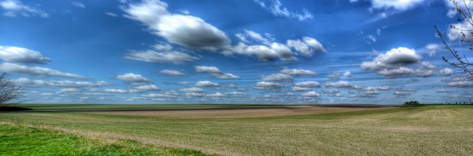
To get to this route I headed out from Cambridge towards Swaffham Bulbeck on the Sustrans 51 route, where after climbing up around the back of Swaffham Bulbeck I set out along the Swaffham Heath road (signed towards Newmarket). As I was cycling along the road I had to stop to take a few pictures of the wide-open skies - blue with puffy clouds floating along. As you can see the soil looks chalky around here - only a couple of miles from the black peaty soil of the Fens.


P1070603_597_598_599_600_601_602_tonemapped.jpg


This is a picture made up of 3 x 7 sets of pictures. (I use 7 exposures to create one HDR picture and then in this case 3 HDR images to create the picture. As I was taking pictures a chap came by in an open-topped sports car to admire the same scene. He wished he had got his camera with him.


SWaff Heath Rd Panorama.jpg


The same clouds in the sky - and crops growing in the fields.


P1070638_2_3_4_5_6_7_tonemapped.jpg


Then just before the Heath Road rises to cross over the A14 dual carriageway there is a turn to the left that takes you down a track which runs parallel to the A14. (This is actually where the A11 and A14 combine so technically it runs alongside the A11 which quickly becomes the A14.) In the main it has hedgerows each side - now showing quite a bit of leaf. The surface is not too bad but the ruts can cause the bike to go a bit unstable. Normally I would wear a helmet, protection from both falling and brambles in the face - just in case - but I had forgotten!


P1070645_39_40_41_42_43_44_tonemapped.jpg


Heading down the track there are fields to the left and a very busy road to the right. I am sure that motor vehicles have become noisier - of perhaps we now get more noise generated from the roads due to heavier traffic (both more and larger vehicles). However because cars and other vehicles have become more luxurious, with more sound-proofing, most motorists do not realise how much noise pollution they create. This is the A14 - it looks like the digger is trying to escape! The ghost images of cars result from the way in which several different pictures are combined to create the final image.


P1070652_46_47_48_49_50_51_tonemapped.jpg


The much nicer view the other way - fields, clouds and a slight hill!


P1070659_3_4_5_6_7_8_tonemapped.jpg


The ridge running along the middle of the picture is called the Devil's Dyke part of a set of several Anglo-Saxon earthworks (Fleam Dyke, Devil's Dyke, Brent Ditch and Bran Ditch.) The Devil's Dyke stretches from Reach to Woodditton and is 7.5miles long. I have walked along it with a bunch of scouts or cubs - it was a while ago!


P1070666_0_1_2_3_4_5_tonemapped.jpg


The path I was on passed under a bridge, built to allow those walking on the dyke to cross over the A14 safely. Here is the view of the devil's Dyke looking towards Reach.


P1070687_1_2_3_4_5_6_tonemapped.jpg


The view of the bridge over the A14 - looking towards the WoodDitton end.


P1070694_88_89_90_91_92_93_tonemapped.jpg


The track I had just cycled down from the Swaffham Heath Road. The A14 is to the left of the track - but I deliberately left it out of the picture. Roads get too much space as it is.


P1070701_695_696_697_698_699_700_tonemapped.jpg


The track towards Exning - the direction I am going - where I will pass into Suffolk. Again you can see that there are ghost cars.


P1070722_16_17_18_19_20_21_tonemapped.jpg


The route then leaves the byway to join the Sustrans 51 between Burwell and Exning on the Heath Road same heath another road.) If you follow the link you will see the point (on Google Maps) where the path emerges - from this direction it hardly looks as if there is a path there. The Heath Road continues to run parallel to the A14 until Exning. To the left some crops in the fields and blossom in the hedgerows.


P1070743_37_38_39_40_41_42_tonemapped.jpg


A closeup of the blossom - which I think is Hawthorn and has a slightly perfumed smell.


P1070757_1_2_3_4_5_6_tonemapped.jpg


I cycled past this pub and then passed another pub incorrectly though both were called the White Horse. In fact this one is the White Horse and the other one...


P1070764_58_59_60_61_62_63_tonemapped.jpg


Is this pub - the White Swan. It does not look too white though.


P1070771_65_66_67_68_69_70_tonemapped.jpg


After Exning I headed back along the main street before turning off down a "No Through Road" - North end. The road leads to a Byway through to Burwell - which can be followed over the B1102 through to North Road in Burwell which then, if you turn left, joins up with Sustrans 11 - I took the Wicken Fen direction and whilst in the village took this picture of the Maids head in Wicken since there was a slight Pub theme to the photographs.


P1070792_86_87_88_89_90_91_tonemapped.jpg


It is quite pleasant heading the "wrong" way around a familiar route, roll on Summer - I will have to take out my MTB (the one which I took to India) and venture further afield. I can't wait for the "shorts" weather to turn to "t-shirt" weather as well.