Showing posts with label Split Drove. Show all posts

Wednesday, March 3, 2010

Inner-city Fens

At the moment , because Windows 7 Backup seems to be much slower than the Vista variant I have changed from running incremental backups once a week to running them once a month. Then in the interim I use a program called Synctoy to copy various directories once a week. (photographs, music, email, Garmin & cycling data). The only snag - well the backup takes even longer - it starts on the 1st of each month and it is still running three days later. It is not too bad but does make my computer feel a little sticky - it takes a little longer to switch from one app to another sometimes.


The weather seems to be holding - frosty in the morning but quite bright sunny days. Out for a quick spin around to Wicken Fen and back the fine weather had also gotten some horse-riders out along Headlake Drove. I stopped to allow the, to move on up the road - then headed out after them.


P1050262.JPG


There was some smoke out along the fields looking back towards the Cambridge direction.


P1050294_295_296_297_298_299_300_tonemapped.JPG


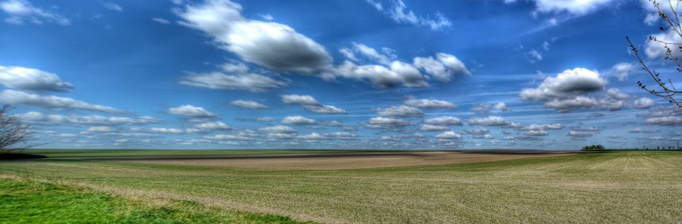
The clouds were suitably dramatic for a picture of Commissioners' Drain.


P1050287_88_89_90_91_92_93_tonemapped.JPG


There was also a burnt out car - it seems that they get stolen - presumably joyriders and then torched to erase any evidence - fingerprints and DNA I assume. Although I am not sure that DNA is collected for stolen cars - probably too expensive and no guarantee that the DNA will match those on file.


What is disturbing is how little is left after the car has burnt out. All the windows have gone, tyres burnt, upholstery gone the radiator collapsed to the ground.


P1050271_2_3_4_5_6_7_tonemapped.JPG


I am not sure what the car is - but thought it looked a bit like a Mercedes estate. I wonder if the number plates were removed beforehand or have burnt to almost nothing.


P1050264_65_66_67_68_69_70_tonemapped.JPG


The interior of the car - not very comfortable now!


P1050280_1_2_3_4_5_6_tonemapped.JPG


The flames were so hot that the windscreen glass appears to have melted in places.


P1050279.JPG


After taking pictures of the car - anybody who saw me must have thought I was a bit weird. Looking down Split Drove the new bridge work seems to be progressing - there is more kit there anyway.


P1050278.JPG


I wonder how long it will take to remove the car - the Jeep I saw a month or two ago was removed very quickly.


Friday, February 19, 2010

Droves, Lodes, Pubs and the CGB

For a variety of reasons I did not go out on my bike yesterday, it was cold and rainy being the main ones. I do find it harder when the weather is not so good. I can take one element of bad weather but add two together and it becomes much more difficult. So windy and wet, wind and snow or the combination I dislike the most, cold and wet, all put me off.


I had another incentive today, I had a lunchtime meeting at the Dyke's End Pub in Reach - one of my favourite pubs for lunch in the area - delicious food, home brewed beer and a fire. There is nothing else like it to look forward at the end of a cycle ride in the freezing fens. Actually in a blazing sunny climate cycling on dry, dusty roads an ice-cold beer is also something to look forward to.


I also took the longer route which took me past Headlake Drove as I cycled on to Upware. This time I stopped to take a picture of the sign that heralds the start of the Connect 2 bridge over Reach Lode. An interesting coincidence is that the contractor appears to be BAM Nuttall who are also the contractors building the Cambridge Guided Busway (CGB). The CGB seems to be quite a topic for the local paper - "Bus slogan drives home anger over guideway delays". One of the two local companies who will run services over the CGB have put a slogan on the side of some of their buses "Will I be on the busway soon? They invested £3 million in new buses which at one point might have been running last Summer. The article does also mention the fact that no-one seems to be able to name the date - I winder why?


The road in the picture is Headlake Drove which will be one of the very quiet roads that cyclists will get to cycle down when the route is complete. You have to be a bit careful at the moment - the combination of peaty soils, decomposing leaves and recent rain have left the road quite slippery.


P1040632_33_30_34_31_35_29_tonemapped.jpg


If you carry on along Headlake Drove you come to Split Drove where contractors have already been at work. Around a couple of bends some trenches have been dug - I wonder if they are to strengthen the road for the passage of heavy trucks carrying bridge bits? Or at least to ensure long articulated trucks can navigate the road. The road (Split Drove) ends where you can see the bushes to the right, which is where there appears to be a base camp for the Bridge work. (I spotted an office and digger and van - although they might be the archaeological investigators.)


P1040657_58_61_62_59_63_60_tonemapped.jpg


In the opposite direction along Commissioners' Drain the clouds were quite dramatic - in fact there were beams of light shining down from them - what my son used to call miracles when he was a little boy. The HDR techniques has over-dramatised the picture - but in a good way I think.


P1040650_1_2_3_4_5_6_tonemapped.jpg


When I got to Reach I was a little concerned that my lunch meeting was at 12.00 rather than the 12.30 time I arrived so I checked my email and left a message. Whilst waiting for a response I cycled around Reach and took this picture of a boat moored on Catch Water Drain - not a bad little backwater to live by.


P1040639_40_38_41_36_42_37_tonemapped.jpg


It turns out that the date for the lunch was the subject of a misunderstanding - the English language can be quite ambiguous sometimes. It was a confusion about what next week meant. Still it was a good opportunity to take a picture of the pub - the Dyke's End - the picture is even more over processed using the HDR program - it almost looks autumnal.


P1040645_7_4_8_6_9_3_tonemapped.jpg


On the way back to Cambridge via White Fen the chap doing the Lode repair work was working by the side of his digger. This picture was taken earlier. With all the recent rain the top of the banking was churned to mud and so too dangerous to work on. It turns out that he has been doing quite a lot of the Lode work around here and has tickets to drive 14 different types of digger and has a lot of experience - but pretty much after these works are finished he will be retiring although not totally from choice. Sometimes expediency wins out over experience.


P1030923_4_5_6_7_8_9_tonemapped.jpg


After my thoughts on the enmity between motorists and cyclists I saw this piece on "5 million death trap cars on the road". I know that this is slightly over-sensationalised but it does not give me much confidence as a cyclist sharing the roads with those death traps.

Sunday, January 31, 2010

Yet more bleak Fens - the GPS still works, but complains

It is amazing how time flies, especially as you get older - it seems like no time at all since we were welcoming in the new year and new decade and already it is the last day of the month. My Garmin Edge 605 GPS still continues to work, but still complains about the low battery level. despite that it operates for 2.5 hours at least in recording mode and over 16 hours when just on - not bad for a low level of charge in the battery. I am not sure quite what to do next:


  • it is either the battery charge level detection that has gone wrong or

  • has a programming fault or the battery has a problem, say a drop in voltage but still capable of storing charge

    (which would throw the battery sensing circuit but could still allow the GPS unit to function - they are pretty tolerant of precise voltage levels)

  • a loose cable from the battery to the battery monitoring circuitry.


If it continues to work I will probably do nothing - but the next step is to see how long it will continue to record data before turning off. I am also going to send an email to Garmin support and post a note on one of the Garmin forums.


I also need to replace the bottom bracket on my Marin. I am not sure how far I have cycled on the Marin Hybrid - but probably around 5,000Km/3,000miles. I am a little surprised that the bottom bracket has gone so soon - but the bike does take a lot of punishment when cycling on the farm tracks. When on rough ground I generally stand on the pedals using my legs to take the bouncing which puts load into the bearing. I am hoping it will last a little longer though and then I will replace the chain and rear cogs as well and put some new mudguards on. I want to avoid all of that before the worst of the winter is over.


We have not had any more snow, it is colder though. The weather report suggested +3 during the day and -2C during the night. As I type this it is 0C. Yesterday's sprinkling of snow has melted in most places but is still in evidence in the shade. They have also gritted the roads after the reports of a number of accidents yesterday.


Funnily enough what got me out was, everyone else had gone out and the need to check out the GPS. I set off later than I had wanted so stuck with a quick zip through the Fens, but I did try to take some different scenes. Here are the remnants of yesterday's snow.


P1040022_3_4_5_6_7_8_tonemapped.jpg


I did cycle up along some of the droves - this is a picture overlooking Commissioners' Drain by Split Drove near Reach. The water level is quite high. despite it being a bit gloomy the clouds in the sky were nicely lit by the sun.


P1040036_37_38_39_40_41_42_tonemapped.jpg


This track does not have a name on the map I am using - although it is a continuation of Headlake Drove - it has been well used by the farm vehicles and there was a lot of the peat mud on the road. It was quite tricky cycling on the road not sure whether it was slippery mud, ice, frozen rutted mud or potholes causing the bike to jink around. Nothing untoward happened though, except for getting thoroughly spattered by the mud - the bike got its fair share of mud as well.


P1040043_4_5_6_7_8_9_tonemapped.jpg


This patch of water lies on the Washes near Upware - it is quite shallow and is the first to freeze.


P1040057_58_59_60_61_62_63_tonemapped.jpg


Some more bleak ploughed fields, although the clouds looked ominous it stayed dry.


P1040064_65_66_67_68_69_70_tonemapped.jpg


Behind this ploughed field is Fodder Fen with the River Cam behind. I liked the pastel skies behind the clump of trees.


P1040071_2_3_4_5_6_7_tonemapped.jpg


After passing through Wicken Fen it was time to negotiate the Highland Cattle. There was a young calf on the track is I approached it shot of, startled by me cycling by. Fortunately his mother did not see any need to chase me. If you look closely you can see mud all over the bike.


P1040078.jpg


The skies were nicely reflected by Burwell Lode -these walkers on the bridge stayed fairly still as my camera took the seven pictures for the software to combine. It was still so the reflections of the clouds stand out.


P1040085_86_87_88_89_90_91_tonemapped.jpg


Yesterday I saw a deer as I was passing down towards Burwell - it stayed still long enough for me to get my camera out and take its picture as it walked away. I saw another deer today, but was not quick enough to take its picture so yesterdays deer will have to do.


P1040014.jpg


Once again my toes were like blocks of ice so the bike will have to wait until tomorrow for its hose down!