Showing posts with label Garmin Edge 605. Show all posts

Saturday, February 6, 2010

Sustrans 11 Cambridge to Kings Lynn - part 3 Kings Lynn and back again

The Sustrans Route (technically 1 not 11) follows the Ouse passing under the A47 bridge and crossing the Wisbech Road continuing along to the docks are. This picture looks back (South) along the cycle path to the Wisbech Road bridge. This section of the path from the Power Station has gates to stop cars and motor cycles. When I first used to cycle along here the gates were quite thin and tricky to cycle through on a bike - they have been improved and still impede cars but are much more cycle-friendly.


P1040326_0_1_2_3_4_5_tonemapped.JPG


The path looking through to Kings Lynn - reasonably wide - it is used by cyclists, pedestrians and dog walkers. The docks look quite run down now.


P1040340_34_35_36_37_38_39_tonemapped.JPG


There are still fishing boats that sail from Kings Lynn though.


P1040333_27_28_29_30_31_32_tonemapped.JPG


The next stop was the Railway Station and a snack from the Station Cafe. I like Kings Lynn Railway Station it looks how you imagine a small town station should look. It also has a well-stocked cafe with all the things you might want before heading off on your travels. In my case there was a 30minute wait for the next train. Although it was cold the station was sheltered and the sun was shining and the egg mayo and salad sandwiches from the cafe were excellent.


I hung my yellow fluorescent cycle hat to dry on my bicycle handlebars and read the newspaper. There is nothing worse than putting on a sweaty hat when setting off after a rest! This time around I had decided to catch the train back to Ely (£5.80) and then cycle the rest of the way. That way I reckoned I would get close to a trip of 80miles/128Km. I did get a bit cold whilst waiting though. I also have to resist the urge to have a nap on the train - must be a sign I am getting old. The train eventually ends up in London - I would not want to miss my stop.


Once at Ely you have to cross a very busy road cycle a short way and the re-cross it to get back onto the cycle track by the River Great Ouse. This could really do with either a short cut to avoid crossing the road at all or some form of crossing. In the rush hour it can be pretty tricky.


By now the sun was getting low in the sky and between Barway and Padney the sun had set but was lighting the clouds from below.


P1040344_5_6_7_1_2_3_tonemapped.JPG


More hedge work seems to have taken place on Padney Drove. I am a little surprised I thought hedges were supposed to be good things - for wildlife and to prevent the soil blowing away!


P1040348.JPG


On my way back I went through Wicken Fen and Burwell. In Wicken Fen I was stopped and asked whether the Stretham Road was still closed. There had been an accident near the level crossing apparently. It looked as if she had been photographing wildlife - you often see people strolling around Wicken Fen with cameras and tripods.


I also had a car pull out at me in the middle of Burwell. He did have the decency to lower his window and apologise - he hadn't seen me! Also on the road near White Fen a car with only one headlight was driving at me - it made passing quite tricky and they say that too many cyclists have dodgy lights!


The GPS worked throughout the trip and I clocked up over 80miles/128Km so a good day out. Mind you I did have a few aches and pains from the slightly different riding position on my touring bike.


Monday, February 1, 2010

Update: XHTML, Garmin EDGE 605 GPS & Cambridge Guided Busway. Deer - like buses too!

The GPS is still reporting low battery levels - this time after cycling for 30 minutes and then within minutes of resetting the History at the end of the ride (so it stores properly) it reported again. I must get around to reporting it to Garmin and seeing what comes back.


I have also learnt more about trying to code up a web page than I had anticipated. My problem stems from the fact that I use an Editor to prepare my posts, this then inserts the code into a style defined by the Blog publisher (i.e. Blogspot). It turns out that my Editor enforces strict adherence to the XHTML 1.0 standard and the command (<iframe>) used to embed, say, a Google map in a post is deprecated (not allowed in this version). It is possible to specify a looser level of checking, instead of STRICT you can use TRANSITIONAL. I do not have control over the Editor and alternative ways of embedding Maps are not universally accepted by some Browsers, although they will pass the STRICT test. Mind you even when I do that and my code passes the Editor's check when I actually do embed a Google map it loses anything after the map. So more experimentation is needed.


I have mentioned before I am a member of the Cambridge Cycling Campaign. They publish a newsletter every two months and this month (and next month) there is an excellent article on the Cambridge Guided Busway. Apparently one of the issues holding the opening up is a problem with the cycle path/bridle way alongside - but as the article points out it will be (actually it has been for me!) an excellent 20Km of new cycle way for commuting and leisure when it has been completed. The rest of the newsletter also discussed some of the improvements being made to cycling in Cambridge - in no small part due to the excellent Campaigning work of CCyC


There were lots of accidents because of the ice on the roads this morning - reports in the Cambridge Evening News suggested 25 before 8.30am including 9 cars in a ditch on one icy road. I sounded bad enough that I though I would pop out on my MTB and stick mainly to tracks. Unfortunately, despite the lighter evenings I could not get out without returning in the dark and my MTB does not have a rear light. So I washed my Marin down and set off. It was pleasantly sunny, but I did not have much time to stop and take pictures. Here is an HDR composite taken from Headlake Drove. It emphasises the foreground too much though. I wanted the tree in the background to be more of the focal point with the grass in front blurry because of its movement between each of the 7 pictures.


P1040105_099_100_101_102_103_104_tonemapped.JPG


The same tree taken with a bit of zoom - I ended up creating this picture from three different exposures. The Photomatix software tries to align each of the pictures to take out any slight movement. I must have moved quite a lot for one of the pictures because it created a ghost village in the sky when using all 7 pictures.


P1040106_07_08_09_10_tonemapped.JPG


I have seen a single deer both yesterday and the day before. Today I saw a whole bunch - (more than a few less than a herd). In fact I saw five, two in the foreground here well camouflaged in the stubble and three more in the field behind. You can see the white dots of their tails.


P1040113.JPG


I did not have any run-ins with the Highland Cattle though , when cycling through Wicken Fen. It looks as if I am going to have to sort out my bike though, the gears are starting to slip, a problem of having both a worn chain and wobbly cogs at the front.

Sunday, January 31, 2010

Yet more bleak Fens - the GPS still works, but complains

It is amazing how time flies, especially as you get older - it seems like no time at all since we were welcoming in the new year and new decade and already it is the last day of the month. My Garmin Edge 605 GPS still continues to work, but still complains about the low battery level. despite that it operates for 2.5 hours at least in recording mode and over 16 hours when just on - not bad for a low level of charge in the battery. I am not sure quite what to do next:


  • it is either the battery charge level detection that has gone wrong or

  • has a programming fault or the battery has a problem, say a drop in voltage but still capable of storing charge

    (which would throw the battery sensing circuit but could still allow the GPS unit to function - they are pretty tolerant of precise voltage levels)

  • a loose cable from the battery to the battery monitoring circuitry.


If it continues to work I will probably do nothing - but the next step is to see how long it will continue to record data before turning off. I am also going to send an email to Garmin support and post a note on one of the Garmin forums.


I also need to replace the bottom bracket on my Marin. I am not sure how far I have cycled on the Marin Hybrid - but probably around 5,000Km/3,000miles. I am a little surprised that the bottom bracket has gone so soon - but the bike does take a lot of punishment when cycling on the farm tracks. When on rough ground I generally stand on the pedals using my legs to take the bouncing which puts load into the bearing. I am hoping it will last a little longer though and then I will replace the chain and rear cogs as well and put some new mudguards on. I want to avoid all of that before the worst of the winter is over.


We have not had any more snow, it is colder though. The weather report suggested +3 during the day and -2C during the night. As I type this it is 0C. Yesterday's sprinkling of snow has melted in most places but is still in evidence in the shade. They have also gritted the roads after the reports of a number of accidents yesterday.


Funnily enough what got me out was, everyone else had gone out and the need to check out the GPS. I set off later than I had wanted so stuck with a quick zip through the Fens, but I did try to take some different scenes. Here are the remnants of yesterday's snow.


P1040022_3_4_5_6_7_8_tonemapped.jpg


I did cycle up along some of the droves - this is a picture overlooking Commissioners' Drain by Split Drove near Reach. The water level is quite high. despite it being a bit gloomy the clouds in the sky were nicely lit by the sun.


P1040036_37_38_39_40_41_42_tonemapped.jpg


This track does not have a name on the map I am using - although it is a continuation of Headlake Drove - it has been well used by the farm vehicles and there was a lot of the peat mud on the road. It was quite tricky cycling on the road not sure whether it was slippery mud, ice, frozen rutted mud or potholes causing the bike to jink around. Nothing untoward happened though, except for getting thoroughly spattered by the mud - the bike got its fair share of mud as well.


P1040043_4_5_6_7_8_9_tonemapped.jpg


This patch of water lies on the Washes near Upware - it is quite shallow and is the first to freeze.


P1040057_58_59_60_61_62_63_tonemapped.jpg


Some more bleak ploughed fields, although the clouds looked ominous it stayed dry.


P1040064_65_66_67_68_69_70_tonemapped.jpg


Behind this ploughed field is Fodder Fen with the River Cam behind. I liked the pastel skies behind the clump of trees.


P1040071_2_3_4_5_6_7_tonemapped.jpg


After passing through Wicken Fen it was time to negotiate the Highland Cattle. There was a young calf on the track is I approached it shot of, startled by me cycling by. Fortunately his mother did not see any need to chase me. If you look closely you can see mud all over the bike.


P1040078.jpg


The skies were nicely reflected by Burwell Lode -these walkers on the bridge stayed fairly still as my camera took the seven pictures for the software to combine. It was still so the reflections of the clouds stand out.


P1040085_86_87_88_89_90_91_tonemapped.jpg


Yesterday I saw a deer as I was passing down towards Burwell - it stayed still long enough for me to get my camera out and take its picture as it walked away. I saw another deer today, but was not quick enough to take its picture so yesterdays deer will have to do.


P1040014.jpg


Once again my toes were like blocks of ice so the bike will have to wait until tomorrow for its hose down!

Saturday, January 30, 2010

Gadgets - huh! Cold days and clear skies

It had to happen, no sooner had I mentioned that my Garmin EDGE 605 GPS was great and it has started playing up. The first problem is one I have gotten used to - it starts reporting memory full errors, even when there is a fair amount of memory free. I then generally delete the history of rides. As these are stored (and backed up) on my computer it is no big deal. Unfortunately my experience is that it only buys a short amount of time before reporting memory full errors again. At this point the work around is to do a power-on reset and re-enter various settings (metric, auto stop start, record every second...) and it is fine again. This problem has been around for quite a few revisions of the OS (Operating System) and is still there on version 3.1 - the current one. I've given up hoping that they will fix it. I don't think I am the only one to rack up around 15 hours per week of cycling (54,000 data points) and so cause the thing to fall over. I ought to report it - but my experience of reporting problems is patchy and life is to short when there is a work-around.


The second problem is a new one. I normally charge the EDGE by leaving it connected to my computer after being plugged in to download data. Well one morning it reported that the battery level was low after a full nights charge. My first thought was maybe I have a problem with the USB port on my computer and tried it with the mains charger. It still refused to charge. At this point I was starting to get annoyed, the unit is around 16 months old - not much beyond its warranty period. Surely electronics kit like this should be good for a longer period.


The next step was to re-cycle the battery - it might possibly be the electronics that monitors the state of the battery that had gotten into the wrong state. So I left it on and disconnected from a charger - it lasted around 15 hours before turning off- hum not bad for a battery with no charge. I then connected it to my mains charger for 5 hours and it showed it was charging, but only ended up with a minuscule amount of charge. I then took it out in the car and let it run for an hour on and recording - it was fine. Hum it pints to a problem with the sensing of the charge level rather than the actual charge. I let it charge again and tried it out on a cycle ride.


It managed to record 3 hours of data - although it did report a low battery level after 30 minutes. I have since downloaded the data and it is fine. So I now wonder if it is a problem with a connection to the battery since it seems to take charge and will run the unit for some time - yet all the while report little battery charge. At this point I am going to try it out for a bit longer - it might be related to the latest version of the OS - 3.1 which I loaded at the end of last year - sometime in the first week of December. If it continues to fail than I might try a re-cycle of the battery again and after that the option has to be surgery.


I have been checking various websites and I will take it apart and check for loose wires and perhaps replace the battery - new ones seem to be available for around £10 - much less than the cost of a replacement Edge 605.


I have also bought a book on HTML and CSS - the wonders of Amazon and have been writing my own HTML and checking out the results. I am hoping that this will allow me to add richer content to this Blog - but so far it looks pretty straightforward. Although not a programmer I have used text markup languages - the first time around 1980, it was a program called ECCE. Edinburgh Context Compatible Editor - I think. They have not changed a whole lot in the intervening 30 years - the content has gotten richer though and the ways in which you call it a bit more sophisticated.


When I woke this morning my first though was - humm the mornings are getting brighter - my wife then, after peeping out of the curtains, told me it had snowed overnight. Although it was not a lot of snow, the roads around where I live had not been gritted and despite cars driving over them they were still white. The weather has turned quite cold and so the snow was not really melting. Fortunately it was also sunny today an despite the cold weather rather nice. We go a reminder of the dangers when we stopped at a set of traffic lights - just before we arrived a lorry had skidded on the back ice and knocked over one of the lights.


Although the roads were icy and there were reports of a lot of small accidents when I went out this afternoon the roads were ok for cycling along - with a little care. The skies were interesting with sun and cloud and some rich red colours as the sun set.


When they build the Connect 2 bridge over Swaffham Bulbeck Lode as part of the plan to develop my pedestrian//cycle/horse access to the fens the left behind some pools = which will over time develop into a wildlife habitat. Here is one of those pools under a dark brooding cloudy sky - mind you the sun shining in under the clouds was almost warm. You can see some of the sprinkling of snow we had on the edges of the pool.


P1030933_4_5_6_7_8_9_tonemapped.jpg


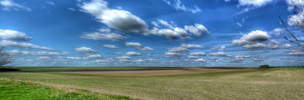
Other parts of the sky were blue though with puffy clouds. This is a farm-track I sometimes cycle along - although not today - the puddles were frozen and the path itself still had snow on.


P1030940_1_2_3_4_5_6_tonemapped.jpg


The fields had a dusting of snow, it was left in the ruts. I like this picture - a pity that there is the green splodge on the right - caused by some internal reflections in the lens.


P1030947_48_49_50_51_52_53_tonemapped.jpg


A close-up of the field without the green splodge.


P1030954_55_56_57_58_59_60_tonemapped.jpg


I have cycled past these buildings, near the Wicken Fen village many times and it was only when I was checking out a route by viewing it in Google earth that I saw a link to the building. It turns out to be a Farm, which offers Bed and Breakfast and is based around an Abbey founded around 1200 AD. A previous owner was the fourth son of Oliver Cromwell There is more detail on the Spinney Abbey website.


P1030961_2_3_4_5_6_7_tonemapped.jpg


The other side of Wicken Fen village are some electricity pylons marching down towards Burwell. I tried to show this as if the pylons were on the march down the footpath. You can see how the sky was already taking on an interesting colour - although the sun had not yet set.


P1030975_76_77_78_79_80_81_tonemapped.jpg


The Lode at Wicken Fen - further up the lode had frozen.


P1030982_3_4_5_6_7_8_tonemapped.jpg


A bridge over Burwell Lode - which features a lot in my pictures. Here the sun was nicely positioned to appear under the bridge.


P1030989_90_91_92_93_94_95_tonemapped.jpg


The same aspect, but with more zoom. The sky was a nice mix of blue gradually changing into orange.


P1040004_05_06_07_08_09_10_tonemapped.jpg


By the time I had reached Swaffham Bulbeck Lode the sky was turning pink.


P1040015_16_17_18_19_20_21_tonemapped.jpg


It was dark before I got home and although it was not windy my toes felt frozen - it was great to soak in a hot bath.