Monday, April 26, 2010

Leeks and Lodes - cycling around the Fens on a Sunny Sunday

I've long thought that you end up with one too many gadgets and certainly one too many software programs. Yesterday after writing a Post, using Zoundry Raven as my off-line editor, I kept getting an error and on checking the Blog no Post appeared. Of course the first ting I tried was publishing it again - no luck. The I closed and re-opened Zoundry - still no luck. In the end it turned out to be a a problem with my tagwords. The editor has a space to enter tagwords - with each one being separated by a "," only in this case I had started with a "," - it saved as soon as I deleted the extra ",".


The observant of you might also by wondering why I seem to be deleting random comments. I too thought they were random comments until I worked out how to get automatic e-mail notification of comments, to ensure I reply more promptly to any questions that get left. Anyway when I got the email notification it showed that there were a whole bunch of rather odd looking links in each of the ".", pointing at rather iffy bunch of web addresses. So I now delete them when I get the chance.


My Garmin GPS has also been "complaining" of a full memory, despite the memory being reported as having 291MB free of 465MB. So I have deleted all but one months history and it now shows 362MB free - so I will see how long it lasts. (The last time I had this problem was the 10th Jan 2010.)


At least the weather is staying fine - except that Sunday morning it was raining - hard. Fortunately by afternoon the weather had become fine once again with a few puffy clouds in a blue sky. Just the weather for a bit of meandering around the Fens. The rain did not seem to have muddied up the paths - it did freshen up the air though.


A view of Swaffham Bulbeck Lode - you can see how the water level is much higher than the surrounding land. I got stung climbing up the bank - the stinging nettles have sprung up as well (or stingles as my son used to call them when he was younger). The tingle did not last for too long though.


P1090194_88_89_90_91_92_93_tonemapped.jpg


The view of the farm tracks from the top of the Lode banking - the track has been improved as well as the drainage ditches cleared.


P1090201_195_196_197_198_199_200_tonemapped.jpg


There had been a bit of fly-tipping along Headlake Drove - part of the Lodes Way path being opened up through the Fens by the National Trust/Sustrans.


P1090208_2_3_4_5_6_7_tonemapped.jpg


I also saw a couple of cyclists coming the other way and if you look closely there is also a horse rider in the background along Split Drove.


P1090209.jpg


I was popping up Split Drove to take a look at the drainage culvert being built as part of the new Reach Lode bridge. They must be expecting a fair bit of flooding with a culvert this size. It could be a reaction to the flooding on the Cambridge Guided Busway (CGB) - once bitten twice shy.


P1090216_0_1_2_3_4_5_tonemapped.jpg


The Leek Locust (from outer space) has now moved onto another field - a bit further up the track.


P1090230_24_25_26_27_28_29_tonemapped.jpg


The field was also being irrigated - I think that it is to soften the ground so that the leeks don't get damaged when they are lifted.


P1090244_38_39_40_41_42_43_tonemapped.jpg


The weather is a bit changeable though - by the middle of my ride the clouds were back in the sky with only a bit of sunlight peeping through.


WF Panorama April 2010.jpg


I also saw four deer in a different part of the Fens - but they could well have been the deer I saw yesterday. I also had a couple of Sunday afternoon drivers get pretty close to me on the narrow country lanes.


Saturday, April 24, 2010

Spring has arrived - I saw my first Charity Bike Ride of the year!

It really must be Spring - I saw my first Charity bike ride of the year out and about today. I first noticed it when driving in my car and a string of cyclists were travelling in the opposite direction. They also had to put up with a car driver who did not seem to know whether they wanted to overtake, hang back or just force me off the road. I stopped - it was the safest thing to do. It was a mixed bag of cyclists - but they certainly looked enthusiastic and had a great day for their ride - sunny but not too warm. There were quite a few white A4 notices on lampposts and poles along the route - it was the Hannah 100. A 100Km from Cambridge up to Ely via Burwell, Exning, Chippenham and Prickwillow and then back on Sustrans 11 to Burwell and Sustrans 51 to Cambridge. At least I think that was the route - their map is here. By the way the 100 is 100Km not 100miles - still a good distance (around 60miles) especially when undertaken by people who do not do a lot of cycling.


I must admit I would have enjoyed taking part - and it was on a route I know well. Later that day when I went out for a cycle ride I did come across a few stragglers - some just wanted reassurance that they were on the right route back to Cambridge others looked as if muscle strain or cramp was a problem. I hope they all made it successfully.


I did a bit of meandering on my ride - partly to see if I could work out what route they were taking and partly because it was a nice day for meandering. Instead of turning right on Sandy drove towards White Fen I turned left and followed the track a short way - then took this picture looking back - the White Fen cycle path lies roughly between the two Pylon runs - off to the left. You see a lot of "plank" bridges around here - the only way to cross from one field to the next over the drainage ditches without taking the long way round. I had to try it of course.


P1090113_07_08_09_10_11_12_tonemapped.JPG


TI also visited the site of the new Reach Lode bridge being built as part of the Lodes Way cycle/walking/horse riding route through the Fens. Apparently the design requires some large culverts to be built in case of flooding in the fields - this is one of those culverts.


P1090120_14_15_16_17_18_19_tonemapped.JPG


The leek fields are being slowly harvested. It seems to take quite a long time as it is done by hand, presumably to ensure the leeks don't get damaged - there is an interesting onion-y smell in the air when you cycle past.


P1090127_1_2_3_4_5_6_tonemapped.JPG


To avoid the traffic - such as it is, I cycled along the tracks Split Drove, Straight Drove and Harrison's Drove. I saw a group of 4 deer in the field alongside Reach Lode - it is not unusual to see them in the open - they were being cautious though. Each of the deer seems to be looking in a different direction. The top of the lode bank is much higher than the surrounding land as you can see in the picture.


P1090129.JPG


Straight Drove is a grass/mud track - which connects the tarmac of Split Drove with the tarmac of Harrison's Drove. I rarely see anyone else around on the track - normally it is just farmers and farm workers in the fields. I do pass an occasional cyclist - we normally stop and have a chat about things. The mud was rock hard - I normally cycle at the edge. The ruts were a little to deep to cycle in - the pedals catch.


P1090136_0_1_2_3_4_5_tonemapped.JPG


with the amount of drainage required there are quite a few concrete bridges across the drain (as some are called). This one is Commisioners' Drain - a bit further South it turns through 90 degrees.


P1090143_37_38_39_40_41_42_tonemapped.JPG


The use of covers to accelerate the growth of freshly drilled crops is reasonably common - it seems to work - where the wind has blown away the cover there appears to be healthy growth.


P1090157_1_2_3_4_5_6_tonemapped.JPG


Round the back of Wicken village , on the Sustrans 51 route one of the many signs to encourage participants in the Hannah 100 - in this case to encourage Carl Isaacson specifically.


P1090164_58_59_60_61_62_63_tonemapped.JPG


It is not just the oilseed rape that is doing well - here is a large crop of dandelions growing well in a field. They have a slightly deeper yellow colour.


P1090171_65_66_67_68_69_70_tonemapped.JPG


On my way back through Reach were, what I hope was the last two stragglers sitting in the shade of the Horse Chestnut tree in the middle of the green. It can get a bit unpleasant sitting for hours on a bicycle saddle when you are unused to it. Let's hope they made it ok.


Rolling along the Roman from from Cambridge to Balsham and back the longer way in Spring

When I go out cycling (and walking, or just out for that matter) I usually take my camera. When I return home I usually select a few pictures of the ride and then create a new DRAFT Post and load the pictures into the Post and then later on when I have a few minutes write the Post. Unfortunately over the weekend I noticed that around 30 or so older Posts had lost their photographs.


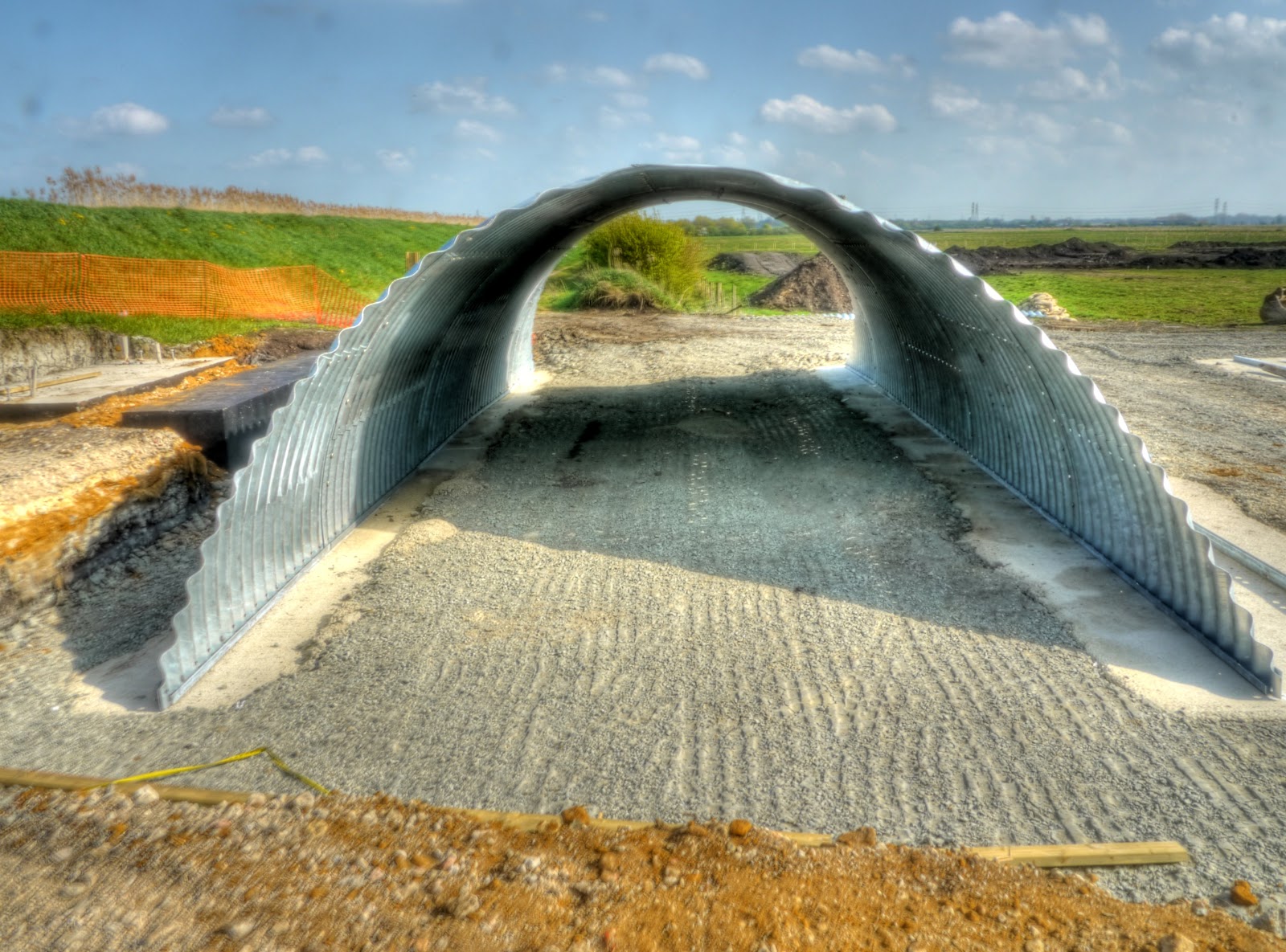
I create Posts using an off-line editor - Zoundry Raven. This uploads my Posts onto the Blogspot website and uploads my pictures onto my Picasaweb photo store from where the Post links to the pictures. Picasaweb has some limitations on the number of photographs in an Album and so from time to time I have to do some housekeeping. On Friday I moved several hundred photographs from the Album used by Zoundry Raven into a new one. I has assumed that the link used within the Post would not change. Unfortunately it seems that it did in my case and so quite a few posts were devoid of pictures.


I ran a test and uploaded a picture into one album as part of a Post and then moved the picture - no problems it was still visible in the post and had the same URL. I joined the Google Help forum - but over the weekend decided it would be easier to republish the Posts. One advantage of using an off-line editor. This had the disadvantage of duplicating a bunch of pictures - but by deleting the "rogue" album I should be able to deal with that. Unfortunately this took me away from generating new posts - so my apologies. I now have 4 Draft sets of pictures awaiting words


One bonus though - the weather is so nice I have been unable to resist going out for a spin - even when I should be doing other things. When I set out on this ride I was not really sure where to go and on my way through to Lode from Cambridge (via Sustrans 51) decided to head back through the Wilbrahams to Fulbourn and then onto the Roman Road (Cambridge to Balsham). Once I got to Balsham I then followed the Icknield Way before heading to Westley Bottom across the Cambridge to Ipswich Railway line towards the A11 then alongside it before turning towards Swaffham Prior and then round to White Fen.


The map below shows the route I took - these links 1 and 2 show the OSM Cycle map of the area. I have marked in blue the off-road parts of the route (including Sustrans 51 along the Newmarket Road) and in yellow the on-road bits. The are places that have shared paths (Lode road into Bottisham) but as I did not use them I have shown them as roads. I would guess that a good third of the route was along by-ways - which were almost deserted.


RR April 2010 Mkd.jpg


Just outside Bottisham I walked into a field to take a picture of the oilseed rape with a Horse chestnut tree in leaf in the background.


P1080804_05_06_07_08_09_10_tonemapped.jpg


In fact I liked the view so much I took a similar picture but showing a red corrugated roof in contrast to the yellow. Normally I force myself to only use one picture when they are so similar - I couldn't choose in this case.


P1080831_25_26_27_28_29_30_tonemapped.jpg


This is how the Roman Road looks when you first enter from Shelford Road/Worts Causeway end. If you follow the link it has a Google Streetview image - you travel down for around 100yards/100m before turning left onto the Roman Road.


P1080838_2_3_4_5_6_7_tonemapped.jpg


A little but further on the track passes under a canopy of Beech trees - already in leaf. The track is pretty good here - but there are occasional sandy bits that can make the wheels drag.


P1080845_39_40_41_42_43_44_tonemapped.jpg


The "Road" has some information boards along its route showing where you are and what wildlife there is to see.


P1080846.jpg


The route is not flat - although there are not any really steep bits either. This view is looking back towards the Cambridge end. I did not meet any walkers on the path but did pass a couple of cyclists going back to Cambridge.


P1080888_2_3_4_5_6_7_tonemapped.jpg


Spring was doing well along the Road with hedgerow blossom, new leaves on the trees and in places bunches and bunches of cowslips growing.


P1080902_896_897_898_899_900_901_tonemapped.jpg


The blossom was glorious. At this point I will mention that I was wearing a helmet - both because the track can get a little rugged and tip the unwary cyclist of his or her bike and because the fresh growth can lead to branches and brambles hanging at head height (on a bike) across the path. I find sunglasses and a helmet good anti-bramble protection. (I once got caught by brambles when cycling to the railway station in Cambridge for an early morning breakfast meeting in London. When I got to the station the and bought my ticket I got a funny look - when in went into the toilets I could see why I had blood running down my face and matted in my hair. It made for an interesting meeting in London (I was interviewing someone for a job!).


P1080923_17_18_19_20_21_22_tonemapped.jpg


It seems to me that as well as the fresh growth Spring also seems to bring out the fly-tippers. Whoever left these drove a quarter of a mile along the track (where it crossed a country lane) to tip these tyres. What a tosser eh. Apparently the cost varies from around £1 to £8 per tyre depending upon the size. Assuming around 30 tyres at, say £3 each then whoever did this saved £90 - as I said - what a tosser.


P1080930_24_25_26_27_28_29_tonemapped.jpg


Towards the Balsham end the track is also used as a farm track. I have also seen motor cycles along here, so could also be used by 4x4 drivers as well. This requires a bit of care and both forward planning; when the ruts get deep the pedals can easily catch the side and throw you off. I generally either stick to the middle or the outside - but the outside has overhanging brambles and the middle can be very narrow - which requires confidence in your ability to balance.


P1080937_1_2_3_4_5_6_tonemapped.jpg


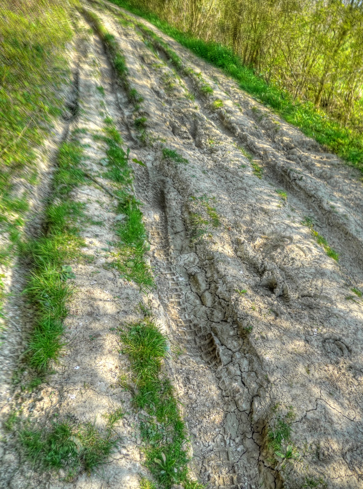
I took a by-way route to Balsham which also a farm track for part of its way - tricky but easier than the last bit of the Roman Road.


P1080944_40_41_39_42_38_43_tonemapped.jpg


In Balsham I decided I wanted to cycle along a bit more by-way - much nicer on a sunny Spring day than noisy roads so I headed left (towards Cambridge) and found the Icknield Way at the edge of the village. The track was quite passable - although at one point it looked as if a load of rubbish had been ploughed into the ground. The surface was very bumpy - small bumps though - so quite safe to cycle on - just very unpleasantly bumpy. Actually it was ok - and so nice to be out in the countryside.


Also you can see planes flying in the skies again - or in this case the contrails they leave behind.


P1080972_66_67_68_69_70_71_tonemapped.jpg


There are still quite a few farm buildings out and about using corrugated asbestos - not to be treated lightly according to the Health and Safety Executive website. (There are three types - all dangerous but the blue and brown types are more dangerous than the white.)


P1080986_0_1_2_3_4_5_tonemapped.jpg


TI then decided to head off down to Westley Bottom in search of some more off-road cycling. The road down was a reasonable hill - I reached around 30mph/50Kph. Unusually I also passed a car on this single width road - he thought it would be ok to speed past me inches from my handlebars. At the bottom of the road you have to stop and cross a railway line - in this case not a busy one - the Cambridge to Ipswich line - no trains came along whilst I was there.


P1080993_87_88_89_90_91_92_tonemapped.jpg


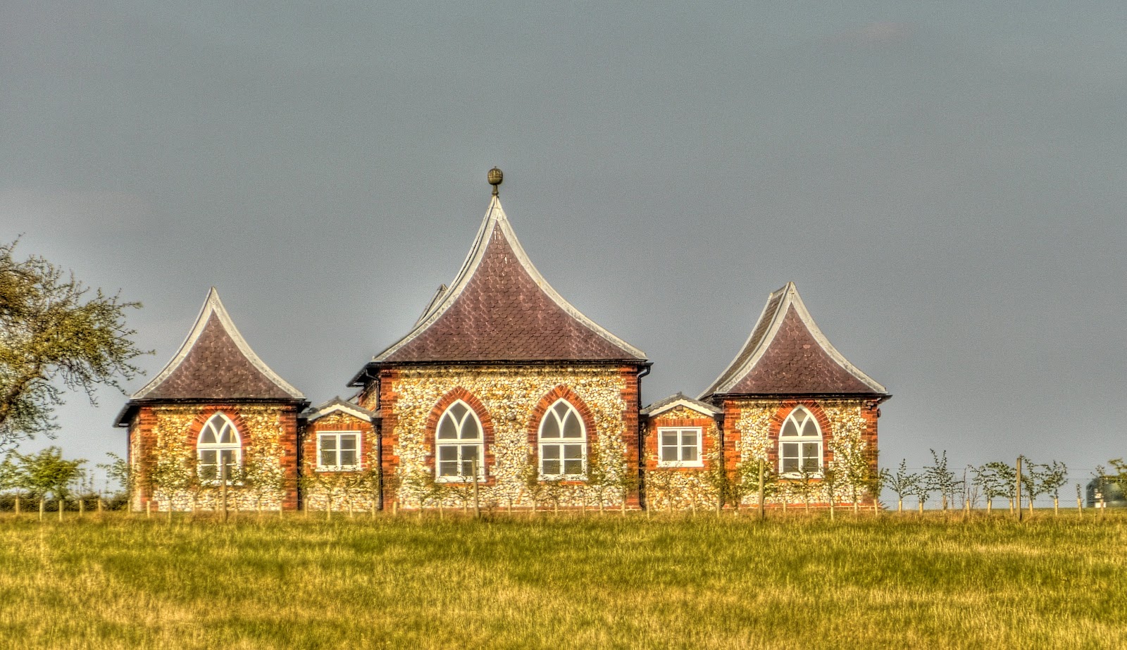
Then on the other side the road turned bumpy - although this odd looking building was visible from the track, the hill was called Bungalow Hill - named after the building? It turns out to be a listed building and is known as The Folly and was claimed to be Britain's first bungalow when built.


before crossing the busy A1304 onto a byway which seemed to be pitted with rabbit holes. I could have carried on along the by-way to wards Bottisham and picked up Sustrans 51 to Cambridge - but instead turned of on another byway just before the A11


P1090015_09_10_11_12_13_14_tonemapped.jpg


I did cross the A11 using the bridge briefly as I was deciding which way to go. There was time to take a picture of some more "agricultural art" in the field.


P1090036_0_1_2_3_4_5_tonemapped.jpg


The route up the hill alongside the A11 is shown here it was only a 20m climb.


P1090057_1_2_3_4_5_6_tonemapped.jpg


With a brief detour onto the roads I was able to pick up on a by-way alongside the A14 (as the A11 merges with the A14 nearby) before leaving that noisy by-way to cycle back towards civilisation - well actually Swaffham Prior along the Heath road - not to be confused with the Swaffham Heath Road. This was being used as a barrier to the field and not as art - I wonder if farmers get tax breaks when they make such diverse uses of their equipment.


P1090064_58_59_60_61_62_63_tonemapped.jpg


There was a nice view of one of the two Swaffham Prior windmills from the Heath Road. This one is called the Smock Mill the other one is Fosters Mill.


P1090085_79_80_81_82_83_84_tonemapped.jpg


My route then took me along the Upware road to White Fen - where there was time to take a picture of this tree - which has featured the last few times I have been by - the leaves have really come on well.


P1090092_86_87_88_89_90_91_tonemapped.jpg


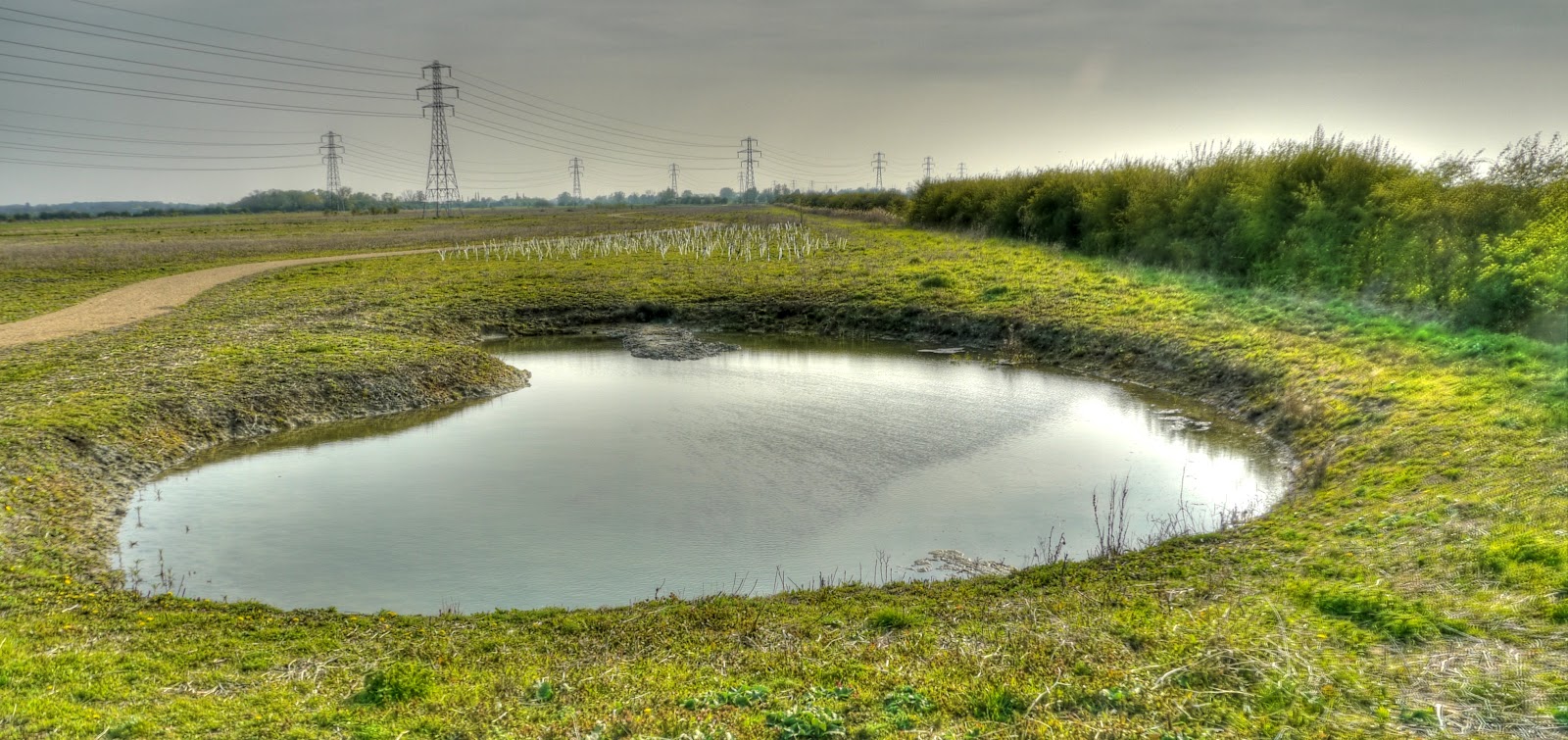
When they built the Swaffham Bulbeck Lode bridge they dug out a couple of pits to encourage further wildlife diversity - when I went past this one I wondered whether it had sprung a leak though!


P1090099_3_4_5_6_7_8_tonemapped.jpg


I could have gone through to Horningsea from Lode but stuck with the roads/shared paths instead for the last bit into Cambridge - a great Spring Cycle in the countryside - especially when it was warm enough for shorts, t-shirt and (cycling) sandals (and helmet).

Thursday, April 22, 2010

Tins path to the Station

I had an afternoon meeting in London today. Given the challenge finding a bicycle parking space at the Cambridge Railway Station I did consider taking my Brompton - but the meeting was being held in an office I had not visited before - and so was not sure quite how to cycle there. Also we generally have a post-meeting debrief elsewhere - a pint in a local pub afterwards which compounds the problems. Now it is not impossible to take my Brompton under these circumstances but it is more hassle when you have a bike and bag to keep an eye on.


So in the end I decided to set off for the station slightly early to give me time to hunt around. As I was returning after the Station Cycles closing time I did not have the option of leaving my bike there. (It costs £1.50 for a day - and is good for peace of mind.) It was also a lovely sunny day and I just could not bring myself to cycle in long trousers, so I set of in shorts and shirt - with a pair of long trousers, jumper and bright yellow fluorescent jacket just in case it got too cold. I also took a front light with me for the return cycle part of the journey. The trip to the Station was lovely - I took a path known as the Tins Path which is also slated for some improvements along with other areas of Cambridge as part of - "£7.2Million Cycle Improvements Ride Forward". It is a pleasant route into town from the Cherry Hinton direction - but caries significantly in terms of the overall quality of the path.


The cycle bit of the route starts path just of Coldhams Lane where you turn down an almost hidden path just after Katherine Elliot Way. You then end up on a broad pink tarmac cycle path and pass a large Gym complex and then a Holiday Inn Express. You have to be a little careful going past the Gym as you get a downhill run (don't expect it to be too steep - this is Cambridge) and tired "exercisers" don't always seem to have the energy to look before they cross the path to the Gym car park.


I had to stop and take a picture of the Holiday Inn car park. There seemed to be a Satellite TV Installers Conference going on judging by all of the Vans in the car park. It would seem that they do not use bicycles at all as the cycle parking was empty.


HolInnXpress -Sky convention_Panorama1.JPG


The path the reverts to the type of path I more normally associate with share use cycle/pedestrian paths when it crosses the Ipswich to Cambridge Railway Line (apparently Ipswich to Ely with a branch line to Cambridge). Seen here - it looks as if the line was originally built for two tracks.


DSC00239.JPG


The bridge over the line is rather narrow and a "blind" and steep approach from both sides. This is the Cherry Hinton side.


DSC00240.JPG


This is the Mill Road side.


DSC00241.JPG


Once you leave the bridge this is what you see. Although the camera accentuates the darkness - it is pretty dark - did you notice those two people walking up the path. (Wondering why I am taking the picture probably.)


DSC00242.JPG


Once your eyes get accustomed to the gloom the path itself, having been recently re-surfaced is fairly flat. It was very bumpy from all of the tree roots. The plan is to widen this assuming all the negotiations go through. It is tricky when two bicycles pass, especially next to the lampposts.


DSC00244.JPG


Although I left more time to find a cycle space I got luck this time and found one almost straight away. These stands are rather close together and there was a bike with a basket in the adjacent stand that appeared to be blocking the space I took. When I took the picture I did wonder will this be the last time I see my bike? The bag is an Altura bag designed for clipping easily on and off the rear rack of the bike. In this case there are a wodge of papers (so I can work on the train) along with trousers, jumper, bright yellow jacket and phone and money.


DSC00246.JPG


Getting out of London made me wish I had taken my Brompton - Oxford Circus Tube station was closed when I turned up - most people hung around - I had a 7.15 train to catch fortunately I got a taxi. At the station there was the inevitable hanging around until what seemed like seconds to go they tell you which platform to head for. At that point it seems as if everyone in the station makes a dash for the train to ensure they get a seat. But not everyone does. The problem is that if you catch an earlier train then they charge peak rate - the 7.15pm is the first non-peak rate trains and lots of people wait for it.


The ride home was very pleasant though - I did put on my fluorescent yellow jacket and use lights on my bike - it was not dark but getting gloomy and I took a different way home.

Sustrans 11 - South From Cambridge to some hills and back

Cycling has been hitting the local news again recently - one of the reasons is probably because cycling is a significant form of transport in Cambridge which in turn means more people are interested in news about cycling - good or bad. Although given the high percentage of journeys to work by bicycle in Cambridge I guess I am surprised that more resources are not devoted to the provision of better facilities. According to 2001 census data 27.3% of journeys to work were by bike/motorbike/walk, with 57.4% by car. I found this in an interesting document published by Cambridge City Council each year - Annual Monitoring Report. I am not sure why there is not more recent data - 2001 was quite a long time ago - a lot has happened in the last 9 years.


So the latest cycling news? "Dad's fury as cyclist suffers injuries during police chase". I am not sure of the rights or wrong in this case - but I do thinks that in the UK the relationship between the public and the Police has lost the respect element along with a rise in the so-called "compensation culture" - it is always easy to blame others.


The other bit of "cycling-related" news - well to me anyway, is also reported in the Cambridge News: "Guided bus work 'could be finished by June'". I know that the CGB is not really there for cyclists - however it does represent a potentially significant route for cyclists. Unfortunately it seems that although there could be buses running by June the Maintenance track will not have its repairs completed until July and that buses could run at the same time. Is this a sign that Cyclists are being treated as second class citizens again. Why wait? and what can we expect from the fix - the track has been out of commission for months at the St Ives end - fix it now whilst cyclists can still use the concrete tracks to bypass the flooded bits please. It also worries me that they refer to the Track as a Maintenance Track which will also accommodate walkers and cyclists. Are these ways of trying to reset expectations!


Talking about lack concern by car drivers for cyclists and pedestrians. Whilst cycling along Sustrans 51 near to the airfield on Newmarket Road how about this bit of total disregard. A car parked right across the shared use path - not in the drive of the house, or on the road to the right, (which is not a through road and only serves 3/4 houses). Deliberate or ignorance - who knows - and many non-cyclists will wonder why it is an issue - well when you slow a bike down it takes significant physical effort to regain the speed you lose - personal effort (which for those of you who remember Physics at School that effort is proportional to the square of the speed you wish to attain! - so being slowed on a fast track is much worse than being unnecessarily slowed on a slow path.)


My car shows the fuel consumption and there are two factors that really increase fuel consumption; going fast and continually slowing down and accelerating. Both are things that the intelligent driver can significantly improve upon.


P1080692_3_4_5_6_7_8_tonemapped.jpg


I chose the route I took today for no other reason than I have not been out that way for a while. Also as it was not so windy I didn't let the wind direction influence my choice of ride. It was once again a lovely, sunny day and reasonably warm for the season. At the weekend I cycled in fingerless cycling gloves but reverted back to thinnish but full finger gloves for this ride - still riding in shorts though. My legs are starting to regain their sun tan.


Normally when I cycle (or drive for that matter) I like to avoid returning on the same route there and back - but I was a little pushed for time - this was a cycling ride I sneaked in because the weather was so nice. So for simplicity it was down the Sustrans 11 route for 20 miles /32 Km and then back again. When you look at the Sustrans map quite a lot shows as off-road - which means in this case on shared pavement alongside the roads. There is an exception though the bit between Addenbrooke's Hospital and Great Shelford which in part runs alongside the Cambridge to London "used" Railway Line and seems to be a well used path.


When pushed for time I tend not to take so many pictures - I did stop to take a picture of the Sawston Bridge where the A1301 crosses the River Granta. There is a separate bridge for the pedestrian/cycle route - it is quite narrow, two cyclists have to be careful when they pass each other. It is funny how brick bridges look so much more "picturesque" compared with concrete bridges. I am not sure why the bridge is called the Sawston Bride - it is much closer to Stapleford.


P1080712_06_07_08_09_10_11_tonemapped.jpg


The view downstream - here the route of the Cambridge, Haverhill and Sudbury Branch line briefly ran alongside the river before joining the Cambridge to London railway line.


P1080719_3_4_5_6_7_8_tonemapped.jpg


The route rejoins the road in Sawston - which at the far end has traffic calming measure - obstructions on half of the road - cars hate to give way to cyclists, their interpretation of "Give Way" does not include giving way to cyclists. The route then crosses the very busy A505 which connects the M11 and A11. This is a terrible road to cross during the rush hour- be careful. Actually a car stopped to allow me to cross the road - the age of courtesy is not dead.


The route then appears on the map as off-road - this is what it means - a shared path alongside the A1301 with a white line acting as no-mans land between the cyclists and the pedestrians. I did not see any other cyclists or pedestrians - I did see this lorry driver who had stopped though - the lay-by was not enough - he wanted to block the cyclists bit of the shared path as well. The curtains were down on the windscreen so perhaps he wanted to sleep? If he had just parked on the lay-by then he would probably have ended up being rocked by the slip-stream of passing lorries - at least that is my guess for why he (or she) is encroaching on the path. No issue today - but it will cause damage to the path and crossing the painted line in the wet can sometimes be a bit interesting on thinner tyred bicycles.


P1080726_0_1_2_3_4_5_tonemapped.jpg


The route carries on through two very picturesque villages - Hinxton and Ickleton where it crosses the Cambridge to Liverpool Street Railway Line, River Cam or Granta (as it appears on the OS map) and the M11. I stopped in between the two villages to take a picture from a footbridge across the river - this is looking upstream towards Cambridge.


P1080733_27_28_29_30_31_32_tonemapped.jpg


This is looking downstream. When I don't stop so often I tend to take several pictures at the same spot!


P1080747_1_2_3_4_5_6_tonemapped.jpg


After Ickleton the route climbs up to the dizzy heights of around 90m with some great views back towards Cambridge the M11. I stopped at a crossroads just before Strethall where the Icknield Way Trail crosses the road. The path is marked as a bridleway but where it crossed this field it would have made for unpleasant cycling. This is made from 6 ( x7 different exposures) pictures. The road is the cycle route and here is looking North - the hill is Coploe Hill the high point around these parts. The pictures must have been slightly different as you can see the field appears slightly darker in the middle.


Nr icklington_Panorama1.jpg


On the way back there was time for a quick stop to take a picture of this recently sold house in Hinxton.


P1080796_0_1_2_3_4_5_tonemapped.jpg


Although it was not too windy it was against me on the way back - but at least I had a hill to go down first. This plot shows the gradient as recorded by my GPS. I have a Garmin 605 EDGE which measures the altitude from the GPS trace rather than Barometrically and is prone to significant fluctuations. It does show the hills in the middle of the ride though.


Sus11 nr Icklington.JPG


On my way back I did check out the work on the Southern part of the CGB - not enough change to be worth taking pictures of though - at least from the vantage points I had. There is still a significant caravan park just off Long Road though. I wonder what they are all doing. The work seems to be focusing on the Station end.