Tuesday, August 31, 2010

The King's Forest - Part 3 Getting back

"Red dot lanes", as I think of them or rather "other routes with public access" as the OS 50K map legend refers to them, are like a curate's egg - "good in places". I tend to think of them (rightly or wrongly) as routes that once had some importance/relevance, but for whatever reason failed to make the grade as a road. For a cyclist this means they can often be excellent "short-cuts" avoiding the unpleasantness of fast country roads and sometimes stinging nettle alleys. To get back to Cambridge from Lackford I could have followed the Icknield Way a minor road that heads South-West to Kentford. (The Icknield Way has its own association which you can join and lays claim to being the "oldest road in Britain".) It is quite a pleasant stretch of road, it has not been too busy when I have cycled it before. What caught my eye when looking at the map though was a "red dot" lane between Lackford and Risby pretty much heading South.


It did mean cycling along the A1101 though Lackford - but main roads in towns are not quite so unpleasant. I know I have gone on about this before, but I am convinced that fast roads have gotten noisier than ever. I am not sure whether the cause is speed, tyres or road surface, I am sure they are unpleasantly noisy. The track is opposite Old Bury Road and starts off as a reasonably wide Farm Road - climbing gently. When zoomed in on Streetmap the sheds to the right of the track are called the Engineshed Buildings.


The track carried on past a number of fields with various signs indicating No public right of way and passed through Risby Poor's Heath past some Round Barrows, a Scheduled Monument, at risk. Next time I must look out for them. As a boy I do remember my History teacher - Mr Whiteley encouraging us to learn map references for historic "things" and them quoting them in essays. One such map reference was "598632 this will get you to Stanton Drew" - where if you look at the Grid Reference on OS Map you will find some Long Barrows. (I think it was OS MAP sheet 172.)


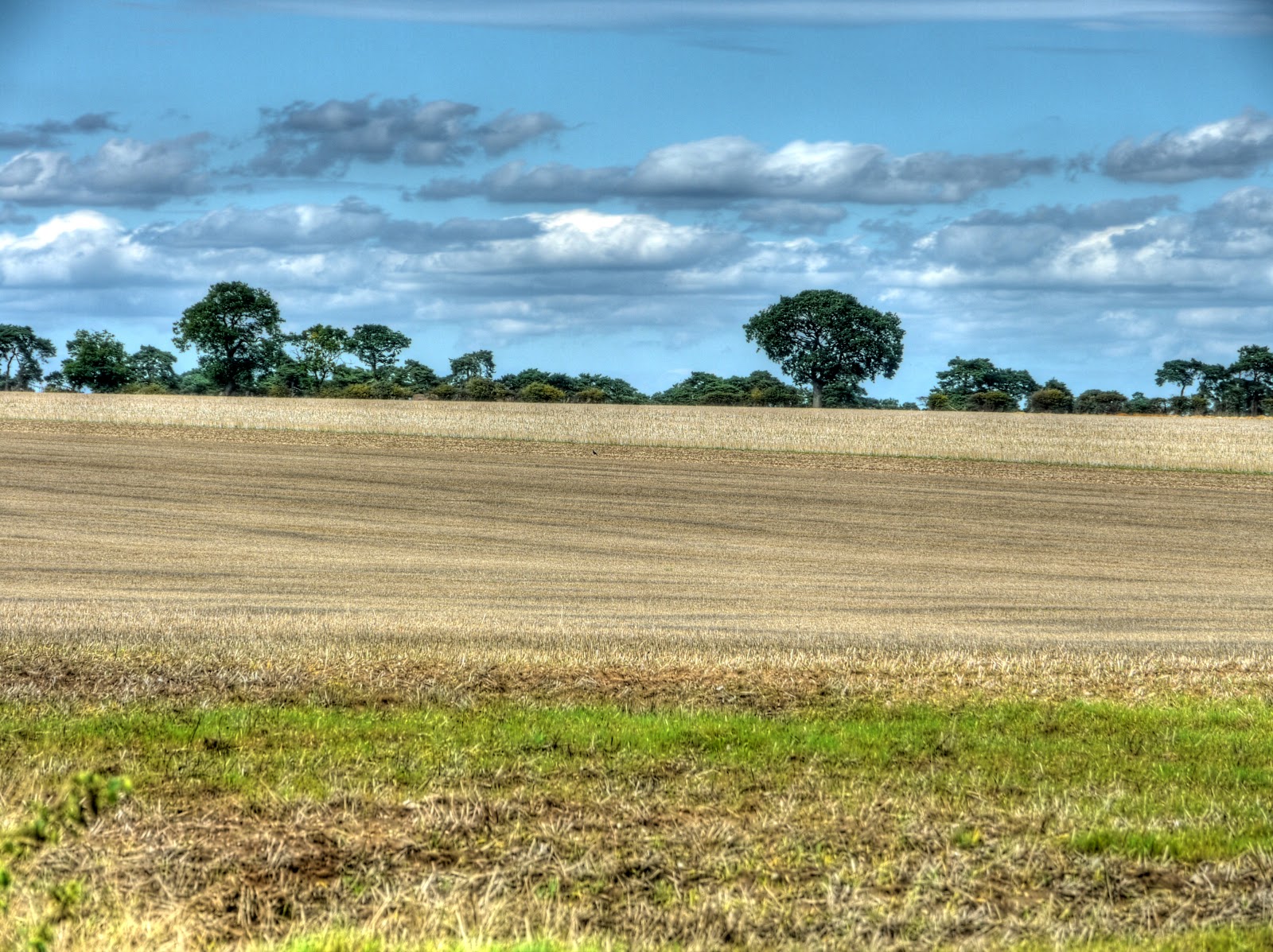
These sorts of "red dot" routes generally start well, turn into farm tracks and then end well. This route was no exception even before I got to the other end (Lackford Lane) it was quite a reasonable stretch of hedge-lined road.


P1160745_39_40_41_42_43_44_tonemapped.jpg


Once past Bullock Lode Farm there was a Water Tower to the right hand side , this was also probably around the high point of this stretch of road at 59m.


P1160754_5_6_9_7_3_8_tonemapped.jpg


I used a tree to steady the camera when taking the last picture - as you can see it was now a proper minor road.


P1160773_67_68_69_70_71_72_tonemapped.jpg


The Village Sign in Risby caught my eye - the tower depicted is Norman Church Tower but I have not been able to find anything on the web (in a short search) explaining the sign however fruit and a plough are fairly generic.


P1160780_74_75_76_77_78_79_tonemapped.jpg


As I was heading through Risby towards the Newmarket Road I noticed what looked like a pigeon sliding across the road rather strangely - it turned out to be a pigeon that had been caught by a stoat or weasel. It had a long body, longer than a rat and is thinner. As I cycled along the stoat (or weasel) let go and disappeared into the hedgerow - I am not sure if the pigeon was mortally wounded or not it was certainly trying to get away. According to the link they do eat birds.


After the excitement of the pigeon I then joined the Newmarket Road - which no longer gets to Newmarket - is is a short strip of road then has been bypassed by the A14 dual carriageway, previously known as the A45. Even on a Sunday it was fairly busy. I was certainly not intending to cycle along here. (I have cycled along the A11 dual-carriageway before - although the traffic is fast there are wide margins at the edge of the road - but passing junctions can be tricky.) My route took me over the A14 (which is where I took the picture) and then onto New Road heading towards Barrow but I turned off along Shaker's Road a bridleway heading East.


P1160781.jpg


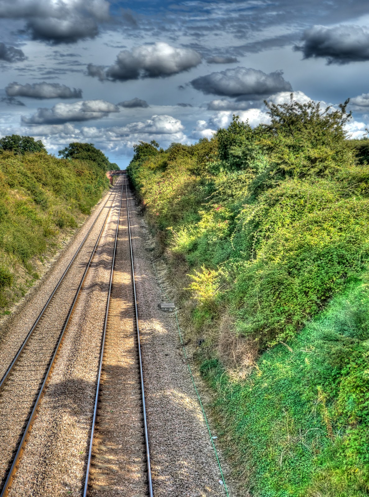
As is often the case major routes are served by several modes of transport as our transport system evolved (or some might say degenerated). Alongside the A14 is the Cambridge to Ely Railway Line which also has a branch line to Cambridge. as you can see it has not yet been electrified and a line speed of 40-75MPH - though there are plans to dual the bit between Kennet and Ely to improve capacity for hauling freight from Felixstowe. As you can see this bit already has a dual track.


P1160788_2_3_4_5_6_7_tonemapped.jpg


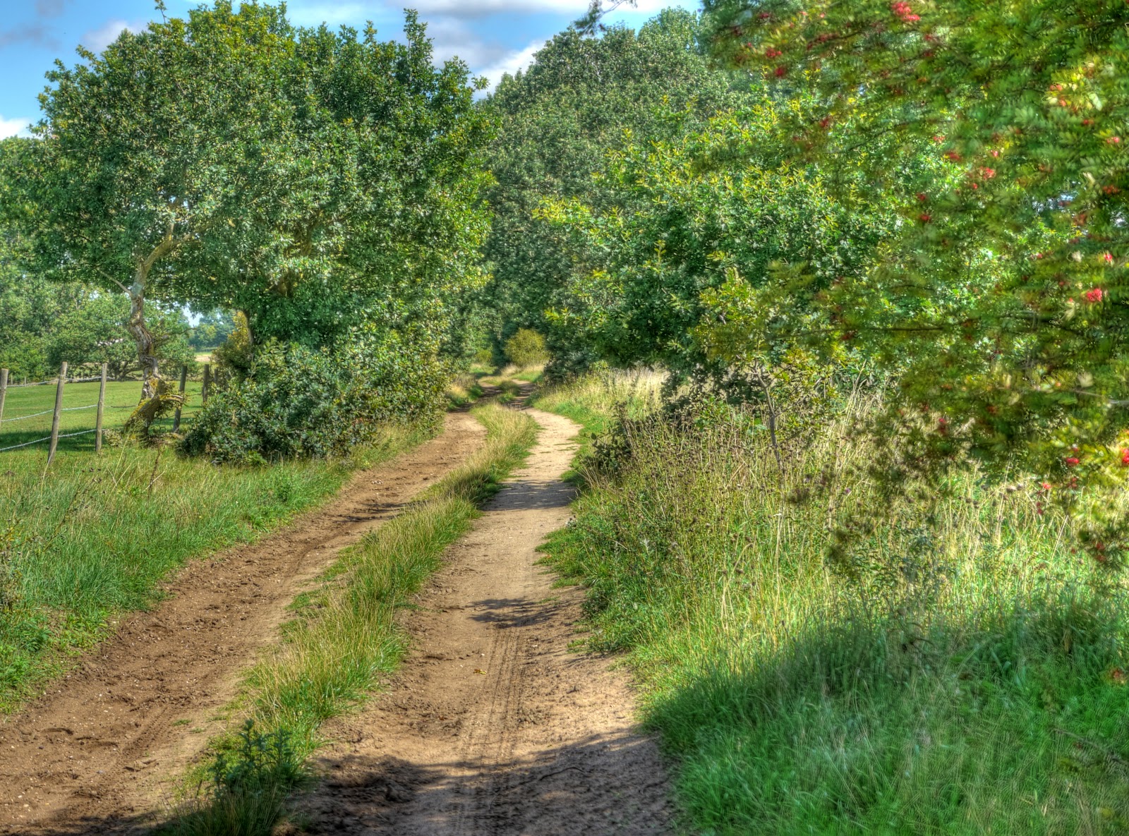
This is Shaker's Road it passes through a farm yard and then emerges alongside another farm.


P1160803_4_5_6_7_8_9_tonemapped.jpg


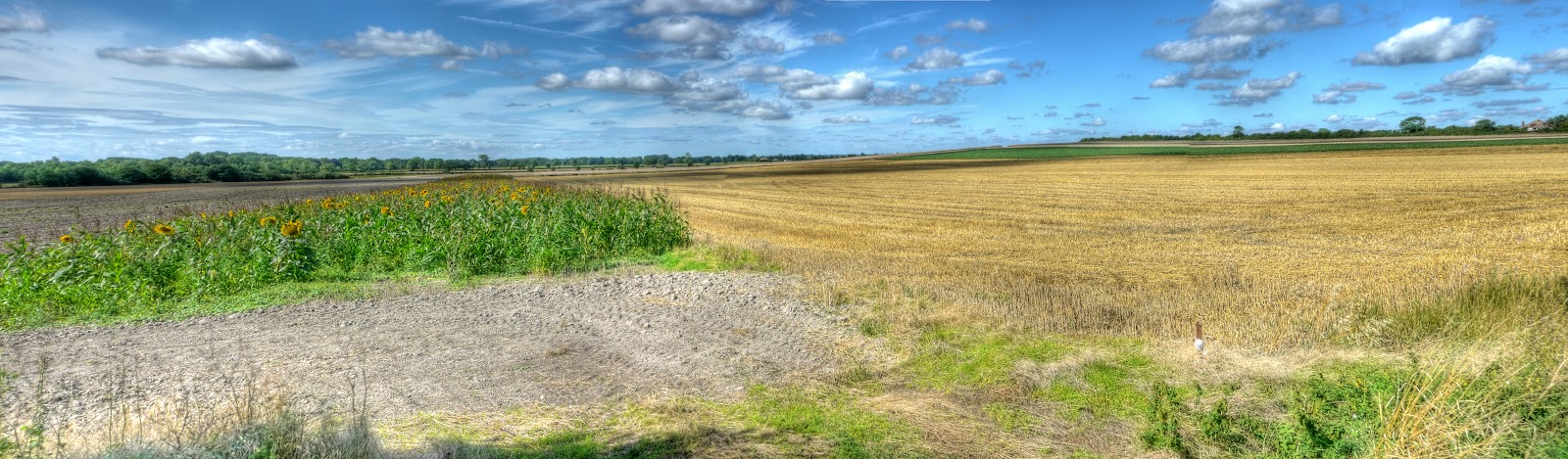
Apparently it is an ancient trackway and passes across Barrow Field. It also passed a disc harrow on the day I cycled along it.


P1160816_0_1_2_3_4_5_tonemapped.jpg


There was also a giant haystack - well pretty big - this was two (x7) photographs stitched together.


haystack.jpg


The clouds had thinned out a bit and hung in the sky - which is why I took this picture - the disc harrow lies to the right just outside of the picture.


P1160823_17_18_19_20_21_22_tonemapped.jpg


My route took me through the outskirts of Barrow and then up Coalpit Lane back up the the A14 where I was able to take a side road that took me onto the Higham Road - although it is marked as the A14 it is only a slip road for relatively minor country lanes. I also crossed the Railway Line twice and passed a War Memorial. At this point I headed towards Gazely and joined the Sustrans 51 route towards Newmarket. Every now and then I stopped to take pictures of the dramatic skies. This was taken on the Higham Road somewhere between Higham and Gazely.


P1160830_26_27_25_28_24_29_tonemapped.jpg


I carried on Sustrans 51 until Exning where I diverted though the village and along Haycroft Lane and Howlem Balk - both bridleways. This picture was taken on Howlem Balk - the field had been recently combined.


P1160851_45_46_47_48_49_50_tonemapped.jpg


After rejoining Sustrans 51 in Burwell I left it in again in Reach and headed towards White Fen and what will be Lode's Way. Once again taking a bridleway (Black droveway) in preference to cycling along, even the country lanes. This is Black Drove in the picture.


P1160852_3_4_5_6_7_8_tonemapped.jpg


Then I headed back to Cambridge through Lode. In Lode I bumped into MikeC coming the other way. (Not literally the road was wide enough for the both of us!) We stopped to have a chat and Dave (someone I have cycled with) happened to pass by and joined us. The conversation turned to Mike's recumbent and Dave and others in his group gave it a go. As you can see here it is harder than it looks - Dave is pushing and Mike is looking on in this picture. Mike reckoned it was easy - but watching them try reminded me of what it was like just after I took my stabilisers off when I was learning to ride a bike.


P1160860.jpg


Mike did a bit of adjustment to make it easier for Dave to fit and as you can see he mastered it - look at the concentration in his face and smile of satisfaction!


P1160862.jpg


After the stop in Lode it was time to push on home and to reassure you no-one was hurt in the making of this Post. Although there were times when the 'bent looked a bit wobbly. I managed to get home before my wife and daughter for a well-earned (I think) soak in the tub.

The King's Forest - Part 2 - there

Once I had reached Icklingham I was at the edge of the King's Forest, although the challenge for me at this point was actually finding the byway rather than cycling along some private driveway. I did find if though and started cycling along it - it started as a thin "farm" track with the two tyre-tracks worn to mud but reasonably flat. As I cycled along my enjoyment levels were high - an unexplored route, sunny skies, not a soul around. Of course at this point the inevitable happened. When you are cycling and get a sudden puncture there is always a moment of denial. You heart tries to tell you carry on, it was nothing, just a bit of a bump and no the bike isn't starting to go all wobbly. Meanwhile you head is saying, yep, that's a puncture and now the bike is going wobbly and now you can feel the rim bouncing along the surface of the track as the cushioning has gone.


It was indeed a puncture despite using almost bomb-proof tyres. I use Schwalbe Marathon Plus tyres which I find offer the best trade-off between puncture-resistance, comfort and low rolling resistance. However unlike the marketing blurb on the web page punctures are not a memory. I don't get many punctures really, but my memory isn't that bad , the last time a thorn went right through the tyre and inner tube, this time it was a drawing pin. What on earth was a drawing pin, or thumbtack as it is known in the US, doing along a byway. The conspiracy theory suggests that some disgruntled path users have got it in for cyclists and have liberally sprinkled drawing pins along the track. The simpler explanation is that perhaps an educational group was on a school visit to the area and a drawing pin popped out of the someone's pencil case.


Whatever the cause of the misplaced drawing pin, I had to fix the puncture. For some reason the pin did not just deflate my tyre it also deflated my "euphoria". Normally I would just unhook the tyre from the rim in the affected area, then pull out a bit of the inner tube and clean up the area around the hole, apply some glue and then apply a patch. Then pop it all back and pump up the tyre and be on my way. For some reason I could not find the hole in the inner tube - I knew roughly where it was, as the drawing pin was still in the tyre when I got off the bike. But as I stood over the upturned bike fuming slightly it took way to much time and in the end I thought it would be more certain to replace the inner tube, which is what I did. There is nothing more annoying than patching a tube to find that either the patch hasn't stuck (unlikely) or that there was another hole, which in this case might have been caused by the drawing pin piercing the other side of the tube when it went flat.


As a consolation prize I did have a drink and ate some jelly babies - here is the bike after being fixed, but before being upended. Alongside is the old inner tube, the orange box that contained the new one, the green box with tube glue and spare patches, a packet of jelly babies a can of coke and my camera bag. To lift my mood as I was at the tail end of fixing it a cyclist came along on an MTB and stopped to check everything was OK - cyclists are like that. We had a chat and then he headed off in the other direction. You can see in the photo the track seemed pretty reasonable.


P1160638_2_3_4_5_6_7_tonemapped.jpg


As I ate some jelly babies and re-hydrated drank some coke I saw a deer in the adjacent field, it seemed to be looking for a gap in the fence, one minute it was there then it just seemed to disappear (there's that conspiracy theory again!) Whilst chomping on my jelly babies a convoy of 4x4s came down the track. There were 5 vehicles all looking as if they had done a bit of off-roading in their time, some had families in some just a couple of occupants. In one case a toddler was sitting on his dad's knee (I assume that it was his dad) helping to drive the car. I dragged my stuff to the side to allow some space for them to go by.


When I am out cycling byways I occasionally meet other cyclists, the occasional tractor, the occasional farmer's car (pickup or 4x4) but I have never come across a convoy before. They went through at a sedate pace though - so I can't really complain,


P1160641.jpg


The track climbed up through a couple of fields with gates, from around 20m above sea level up to 50m - not a huge climb by any stretch of the imagination, except for a flatlander inhabitant. The track did get pretty soft and sandy in places though and I found myself having to cycle along the edge I even walked on one bit. Once on the top the track seemed to open out a bit. Looking at the map there seem to be a number of disused pits in the area. Around Thetford Forest they used to mine the flintstone - not sure what was being dug here. Again according to the map the track goes past Seven Trees - which I presume was a group of Seven Trees at one point in time. Whatever the case it does give its name to the track - Seven Tree Road (Track), which seems to be quite well used and quite large - the motorway equivalent of a byway?


Apparently the Forest got its (current) name to commemorate the Silver Jubilee of King George and Queen Mary in 1935. (The Forestry link has too many "mm"s! - not that my proof-reading is any better.) There does not seem to be a huge amount on the Web this forest, it seems to get subsumed into the Thetford Forest information. Although there is a better Horse rider's website with a useful map. Their rides seem to avoid the main byways though. Perhaps I should enter on my bike?


P1160650_44_45_46_47_48_49_tonemapped.jpg


The view along the path changes quite lot, with fields, woods and heaths - like this blaze of colour from the heather. The clouds looks worse in the picture than they were really. It was a really pleasant day for cycling and the clouds helped to cut the direct sunshine a bit so I did not need to bother with sunscreen. Looking on the Google Earth map there are loads of tracks around and about the Forest and parts are open access. Although according to the website that is for horse-riders (not that much different to a bike really though!)


P1160657_1_2_3_4_5_6_tonemapped.jpg


The path continued to change but was easily cycle-able after the first few sandy bits climbing up the "hill" Looking at Google Earth there is a big tree plantation in the shape of a cross near the path - on the OS map it is called Benjamin's Hurst. A Google search indicates that this area was used as a High-altitude bombing range around the late 1930s into WWII. It turns out that this odd construction I took a photograph was a bombing target. (Here is a Where's the Path link. - use the OS and Satellite view.)


P1160664_58_59_60_61_62_63_tonemapped.jpg


At this point the track became more gravelly and turned to the right. (East). I think it was here that I convinced myself I was elsewhere on the map and started to misread my position! There were points where I had to walk as the track was so sandy the wheels dug in. I also passed a few motorcyclists out on the tracks as well.


P1160673_67_68_69_70_71_72_tonemapped.jpg


When I got to the B1106 I had intended to cycle North along it then along a byway to Elveden. But in my confusion I carried on over the B1106 and up the Old Barnham Slip and then the New Barnham Slip. a track with woods (part of Elveden Park) on one side and fields on the other. There was mixed farming here - crops and if you look to the left of the picture some sheep. The sheep tended to ignore me except when I went over bumps and the bike rattled a bit - then they ran off like I had the plague. The crops had scarpered a while ago.


P1160680_74_75_76_77_78_79_tonemapped.jpg


This is the Forest side of Barnham Slip - it looks as if a stolen car had been burnt out here - a good job it did not set more of the trees alight.


P1160681.jpg


Barnham Slip reached the Elveden Road and I worked out where I had gone wrong. It was not really a problem. I turned right onto the road and set off until the next byway heading South. There was a disused railway line just a little bit further along - the L&NER track between Bury St Edmunds and Thetford. Whilst to the North of Elveden Road was Thetford Heath. Although the route was marked as a byway for a reasonable distance it was more like a road - which had me checking my map to make sure I was not cycling into some private industrial or military area I shouldn't have been. The route then took to the tracks and detoured around a place called Little Heath where once again I found myself walking for a short way because of sandy tracks. I was passed by someone cycling in the opposite direction. He managed to cycle - mind you he had thicker tyres and was heading downhill. (That's my excuse.) The countryside then opened up and I cycled past a pig farm - well pigs in a field - loads of them and a combine working in a field before reaching the King's Forest again. I had reached a T-junction where I could have taken either direction as both headed towards byways heading south. I went right - it got me onto the Icknield Way Path - which was where I intended to cycle.


This picture was taken looking back from the "T-junction" through the open fields - the pig field is hidden by the clump of trees in the middle. After the problem of skirting Little Heath whilst the path was never easy I managed to cycle along all of it sometimes having to cycle along the grass strip in the middle though.


P1160694_88_89_90_91_92_93_tonemapped.jpg


Another view from the "T-junction" - this time towards West Calthorpe Heath - as you can see the darker clouds earlier had been replaced by smaller puffier white ones. I did wonder whether to put on some sunscreen but the route from here was through the trees so I didn't bother.


P1160715_09_10_11_12_13_14_tonemapped.jpg


The "T-junction" yet again - this time looking along the path I was going to take - there was a bit of shade and the sandy path was not as bad as it looked.


P1160701_695_696_697_698_699_700_tonemapped.jpg


At this point I headed in a north-west direction back towards Old Barnham Slip and where my path briefly touched the route I had taken earlier. I had to pass a field being irrigated and the track as well judging from the muddy puddles I had to cycle through. I then cycled south along the B1106 convinced I was going to turn left off the road and after a while when no such path presented itself I had a quick check of the map. I was supposed to turn right - ah well only a couple of kilometres extra on my journey.


I did pass what looked like a group of young 8-12 year-old motor-bikers on small motorbikes, fortunately they seemed to be packing up after a day out riding around. I then headed down the Icknield Way Path - the scene of my only unplanned dismount. It was not sand or gravel that caused it though. I was cycling along trying to avoid puddles on a more road-like track and on the steep edge of a muddy puddle I lost the front wheel - it slipped downwards. The thought that, at least I would fall on my left side and not my right, went through my mind (I broke my right collar bone last year). Fortunately I hung on and jumped off at the last minute and avoided the bike falling in the puddle and more importantly me falling to the ground. It got the adrenalin pumping though - humm must pay more attention to the tracks and less to the scenery!


Here is the Icknield Way passing through the King's Forest - downhill and wiggly. It was sandy but not too bad when going downhill you can put more weight on the back wheel and it stops the front from digging in too much. I can't remember passing anyone on this stretch of the path either.


P1160722_16_17_18_19_20_21_tonemapped.jpg


A roadside snack - not. They had an interesting shape though and a reminder that diversity of wildlife requires diversity of habitat.


P1160736_0_1_2_3_4_5_tonemapped.jpg


Before long I had reached the outskirts of the King's Forest and Lackford, which wants faster Internet has some rather nice lakes and a website. Right my next task was to find a "red-dot" route through to Risby and start the homeward leg of the journey.

The King's Forest - Part 1 getting there

The forecast for Sunday had been good and as my wife and daughter had planned a day trip into London I decided to go out riding for the day. I had thought about joining the CTC Cambridge group on one of their Sunday day rides - but for a variety of reasons, mainly to do with going to bed quite late and not wanting to get up too early and wanting to explore I decided against it - but I will. I must also get around to entering the Oxford to Cambridge ride as well.


I had noticed that there were long byways and bridleways through a bit of Forest known as the King's Forest below Thetford and above Bury St Edmunds that I was not familiar with. I have cycled and walked in Thetford, but as you can see from the route I took in this OSM map whilst the forest above Thetford appears clearly marked the forest below doesn't. However on the OS Map there is quite a large chunk of forest shown with three byways running North South, one through the middle and one one each side.


For this ride I did mark out my intended route on an OS map, because it was in an area I was unfamiliar with and involved crossing the A11 dual carriageway just south of Mildenhall. Also sometimes the paths are not quite as easy to cycle on as they might be and so I wanted to be able to change my plans if necessary. As it happened I did not follow the route precisely, because I was not following it quite as closely as I should have. I thought I had cycled further than I had and got my turnings wrong. It did not really matter though as I did cycle along the byways I wanted to and replaced a short byway with a longer byway. Crossing the A11 - well that was not fun I took my time and waited. Basically the A11 bisects a right of way, but no bridge has been built over the road and I ended up crossing in two stages first to the middle and then across the other side. I am sure a few motorists wondered what on earth a bloke with a bicycle was doing standing in the middle as they sped by at 80mph. It is another example of the routes for motor vehicles being prioritised over the routes for walkers, riders and cyclists. There is no way I would have taken a horse across the road.


The ride was almost 130Km in length (80miles) with 459m of ascent/descent and reached the dizzy heights of 90m. I took two water bottles (with ice and lemon squash), a bag of jelly babies and a couple of cans of coke that had been in the fridge. I was going to make up some sandwiches, but time was pushing on when I set off. The Bike Route Toaster link is here. As I had expected there were one or two places where I had to walk as the track was incredibly sandy, I also punctured, a drawing pin in the middle of nowhere. I saw some interesting wild-life and not so wild life out on the tracks. I also listened to a whole load of radio podcasts that had backed up on my MP3 player. I also fell off because of the sand as well. All in all it was a lovely day to be out exploring on a bicycle and it is rather nice to be able to explore new routes.


Kings Forest Annotated.jpg


Although I wanted to travel a reasonable distance away from Cambridge I still followed the Sustrans 51 route out as far as Exning. I could have taken a few short-cuts - but I had all day. As I was cycling into Swaffham Prior, along the shared use path I noticed a sign that usually I ignore for being so absurd. What purpose is served by trying to get cyclists using the path to dismount? I don't jump red lights, but I balk at obeying this sign. If it had said Give Way it would have made more sense, or perhaps it applies to cyclists who wish to continue along the pavement. In fact thinking about it perhaps its real purpose is to indicate the end of the shared use path. As it is legal for a cyclist to walk a bicycle along the pavement then this sign represents the appropriate level of regulation (in that you can force the cyclist of the path - just to stop cycling.). Except it adds ambiguity. I look behind me when I cycle along when I join the cycle lane, which has been dovetailed with the pavement as the designers intended - I think.


P1160473_67_68_69_70_71_72_tonemapped.jpg


No sooner had I left Swaffham Prior than I had stopped and was reaching for my camera. At this rate it was going to take quite a while to reach the King's Forest. I stopped to take a picture(s) of some sunflowers being grown in the field. This picture was made up of three pictures stitched together. As you can see there were blue skies with a few puffy white clouds with Church Hill (Reach) off to the right of the picture.


Sunflowers Reach.jpg


I couldn't stop there, I had to take a few more pictures! So I nipped into the field, not all appear in the Post, but there is something about seeing such striking flowers growing en-masse in a field.


P1160515_09_10_11_12_13_14_tonemapped.jpg


There had to be a close-up as well - I assume that these are either grown for seeds or maybe as a cover-crop. Although the farm nearby - Snakehall Farm is no ordinary farm and is owned by the Prospect Trust to work with people who have learning disabilities to provide training and work opportunities in horticulture and organic market gardening. They also have a farm shop where they sell their wares. So I imagine the flowers are not grown as a cover crop for game birds.


P1160522_16_17_18_19_20_21_tonemapped.jpg


I managed a few kilometres and passed through Reach and the outskirts of Burwell before needing to stop and take pictures again. This hangar like building is near the A14 on the edge of the Sustrans 51 route between Burwell and Exning. Apparently there was an airfield - RAF Newmarket which made use of the area as an overspill for RAF Mildenhall. This appears to be a B1 Type Aircraft shed. :-) It was first used during the 1914-1918 war - the airfield, not this shed! Further history is available on the RAF website here. For a walk around Exning see this.


P1160529_3_4_5_6_7_8_tonemapped.jpg


I left the Sustrans 51 route at Exning and headed up Windmill Hill, crossed the A142 and then onto the Snailwell Short Road past the Snailwell Stud. Through Snailwell (another link) (where there was an RAF Snailwell) and Chippenham (flower show coming up there) and on towards Badlingham. No this is not a Ford in the road - just evidence of quite a bit of recent rain as the road jinks around Badlingham Manor where old racehorses get re-trained.


P1160536_0_1_2_3_4_5_tonemapped.jpg


The road out of Badlingham then reaches a T junction with a route opposite, that is marked on the OS 50K map as red dots. Red dots mean "other route with public access" which I assume means somewhere between a road and a track - but I was wrong this was somewhere between a bridleway and a footpath at least at this end. In places it was a bit over-grown - but was used and both hoof-prints and what looked like a motorcycle tread were in evidence. I did get a little scratched on my legs from brambles encroaching the path but no stingles - it was harder work cycling along it - because the recent rain had softened the ground - I prefer the going to be good to hard for cycling.


P1160543_37_38_39_40_41_42_tonemapped.jpg


The "path" opened up into a track with evidence of vehicles with more than two wheels using it and although the path looked a bit sandy it was not too soft although I did use the edges of the track in places.


P1160551_45_46_47_48_49_50_tonemapped.jpg


There seem to be more farms rearing pigs outdoors than there used to be - these pigs seemed to be enjoying wallowing in their mud-bath. It was a sunny day - I did wonder whether to stop and put on some sunscreen - but, to be honest, couldn't be bothered!


P1160558_2_3_4_5_6_7_tonemapped.jpg


I then cycled past a golf course to Barton Mills and to what was the first real challenge of the ride, my planned route involved riding towards Barton Mills and then taking an"other route with public access" which appeared to cross the very busy A11 dual-carriageway. The fall back was to carry on up to what appeared to be a road crossing or even a roundabout - although none of them seemed to be any more reasonable ways for non-motor vehicles to cross the A11. Barton Mills is a small village between Mildenhall and the A11 so easy to get to - but I wonder how much traffic noise there must be.


P1160559.jpg


The "red dot path" was still passable, although it looked a bit like someone's drive at first. It then reached the A11 where there was a brief interruption in the crash barriers in the middle of the road and pedestrians and cyclists could take their lives in their hands. This is the crossing looking back after I had crossed it. I walked my bike across and waited for what seemed like ages for a gap in the traffic. I then stood in the middle and again waited for quite a lot of time before getting safely to the other side. I did get some funny looks from the occupants of passing cars - it is not every day that as you speed along a fast road that you see a strange guy standing with his bike in the middle of what would normally be a pedestrian free-zone. The path was used but a bit overgrown so other people do use the path and presumably cross this road. Remember that I crossed it on a Sunday when the traffic is less busy - although this route is a popular route to the seaside.


P1160560.jpg


This is what the "red-dot path" on the other side looked like - single-track - so yes it was worth it. A slight climb into "unknown" countryside on a good bit of mud-track. (On the 25K Streetmap OS map the red dots are shown as green dots.)


P1160567_1_2_3_4_5_6_tonemapped.jpg


Not far off the "summit" along what has the name Cherry Hill track for this is Cherry Hill at around 30m and a bit, was a Pillbox. These were built in 1940 as a network of defences at various strategic points - I guess this is strategic because it is on a hill. As a lad I used to think that I knew most of them near where I grew up in Somerset.


P1160581_75_76_77_78_79_80_tonemapped.jpg


Cherry Hill Track, leading of from the Pillbox, although it was a bit sandy the sand had been compacted by tractors and the recent damp weather had helped. Again I used the edges where it got too sandy. Part of the trick is to maintain momentum, but if you are going too fast and the wheels really bog down you get thrown off the bike, too slow and you stop.


P1160588_2_3_4_5_6_7_tonemapped.jpg


Once back on the road it was a short ride through to Tuddenham and I cycled along the Icknield Way Path. This starts as a road and has warnings about a bridge blocked to cars. There was a byway near the start of the road out of Tuddenham, but according to the map it seemed to stop in the middle of nowhere. The village does not seem to have much of an entry in Wikipedia, there was a WWII airfield there though. I did not actually notice where the bridge was, but the road quickly turned into a track running alongside the heather.


P1160595_89_90_91_92_93_94_tonemapped.jpg


This is the view looking North along the track towards Cavenham Heath Nature Reserve through which the route passed. As it says on the website link - a typical bit of Breck heathland.


P1160602_596_597_598_599_600_601_tonemapped.jpg


Here is the sign highlighting the area - "highlighting an unnatural heathland". (As it says on the sign heathlands were man-made around 5,000 years ago.)


P1160603.jpg


Looking at the map I realise why I did not pay much attention to the bridge - I was busy taking photographs when I crossed the River Lark - which is where I presume the dodgy bridge was. In fact I might have taken a detour onto a footbridge - whilst typing this I will check my GPS track to see where exactly it went. Yes, my guess was right the route I took was diverted at the "road" bridge a little bit downstream to a footbridge and then back again. Here is the view to the West along the River Lark.


P1160610_04_05_06_07_08_09_tonemapped.jpg


Here is the view to the East - there is a pipe that crosses the river, but zooming into the picture it looks as if the bridge is no longer there. As I carried along I passed 5 MTBers out for a Sunday ride - they were dressed for the part with helmets and bikes with suspension. I guess they must have been heading off the track - it was not that tricky, even on a hybrid bike.


P1160624_18_19_20_21_22_23_tonemapped.jpg


At this point I followed the track through to Icklingham, another place that does not seem to feature much on Wikipedia or have much of a web presence, oops no it does have a Parish Council website. At this point I got a little lost - although not as lost as I got later on. The byway leads off on a bend in the road and there was a road that I took that said Private - but sometimes signs are put up even though there is a public right of way - they try to discourage cars using the tracks I guess. Here is a Streetview link to the private road, this link shows where I should have gone, to the right. Just off is this gateway - which is the way the track goes - the track has rather a nice name - Seven Tree's Road and passes Deadman's Grave. (No fun being alive in a grave though!)


P1160631_25_26_27_28_29_30_tonemapped.jpg


After that brief detour along someones private road I was back on track - so far this had been really pleasant, great tracks, not too sandy, wonderful countryside, and pretty peaceful. That changed!

Wednesday, August 25, 2010

Traffic Jams in the Fens

Today is Saturday's Post (from 21 August 2010) and as my wife and daughter are going to London for a day out on Sunday I am planning a day ride so for this ride I went for an amble around the Fens not going anywhere in a hurry nut just loosening up my limbs for a longer ride on Sunday. The weather did not look too bad and the forecast for Sunday was looking good as well.


The route was my usual meander around and about taking in Horningsea and Lode and is shown below and can be found on Bike Route Toaster here. For a meander it is quite a reasonable ride of just under 60Kms, what happens is that I set off and tend to add lit bits to the journey I might though about taking when I set off. It always helps if the weather is good. I am surprised that the route involves more climbing than the loop around the North of Cambridge yesterday. In fact according to BRT 90m of ascent/descent although the height variation was 1m to 20m so my guess is that is must be that bridge over the A14 on Low Fen Drove.


I forgot to mention it was quite windy - but when you are meandering it is not so much of a problem. When you are just looking around and not going anywhere in particular it means the wind loses its psychological power - that's what I tell myself anyway.


When cycling on the bridge over the A14 I followed a police van over and down the byway - I am not sure whether the recent burnt-out car or perhaps the fact that lots of travellers had departed the Swavesey camp had required them to check out the byways. They stopped before reaching the Kennels - that road is seriously pot-holed and takes a lot of car to drive along. They took care, I've not driven down it and am not planning to. After reaching White Fen (on the Lode's Way) I broke with tradition and decided to cycle along Rand Drove - this is a very soft peaty track alongside the fields - it heads North and usually the peat is so soft that the wheels dig in and I find it almost impossible to cycle along on my Hybrid. Why the masochism - well tomorrow's plan was to cycle in the Thetford Woods and I needed some practice cycling in the soft stuff. Although in the woods it is sand rather than peat. For probably only the third time ever I manager to cycle along Rand Drove without stopping, there were moments when it was more about balance and effort on the pedals than any real forward motion. All that good work was halted though as there was a traffic jam on Rand Drove. To be fair the farmers have got a lot of work on at the moment and this combine was just about to start work in the field on the right. It seemed that the Combine driver and the accompanying tractor driver were just planning their strategy.


Despite the blue skies earlier once I got around to Wicken village the clouds were looking a bit greyer but acted as a backdrop for the village Swallowtail butterfly sign. Apparently the Fens used to have lots of this type of butterfly but they gradually became extinct in the area by 1952. Three attempts were made to re-introduce but they failed as it was not wet enough for their Milk Parsley, a rare plant they feed upon. (Or rather their caterpillars feed on.)


The Fens were starting to resemble the roads - first a traffic jam and now I came across road-works. Where Sustrans 11 switches from the road to the Wicken Fen reserve at the end of Lode Lane the usually pretty good shared-use path has suffered quite a lot. There is only a short patch of damage but it seems that it is the only route by which maintenance vehicles get into this part of the reserve. So when it was wet the path got chewed up pretty badly and then quite a few weeds have grown so that there is a single mud rut to follow for around 10-20m before the path flattens into what you see at the bottom of the picture. This bit of the path can also be quite tricky in the winter as it gets muddy and freezes - so let's hope this work sorts it out.


On the other side of the Wicken Fen reserve yet another cycle-jam? The paths around here are really good for families with cyclists of different levels of "competence" to cycle together.


The earlier clouds did not seem to have hung around and you could see quite a lot of blue in the sky. I shall be happy if it is like this for my extended ride.


Then all of a sudden the road clear and I was able to put my foot down. No of course not - it is normally like this, you meet a few people but it is never unpleasantly busy and of course there is no need to speed on a bicycle.


On the way back to Cambridge as I passed White Fen and before Lode I noticed an encampment - no this is not where the traveller's have moved to - I think that this is our equivalent of Glastonbury (which is actually near Pilton) - this is the Lodestar Festival. Let's hope it is a success and that they have some good weather. I would not mind going - but my wife would not be too keen and my kids are too old to go with me! Are well perhaps I'll just have to cycle up and down the lane. I did see another police car speeding around the lanes as it happens though.


Well that ride has certainly got me in the mood for some exploring tomorrow - I did think about joining the Cambridge CTC for their Sunday day long ride - but as it turned out I did not get up quite early enough - so the King's Forest it was.