Monday, May 31, 2010

Yet another cycle-pootle - Horningsea and Wicken Fen - fighter planes and poppies

The weather has maintained its record of changeability over the bank Holiday weekend with fine drizzle during the morning and rather grey clouds. I did not look at the temperature- but it was not too bad - OK for shorts and sandals, but I did wear a wind-proof/shower-proof in case it rained or drizzled again.


I had to start early in order to be back home on time for a family dinner so it was a fairly local cycle ride. Mind you with the gloomy weather I did not feel inspired to go far in any case. I left town on the High Ditch Road and then up Lower Fen Drove Way and the bridge over the A14. The last time I was here the drains covers were missing (well all but two). This time around cones have been used to warn bridge users of the holes in the road. This reinforces my guess that the covers were stolen. If this were Council piece of work I feel it would have happened more quickly and the cones would have been deployed as soon as the covers were removed. Still all credit to the Council for spotting it and getting some warning cones out. The bridge looks steeper than it really is from the picture. The sky was just as grey as it looks.


P1110420.JPG


One thing about Bank Holiday Weekends is there are more traffic jams - people take the opportunity to go away over the long weekend and there are also more shows and events held. As I was cycling over the bridge this B-17 Flying Fortress flew by. Its engine noise was quite a low distinctive sound - coming from those four turbosupercharged radial engines, each developing 1,2000hp. With the power of the Internet (and the fact that there are not many B-17s left) I was able to identify this particular B-17 - Sally B. Apparently it is the last remaining airworthy B-17 in Europe and is based at the Imperial Air Museum, Duxford when not on flying duties. (So I must have seen it - I have been to Duxford a few times over the years.) Looking at the Sally B website it appears that the flight I saw was a Memorial Flight over the US Military Cemetery at Madingley. (Note the last Monday in May is known as Memorial Day in the US and is a federal holiday to commemorate U.S. soldiers who died in the military service.) Judging from the Sally B Calendar, this plane has a busy schedule and there will be quite a few opportunities to see it flying over the year.


P1110421.JPG


Following Low Fen Drove way round I came to this bit of graffiti - quite visually striking in the middle of the countryside. It makes me wonder how some "vandal" happened to be out this way and then decided to spray the building. My guess is that there was a bit of either joy-riding or perhaps the owner of a car allowing some one else to have a go. The wind blowing the leaves whilst taking the multiple different exposures creates an unusual effect with the leaves almost being uncomfortable to look at whilst the graffiti is static. My sister finds these HDR pictures to be a bit weird to look at - I like them for their vibrancy and the way in which they create odd focus planes in the picture.


Near where I took this picture someone had tipped rubbish right in the middle of the track. It had been inspected and a note left asking for any witnesses to get in touch. This time around it had gone. The council really does a pretty prompt job of keeping our countryside clear of rubbish. Perhaps the team who do this should have run the Guided Busway contract!


P1110426_4_5_tonemapped.JPG


When I joined the Horningsea road - the new shared cycle/pedestrian pathway has been tarmacked between Horningsea and the bridge over the A14.All it needs now is some paintwork and signposts - I wonder if they will put lighting into the path (like the Newmarket Road cycle path). This road does not have lamp-posts so does seem to be a good candidate.


P1110429_7_8_tonemapped.JPG


Looking towards Cambridge a good stretch of Cycle path. Where the bridge crosses the A14 there is a partial junction allowing cars on and off the A14 from/to the West. There are lights on the A14 exit, so when you cycle up here towards Cambridge the lights do halt the traffic (leaving the A14) which allows the cyclist to go past. What amazed me is that there is a tarmac path that carries on across the bridge and I have never noticed it before.


The challenge lies at the next bit of the junction on the far side of the bridge. Here traffic from the Horningsea road can join the Westbound A14. There are no lights and even on a Bank Holiday Monday it was not the easiest junction to cross.


P1110430.JPG


I cycled back towards Fen Ditton and then down the High Street and onto Green End. This is a"No Through Road" but there is a byway that lops back onto the Horningsea Road that I have never used before (The byway is called Field Lane). At the crossroads of the High Street and Ditton lane (as the Horningsea Road is called at this point) there is the customary village sign. This picture shows why my sister finds the "HDR" approach a bit much sometimes. I was holding the camera for the multiple exposures and I was not holding it very still by the looks of things. It nicely pops the sign out of the picture - but even with multiple exposures the sky was too bright and so flares up behind the sign. (I took this with three exposures - not enough it seems.)


P1110433_1_2_tonemapped.JPG


I then headed back up towards Horningsea - as you can see the cycle track has been surfaced all the way to the village.


P1110436_4_5_tonemapped.JPG


There was not much (different) to photograph on the way round towards Wicken and back - although the Wicken Fen NT Reserve was packed. The car park was full and there were loads of people in the Reserve and walking along the Sustrans 51 route alongside Monk's Lode. It seems that the NT was also running trips up Wicken Lode.


P1110438.JPG


On the way back through to Cambridge (via a few tracks and White Fen) there are quite a few poppies out - this is the Common poppy (Papaver rhoeas). It has flowers that are 6-8cm in diameter with 4 papery overlapping scarlet petals. The flower is notable for growing in arable and disturbed soil. Which is one reason it was chosen as the flower for Remembrance Day (also known as Poppy Day). The reference comes from a Canadian military physician, John McCrae's poem In Flanders Fields


P1110442.JPG


Growing alongside the poppies was the Common Mallow (Malva sylvestris) - Like the Common poppy it favours disturbed land (and verges) and grows to a height of around 1.5m. The flowers have around 2.5cm to 4cm in diameter and have 5 purple veined pink flowers. When looking it up the other option was the Dwarf Mallow - but it has smaller pale lilac flowers of around 1-2cm diameter.


P1110444.JPG


Not long after stopping to take these pictures, as I was leaving the other side of White Fen, I think I embarrassed a female cyclist who must have thought it was so secluded that she could stop for a wee (comfort break) by the grass verge. Her bike was halfway across the "road - track really". Still no harm done - and if you are reading this I apologise.


When I got to the end of White Fen Droveway I turned right (not the way home) to see where Commissioner's Drain appeared. This is it - it looks much less formidable than nearer to Wicken Fen. Although that might just be the growth around the ditch.


P1110446_7_8_tonemapped.JPG


The drain looks even less visible looking towards Cambridge. I think it crosses under the road and Bottisham Lode through a "tunnel" - a large pipe really. (Bottisham Lode is the water in the foreground of the picture.)


P1110457_5_6_tonemapped.JPG


I then headed back the right way towards Cambridge (via Lode) - I should have waved to the lady cyclist as I went by - but us Brits are too reserved. I do normally wave, say hello and sometimes stop and chat with fellow cyclists - but not just after they have had a comfort break!

Another visit to Reach Lode Bridge (by bike of course)

After Saturday's washout I had to get out on Sunday and once again the weather had changed, this time for the better. Rather than rain and dull skies we had sun, puffy white clouds and blue skies. I though I'd pop over to the new Reach Lode Bridge and see what sort of clearance there was. The National Trust have a nice picture of the crane in action on this Press Release. Mind you the web page has an odd title so I am not sure they have a policy on organising their web data in a structured form. The Press Release also got picked up by the Cambridge News: "New bridge lowered into place" - the picture is smaller and was cropped - but you get the picture!


I have not been seeing Herons quite as frequently this year - so when I saw this one along Swaffham Bulbeck Lode stopped to take a picture. I would like to get a picture of it nesting - but they fly off as soon as I come clicking along on my bike.


P1110387.JPG


These neat rows of spuds caught my eye, I think I was cycling along Black Droveway ( a track) as part of my road avoidance scheme. If I am right then the red brick house is either Station House or Station Cottages on the edge of Swaffham Prior. The track pops out near the Swan Lake grain store on the edge of the Reach village. A quick hop across the road onto Blackberry Droveway past Delver Bridge leads to Straight Drove, which heads out at a slight angle to Reach Lode. They track is rutted and needs concentration. In one place I cycle close to the edge with a deep tractor rut on the left side and a Lode on the right side. The strip I cycle on is acceptably wide, but with the pressure of a rut or soaking it just seems thinner.


P1110390_88_89_tonemapped.JPG


This is the new Lode Bridge viewed from the banking alongside Reach Lode. It looks a rather nice blue colour - almost matches the sky! I've mentioned this before - but I think it looks good - a clean design.


P1110393_1_2_tonemapped.JPG


A closeup of the path along the bank under the bridge span. It is OK for walkers, but a digger will not fit underneath it.


P1110394.JPG


The span supports seem to stand on foundations piles (I am guessing) - but again there is no room for vehicles and if I was walking I would probably detour up the bank and down again. (Or maybe through the culverts which are large.). It looks as if any Digger travelling along the top of the bank (as they do when repairing it) will have to detour around the ramp and then back up onto the bank. I am not sure whether getting a Digger up the bank is easy or not.


P1110395.JPG


The dramatic clouds over High Bridge (which it might or might not be called) called for a photograph. This is near where the last of the three (or four) Lodes Way bridges will be built. The uncertainty is because it appears tricky getting across the River Cam.


P1110399_7_8_tonemapped.JPG


The same bridge in closeup - see the Konig ponies. They are semi-wild and help to naturally maintain the land whilst also helping with diversity. Although they are called semi-wild they are actually quite curious and friendly when you have to push through them. On a bike it is easier to stick to the path. So I have had to wend my way through the herd quite a few times. They do not even appear to get agitated when there are foals around.


P1110405_3_4_tonemapped.JPG


Despite the rain this field needed irrigation - as I have said before farmers cannot afford to take chances. The crop looks remarkably yellow - almost like a field of daffodils - which it most certainly is not. I will have to check it out the next time I go by.


P1110411_09_10_tonemapped.JPG


It's funny, some days all it takes is a potter around the Fens and it just lifts my mood. Today was one of these days. Of course it could be the endorphins from the exercise - I like to think that nature plays her part as well.

Sunday, May 30, 2010

Local Cycling news Round up - and gadgets again

Yesterday (Saturday) I did not manage to get any cycling in - partly due to the rain and partly due to funny squeaks from my Discovery. Saturday is normally a day for chores, which, if gotten out of the way early enough leave the afternoon free for cycling and catching up with the week's episodes of the Archers on my MP3 player - yes of course at the same time.


As an aside I like the word "gotten" and an interesting piece on how the usage differs between English-English and American-English can be found here, although I use it as an English-English speaker, technically half-Scottish but that's a wee story we'll save for another time.


One of the chores is the weekly shop after the child taxi run. During the taxi run I noticed that the front offside wheel was making a very loud squeaking noise after (re-)turning the steering to forward direction. At first it almost seemed to be part of the music playing on the radio. - but did not quite fit the tune - with the radio off and the window down it was really loud. So I headed to my local Land Rover dealer. They looked at it straight away. I was pretty upset as it had only beenin four weeks ago after a suspension failure and I had also asked for the squeak to be resolved. With Warranty problems you do not get any paper work and it had gone in before my trip to the US and I picked it up after returning to the UK so I had not asked about the squeaking. On Saturday they were unable to access the warranty records so could not check to see what might have happened.


It got a test run and taken into the garage but as is normally the case they did not hear the squeak (or should it be shriek - when it made the noise it was loud). So the theoretical cause might be because I only do a low mileage the brake disks were a little bit corroded (dealer speak for rust). The corrosion then wears off with a bit of hard-braking and slowly returns. No I know it is not the most green of cars - but I am not a hard braker - that only wastes diesel and is a sign of poor driving ability. I also try not to use it when I can cycle instead. (Yes I could do the shopping by bike and child-delivery by Tandem - but somehow the rest of the family aren't quite so keen on bicycles as me.)


Thank you to Marshall's Garage for taking it seriously and looking at it straight away for no charge, it was appreciated as I have a trip to Oxford coming up which is easier by car than by train. Thanks to Dr Beeching the route to Oxford by train has to be via London. I have lost faith in my Discovery and so getting it looked at helped to restore my confidence that it might be OK for a trip to Oxford.


This all meant we hit the Supermarket at what must have been rush hour for a Bank Holiday weekend with the World Cup coming up, so it took longer. We also bought more as my our son was home for the long weekend and by the time it was all sorted it had started raining and I had lost the will to live cycle.


I had noticed that Nokia were offering free maps for Nokia phones and started down the path of loading them onto my phone. This required an update to the Software that checks for updates and then a software update on the phone. I always back up my phone before a new phone OS update - a good job as the update, after a few stumbles had wiped all the data and settings on my phone.


I then restored the phone from the back up and re-started the phone which came up with the helpful message - "TOTALLY KNACKERED - PLEASE CONTACT RETAILER" - alright I made up the first two words but the rest was true. Hum an hour ago I had a mobile phone that could do various things such as make and receive phone calls, now I had a lump of plastic and metal - on a holiday weekend, so the earliest I could do anything would be Tuesday.


A search of the Web suggested that this was not an unknown problem and that to reset the phone you had to hold down the "green telephone button", the "3" button and the "*" button and then power on the phone. This is not as easy as it sounds - but it did get the phone to re-start as a phone. After a bit lot of trial and error, consuming quite a lot of time I found that it was restoring the "settings" that caused the problem. (Not before I had had to reset the phone a few times.) I restored everything but the settings and at some stage I also had some other stuff (updates) to down load so that the "Ovi" maps would download to the phone. I then loaded the new maps and some missing applications that had gotten lost in the upgrade and it was all hunky-dory again. Was it worth it - no!! Still it is up to date!


DSC07348.JPG


Oh yes - local news. Our local (new) Cambridge MP has joined in the call for a public enquiry on the "Guided Bus fiasco". The report also suggests that litigation is inevitable. I suppose I ought to be pleased - it means it is still a quiet cycle way - but in reality it is a lot of tax-payer money tied up not doing anything. If you are interested this picture was taken in March 2009 when the good citizens of Cambridge were offered the chance of a ride in the Guided Bus along part of the track from Cambridge to Histon. Little did we know then that there were going to be months of delay and then what appears to be a fall-out between the Country Council and the Contractors.


I believe that in these circumstances, rather than have a blame culture, the way forward is to understand what the problems were and then to do it better next time and to ensure that the whole organisation benefits from the learning. The alternative, in a blame culture, is that mistakes get brushed under the carpet and the climate is more one of fear.


P1070359_3_4_5_6_7_8_tonemapped.jpg


Whenever I cycle past the Wicken Fen National Trust Car Park at the weekend it is busy. The NT have done a lot to make the area an interesting and attractive place to visit and the Boardwalk provides a reasonable surface for pushchairs, wheelchairs and those a little unsteady on their feet. It hopefully will also bring some diversity to the nature of the area. There is a balancing act to play between access for visitors and diversity - but I think the NT judge this well. Part of the process of achieving diversity of wildlife has to be an education of the younger generation. With the pressures of modern living we have farming "mono-cultures" and shopping "mono-cultures" - particularly super-markets. It is easy to point the finger of blame - but the reality is that society is what creates these structures. It is easy to blame the Supermarkets - but our shopping preferences are what make them successful and give them the power (over their suppliers).


Actually all I was going to mention is that the NT have a get back to water session. They are organising Paddle boarding safaris along the Fens during teh School holidays. A pity my kids aren't a bit younger I'd mtake them (go) otherwise. It sounds like great fun.


IMG_0593.JPG


My eye was also caught by an article in the Cambridge News, "From "Cambridge to Casablanca by bike". A group of lads are cycling over 2,800Km for charity. They are planning on it taking 30 days and have a blog with more information, including how to sponsor them. Well done - it makes me want to start planning a cycle trip!


The picture shows the Casablanca Mosque - where they are heading - hopefully the roads will not be too bad in Morocco to cycle on. You do see a few damaged vehicles by the road side there though.


Talking of which, there seem to have been a number of fatal accidents in the Cambridgeshire region recently with calls for a cut in speed limits on the A1303, Madingley Road. This is not a road I cycle on that often, there are other more scenic routes out of Cambridge - but it is a direct commuter route through to Hardwick. There are also shared use cycle paths - although they are a bit haphazard in places - essentially "constructed" by calling wiggly pavements shared. They are better on the outskirts of Cambridge though. It is interesting to note the comment in the report that "Residents are terrified and some parents are too scared to let their children ride to school". It is unusual to hear the problems caused by motor vehicles reported in such stark terms - however motor vehicles can be terrifying which makes some drivers terrorists? In my view all that happens when new, wider roads are built is that people end up commuting even further distances and house prices increase on those corridors. There is little regard for the people who live close to the "new" roads and so suffer more noise.


What's worse is that recent research suggests that cycling in cities causes cyclists to inhale billions of particles on a cycling journey through a city - mind you car occupants, whilst not breathing in so many, do not get away from the pollution. The nano particles are so small they can then find their way into the brain and heart...

My Eddington Number

Whilst trying to sort out why it was so difficult to get the GPS traces from my Garmin Edge to DSC06714curve.jpgdisplay when loaded into various Mapping websites I came across an interesting Blog: Tlatelet - "Ridding the World of Grumpy Old Men" - basically the Blog of another silver cyclist! I think there must have been an interesting snippet on GPS. somewhere in it. However what caught my eye was a reference (and Post) to the Eddington Number for cyclists. Sir Arthur Stanley Eddington (link 2) was an Astrophysicist who amongst other things developed the Eddington Limit which relates to the natural limit of the luminosity of stars. Apparently he was a gifted communicator as well as scientist and during the 20s and 30s give many lectures as well as Radio Broadcasts where he added a philosophical twist to the physics of the time - Relativity and Quantum Physics.

He graduated from Cambridge and later came back to Cambridge as the director of the Cambridge Observatory. I like to think that his time in Cambridge (a cycling City) as an Undergraduate led to his interest in cycling. The Wikipedia article has a small footnote on the Eddington Number (cycling), E. E is defined as the number of days a cyclist has cycled more then E miles. So if in a lifetime of cycling you had an E number of 56 it would mean that on 56 occasions you had cycled 56 miles (in a day). The implied message being that a high E number is good. The way I look at it is that the degree of difficulty follows a square law - since to achieve an E number of 10 requires 10 x 10mile rides, a total of 100 miles. Whilst an E number of 20 requires 20 x 20miles, a total of 400miles. So although the E number doubles the total number of miles increases by 4 (2x2). The further twist it is mileage per day that is counted then it requires consistency in cycling long distances rather than just clocking up miles. So the intensity increases - 10 miles in 10 days is much easier than 100 miles on one day!


I first started logging my cycle trips back in '94 (19th Aug '94 to be exact). I am not totally sure why. I had resumed cycling to combat a sedentary life a couple of years earlier. I had a sales role which involved a lot of international travel and had a young son and so felt the need to improve my fitness. As I discovered with sales it is important to track and measure progress on accounts (rather than just the eventual sale) and so for the same reason I started to log my cycling - most of the time it was a 30 minute cycle of about 12Km - all I could fit in. All of this was kept on a spreadsheet - and when a few years later ('97) I got a Psion Series 5 it became the repository for my cycling records. I have always enjoyed cycling, I was born in the days when it was common for school-kids to cycle to school, come rain or shine (which I did). The bicycle was my passport to roam. In my first job the bicycle was the mode of transport for socialising (Er well going to the pub with my mates really).


This is a long way of saying that I have all my data on a spreadsheet - well over several pages actually. I keep a separate page for each year and then a summary page comparing past years. The record is continuous (all my cycling) - but I did not cycling during 2000 and 2001. I had a Millennium moment and tore the cartilage in my left knee. (It was probably in August '99 which is when records stop). After enduring the problem for some time it got worse and after seeing a Specialist , who thought I was too young for the op' I re-started cycling as a way of stabilising the knee. (With the Doctor's agreement of course.) So I have around 112,000Km (70,000 miles) of cycling recorded and it was pretty straightforward to create a page to calculate my E number. This is one of the charts I keep, it summarises the yearly number of kilometres I have cycled. This year (2010) at the end of Month 5 (May) I have cycled a little over 5,000Km so am on track to hit my target of 12,000Km. I managed to achieve over 12,500Km last year despite being off the bike for 6 weeks after being SMIDSY'd by an inattentive car driver.


total cycling may 2010.JPG


My E number calculator is not sophisticated you have to enter a number of miles and then it reports on the number of days when my cycling has exceed that number. So you have to increase the number of miles and see how many days get reported. My E number - well I have cycled in excess of 75 miles on a total of 77 days. I have cycled 76 miles on 75 different days so one more ride of 76 miles will increase my E number by 1! In 2005, when I cycled from Land's End to John O' Groats, I exceeded 75 miles on 22 days.

Saturday, May 29, 2010

Reach Lode - the bridge is in place

To cut a medium cycle ride short - the Reach Lode Bridge has had the span winched into place by crane. It was all done over Thursday and Friday - they got the crane delivered and built. This bit required some work to the road to allow the lorries carrying the bits of crane to get through. The central span has been lifted into position and the crane dismantled and all the bits (of crane) taken away. I am impressed with the pace of the work on this bridge.


It was Friday and at the end of the day I felt like a pootle in the sun - it was a pleasant afternoon with sun, blue skies and puffy white clouds. The weather forecast for the weekend looked a little unsettled so I though I ought to make the most of the nice weather before it changes. I took the rest of the jelly babies, left over from the previous day's cycle ride and a drink and "plodded" on my bike up and down the various farm tracks around Reach and Upware and Lode. I was not really intending to go anywhere - just to stay off the roads, not that they were busy in this part of the Fens - but generally ride around, nibble a few jelly babies and stretch my legs.


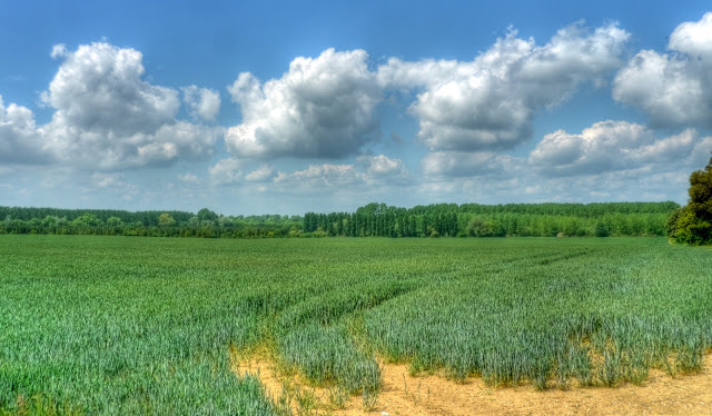
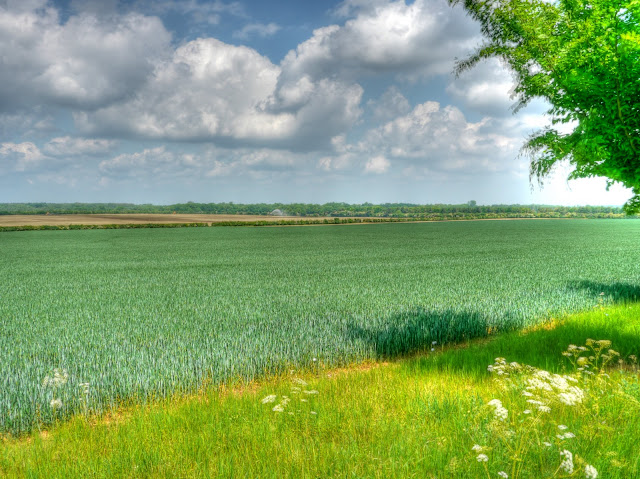
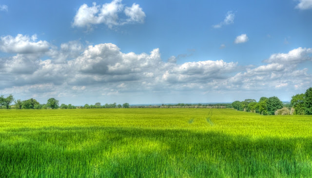
With the crops growing in the fields and the puffy clouds looking as if they are heading off for the bank holiday weekend I find that each time I cycle out I take a picture like this. The slightly blue-green of the crops, almost look like a sea.


P1110340_34_35_36_37_38_39_tonemapped.JPG


Up by Swaffham Bulbeck Lode I have been trying to identify this tree that frames this picture of the barn in the distance.


P1110350_48_49_tonemapped.JPG


So I have taken a close-up of the leaves in order to check what it might be in my Collins Complete Guided to British Trees. Of course when I type up my Post I am back at my computer and so I have. I reckon the leaves belong to the Black-Poplar (Populis nigra ssp. betufolia). The bark also looks similar to the pictures.


P1110353.JPG


It was as I was cycling up from Reach along Straight Drove (but pretty rutted and so requiring quite a lot of concentration) that I realised there was not Yellow crane standing, instead there was a bridge! Here you can see it - personally I think it looks pretty good and in keeping with the flat countryside in these parts. I was really impressed with BAM Nuttall and the crane sub-contractors they must have worked really hard to get the crane built, bridge positioned and then the crane dismantled and trucked out.


I was listening to music as I cycled and had been listening to Marina and the Diamonds - which I really like. But for a change I had switched to some old school Pink Floyd and was listening to Dark Side of the Moon, so between the track ruts and the music it was quite surreal to see the bridge in place.


P1110359_7_8_tonemapped.JPG


The same view, but zoomed in, I must check to see the clearance under the bridge for people walking along the banks of Reach Lode. From this distance there hardly looks to be any clearance unless walkers are diverted off the bank and then back on again. I wonder what they anticipate will happen when the Lode banks need repair by JCB - there does not look to be enough clearance for a digger under the bridge. Still something to look at the next time I am closer.


P1110356_4_5_tonemapped.JPG


This shot, further along Straight Drove gives a better idea of the clearance. Perhaps a Digger will be able to drop down the bank and under the bridge.


P1110363_4_5_tonemapped.JPG


As I cycled further up Straight Drove another photograph of the new bridge.


P1110366.JPG


Although there is the promise of some rain over the weekend there was a bit of synchronised irrigation in this field.


P1110368.JPG


On the Upware Road the colours in the hedge caught my eye. The whites and pinks of the blossom looked quite striking.


P1110372_0_1_tonemapped.JPG


After cycling through Wicken Fen a view of the Reach Lode Bridge from CockUp Bridge on Burwell Lode. Yep- I think this is pretty good and well done to all those people pushing to open up access through the Fens for walkers, cyclists and horse riders. When cycling around the area it does strike me that the Fens do look to be a bit of a mono-culture environment. There does not seem to be the profusion of spring flowers (weeds) that I remember as a child. Mind you I lived in a different part of the UK. Hopefully this will open up a bit of the more diverse countryside for people to see.


P1110376.JPG


I also noticed, whilst standing by CockUp Bridge, a boat coming down Burwell Lode - at this distance it looked is if it might be a little too tall for the footbridge - it did fit. There was a dog in the back barking at various sights on the banks as it passed. That is a pleasant way to see the Fen countryside as well, preferably with a cold beer whilst someone else "drives".


P1110382_0_1_tonemapped.JPG


The last time I was along here (a day or two ago) this part of the Lode was clogged with weed, now it has all gone. I have no idea whether it was cleared or just moved out of the way as boats navigate the Lode. ind you I have not seen that many boats travelling along this Lode - it is a bit of a No Through Lode.


P1110385_3_4_tonemapped.jpg


I have to say that the Fens are a great place for a potter on a sunny day - flat but some interesting tracks and sights to see. With the opening up of a few more routes it helps maintain the (my) interest levels. Lets hope that an alternate route through from Cambridge opens up soon.


Friday, May 28, 2010

Cycling a Loop(s) from Cambridge to Moulton and back - new sights and un-noticed sights

Today I was meeting someone over in Moulton (Suffolk) in the middle of the day. So it was a good excuse to take a roundabout route even though the Sustrans 51 route passing from Cambridge to Ipswich also passes through Moulton and is quite pleasant. A look at the map to see what interesting ways there were showed some by-ways near Red Lodge. One route headed South-East where it passed under the A14. Whilst another route headed East to Herringswell before dropping South to the A14 to the same point as the other by-way. There is always a risk that by-ways can become virtually uncycle-able which can throw timing to the wind - so I decided to set out and keep an eye on the time and make a decision closer to Moulton.


In fact I had intended to leave the house earlier and head up to Prickwillow, home of the Prickwillow Engine Museum to the East of Ely and then cycle down alongside the River Lark to West Row - but I things to get done and left later than hoped. It seemed colder so I wore socks under my sandals and a fleece and vest - in the event the weather was very pleasant for cycling - warm enough and with some occasional bursts of warm sunshine. As I was running late I picked up a bag of jelly babies for a lunchtime snack along with a couple of bottles of orange squash, with no ice. Adding ice would have delayed my start even more.


In the end I took the slightly shorter route and ignored Herringswell - no matter somewhere to visit the next time I visit the area. The route I did take is shown below on the OSM Cycle map. On the way back I followed Sustrans 51 to Reach and then detoured up Reach Lode to check out the Lodes Way Bridge being built there.


Also I apologise to those of you looking at my Blog on a low-bandwidth connection. I use quite high-resolution pictures, so that you can right click on them and see in a new window at a large magnification. I had not realised how this might slow the download - I have a high bandwidth connection and had not really thought about it. (Apart from the time I was travelling in Cambodia and found it was taking so long to download my posts that I reduced the resolution!) I will look at whether I can use two different resolutions - although as I use an off-line Blog Editor it might be tricky.


Chippenham.JPG


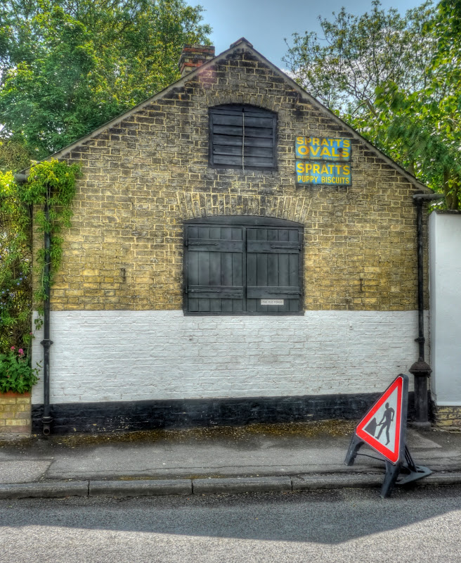
I had not planned on stopping and taking too many pictures early on, since I have already taken many pictures of the area and was running out of time. However this old advertising sign on The Old Forge caught my eye - and I had only gotten to Swaffham Prior.


P1110133_27_28_29_30_31_32_tonemapped.jpg


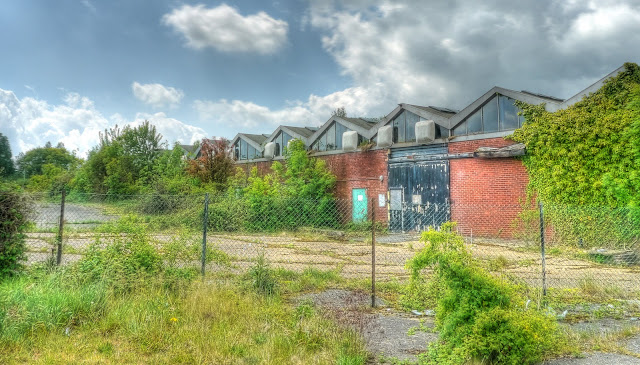
Reach passed by without stopping, but there are several Sustrans routes (11 and 51) through Burwell, on the direct route from Reach to the Exning leg there is a piece of Urban decay in a Rural setting. I have often thought about stopping to take a picture - the clouds behind seemed like a dramatic backdrop for the crumbling factory.


P1110140_34_35_36_37_38_39_tonemapped.jpg


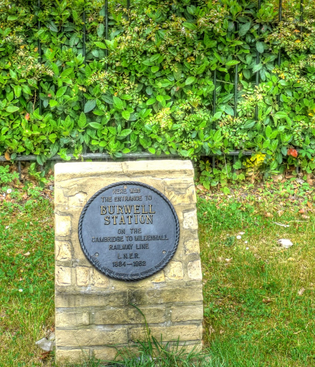
At the junction on the Swaffham Road, before a dog- leg onto the Heath Road I noticed this plaque. This was the entrance to the Burwell Railway Station on the Cambridge to Mildenhall line (1848 - 1932). It is all that is left - there is little evidence of the line around this area.


P1110147_1_2_3_4_5_6_tonemapped.jpg


I managed to hold back on taking pictures until I was in Snailwell. On the Snailwell Short Road into Snailwell I found the road closed after passing Plantation Stud Cottages. Road closures are a hassle in a motor vehicle - they can be terrible for a cyclist. There was no indication of why or what a diversionary route might entail so I carried on. Nine times out of ten it is usually ok to pass with a bicycle. In this case BT were doing some work in the road with trees and telegraph poles. I asked and they said yes, a bt of courtesy goes a long way - so I snaked past the various vehicles and was in Snailwell. I stopped to take some pictures of the fields, trees and clouds - you can't tell from the map - but it looks like there are a lot of trees around here. This picture was taken on Short Road (it lost the Snailwell when it reached the village) next to Snailwell Stud (perhaps that is where the name ended up!)


P1110154_48_49_50_51_52_53_tonemapped.jpg


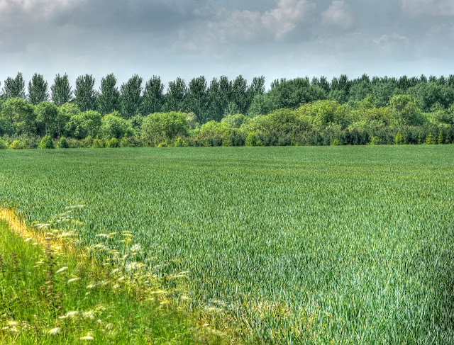
The trees look like a serrated edge, seen looking back down the road.


P1110161_55_56_57_58_59_60_tonemapped.jpg


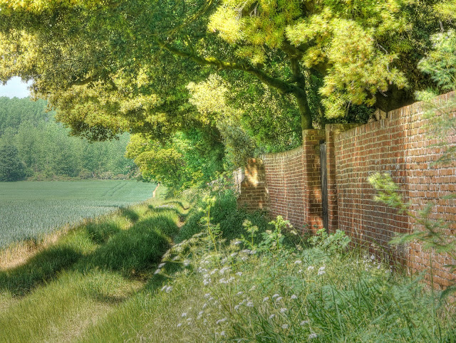
Alongside Snailwell Stud there is a footpath and a rather nice brick wall. The footpath comes out near the Church (on Church Lane).


P1110164_2_3_tonemapped.jpg


Heading out of Snailwell, on the same road the picturesque views of the country continue - if you look hard enough you can see the field in the background in the middle of the picture being irrigated. One of many fields I passed out cycling - although we had rain overnight farmers can't really afford to take chances with the weather when operating on tight margins.


P1110178_6_7_tonemapped.jpg


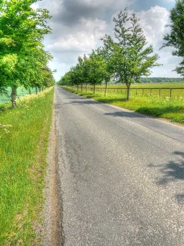
The road itself was very straight with an interesting by-way heading off back over to Newmarket to the right. The by-way seems to have its own bridges over the A14 and Cambridge/Ipswich Railway Line. As I was now heading to Chippenham the road was now called the Chippenham Road - you can see why they number roads in the UK - it is much less confusing. Although the road was straight it was not very busy and cars did give me space when they overtook. The road then junks around Chippenham Park before arriving at the village of Chippenham.


P1110185_3_4_tonemapped.jpg


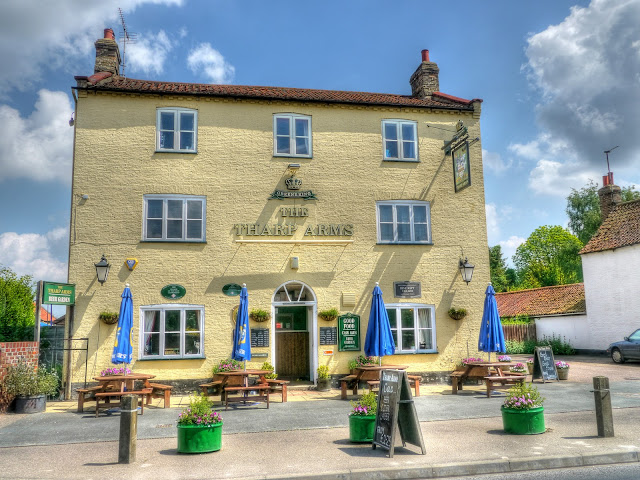
One of the first sights as I entered the village - it looks to be a nice pub - the Tharp Arms, an interesting name. Apparently the name comes from the Tharp Family who still live at Chippenham park - the name on the pub is relatively new until the late Nineteenth Century it was called the Hope Inn. What I missed in this picture is the strange roof-line - follow the (pub) link to see a different picture of the pub and find out who is pertinacious! (A free copy of my book to the first commenter to get the right answer, when I write the book.)


P1110197_8_9_tonemapped.jpg


Opposite the pub


P1110206_4_5_tonemapped.jpg


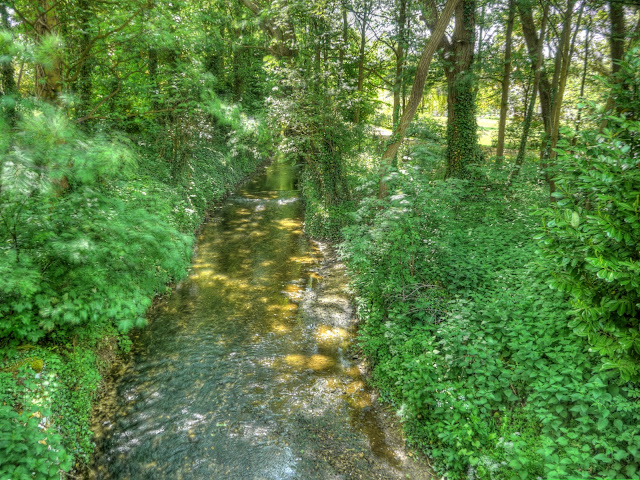
I then headed of up the Badlingham Road to Badlingham Manor stopping briefly to take this picture of the River Kennet on its way to Moulton. Just after passing the river there was a Bridle-way to Red Lodge - but I wanted to keep moving and had already decided upon the route. Checking the map afterwards I should have taken it not the the road parallel to it was bad - but the bridle-way would have been better.


P1110217_1_2_3_4_5_6_tonemapped.jpg


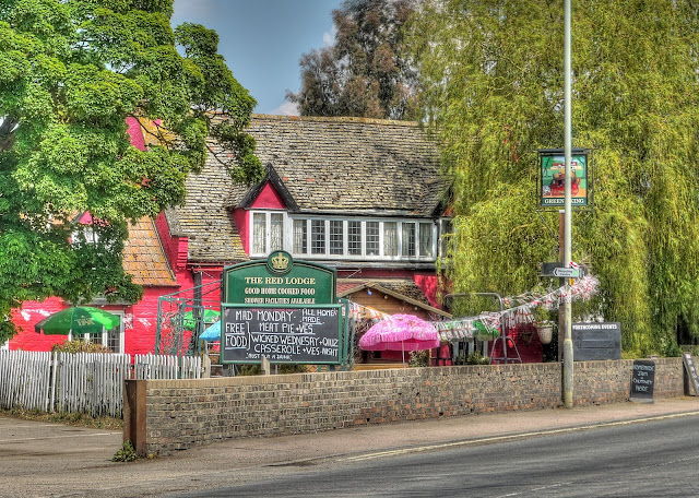
Red Lodge is an interesting place. It used to be on the main road from Cambridge to Norwich and looked rather like a glorified "truck stop". Oh yes - they also have a Karting Centre and Off-Roading centre called Wildtracks - both great fun. A dual-carriageway bypassed the town - but only just and I think it rather hit the place economically. However since then there appears to have been a huge amount of new housing built and the place is getting bigger by the day. There is also a Pub called the Red Lodge - painted red as you might expect. (Note the link did not when when I wrote this - you can view the cached and not very informative version - perhaps it will be back later.) the by-way I took is a turning to the right just past the pub. The by-way sign is not very visible, in fact I did not see it when cycling, I only noticed on the Google Streetview of Turnpike Road - the road looks more like a turn off onto an industrial site. As I passed there were various vehicles flattening the "road".


P1110231_25_26_27_28_29_30_tonemapped.jpg


After passing a car scrap yard the path then passes through some woodland before briefly before passing along a road and then back onto the track. The route is pretty straight. It is marked on the OS maps - just not yet on the OSM maps. (The recent edition of the Cambridge Cycling Campaign Newsletter has some information on the cyclestreet Mapping project which uses the OSM map.


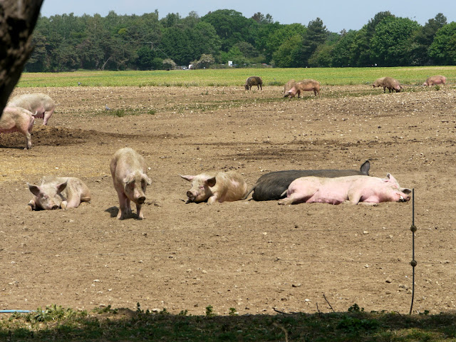
I like the idea of pigs being allowed to live in the open (or rather I dislike the idea of factory farming) - where I grew up it was mainly cattle farming (with some sheep) so living here in East Anglia I like to see the pigs out in the fields - sunbathing!


P1110232.jpg


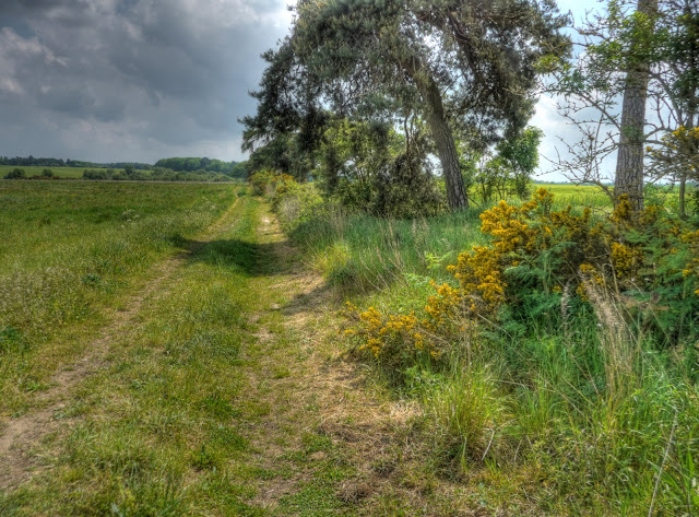
This route then went past Kentford Heath, which in June 1647 was the HQ for the Parliamentary Army during the Civil War. The countryside is typical of this area - known as Breckland with sandy and flinty tracks, stunted pine trees and yellow gorse bushes. Once again the track was perfectly OK on my Hybrid although I had to take a little more care not to get caught in a sand trap - but these tracks were not as bad as some in Thetford Forest (also part of Breckland).


P1110239_3_4_5_6_7_8_tonemapped.jpg


The track then met a road just by the A14. Apparently the Yards used to house old aeroplane scrap. I also passed a Policeman giving his dog a bit of exercise in the field next the the A14. After that I climbed up - well climbed for the Flatlands up to around 90m - fortunately I did not suffer from altitude sickness. The jelly babies probably helped - when I was in Peru we were told to drink the local Inca Cola as the sugar helps to combat the altitude sickness - mind you 5000m is a little higher than 90m.


The views were good though - when everything else is less than 90m you can see for some distance. This is a picture looking North.


P1110246_0_1_2_3_4_5_tonemapped.jpg


This tree standing along between two fields stood out - you can also see that the land is more rolling out towards the South East, which is where this picture looks towards. The previous picture shows how flat the Fens are.


P1110260_54_55_56_57_58_59_tonemapped.jpg


This cottage is on the outskirts of Gazeley, just by a Windmill - although I did not actually see the mill - The cottage is called Gazeley Mill Cottage - another picture that I will have to remember to re-take as some stage.


P1110270_68_69_tonemapped.jpg


After the heights of Gazeley my route joined up with Sustrans 51 (heading back to Cambridge). At Moulton (the village after Gazeley) the road drops steeply down a small country lane, where some care is needed the drop is around 50m and you arrive at the Packhorse Bridge in Moulton. As you can see in the picture the locals need 4x4s to drive up and down such steep hills. Although the road drops it is into a valley and you then have to climb again before another down hill to Newmarket.


I then learnt a lot about the various interesting places to cycle, on and off-road in the Cambridgeshire area - so there are still plenty of places to explore.


P1110276.jpg


There are some large studs with some fine houses all around the Newmarket area - this is Warren Hill House - which as the name suggests as back up a hill almost as high as the hill the other side of Moulton at 88m.


P1110279.jpg


The route then drops down into Newmarket past various gallops where the racehorses are exercised in the mornings.


P1110290_1_2_3_4_5_6_tonemapped.jpg


Instead of taking Sustrans 51 back I headed through Exning onto a No Through Road call North Road which led to a byway known as Haycroft Lane - shown here in this picture. The gap between the hedges is quite wide - but the path is pretty much a single track so I assume that it is not used by farm traffic. After crossing the Ness Road the track is called Howlem Balk and after a left turn onto North Street meets up with Sustrans 11 and then Sustrans 51.


P1110304_05_06_07_08_09_10_tonemapped.jpg


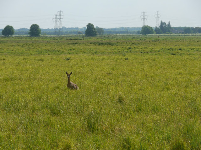
At Reach, as it was such a pleasant day I took to the tracks rather than the roads and surprised a deer which hopped over the fence, it ran a short distance and then turned and stared at me for a while - I turned to make sure I was not cycling into a rut and when I looked back it had vanished.


P1110311.jpg


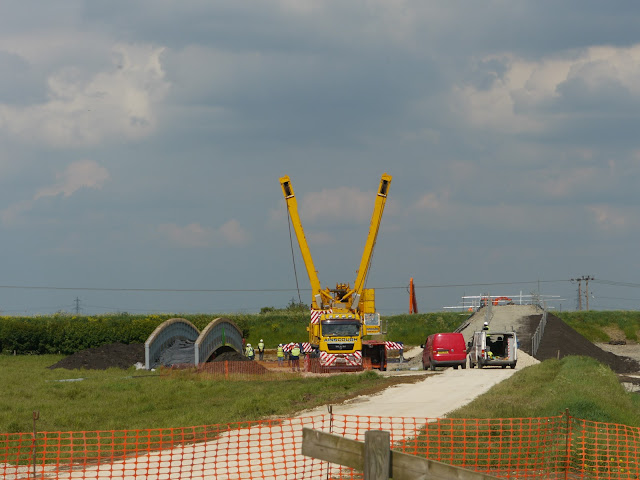
The other surprise was that there was a crane being erected on the Reach Lode Bridge site. Quite a few trucks had brought in the bits and a bunch of people were busy sorting it out and putting it together.


P1110313.jpg


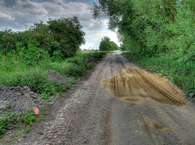
Although they had added to hardcore to the side of Headlake Drove there were also dips in the road that had temporarily been filled with sand. These work with large lorry tyres - but a thin bicycle tyre tends to dig in and throw the cyclist off - so I had to avoid them.


P1110318_19_20_21_22_23_24_tonemapped.jpg


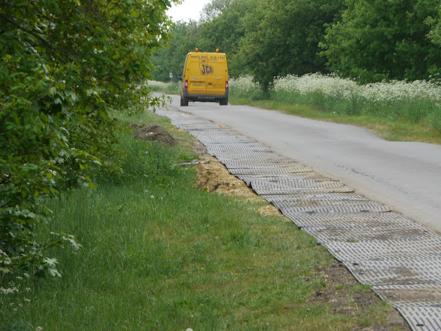
Further along on on the same road, but a part used regularly by the traffic between Upware and Swaffham Prior, they had packed the edge of the road with sand and put down plastic mats to help widen the road for the crane carrying lorries. The van here in the picture is one of the construction vans it shows how wide the lorries must have been.


P1110326.jpg


I must say I am impressed with how BAM Nuttall seem to be getting on with this build. I wonder when they will swing the bridge into place - presumably next week.