
September 5th: I did not have time for a cycle ride yesterday and neither did I have time to sort out the punctured tyre on my Marin. So it was back out on my Longstaff touring bike again. I am not quite sure why but although I had no clear idea of where I wanted to cycle I did have in mind that I would cycle along Sustrans 11 though Milton Country Park to the north of Cambridge. So I set off up the Cam along the cycle path and realised that Sunday is not the best of days to be cycling along that particular path - there are quite a lot of people out for a stroll.
I did make it through the Park and then made use of Cambridge Guided Busway (CGB) cycle path to head out of town returning via the American Museum in Madingley. I then checked out the Southern Section of the CGB before heading for the hills and then returning via SustraNS 51. The route I took is shown below and meanders around - the total distance was around 60Km with 164m of ascent/descent - not a record but quite good for Cambridge. Here is the BikeRouteToaster Link.

So my first mistake was choosing to ride along the side of the Cam (Sustrans 11) on a Sunday afternoon - only because the shared-use path is not very wide and you get quite a few people walking along it on a Sunday as you might expect. So to reduce conflict and to make my journey a little faster I thought I would switch to the Fen Road which runs up from Chesterton in parallel with the Cam path. The trouble is it is not a road I know well. As far as I could remember it was a no-through road (even for cyclists) and I was not even sure how many connections there were with Sustrans 11. Also I had not checked the map to see how to get from the Cam path over through to Milton country park.
Having switched to the Fen Road I made better progress and passed this path, although if you follow the link the Google car did not go all the way along Fen Road, so the path towards the Cam is up just past the brick wall on the right of the picture. (This is a satellite view and the path is clearer.) I decided that there was probably another path further along and carried on and just as I passed a gateway a dog came hurtling out barking and chasing after me. Discretion being the better part of valour along with shouting "shoo" I sped up and outran the dog before anything untoward happened to me. It turned out though that there was no other way through and at the end of the road there was a group of horses being corralled and it looked as if they did not want some random cyclist stirring things up. So basically I had go back the way I came and pass the chasing dog again.
This time as I approached the dog's gateway (well the dog's owner's gateway really) I kept to the edge, so the dog would not see me until I was right by the entrance and shot by - it worked - the dog did come out barking but it didn't manage to catch up with me and soon gave up chasing me. You might be wondering what breed of dog - well I am no expert - but it looked a bit like a large Basset Hound to me. After that excitement it was pleasant to get back the Cam and a more relaxed pace of cycling. Perhaps the bike in this ditch belonged to someone who did not escape the hounds.

After passing Baits Bite Lock I reached the turn to Milton and another Fen Road or perhaps the same one - just separated when they built the A14 dual-carriageway around Cambridge (aka A45). This is Fen Road looking back towards the Cam. i took the picture to show how the Horse chestnuts are suffering with Leaf Miner. The Horse chestnut looks to be in the final stages of Autumn (Fall). Apparently a survey in the UK has shown that the rapid spread of Horse Chestnut Leaf miner has slowed at the problem has spread and has slowed considerably by Middlesborough. When we were on holiday in York I certainly noticed that the leaves of the Horse Chestnuts up there seemed very much less affected by the mite. (York is 50 miles south of Middlesborough.)
This road is not that flat and a car whizzed by me and then there was a load crunch as they went over a bump and then dip in the road. They had to stop and check out what had happened and looked a bit sheepish as I cycled past - more haste less speed I think.

There was a sign for those emerging from the Country park pointing to Sustrans 11. Although as I have mentioned before Sustrans 11 is not one linear route - it has different legs some of which go places and some that don't

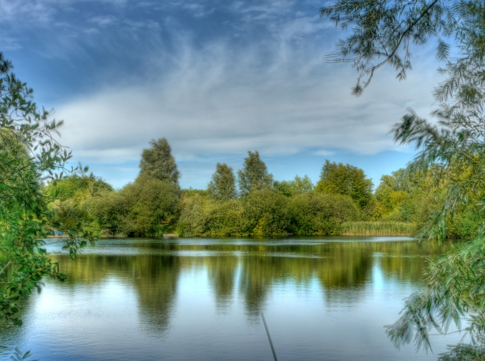
The route through the Milton Country park that I show on the map is not the route I took - I seemed to weave all over the place. The park does not have a lot of "11" signs for the cycling traveller. It is quite a nice park though and was very popular with young families. Mental note to self - don't cycle through Milton Country Park on a Sunday if you are in a hurry. There are some lakes with small bridges to cross the interconnections between the stretches of water. The wooden floor of the bridge gives quite a lot when you cycle over it (well it did when I cycled over it). I am not sure whether it is for effect - or they did not use thick enough wood.

This is a picture taken from the bridge in the previous picture looking South.

The same bridge looking North - see if you can tell where I was on the Satellite view
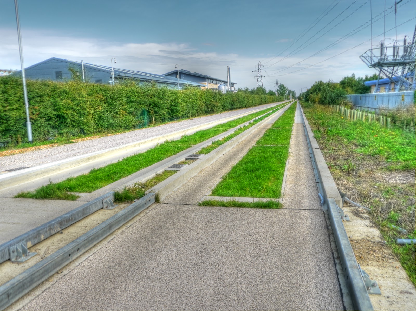
I then headed down to Cambridge over the Jane Coston Bridge over the A14 and then down Cowley Road and onto Milton Road to cycle along the CGB. For a change and because the first bit of the CGB cycle path is really lumpy I cycled along the concrete tracks. I feel more comfortable cycling with my right side next the the concrete lip as opposed to my left side. In some places the gaps between the concrete beams are very smooth in others there is a noticeable bump. Once buses start running I wonder how much tolerance has been designed into the system to allow for beams to settle at different heights? If you have ever cycled along an old farm track made of concrete you will know how mis-aligned the slabs can get. Coming to think about it - I wonder how they will fix the track when repairs are needed - will they re-route buses onto the road or go to single-track running or do it an night. They seem to be growing a nice layer of turf down the middle of the tracks though.
This is the B1049 bridge over the CGB just near to Histon. There was a family out cycling down the track - which is why I took this picture, but by the time I was ready they had travelled quite a long way.

The inevitable graffiti.

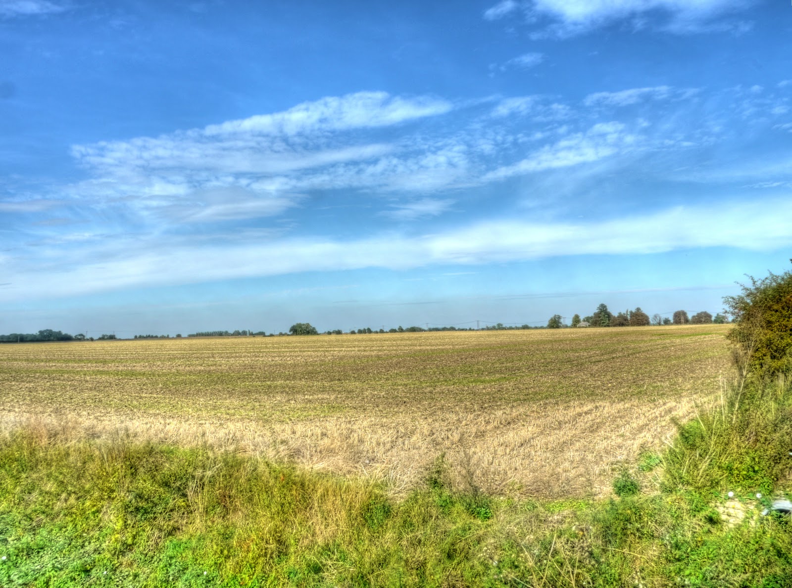
For a change I cycled along another the Park Lane Cycleway between Histon and Girton. This connects the CGB with Sustrans 51 - or maybe that should be the old Sustrans 51 - or maybe they will keep two Sustrans 51 routes. There are lovely views along the fields. The ridge in the middle is Beck Brook, which also runs alongside a bridleway between Girton and Histon.

The line of trees at the far edge of the field is the CGB. Lovely blue skies - it was a very pleasant afternoon to be pootling around on a bike.
Where the Park Lane Cycleway meets Sustrans 51 are some rather splendid signs - not just indicating that it is a cycle route (blue) or the number - 51, but also far and near towns Cambridge, Girton, Oakington and Huntingdon and the distances. Is cycling being taken seriously as a sensible means of transport for more than trivial distances at last?

The I cycled up to Oakington and over the A14 to Dry Drayton. Although some friends who rented a damp house nearby used to call it Damp Drayton. This is the Cambridge to Huntingdon stretch of the A14. This is a busy road and attracts a lot of commuter traffic and haulage traffic. This is very light traffic - look how close some of those lines of cars are - "only a fool breaks the two second rule". (My daughter has not long turned 17 and so is learning to drive.)

On my way through Madingley towards Cambridge there is a school and the road has islands designed to slow down through traffic. The sort that obstructs one lane and makes it give way to oncoming traffic and then the same (but vice-versa) a bit further along. I don't know whether you have ever cycled through one of those - well beware, some tossers car drivers don't believe that you have to give way to cyclists, ever. Some chap in an open-top Morgan sports car, probably with a small penis, was showing off to his lady friend and drove straight at me at speed. I am just not that convinced by some of the strange things they build to slow motorists down. (What me bitter - non.) I then cycled past the American Cemetery and Memorial near Madingley. It is a sombre place to visit - but worthwhile. I have visited with American friends who have lost family in the WWII conflict and they are commemorated here. You can't fail to be moved.

The Cemetery has a commanding view over the Cambridgeshire countryside - this is the view taken looking away from the Cemetery. (It consists of 4 (x7) pictures stitched together.

Alongside the Cemetery is Madingley Windmill - which was restored after being damaged in the late 19th century..

Then I headed around Coton and into Cambridge and along Long Road and past the Southern Section of the CGB - it looks fairly complete. They also seem to be growing turf between the tracks here as well.

Then it was head down and a bit of hill cycling to Fulbourn, through the Wilbrahams and back along Sustrans 51. This restaurant is called the Missing Sock and I was pleased to see they had fitted some bike racks. That can't be a bad thing on when a Sustrans route runs outside your door. (This is between Bottisham and Quy.)

Sustrans 51 runs through the Park and Ride site on Newmarket Road and then through a field (with a tarmac path) - it is now a nicely ploughed field.

Before heading back into Cambridge I detoured up towards Horningsea, thedevelopment of the shared-use cycle path has continued. This bit has been built between the outskirts of Fen Ditton and the A14 bridge and very nice it was to cycle along too.

Not a bad place to live Cambridge - even if it is a bit flat. I might moan about how cyclists are treated - but the problem is more with the motorists than the political will to improve things. (Could still be a lot better though - think Holland).
Great photos! Thank you for sharing. ♫
ReplyDeleteLinaBelle♫
Thank you
ReplyDelete