
The bit of the route from Linton down towards Great Chesterford feature in my recent post about my cycle ride down and around Duxford - so there are no further pictures here. I was planning on eating my ham and cheese sandwiches at the old Farm Buildings halfway between Linton and Great Chesterford at the peak of the mountain slight hill (all of 105m above sea level). In the end I did not, partly because it was raining and partly because of the delays caused by chain slips. At least there was a bit of downhill (wooded hill at that). I was using my Marin Hybrid bicycle - 25mm Schwalbe marathon plus tyres - tough but not a lot of tread for rocky, slippery, down-hill, almost-single-track and once or twice I had to skid to a stop. I did get stung a couple of times - and almost fell off at another - nothing serious, but it would have been into more stingles. I really must bring my "proper" MTB out on this track and some leggings (although aren't leggings for wimps!).
It also occurred to me that the route was not quite as wonderful on a windy, drizzly day compared with the last time when it was gloriously sunny. Even though it was not as good it was still disappointing to reach the "road" bit of the byway. The fact that it is not easily ridable and that it feels so secluded is what really make it enjoyable for me.
There is a gate where the byway passes Crave Hall farm and having stopped to go through I took some pictures of the Horse Chestnut trees - these leaves seem to have the same rust spots that I saw on a tree near Swaffham Bulbeck. I wonder if these are the early stages of the leaf mite or a common marking that I have never really noticed before?

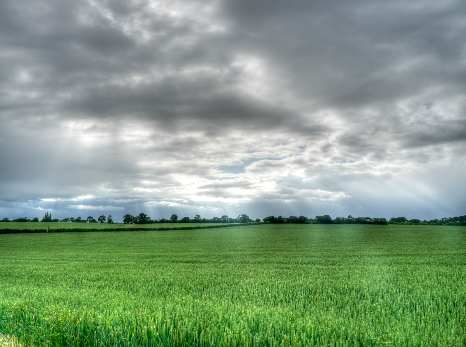
After descending down through the trees - well big hedgerows on Cow Lane the countryside opens out and there is a wonderful view of a small estate set amongst the trees, the large-scale OS map shows this as Grumble Hall. You can see rain falling in the distance behind the hall. Cow Lane continues on a small road dropping down to around 45m before reaching a left turn.

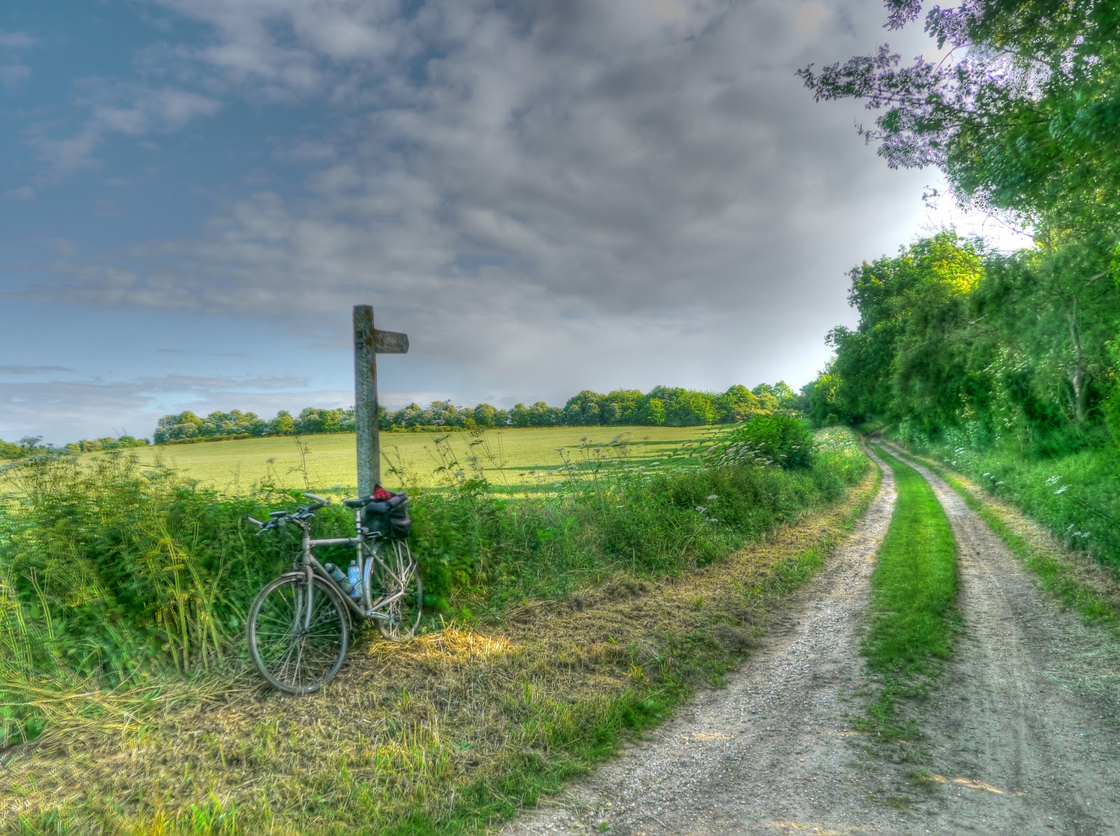
The route then carries on up towards Burton Wood and yes it is up hill. I also seem to be having gear slip problems. I had assumed that it was the rough track that aggravated the problem as the chain seemed to slip more on bumps - but it was a struggle on this road. The climb gets back up to around 110m, although the road itself ends at 90m or so. If you follow the link you can see a picture with the Byway clearly signposted. The picture below does not look quite so convincing - at this time of year tracks can quickly get quite overgrown.

The path soon becomes a lot clearer and is more like single-track between hedgerow. I did meet a couple out walking their dog here so it is perhaps not quite so isolated as the previous by-way but it is great fun to cycle along. This bit had tree roots running across the path - best negotiated whilst standing on the pedals.

At one point the hedgerow came to a very small "cross-roads" of tracks. I stopped and ate my lunch - it was still cold but with the hedges I was sheltered from the cold wind - mind you I did not hang about once you stop moving you stop generating heat. The picture is a composite of 5 or 6 pictures stitched together - you don't have to look too closely to see the joins. I think the camera was set on automatic and so changed the exposure for each of the pictures as I panned around. Looking at the map later one of the legs heads down towards Chesterford Research Park - although it is not a right of way.

After the mini-clearing and a welcome snack single-track service resumed - this bit looks quite well used - I did not even have to worry about stingles. Really I should wear a helmet when doing this type of exploring - just in case and I was on my own. In emergencies I do have my phone with me - but not much use if I get knocked out. Mind you I was not really worried about falling off here so much as getting my hair caught up by hanging branches, they overhang came quite low in places. The path was also darker than this picture makes it seem.

The path then emerged onto open space. From the OS map this must have been an airfield at one stage. A check of the fount of "all" knowledge (Wikipedia) shows that it was called RAF Little Walden and closed in 1958 - there are a few remnants left but it has returned to mainly agricultural use. This is track the reaches the road (B1052).

Whilst cycling along the B1052 I saw the unmistakable look of a Control Tower - not quite as tall as they make them now! It has been restored and contains a memorial to the USAAF groups that used the airfield.

After a short distance on the road I turned off down Bowsers Lane. I have to admit I was not totally clear whether there was a right of way from the road (Bowsers Lane) and the byway just behind Bowsers. The OSM Cycle map shows it more clearly and Google Streetview does run along to the end of the road. I could not find that much information about Bowsers although it is a working organic farm run by Farmer Kit with some Holiday cottages.
As I was reaching the end of Bowsers Lane, looking for the legal route through to the byway my gears really started going haywire - I was trying to cycle slowly and had switched to the middle cog at the front. (My Marin has 27 gears 3X9) the chain kept jumping off. After stopping and putting it back on and proceeding I and it jumping off again I looked down whilst trying to cycle to see if I could work out what was happening.
Flipping heck - the middle cog at the front was wobbling all over the place causing the chain to jump of and then jam between the outer big cog and the slightly smaller middle cog. So I laid the bike down to have a look. All became clear, there are 4 bolts that hold the front sprockets ( or cogs or chain-wheels) together - quite a lot of force gets transmitted from the pedal to the cog and then through the chain to the back wheel. As you can see in the picture below two of the four bolts were missing. The bottom two holes each side of the crank are missing their bolts. I must have missed it before because to keep weight down the bolts have hoes through them.
At this point I thought I might have to ring my wife to come out and pick me up in the car - since this is not a part of the world she knows it would be "fun" trying to tell her where I was! At first I though that I would have to try and find the nearest road route back home and see if I could manage using say just one gear. So I tightened up the two remaining bolts as tight as I thought was reasonable - the last thing I wanted to do was shear them off as well. It was a good job I had my multi-tool with me. I do not need that often but when I do.
I then cycled around a bit to see if anything had improved. Well the good news was the chain seemed to be ok on the biggest ring at the front - but still slipped on smaller two sprockets. This meant that I was down from 27 gears to 9 - and the 9 hardest gears at that. This meant that even if it was ok going along the flat I would end up putting a lot of force into the gears going up hill - because I had lost the easier gears.
Now at this stage the sensible thing to have done would be to pick a road route back home and give up for the day. That was the sensible option - having come this far I decided to see what the next leg of byway looked like and give it a go. When you are out exploring you can't give up an the first sign of trouble can you? Although it would mean more walking to get to a road where I could be picked up if it all fell apart.

This is what the track looked like - I really would not wanted to have missed this. Although at one point as I was travelling quite fast down a hill I got distracted looking at my chain and sprockets and then my GPS which had slipped round the handlebars as it was so bumpy that I shot out of the rut I was in and into the adjacent rut. At this point the thought "hum this could hurt a bit"passed through my mind along with the positive realisations that at least I would end up on my left hand side and not my right hand side when if I tumbled off. Why did it matter - well it was my right collar bone that got broken in Feb 2009 when a car ran into me in Histon. Hopefully nothing would break, but at least I would be following my doctor's advice not to break my right collar bone again. (He thought it would probably need to be pinned the next time!) Fortunately I managed to stop the bike before any of this happened, with just a few pedal scrapes and some oil on my legs from the front cogs.
As I had stopped I tightened up the sprocket bolts again and then set of up the other side. Although I only had 9 gears I managed to get up the other side without any chain slip - it looked as if my gamble was going to pay off.

The weather was still changeable with drizzle and then sun, but always wind. It was great cycling through fields without a soul in sight though.
The byway came to a T-junction so a quick check of the map and then the left fork up through more fields a slight climb and then a slight drop down to a road. This is the track that emerged onto the road - well marked and not bad for cycling along, a bit bumpy. I also checked the bolts again to make sure that things weren't getting loose. At this point I decided I would just carry on with my planned route - even the weather was getting better with a bit of sun.
I called it a road that the byway ended on - this was the sort of road I liked - one that looked as if it were so little used that grass would be growing up the middle - it was the Bartlow Road to, well Bartlow. It turns out that there is not much information on the village on Wikipedia - the village website is much more informative. Check out the Bartlow Railway pages - some wonderful pictures of the railway line and something I missed on my ride through - the Bartlow Hills - two rows of Romano British barrows.

I did notice that the road went through the gap left by an old railway bridge part of the Stour Valley Railway. This part of the line closed on the 6th March 1967 and apparently there was a study in 2004 looking at the possibility of reopening the Cambridge to Haverhill line.

Bartlow is a small place - and my route was to take me through and then along another byway to Cardinal's Green - but I got lost.
No comments:
Post a Comment