Showing posts with label Ely. Show all posts

Sunday, March 14, 2010

More grey skies in the Fens

The weather seems to be picking up a little - despite the BBC local forecast predicting rain it was sunny in the morning, but by the time it came to getting out on my bike it was cloudier. The lighter evenings are also making it more pleasant to venture out a little further in the afternoon. Not that I mind cycling at night with some decent cycle lights - but there are less opportunities to take pictures. With the shift in sunset from around 16:50 to 17:39 during February it is now around 18:00 in March plus the change to BST (British Summer Time, when the clocks go forward on March 28th) - will along with an improvement in the weather and leaves on the trees make for some interesting scenery and lighting. Both are needed for photography.


I headed out North of Cambridge up to Waterbeach, there is an off-road Sustrans route (11) alongside the River Cam, but I tend to give it a miss on weekends - it is popular with walkers and can be a bit slow. Actually this bit of Sustrans 11 goes nowhere (well Waterbeach) it stops at Waterbeach awaiting further developments before new routes are opened. The indication on the Sustrans map is that a Connect 2 route will connect the route from Waterbeach to the Southern Edge of Wicken Fen. As I have mentioned part of this route now exists with a route through White Fen and a bridge over Swaffham Bulbeck Lode already in place and bridge construction starting at Reach Lode. This will leave a bridge for Reach Lode and some way of crossing the River Cam to complete the route. I can't find any information on how the missing dots will be connected though. On the Sustrans map there is a proposed route shown from White Fen up Lug Fen Droveway, stopping at Vicarage/Fen Farm and then on the other side of the River Cam and the Ferry House - but no clue as to where the route goes between these two places.


So I took the road route to Waterbeach - not the nicest of roads for a cyclist, from Fen Ditton through Horningsea and Clayhithe to Waterbeach. It is a narrow but fast road and a couple of cars got closer than I would like when out for a cycle. All cyclists know that bikes wobble, whether a gust of wind (yes really) or a pothole - it happens. The greater the number of cars that don't follow the highway code and don't give you room the greater the chance you will get hit. At the speeds cars travel you would not stand much chance - and what really annoys me - they try to make the cyclist the (partly) guilty party if they are not wearing a helmet.


Fortunately the route switches to less buy roads through Landbeach and then onto the outskirts of Cottenham before taking Long Drove (a popular name for a road in these parts). This road is single track and bypasses Cottenham, but does pass Green End Cow Pastures and Two Bit Farm - there were also quite a few (10 or so) people out for a walk along it. Unfortunately the single track road rejoins a busier road - Twenty Pence Road (B1049) near Twenty Pence Cottage. Although this is a faster road than the road through Horningsea it is wider and I find that cars overtake with a wider gap. Here is a random field, just off Long Drove, ploughed and drying in the dry winds of the Flatlands. The track alongside the field is not marked on the map but there is one a little further on called Engine Drove that I will try in the warmer weather.


P1050798_799_800_801_802_803_804_tonemapped.jpg


Long Drive, it must have been constructed from slabs of concrete, with expansion gaps, but has not been resurfaced with tarmac. It is quite unpleasant cycling along with the rhythmic thump, thump, as the wheels go into the gaps across the road. The middle of the road is slightly better, but the gravel collects in the middle. You pays you money you takes you choices. I then carry on North through Wilburton (crossing the A1123) and zig-zagging North past Grunty Fen, Wentworth, crossing the A142 (a busy road and tricky to cross sometimes) before climbing up to Coveney. When I say climb this is the Fens remember - the peaks around here around 20m! My route then heads into Ely, another climb up past the cathedral before following the Sustrans 11 route back to Burwell and Sustrans 51 to Cambridge.


P1050812_3_4_5_6_7_8_tonemapped.jpg


On the outskirts of Ely you have to cross the A142 near a bridge over the Great River Ouse - this can be the trickiest crossing of the journey - it is a busy road with constant traffic in both directions. During rush hour there is often a line of traffic caused by the railway crossing just up the road. (There is a bridge under the railway, but tall vehicles cannot use this and have to go over a level crossing. If enough lorries are waiting then it can block the underpass. All trains going East cross country and West to Norwich and North to Kings Lynn head over this bridge over the great River Ouse. There is a large loop in the track further along to allow this feat of "steering".


P1050826_27_28_29_30_31_32_tonemapped.jpg


The Sustrans 11 route then follows a shared pedestrian/cycle way alongside the Great River Ouse using a combination of tarmac path and farm track. Here there is also evidence of recent ploughing. I did not know the Electricity poles lean into the prevailing wind!


P1050840_1_2_3_4_5_6_tonemapped.jpg


Looking over the Great River Ouse from the Fen Rivers Way (as this part of Sustrans 11 is known).


P1050847_48_49_50_51_52_53_tonemapped.jpg


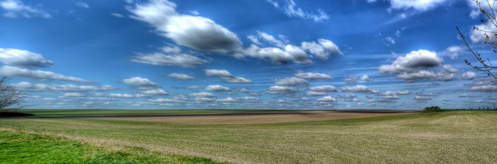
I could not choose between the last picture and this one - this one typifies East Anglia's wide open skies.


P1050854_55_56_57_58_59_60_tonemapped.jpg


My bike had a rest whilst I was taking these pictures. There are around four or five benches on this stretch of the path. I used the seat I was on to steady my camera whilst taking the pictures. In this one you can see Ely cathedral in the background. As you can also see it is not a wide path. It is useful having a bell to give a warning ting - you see quite a few people walking their dogs and a number of agricultural workers (based at Barway) walk this route into Ely.


P1050861_2_3_4_5_6_7_tonemapped.jpg


Just before entering Barway and leaving the tracks to re-join the road I there were people busy putting covering over newly ploughed fields. This picture is made up of seven pictures and because some of the guys in the field were moving (between pictures) they look a little ghost-like in the picture.


P1050868_69_70_71_72_73_74_tonemapped.jpg


This part of the Sustrans route uses a No Through Road which helps to keep the traffic levels down- but again along Padney Drove the farmers had been busy. I guess with the late spring start a lot of farmers will be trying to catch up.


P1050875_6_7_8_9_tonemapped.jpg


I generally detour from the Sustrans 51 route from Burwell to Cambridge and head through Reach towards White Fen. Another picture in my series entitled "Farm Machinery in a Field"


P1050917_18_19_20_21_22_23_tonemapped.jpg


The skies were quite softly lit as the sun set - here is an orange glow over another freshly ploughed field just off Lord's Ground Drove.


P1050924_25_26_27_28_29_30_tonemapped.jpg


All in all the ride was around 50miles/80Km in pretty decent weather and for once I got home without frozen toes - I did feel unusually drained when I got home though. I should have known something was up - I woke up feeling sick and with a headache the next day. A pity because the sun was shining - but I could not even eat breakfast - unusual for me - ah well. Spring is coming,

Saturday, February 6, 2010

Sustrans 11 Cambridge to Kings Lynn - part 3 Kings Lynn and back again

The Sustrans Route (technically 1 not 11) follows the Ouse passing under the A47 bridge and crossing the Wisbech Road continuing along to the docks are. This picture looks back (South) along the cycle path to the Wisbech Road bridge. This section of the path from the Power Station has gates to stop cars and motor cycles. When I first used to cycle along here the gates were quite thin and tricky to cycle through on a bike - they have been improved and still impede cars but are much more cycle-friendly.


P1040326_0_1_2_3_4_5_tonemapped.JPG


The path looking through to Kings Lynn - reasonably wide - it is used by cyclists, pedestrians and dog walkers. The docks look quite run down now.


P1040340_34_35_36_37_38_39_tonemapped.JPG


There are still fishing boats that sail from Kings Lynn though.


P1040333_27_28_29_30_31_32_tonemapped.JPG


The next stop was the Railway Station and a snack from the Station Cafe. I like Kings Lynn Railway Station it looks how you imagine a small town station should look. It also has a well-stocked cafe with all the things you might want before heading off on your travels. In my case there was a 30minute wait for the next train. Although it was cold the station was sheltered and the sun was shining and the egg mayo and salad sandwiches from the cafe were excellent.


I hung my yellow fluorescent cycle hat to dry on my bicycle handlebars and read the newspaper. There is nothing worse than putting on a sweaty hat when setting off after a rest! This time around I had decided to catch the train back to Ely (£5.80) and then cycle the rest of the way. That way I reckoned I would get close to a trip of 80miles/128Km. I did get a bit cold whilst waiting though. I also have to resist the urge to have a nap on the train - must be a sign I am getting old. The train eventually ends up in London - I would not want to miss my stop.


Once at Ely you have to cross a very busy road cycle a short way and the re-cross it to get back onto the cycle track by the River Great Ouse. This could really do with either a short cut to avoid crossing the road at all or some form of crossing. In the rush hour it can be pretty tricky.


By now the sun was getting low in the sky and between Barway and Padney the sun had set but was lighting the clouds from below.


P1040344_5_6_7_1_2_3_tonemapped.JPG


More hedge work seems to have taken place on Padney Drove. I am a little surprised I thought hedges were supposed to be good things - for wildlife and to prevent the soil blowing away!


P1040348.JPG


On my way back I went through Wicken Fen and Burwell. In Wicken Fen I was stopped and asked whether the Stretham Road was still closed. There had been an accident near the level crossing apparently. It looked as if she had been photographing wildlife - you often see people strolling around Wicken Fen with cameras and tripods.


I also had a car pull out at me in the middle of Burwell. He did have the decency to lower his window and apologise - he hadn't seen me! Also on the road near White Fen a car with only one headlight was driving at me - it made passing quite tricky and they say that too many cyclists have dodgy lights!


The GPS worked throughout the trip and I clocked up over 80miles/128Km so a good day out. Mind you I did have a few aches and pains from the slightly different riding position on my touring bike.


Sustrans 11 Cambridge to Kings Lynn - part 2 Ely to Kings Lynn

The Sustrans 11 route out of Ely drops down to below 10m and follows a moderately busy road the B1411 to Little Downham, although the Sustrans website shows an alternate route in development along a smaller road/track called the Downham Road. I must try it out when the weather is a bit better. Little Downham is also on a hill almost as high as Ely so there is another small climb up into the village where it continues along the B1411 to Pymoor and Welney.I mentioned that standard of Sustrans signage - they not only indicate the route number but in this case the towns and distances as well. Very reassuring when you are on a bicycle - but they must assume that cyclists have better eyesight than car drivers!


P1040206.JPG


The road runs alongside the New Bedford River (or Hundred Foot Drain) and passes under the Ely to Peterborough railway line. Ely is well served for railway lines despite the small size of the station. with services to Cambridge, Kings Lynn, Peterborough, Ipswich and Norwich (and of course beyond). I travel to Manchester a couple of times a year and there is a very convenient direct train from Manchester (Oxford Road) to Ely - much easier than driving.


P1040207.JPG


Despite this being a B road there was hardly any traffic at all on Friday, it was lovely to be away from the noise of cars and lorries. There were some fighter jets flying around from time to time though. Although they were flying quite high they seemed to be flying with after-burners on and so making a huge amount of noise.


P1040214_08_09_10_11_12_13_tonemapped.JPG


The route then heads close to Welney and Welney Washes where it briefly joins the A1101 (again not too busy, although busier than the B road.) It is is a natural flood area. The A1101 has signs alongside the road to indicate how deep the floodwater is. At this point the Sustrans 11 route leaves the A1101 and passes alongside the Welney Wetland Centre on an unclassified road. This is looking south near the A1101/Country road junction.


P1040243.JPG


The road is on the right below the bank of the New Bedford River - seen here looking towards the North. The washes are actually called The Hundred Foot Washes.


P1040253_47_48_49_50_51_52_tonemapped.JPG


The route then heads east to a place called Ten Mile Bank - a group of houses on a crossroads. Where a bridge crosses the River Great Ouse. At this point the route turns left (North) and heads towards Kings Lynn. I normally cycle on the route from the south direction which is more direct from Ely and Littleport (known as the Fens Cycleway - Southern Loop on the Sustrans map). It is a small road which follows the River Great Ouse from Littleport. There is a main road the other side of the River, the A10 which syphons off all but the farm and angling traffic.


This is a composite picture made up of three photographs of the cross roads and bridge of Ten Mile Bank. With my bike in the foreground. I often stop at this point to drink and eat. Did I mention that I had brought some Jelly babies with me on this ride - but of course. I stopped to eat some as well. A pity I had forgotten to bring anything to drink.


TenMile_Panorama1.JPG


The route carries on North up near the River before detouring through Downham Market. Here the Sustrans 11 route wiggles oddly through the town. It is not really odd - it is more a local route good for cycling to school (it passes at least two schools). Here the Sustrans map shows there is a plan to bypass the main road out of Downham Market. It then heads off onto C-roads again, with the river(s) old and new to the left one wiggling, one much straighter. The cycle route then joins with Sustrans Route 1 from Wisbech where the Sustrans map shows it as Route 1. I must check out the Sustrans Road Signs the next time I head that way.


This is a picture looking south down the Relief Channel - quite a substantial chunk of water. You can just make out St Peters Church Tower in silhouette. (This picture and the next were taken from Wiggenhall Bridge.)


P1040277_1_2_3_4_5_6_tonemapped.JPG


To the North of the Relief Channel is Kings Lynn Power Station - framed by electricity pylons, although these pylons don't seem to have anything to do with the Power Station.


P1040278_79_80_81_82_83_84_tonemapped.JPG


A closeup of the Power Station with Saddlebow Bridge in front. Apparently it is a Combined Cycle Gas power station capable of up to 325MW


P1040285_86_87_88_89_90_91_tonemapped.JPG


There are pylons coming out of the power station though (not literally though) here are two near the Tail - more to come on that subject. It was the clouds that inspired me to take this picture.


P1040312_06_07_08_09_10_11_tonemapped.JPG


Again Sustrans have done a great job of developing a cycle route, in this case into Kings Lynn. The cycle route detours around the Power Station and then follows the River Great Ouse under a couple of bridge into Kings Lynn. The path is tarmacked and so easy top cycle along.


The path passes this construction known as the Tail on the maps. It is a series of gates used to control the water flow in the Relief Channel. If you walk by a loud voice warns you not to go on the machinery and to stick to the path. There are sensors at each end that trigger the warning. They don't seem to work if you cycle by them above 10mph/16Km/h though. I passed through to take this picture and then headed back to rejoin Sustrans Route 1.


P1040313_4_5_6_7_8_9_tonemapped.JPG


The next stop is Kings Lynn.