Over the Holiday Weekend I had been thinking about a slightly longer cycle ride and going by the weather forecast Tuesday looked the best bet - although it was sunny there were 20MPH (32Km/h) winds from the South as well. I had also been looking at the Sustrans website and using the Where's the Path website to compare the current OS map for this part of the world with the 1930s OS map. I am amazed how many railway lines there used to be criss-crossing the area. My interest in the railway lines is mainly driven by the potential they have as cycle routes - but I admit to having a slight interest in the Steam days of rail.
I was originally planning to get the Cambridge to Norwich train and then cycle along a route called the Marriot's Way which runs from Norwich to Reepham along the route of a disused railway line or two. Part of it runs along the Midland and Great Northern Joint Railway from Norwich to Melton Constable and on to the Midlands, part of it takes a route from Themelthorpe to Aylsham, completed by the Great Eastern Railway. However with the wind blowing from the South I did not fancy having to cycle back down towards Cambridge against the wind and decided to cycle out to Norwich via the Marriot's Way and then to catch the train back to Cambridge.
Previous rides to Norwich have been about 130Km/80miles so I reckoned that even with a bit of detouring it would probably only be around 160Km/100miles in total. Allowing for rest stops and picture stops and a 9.30am start I took lights as depending upon when exactly I got to Norwich station it could be dark when cycling back through Cambridge. (The train takes 1 hour 15 minutes. to do the journey) So after a quick scan of the map I decided to cycle via a few Sustrans Routes, but made the mistake of not really working out how far it was going to be!
For some reason I have been finding the Sustrans Map website difficult over the holiday weekend and so could not rely upon it for information - just when it would have been useful - ho hum. Instead I used the OS maps which do mark the Sustrans routes on them.So my plan was to take Sustrans 51 from Cambridge to Burwell, switch to Sustrans 11 to Ely. I planned to detour around Ely and follow the Great River Ouse where there is the Southern Loop of the Fens Cycleway which follows the River first on one side and then on the other on a minor road called Ten Mile Bank. At Ten Mile Bank instead of heading North the route then switched to an Easterly Sustrans Route - 30 - to Thetford forest. At Thetford Forest the plan was to take Route 13, once again heading North where it met Sustrans 1 with an East run along the Marriot's Way to Norwich. What could be easier? I have cycled on each of the routes in the past and so did not bother programming the route into my GPS, I did print out a couple of pages , one showing the direction Sustrans 30 as it has two choices an off-road route and an on-road route - I wanted the off-road route. The other page showed the area around Sustrans 13 joining Sustrans 1.
Although I planned to buy some food and drink along the way I filled up a couple of water bottles and took two bags of jelly babies for energy and a bit of cash for the train ticket as well. No point in taking too much money. I set of before 10am as planned the following wind was great for maintaining a good pace, especially as I started heading off in a more Northerly direction when I passed through Reach on on the outskirts of Burwell joined Sustrans 11. I normally cycle the other way around here and it was almost as if I was on a different road it looked so different. I paused at Wicken Fen to take this picture of a Thatched Cottage before heading up through the village of Wicken, continuing along Sustrans 11 through Barway to an off road bit towards Ely alongside the River Great Ouse.

Once past Barway Ely Cathedral comes into view although the first part of the path is below the banking alongside the river.

The Sustrans Routes 51 and 11 have been well signed with both Route Numbers and signposts giving places and mileages - which is reassuring. When cycling to keep stopping is tiring - and I stop often enough for photographs and normal road hazards so route checking is low on my priorities.

The detour around Ely is actually a straighter route than Sustrans 11 and is marked on their map as part of the Fens Cycleway. As the Sustrans 11 off road bit reaches the main road then there is a short right-left jink onto Queen Adelaide Way to Queen Adelaide another jink on you are one the Fens cycleway route, with the wind behind me it was an easy 25mph/40Km/h - although I did stop at Branch Bridge to take this picture of a long boat looking a little out of place on such a wide stretch of water. There is a railway line on the other side of the River.

I did not bother going into and out of Littleport I just went up to the A10 turned left then right onto Ten Mile bank. This is a great little country lane and with the wind behind really fast on a bike. The road wiggles a bit as it follows the bends in the river quite closely. The A10, a busy main road runs on the other side of the river and occasionally I found myself checking to see whether there was a lorry behind me because the noise seems to transmit from the other road. Pretty soon Ten Mile Bank - the place. With the wind behind me I was making good progress - so time to have a quick drink and snack. Conveniently there is a bench (middle left of the picture) as well. The river was quite choppy with the wind. At this point I was about to cross the river onto Sustrans 30. There are a set of traffic lights at the crossroads on the left of the bridge. They all seem to be at Red and then then sense when traffic from a particular direction comes along and switch that route to Green. I have found it does not always work with my bike - laying the bike at an angle over the sensor helps. (It has a steel frame so should be ok!).
The bridge is called Hilgay Bridge

These geese sometime hang around the bench - today they were off down to Littleport as I went past they had a good hiss at me - apparently they make good guard "dogs" I can see why.

Whilst on the bridge time to take a picture of the River Great Ouse - looking North. At this point my resolve almost wavered and I did think how much easier it would be to carry on to King's Lynn with the wind behind me.

Whilst on the bridge this cyclist came from one side of the river over the bridge and then back up the other side. The river is quite a barrier. According to the OS map just after crossing the bridge the route switches to off-road and crosses the A10 onto the off road bit the other side. No it doesn't, when I got back and checked the Sustrans route map it suggested that the route is on road until the point at which you cross the A10 and then directly opposite it carries on off-road - no that is wrong as well.

This is what happens - you cross the bridge, cycle down the road to the A10 cross the road onto the shared pavement/cycle path, head right and then a short way down turn left onto what looks like a farm track. In this picture the road is the A10 with the spec on the left the sign to turn left towards the bridge and in the foreground is the Sustrans route marker for Sustrans 30.

The off-road bit on the map looks straight, but with the offset start it wiggles back onto the marked route. Here is the track - although a mud track it was dry and straightforward to negotiate. There were on or two potholes and sticks across the path but on a dry day easy enough on my touring bike (with drop handlebars).

According to the OS map and the Sustrans website the route carries on straight on here - but the local signage steers you off up some tracks to Southery and then along the Feltwell Road - one day I will cycle along the track to see where it ends up - but on my hybrid or MTB just in case it gets tricky.

The next tricky bit is finding the off-road turn of the Feltwell Road. You can stick with the road - but I prefer to avoid as much traffic as possible. The strange thing is that on the Sustrans website both routes are marked as on-road, whilst on the OS map it is marked as off-road. The surface is very good for a farm track- but it is not my definition of a road. Interestingly there is a sign at this point - but pointing along the road.

There was quite a lot of flooding in the fields and as at this point the route had started heading back towards the south the cycling became hard work. Cycling across the wind is tricky because the buffeting can push you off course - cycling into the wind is just plain hard work, especially when it is 20mph/32Km/h wind. This is a nice route on a sunny and windless day though.

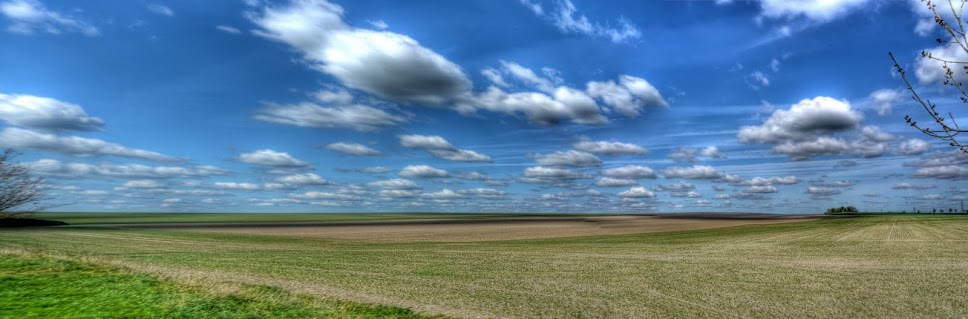
At the end of the road there is a farm track T-junction, at this point I had to stop as a car went one way and a post office van went the other. It was as bleak as it looks, perhaps I should have taken the easy option and carried on to King's Lynn.

The off-road bit then crosses a bridge before rejoining the on-rad part of Sustrans 30 Where it heads south again!! For a cycle ride to the North East there seems to be a lot more Southerly riding than I had expected. This river is called a cut-off channel - quite a substantial bit of river.

The cut-off channel was so "impressive" I photographed it both up and down the channel.

At this point I though I was just under half way - it turned out that I was less than a third of the way along my journey. Still apart from the wind the route was pretty quiet. Part 2 tomorrow and yes it did get worse.


