Showing posts with label Hemingford Abbots. Show all posts

Wednesday, April 21, 2010

Cycling to Hemingford Abbots via Sustrans 51 and back with the wind on the Cambridge Guided Busway (again!)

One thing about the Spring sun is it makes me want to venture further afield on my bike - even when I don't quite have the time to do so. The adventure of working from home is that I can get up early and clear the decks and then get out for a ride mid-afternoon (which means 3pm for me). There is also the advantage that it gets warmer during the day - cold nights - but sunny days. There was quite a strong wind around today and as I prefer to cycle into the wind going and with the wind on the way home that set my direction for the day. As the wind was blowing from the North-West (up to 15-20mph I think) that meant heading out up towards St Ives.


A quick scan of the Sustrans map and it looks as if there will be an alternative route between St Ives and Hemingford Abbots - although only a small part of it was shown as open - hum be interesting to explore that. I also realised that the off-road cycle route between Hemingford Abbots and Godmanchester runs alongside a disused railway - how had I managed to miss that?


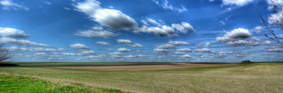
As I was not supposed to be out too long I set off up Sustrans 51 and depending on how windy it was and how "fit" I was feeling - and not too many photograph stops. I had to stop on Sustrans 51 near the Newmarket Road Park and Ride Car park where the route goes off road towards Fison Road. The hedgerow was multi-coloured with different blossoms and shades of green topped by some puffy white clouds.


P1080572_66_67_68_69_70_71_tonemapped.jpg


The next time I stopped was on the outskirts of Oakington - motorists - they hate cyclists blocking their roads but then block the shared cycle-paths - perhaps they think that they get to share as well. Why - well I guess he (probably a he) does not want his fine car damaged by all the other irresponsible motorists. He knows that some motorists just don't give enough space when they whizz past slower or parked "objects". He also knows that cyclists will take more care when passing his fine piece of metal as the cyclist is way more vulnerable.


P1080579_3_4_5_6_7_8_tonemapped.jpg


I stopped to take a picture of a quaint cottage framed by a Horse Chestnut tree in the nearby Churchyard. Unfortunately the wind was blowing the branches around and as an HDR picture it looked weird (multiple branches) and as a normal picture it looked dull so some nearby purple flowers got into the Post instead (Aubretia).


P1080593_87_88_89_90_91_92_tonemapped.jpg


I followed the Sustrans 51 route properly this time - no detours past mare Fen and hardly stopped - despite the wind it was such a nice day I just had to cycle up to Godmanchester and on the bit of off-road sustrans 51 between Hemingford Abbots and Godmanchester stopped to take a photograph of the railway track bed. Now I know it is a disused railway it is easier to spot - it appears on the 1940 OS map as the Huntingdon and St Ives Branch (LN&ER). The Godmanchester Station seems to have been on the outskirts of Huntington rather than Godmanchester - as was often the case with railway stations.


P1080600_594_595_596_597_598_599_tonemapped.jpg


This is the view that passengers on that railway would have enjoyed. That Communication tower in the distance lies alongside the A14 - which follows in part the route of a Roman Road. It is a very busy road one of the reasons for justifying/creating the Cambridge Guided Busway (CGB)


P1080607_1_2_3_4_5_6_tonemapped.jpg


On my way back through Hemingford Abbots I was making good time despite the wind against me - and now I had the wind with me for the return journey so I decided to explore the Sustrans 51 Stub to see where it might go. The route turns off Common Lane onto Meadow Lane a "No Through Road". Interesting that the name of the road was Common Road as there are some far from common houses along it. I had always assumed that this road led to the River great Ouse and no further but it had already gotten some older "Cycle Route" signs so it should lead somewhere. It shows how observant I am - not.


The route followed a bridleway across a bit of the River Great Ouse (the area is a floodplain and the river seems to take multiple routes through). I stopped at the first bridge - called Black Bridge to take pictures up- and down-stream.


P1080621_15_16_17_18_19_20_tonemapped.jpg


On this map this bit does not have a name - but is quite a wide stretch of water.


P1080628_2_3_4_5_6_7_tonemapped.jpg


The bridleway was tarmacked across Hemingford Meadow where it reached Houghton Mill where it was possible to cross the rest of the River Great Ouse - by foot (with my bike). At hits point I did not have a firm plan as to how I was going to get back to St Ives so I headed out and reached the A1123. I would not recommend it - a very busy road - the footpath on the right-hand side (looking towards St Ives) appeared to have intermittent Cycle path signs - but was barely wide enough for one cyclist let along two. When I got home it appears there are paths that presumably Sustrans is negotiating with the "powers that be" on access for cyclists which will make this a much more delightful route for touring cyclists.


P1080635_29_30_31_32_33_34_tonemapped.jpg


As I was still on a bit of a deadline I carried on through and decided to take the CGB route back to Cambridge - it is a fairly straight run as it meanders less than the Sustrans 51 route. The last time I travelled this way, earlier in the month, there were three areas of the shared-used cycle path that were impassable without resorting to the concrete tracks of the Busway. This time around when I reached the first bit of flooding it looked shallow enough to risk cycling through it. Almost a mistake - the path was so soggy that my wheels sank and it was all I could do not to sink into the ground and stop. I managed to keep the bike going but 25mm wide tyres were not really suitable. The real problem was not the depth of the water it was the quality of the path underneath having been flooded for so long. Then I came to this stretch of path - again as I got closer my wheels sank - discretion was the better part of valour, I resorted to the Concrete tracks. where on earth is all the water coming from? It almost appears as if the paths have been designed to flood!


P1080642_36_37_38_39_40_41_tonemapped.jpg


The last of the three remaining stretches - once again I chickened out - maybe on an MTB and if the water had been clearer I would have cycled through - but not today. You can see the wind causing ripples on the water though and that wind was behind me.


P1080649_3_4_5_6_7_8_tonemapped.jpg


Elsewhere the cycle path is actually pretty good - two hard-pack lines have appeared and they make a good surface for cycling along - with the wind behind me it was 32Kmh/20mph cycling. The windmill in the picture was turning - which if you look closely you can see.


P1080663_57_58_59_60_61_62_tonemapped.jpg


The shared-use path swaps sides from time to time as the CGB crosses various roads. I must have passed around 20 cyclists, who looked like commuter cyclists - all but one on the Concrete tracks though. I don't know why I like this small windmill blowing in a field alongside the CGB. A splash of red amongst the green fields and blue skies.


P1080677_1_2_3_4_5_6_tonemapped.jpg


At this point the track is on the right hand side of the CGB - you can see what I mean about the two lines appearing. It implies there is reasonable maintenance traffic along here - although I only met one van though. A but further on the track is starting to pit - small potholes are appearing - I hope this does not mean it will deteriorate too quickly. At the moment it is acceptable (IMHO) for commuting much more deterioration and it will put off longer distance commuting.


P1080684_78_79_80_81_82_83_tonemapped.jpg


A closeup of the small windmill.


P1080691_85_86_87_88_89_90_tonemapped.jpg


A great ride, especially with the wind behind me on the way back and on such a sunny day. I was amused to see that yet another CGB deadline has come and gone. In the Cambridge News it was reported that "Transport bosses miss deadline to name date for guided busway". Why am I not surprised? Given the list of defects I would expect to see the CGB a hive of activity considering how much money is tied up in a construction and not doing anything for Cambridgeshire. I am still concerned that the quality of the cycle-path will be compromised in the name of expediency.

Sunday, April 11, 2010

A Warm Day brings out the Cyclists and the Leaves on the CGB

The weather seems to keep on getting better and better - Horse Chestnut Trees, usually amongst the first to come into leaf (along with Willows) are starting to look fairly green. In fact it was such a lovely day that I decided to get to the bottom of the cause of puncture on my Hybrid Bike (Marin). A while ago a big flint had penetrated the rear tyre, causing a puncture and I replaced the tyre as it was fairly worn along with the inner tube. I usually patch tubes a few times - but, this time because I put on a new tyre I treated the bike to a new tube as well. The trouble is that it has had had a slow puncture since. The last time I used the bike was to go to Cambridge Railway Station. The tyre was fine, going, but when I returned from London at the end of the day the tyre had not deflated but was a bit squidgy. I did cycle on it, but stopped to pump it up as a partially inflated tyre is prone to snake bites. When a partially inflated tyre hits a kerb the inner tube can get nipped on either side by the rim - which can cause two holes on the inner tube - looking like a snakebite - hence the name.


So far I have "solved" the problem by pumping up the tyre from time to time - well today I decided I had to get to the root of the cause. Whilst I did not mind short distances I did not really want to embark on longer journeys on the bike. Perhaps there was a bit of flint still stuck in the tyre causing a minute hole or a spoke sticking through or a metal burr on the rim? As it was sunny I sat outside with a bucket of water to find the puncture by looking for a tell-tale stream of bubbles. The first step is to ensure you know the alignment of the inner tube with the wheel so that when the puncture is found you can locate cause on the wheel.


After putting some air into the inner tube I fed a section at a time into the bucket - hum should have put some warm water in it as well. No bubbles - this must be such a small leak it barely shows. (Which is strange for a puncture caused by a flint). So I pumped up the inner tube a bit more and repeated the exercise, making sure to brush of any random bubbles of air from the tube - you'd be surprised how many cling on - still nothing. At this point I had stopped at the valve and by chance noticed the very occasional bubble coming out of the top of the valve. Thinking about it I had not taken this tube out of a new box, it had been in one of the side compartments on my cycle toolbox. A long time ago I had had a valve problem and meant to look at the valve to check it out - unfortunately I had re-used it without fixing it. This time I threw it out.


Work is starting on some more cycling infrastructure in Cambridge - "Start on new links in bid to put more cyclists in saddle". Whilst Cambridge "prides" itself on having the highest cycling levels of anywhere in Britain - given how flat and relatively dry the area is I think a lot more needs to be done. Whilst I am not a total advocate of the safety in numbers arguments I do believe that encouraging more cycling is good, especially for schoolchildren and that even in Cambridge the Councils under-estimate the distances cyclists are capable of. I also believe that roads are becoming more hostile to cyclists, not always because of hostile intent on the part of motorists but because of badly designed roads - speed humps and "speed reducing" traffic islands are two things that spring to mind. Most motor vehicles do give a reasonable amount of space when they pass, but a significant number do not - and it only takes one. I have been cycling for 10s of years and over a 105,000Km/65,000miles and the behaviour of some drivers scares me.


One of the pieces of work mentioned lies between Horningsea and Fen Ditton where they are creating a 2.5m shared cycle path. Would I use it - possibly, although the road in question is a fast road it has reasonable visibility and turns into a traffic jam during the morning rush hour - but this will make it easier for parents to let their children cycle. Other work also seems to be happening - this picture was taken where Sustrans Route 51 crosses the Horningsea Road in Fen Ditton. The paths up to the crossing have been subtly improved - I wonder if they will also upgrade the crossing - at the moment you have to walk across. it is quite fast though - it changes reasonably quickly after pushing the button - unlike the crossing on Sustrans 51 at Quy which takes ages.


P1070589.JPG


It was such a sunny day I set out without any real plan - just somewhere off in the Godmanchester direction. I ended up cycling through Milton which seems to have acquired some extra cycling signs through the "new" estate - although they do not seem to be complete, nor do the OS and Sustrans maps concur! Then across to Impington and on to Histon - where I was knocked off my bike in Feb '09. The village green was looking very spring-like with the Willow out and a good sprinkling of green on the Horse Chestnut.


P1070588_2_3_4_5_6_7_tonemapped.JPG


On the way out of Histon towards the Cambridge Guided Busway (CGB) there is a bridle path towards Oakington where an avenue of Horse Chestnut trees was looking resplendent in green leaf. Horse Chestnuts are taking a battering at the moment with Leaf Miner and Bleeding Canker being two such problems. From observation it seems that trees with red blossom suffer less than trees with white blossom. Apparently young trees (10-30 years old) are at greatest risk and can "succumb in just a few years".


P1070574_68_69_70_71_72_73_tonemapped.JPG


The CGB - where is crosses the Histon/Girton Road - a family out cycling - the parents setting a good example - the kids on the concrete tracks - it is easier.


P1070565.JPG


The route is signed, as a Bridleway at this point I thought why not pop up to St Ives and then back via the Sustrans 51 route - 10 miles up the path.


P1070564_58_59_60_61_62_63_tonemapped.JPG


The bridleway is still impassable in places due to flooding - I tried the bank but got bogged down in mud.


P1070550_44_45_46_47_48_49_tonemapped.JPG


The Fen Drayton Lakes looked very serene.


P1070543_37_38_39_40_41_42_tonemapped.JPG


The flooding is still reducing - but in all there were three places where I had to resort to the Busway track.


P1070536_0_1_2_3_4_5_tonemapped.JPG


I was going to cycle through this - but sanity took hold - the path has been flooded for so long that the bottom is very muddy and silty - not easy to cycle though even on my hybrid bike.


P1070529_3_4_5_6_7_8_tonemapped.JPG


There were 20-30 cyclists out, from families to friends to single cyclists enjoying the sun.


P1070522.JPG


When I got to St Ives I carried on through Hemingford Abbots up to Godmanchester - now this is what I call a nice cycle route. The route passes through a field alongside Godmanchester Eastside Common - this has a decent bit of tarmac - much, much easier to cycle along than the gravelly stuff alongside the CGB.


P1070520_14_15_16_17_18_19_tonemapped.JPG


After reaching the town of Godmanchester I turned back and headed towards Cambridge on the sustrans 51 route. - detouring through Fen Drayton Bird Reserve - not so much a short cut between Fen Drayton and Swavesey, more a quieter and bumpier route. I again detoured up past Mare Fen to Over, crossing the CGB twice before rejoining the Sustrans 51 route. Mare Fen, in the picture is looking a lot less flooded - which implies that the bridleway on the CGB will be flooded a lot of the time.


P1070506_0_1_2_3_4_5_tonemapped.JPG


The detour route passes over the CGB at Mill Villa - I wonder how it got its name?


P1070499_3_4_5_6_7_8_tonemapped.JPG


That looks like a railway waggon next to the Windmill, since the old railway passes at the bottom of a cutting at this point I wonder how they got it up to the windmill?


P1070485_79_80_81_82_83_84_tonemapped.JPG


The view from the bridge over the CGB - walkers and cyclists on the path and tracks.


P1070478_2_3_4_5_6_7_tonemapped.JPG


A water tower. over has a Windmill, communications tower, Church Spire and water tower in close proximity. A nice bit of blossom to the left of the Water Tower.


P1070471_65_66_67_68_69_70_tonemapped.JPG


The route passes through Longstanton, along a road banned to motor traffic, unless for access, although I am amazed how many drivers of vehicles seem to consider the "need" access. It does pass a rather nice Church - All Saint's which closed for repair for 4 years up until September 2007. It looks as if the Horse Chestnut tree in the Church Yard has had some judicious trimming as well.


P1070464_58_59_60_61_62_63_tonemapped.JPG


My route through Cambridge diverged from the Sustrans 51 route again before crossing the River Cam via the Jesus Lock footbridge from which this picture was taken.


P1070444_45_46_47_48_49_50_tonemapped.JPG


A lovely day for a bit of cycle meandering - sometimes it is better to cycle where the whim takes you. I was impressed with the number of groups of cyclists and walkers on the CGB - I wonder what will happen when they get buses running - will the bridleway be fit for purpose. What agreement has been reached on reducing the flooding of the pathway?