To cut a long story short - the flooding at the St Ives end of the Cambridge Guided Busway (CGB) is even more flooded than the last time I cycled along it. (16th February 2010).
Today was a sunny Saturday - despite the recent rain and the River Cam being brim full it was a chance to see how the CGB had fared. I was not expecting too much - but you have to take your cycling chances when you can. Being such a nice day I decided on a circular route and went up to St Ives along the Sustrans 51 route and then back via the cycle path on the CGB. Well that was the plan - even though I know the route I missed one of the small blue signs just after Longstanton and so instead of a circular route it was almost a Figure of eight route. I did manage to return to the Sustrans 51 route before reaching St Ives.
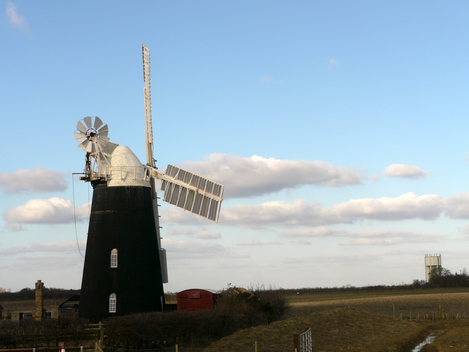
As I passed alongside the River Cam in Cambridge the river was nowhere near as full as it had been. The bicycles caught in the flood by the boathouse were dry and the path under Victoria Bridge was also dry - so no photographs. Because of my wrong turn I ended cycling over Windmill Bridge over the CGB which passes between a Tripod (Communications Tower) and a Windmill.
The view of the Windmill has a water tower in the distance as well. An interesting mix of technologies in a short space including a Guided Busway (high tech) on top of a disused railway (old tech).
The view up and down from the bridge shows the tracks clearly - which are closer than would be possible for a normal road with the Maintenance track/Cycle way/Bridle way alongside. You can see from the tracks along the path there has been a fair bit of traffic - presumably doing the last minute finishing. This view looks towards the Cambridge direction.
You can see from the sun shining on the tracks that it was quite a pleasant afternoon considering the temperature was not too high. This is looking towards St Ives.
As I had accidentally turned off the Sustrans 51 route I ended up cycling towards Over and then turning back to Swavesey to rejoin the route. As a result I ended up cycling past Mare Fen, which unlike the River Cam in Cambridge looked to have been "well flooded". It is a Nature Reserve and preserves a fragment of Wet Grassland. In fact the flooding is now controlled by sluice gates, and in the Summer is is used for grazing cows. The River Ouse was the source of the flooding. This also used to be used by the locals for ice skating in the winter months if cold enough and hosted the National Speed Skating Championships until the mid 1960s.
Helpfully there is an information board nearby - in order to help preserve the wildlife the Fen is only open during May to December - except by special permission.
I joined the CGB from the St Ives end - it pretty much looks complete. It was not long before I found the cycleway impassable (well without getting very wet). As soon as I had crossed over the River Great Ouse (a nice new bridge) I could see flooding and not just short bits.
It seemed that everywhere there was a lake alongside the track the lake had encroached onto the path.
Each of these pictures is a different part of the track - although they all look the same after a while. In this one the flooding seems to stretch on to the horizon.
I thought that this was a repeat of the above picture at first - but no a different part of the path - in this one the flooded part is not quite as long.
The good thing was the weather stayed sunny and it was not too windy - although the bit there was (wind that is) was against me as I headed back towards Cambridge.
This is the worst I have seen the flooding on the handful of times I have cycled along this route. The flooding was really bad - even where there was not a lake right up alongside the path there were parts that were flooded.
The path almost seems to attract the floodwater, in fact it seems as if the path level is designed to act as a drainage ditch - it is practically keeping this adjacent field drained.
The last patch of flooded path - which makes it eight flooded stretches by my count. I know the flooding has been particularly bad just recently - but it does indicate there is quite a problem.
The good news, despite the recent flooding is that the stretch of path that flooded closer to the Cambridge end that was being worked upon was clear this time around. They appear to have built a drainage ditch in the field alongside which has dealt with the problem very well. Most of the Cambridge to St Ives bit of the CGB seems to be complete - there are very few bits that look as if there is still a lot of work required. What worries me is that the flooding at the St Ives end and the lack of information on when it might be finished makes me think that this flooding problem might be a grey area in the contract that both sides are "reasonably" blaming the other for. Actually what really worries me is that this flooding problem does not get sorted out and what could be a great amenity for cyclists and walkers is squandered. I forgot this plot of my route. You can see the lakes either side of the CGB track which is where the problems occur.


No comments:
Post a Comment