
Once I had reached Icklingham I was at the edge of the King's Forest, although the challenge for me at this point was actually finding the byway rather than cycling along some private driveway. I did find if though and started cycling along it - it started as a thin "farm" track with the two tyre-tracks worn to mud but reasonably flat. As I cycled along my enjoyment levels were high - an unexplored route, sunny skies, not a soul around. Of course at this point the inevitable happened. When you are cycling and get a sudden puncture there is always a moment of denial. You heart tries to tell you carry on, it was nothing, just a bit of a bump and no the bike isn't starting to go all wobbly. Meanwhile you head is saying, yep, that's a puncture and now the bike is going wobbly and now you can feel the rim bouncing along the surface of the track as the cushioning has gone.
It was indeed a puncture despite using almost bomb-proof tyres. I use Schwalbe Marathon Plus tyres which I find offer the best trade-off between puncture-resistance, comfort and low rolling resistance. However unlike the marketing blurb on the web page punctures are not a memory. I don't get many punctures really, but my memory isn't that bad , the last time a thorn went right through the tyre and inner tube, this time it was a drawing pin. What on earth was a drawing pin, or thumbtack as it is known in the US, doing along a byway. The conspiracy theory suggests that some disgruntled path users have got it in for cyclists and have liberally sprinkled drawing pins along the track. The simpler explanation is that perhaps an educational group was on a school visit to the area and a drawing pin popped out of the someone's pencil case.
Whatever the cause of the misplaced drawing pin, I had to fix the puncture. For some reason the pin did not just deflate my tyre it also deflated my "euphoria". Normally I would just unhook the tyre from the rim in the affected area, then pull out a bit of the inner tube and clean up the area around the hole, apply some glue and then apply a patch. Then pop it all back and pump up the tyre and be on my way. For some reason I could not find the hole in the inner tube - I knew roughly where it was, as the drawing pin was still in the tyre when I got off the bike. But as I stood over the upturned bike fuming slightly it took way to much time and in the end I thought it would be more certain to replace the inner tube, which is what I did. There is nothing more annoying than patching a tube to find that either the patch hasn't stuck (unlikely) or that there was another hole, which in this case might have been caused by the drawing pin piercing the other side of the tube when it went flat.
As a consolation prize I did have a drink and ate some jelly babies - here is the bike after being fixed, but before being upended. Alongside is the old inner tube, the orange box that contained the new one, the green box with tube glue and spare patches, a packet of jelly babies a can of coke and my camera bag. To lift my mood as I was at the tail end of fixing it a cyclist came along on an MTB and stopped to check everything was OK - cyclists are like that. We had a chat and then he headed off in the other direction. You can see in the photo the track seemed pretty reasonable.

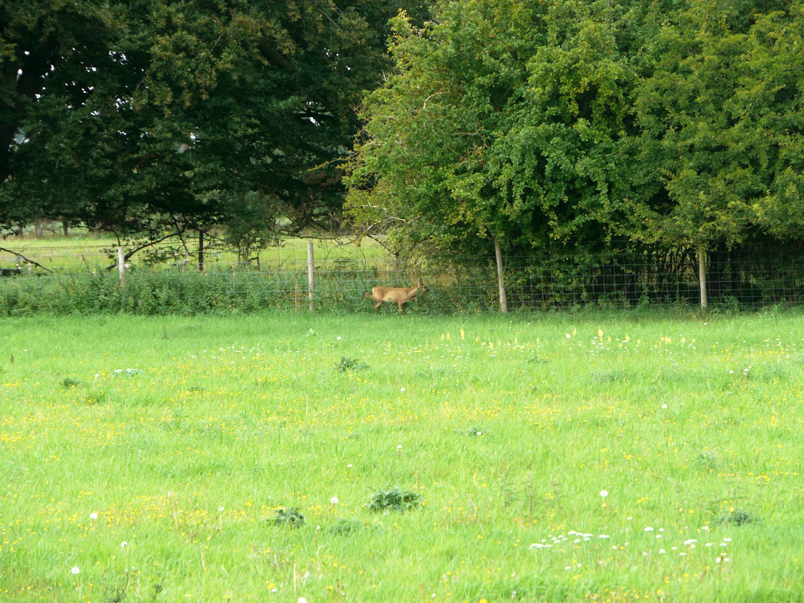
As I ate some jelly babies and re-hydrated drank some coke I saw a deer in the adjacent field, it seemed to be looking for a gap in the fence, one minute it was there then it just seemed to disappear (there's that conspiracy theory again!) Whilst chomping on my jelly babies a convoy of 4x4s came down the track. There were 5 vehicles all looking as if they had done a bit of off-roading in their time, some had families in some just a couple of occupants. In one case a toddler was sitting on his dad's knee (I assume that it was his dad) helping to drive the car. I dragged my stuff to the side to allow some space for them to go by.
When I am out cycling byways I occasionally meet other cyclists, the occasional tractor, the occasional farmer's car (pickup or 4x4) but I have never come across a convoy before. They went through at a sedate pace though - so I can't really complain,
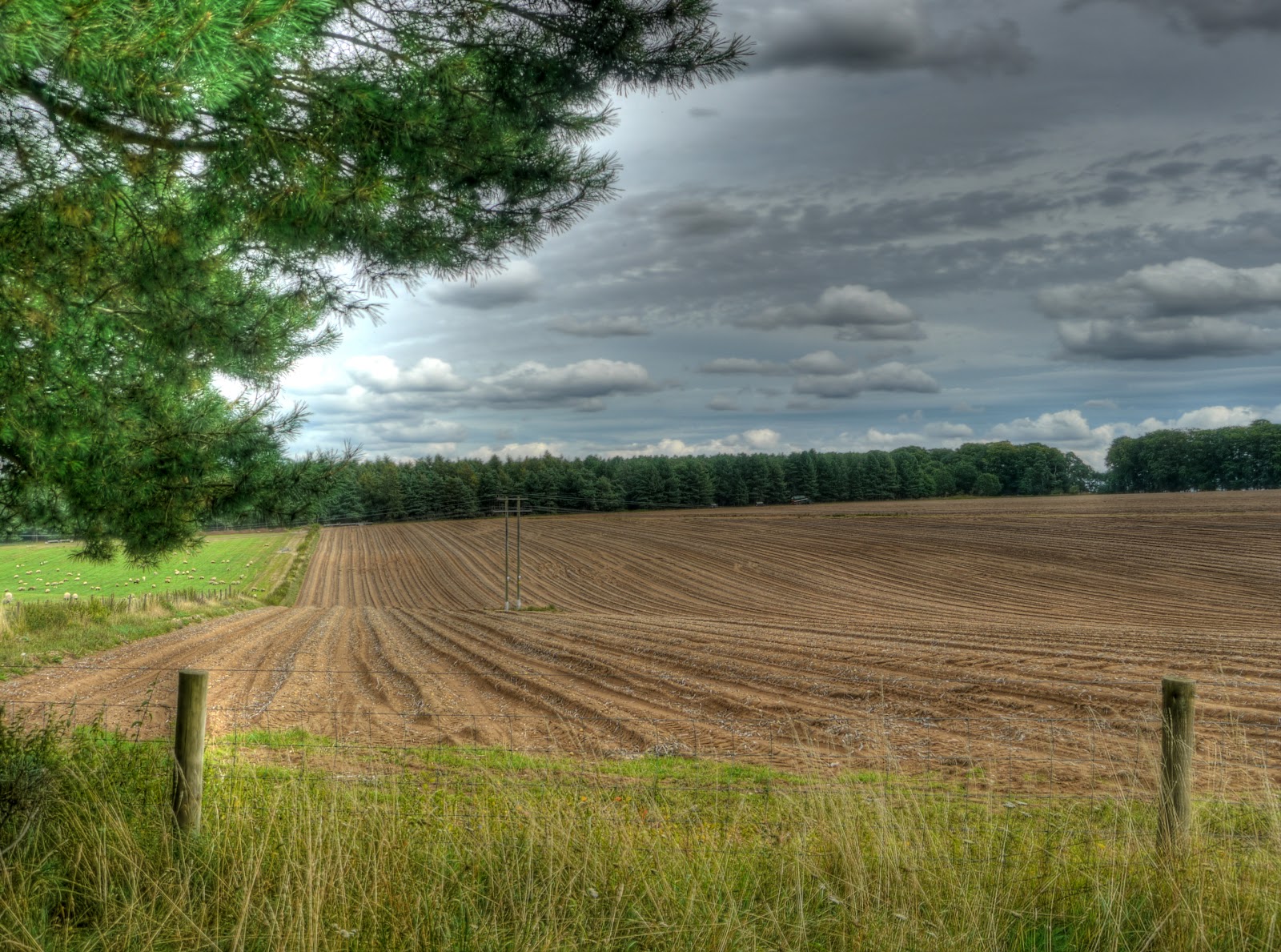
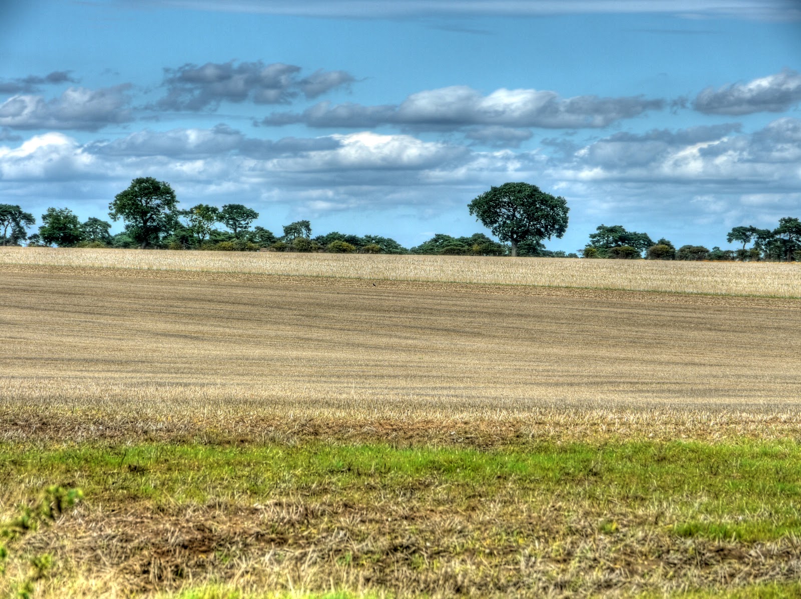
The track climbed up through a couple of fields with gates, from around 20m above sea level up to 50m - not a huge climb by any stretch of the imagination, except for a flatlander inhabitant. The track did get pretty soft and sandy in places though and I found myself having to cycle along the edge I even walked on one bit. Once on the top the track seemed to open out a bit. Looking at the map there seem to be a number of disused pits in the area. Around Thetford Forest they used to mine the flintstone - not sure what was being dug here. Again according to the map the track goes past Seven Trees - which I presume was a group of Seven Trees at one point in time. Whatever the case it does give its name to the track - Seven Tree Road (Track), which seems to be quite well used and quite large - the motorway equivalent of a byway?
Apparently the Forest got its (current) name to commemorate the Silver Jubilee of King George and Queen Mary in 1935. (The Forestry link has too many "mm"s! - not that my proof-reading is any better.) There does not seem to be a huge amount on the Web this forest, it seems to get subsumed into the Thetford Forest information. Although there is a better Horse rider's website with a useful map. Their rides seem to avoid the main byways though. Perhaps I should enter on my bike?

The view along the path changes quite lot, with fields, woods and heaths - like this blaze of colour from the heather. The clouds looks worse in the picture than they were really. It was a really pleasant day for cycling and the clouds helped to cut the direct sunshine a bit so I did not need to bother with sunscreen. Looking on the Google Earth map there are loads of tracks around and about the Forest and parts are open access. Although according to the website that is for horse-riders (not that much different to a bike really though!)

The path continued to change but was easily cycle-able after the first few sandy bits climbing up the "hill" Looking at Google Earth there is a big tree plantation in the shape of a cross near the path - on the OS map it is called Benjamin's Hurst. A Google search indicates that this area was used as a High-altitude bombing range around the late 1930s into WWII. It turns out that this odd construction I took a photograph was a bombing target. (Here is a Where's the Path link. - use the OS and Satellite view.)
At this point the track became more gravelly and turned to the right. (East). I think it was here that I convinced myself I was elsewhere on the map and started to misread my position! There were points where I had to walk as the track was so sandy the wheels dug in. I also passed a few motorcyclists out on the tracks as well.

When I got to the B1106 I had intended to cycle North along it then along a byway to Elveden. But in my confusion I carried on over the B1106 and up the Old Barnham Slip and then the New Barnham Slip. a track with woods (part of Elveden Park) on one side and fields on the other. There was mixed farming here - crops and if you look to the left of the picture some sheep. The sheep tended to ignore me except when I went over bumps and the bike rattled a bit - then they ran off like I had the plague. The crops had scarpered a while ago.
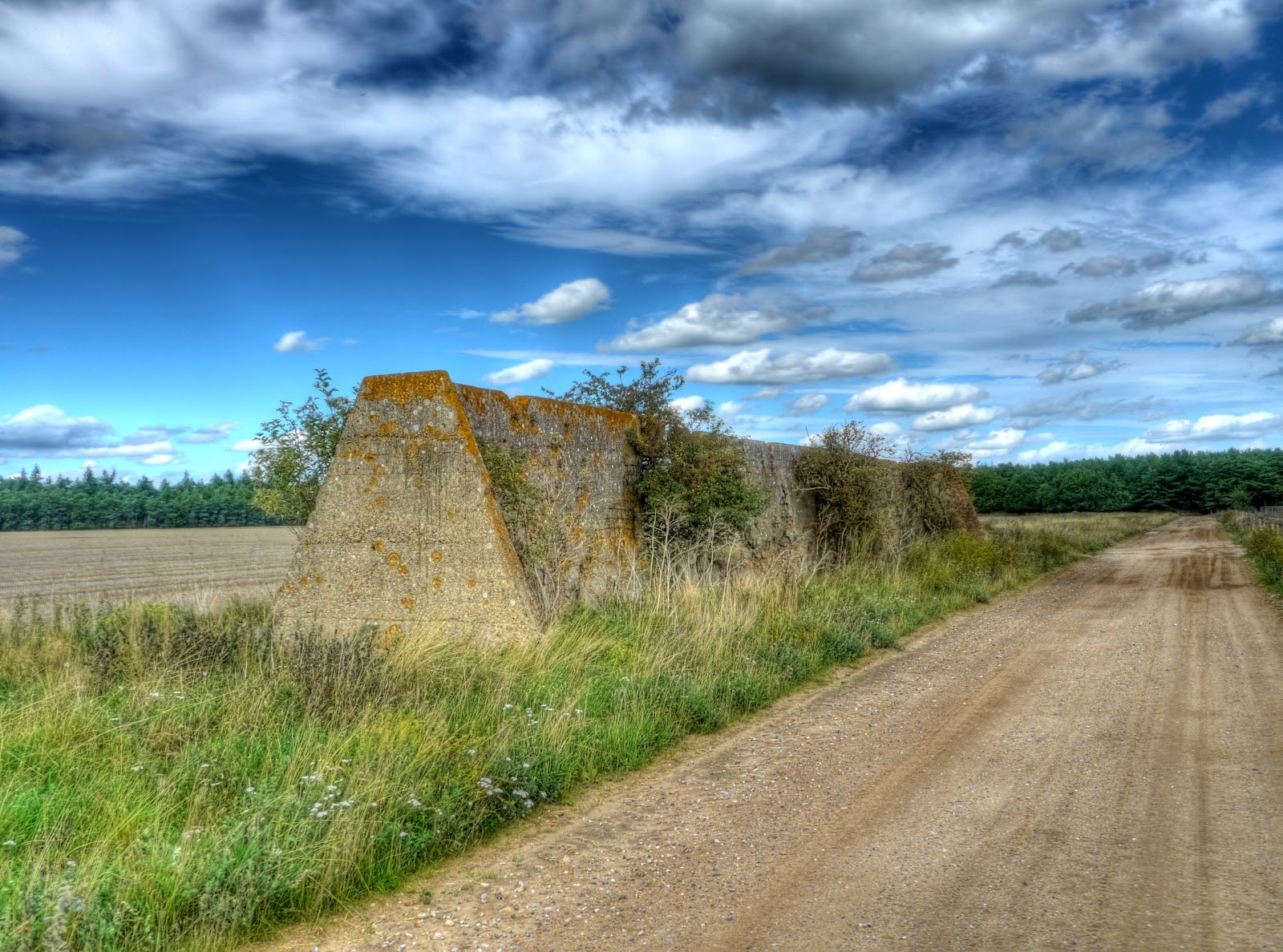
This is the Forest side of Barnham Slip - it looks as if a stolen car had been burnt out here - a good job it did not set more of the trees alight.
Barnham Slip reached the Elveden Road and I worked out where I had gone wrong. It was not really a problem. I turned right onto the road and set off until the next byway heading South. There was a disused railway line just a little bit further along - the L&NER track between Bury St Edmunds and Thetford. Whilst to the North of Elveden Road was Thetford Heath. Although the route was marked as a byway for a reasonable distance it was more like a road - which had me checking my map to make sure I was not cycling into some private industrial or military area I shouldn't have been. The route then took to the tracks and detoured around a place called Little Heath where once again I found myself walking for a short way because of sandy tracks. I was passed by someone cycling in the opposite direction. He managed to cycle - mind you he had thicker tyres and was heading downhill. (That's my excuse.) The countryside then opened up and I cycled past a pig farm - well pigs in a field - loads of them and a combine working in a field before reaching the King's Forest again. I had reached a T-junction where I could have taken either direction as both headed towards byways heading south. I went right - it got me onto the Icknield Way Path - which was where I intended to cycle.
This picture was taken looking back from the "T-junction" through the open fields - the pig field is hidden by the clump of trees in the middle. After the problem of skirting Little Heath whilst the path was never easy I managed to cycle along all of it sometimes having to cycle along the grass strip in the middle though.

Another view from the "T-junction" - this time towards West Calthorpe Heath - as you can see the darker clouds earlier had been replaced by smaller puffier white ones. I did wonder whether to put on some sunscreen but the route from here was through the trees so I didn't bother.
The "T-junction" yet again - this time looking along the path I was going to take - there was a bit of shade and the sandy path was not as bad as it looked.

At this point I headed in a north-west direction back towards Old Barnham Slip and where my path briefly touched the route I had taken earlier. I had to pass a field being irrigated and the track as well judging from the muddy puddles I had to cycle through. I then cycled south along the B1106 convinced I was going to turn left off the road and after a while when no such path presented itself I had a quick check of the map. I was supposed to turn right - ah well only a couple of kilometres extra on my journey.
I did pass what looked like a group of young 8-12 year-old motor-bikers on small motorbikes, fortunately they seemed to be packing up after a day out riding around. I then headed down the Icknield Way Path - the scene of my only unplanned dismount. It was not sand or gravel that caused it though. I was cycling along trying to avoid puddles on a more road-like track and on the steep edge of a muddy puddle I lost the front wheel - it slipped downwards. The thought that, at least I would fall on my left side and not my right, went through my mind (I broke my right collar bone last year). Fortunately I hung on and jumped off at the last minute and avoided the bike falling in the puddle and more importantly me falling to the ground. It got the adrenalin pumping though - humm must pay more attention to the tracks and less to the scenery!
Here is the Icknield Way passing through the King's Forest - downhill and wiggly. It was sandy but not too bad when going downhill you can put more weight on the back wheel and it stops the front from digging in too much. I can't remember passing anyone on this stretch of the path either.

A roadside snack - not. They had an interesting shape though and a reminder that diversity of wildlife requires diversity of habitat.

Before long I had reached the outskirts of the King's Forest and Lackford, which wants faster Internet has some rather nice lakes and a website. Right my next task was to find a "red-dot" route through to Risby and start the homeward leg of the journey.
No comments:
Post a Comment