
The forecast for Sunday had been good and as my wife and daughter had planned a day trip into London I decided to go out riding for the day. I had thought about joining the CTC Cambridge group on one of their Sunday day rides - but for a variety of reasons, mainly to do with going to bed quite late and not wanting to get up too early and wanting to explore I decided against it - but I will. I must also get around to entering the Oxford to Cambridge ride as well.
I had noticed that there were long byways and bridleways through a bit of Forest known as the King's Forest below Thetford and above Bury St Edmunds that I was not familiar with. I have cycled and walked in Thetford, but as you can see from the route I took in this OSM map whilst the forest above Thetford appears clearly marked the forest below doesn't. However on the OS Map there is quite a large chunk of forest shown with three byways running North South, one through the middle and one one each side.
For this ride I did mark out my intended route on an OS map, because it was in an area I was unfamiliar with and involved crossing the A11 dual carriageway just south of Mildenhall. Also sometimes the paths are not quite as easy to cycle on as they might be and so I wanted to be able to change my plans if necessary. As it happened I did not follow the route precisely, because I was not following it quite as closely as I should have. I thought I had cycled further than I had and got my turnings wrong. It did not really matter though as I did cycle along the byways I wanted to and replaced a short byway with a longer byway. Crossing the A11 - well that was not fun I took my time and waited. Basically the A11 bisects a right of way, but no bridge has been built over the road and I ended up crossing in two stages first to the middle and then across the other side. I am sure a few motorists wondered what on earth a bloke with a bicycle was doing standing in the middle as they sped by at 80mph. It is another example of the routes for motor vehicles being prioritised over the routes for walkers, riders and cyclists. There is no way I would have taken a horse across the road.
The ride was almost 130Km in length (80miles) with 459m of ascent/descent and reached the dizzy heights of 90m. I took two water bottles (with ice and lemon squash), a bag of jelly babies and a couple of cans of coke that had been in the fridge. I was going to make up some sandwiches, but time was pushing on when I set off. The Bike Route Toaster link is here. As I had expected there were one or two places where I had to walk as the track was incredibly sandy, I also punctured, a drawing pin in the middle of nowhere. I saw some interesting wild-life and not so wild life out on the tracks. I also listened to a whole load of radio podcasts that had backed up on my MP3 player. I also fell off because of the sand as well. All in all it was a lovely day to be out exploring on a bicycle and it is rather nice to be able to explore new routes.

Although I wanted to travel a reasonable distance away from Cambridge I still followed the Sustrans 51 route out as far as Exning. I could have taken a few short-cuts - but I had all day. As I was cycling into Swaffham Prior, along the shared use path I noticed a sign that usually I ignore for being so absurd. What purpose is served by trying to get cyclists using the path to dismount? I don't jump red lights, but I balk at obeying this sign. If it had said Give Way it would have made more sense, or perhaps it applies to cyclists who wish to continue along the pavement. In fact thinking about it perhaps its real purpose is to indicate the end of the shared use path. As it is legal for a cyclist to walk a bicycle along the pavement then this sign represents the appropriate level of regulation (in that you can force the cyclist of the path - just to stop cycling.). Except it adds ambiguity. I look behind me when I cycle along when I join the cycle lane, which has been dovetailed with the pavement as the designers intended - I think.

No sooner had I left Swaffham Prior than I had stopped and was reaching for my camera. At this rate it was going to take quite a while to reach the King's Forest. I stopped to take a picture(s) of some sunflowers being grown in the field. This picture was made up of three pictures stitched together. As you can see there were blue skies with a few puffy white clouds with Church Hill (Reach) off to the right of the picture.
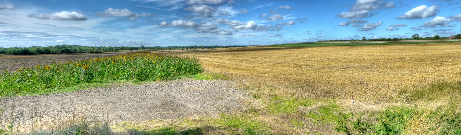
I couldn't stop there, I had to take a few more pictures! So I nipped into the field, not all appear in the Post, but there is something about seeing such striking flowers growing en-masse in a field.

There had to be a close-up as well - I assume that these are either grown for seeds or maybe as a cover-crop. Although the farm nearby - Snakehall Farm is no ordinary farm and is owned by the Prospect Trust to work with people who have learning disabilities to provide training and work opportunities in horticulture and organic market gardening. They also have a farm shop where they sell their wares. So I imagine the flowers are not grown as a cover crop for game birds.

I managed a few kilometres and passed through Reach and the outskirts of Burwell before needing to stop and take pictures again. This hangar like building is near the A14 on the edge of the Sustrans 51 route between Burwell and Exning. Apparently there was an airfield - RAF Newmarket which made use of the area as an overspill for RAF Mildenhall. This appears to be a B1 Type Aircraft shed. :-) It was first used during the 1914-1918 war - the airfield, not this shed! Further history is available on the RAF website here. For a walk around Exning see this.

I left the Sustrans 51 route at Exning and headed up Windmill Hill, crossed the A142 and then onto the Snailwell Short Road past the Snailwell Stud. Through Snailwell (another link) (where there was an RAF Snailwell) and Chippenham (flower show coming up there) and on towards Badlingham. No this is not a Ford in the road - just evidence of quite a bit of recent rain as the road jinks around Badlingham Manor where old racehorses get re-trained.

The road out of Badlingham then reaches a T junction with a route opposite, that is marked on the OS 50K map as red dots. Red dots mean "other route with public access" which I assume means somewhere between a road and a track - but I was wrong this was somewhere between a bridleway and a footpath at least at this end. In places it was a bit over-grown - but was used and both hoof-prints and what looked like a motorcycle tread were in evidence. I did get a little scratched on my legs from brambles encroaching the path but no stingles - it was harder work cycling along it - because the recent rain had softened the ground - I prefer the going to be good to hard for cycling.

The "path" opened up into a track with evidence of vehicles with more than two wheels using it and although the path looked a bit sandy it was not too soft although I did use the edges of the track in places.
There seem to be more farms rearing pigs outdoors than there used to be - these pigs seemed to be enjoying wallowing in their mud-bath. It was a sunny day - I did wonder whether to stop and put on some sunscreen - but, to be honest, couldn't be bothered!

I then cycled past a golf course to Barton Mills and to what was the first real challenge of the ride, my planned route involved riding towards Barton Mills and then taking an"other route with public access" which appeared to cross the very busy A11 dual-carriageway. The fall back was to carry on up to what appeared to be a road crossing or even a roundabout - although none of them seemed to be any more reasonable ways for non-motor vehicles to cross the A11. Barton Mills is a small village between Mildenhall and the A11 so easy to get to - but I wonder how much traffic noise there must be.

The "red dot path" was still passable, although it looked a bit like someone's drive at first. It then reached the A11 where there was a brief interruption in the crash barriers in the middle of the road and pedestrians and cyclists could take their lives in their hands. This is the crossing looking back after I had crossed it. I walked my bike across and waited for what seemed like ages for a gap in the traffic. I then stood in the middle and again waited for quite a lot of time before getting safely to the other side. I did get some funny looks from the occupants of passing cars - it is not every day that as you speed along a fast road that you see a strange guy standing with his bike in the middle of what would normally be a pedestrian free-zone. The path was used but a bit overgrown so other people do use the path and presumably cross this road. Remember that I crossed it on a Sunday when the traffic is less busy - although this route is a popular route to the seaside.

This is what the "red-dot path" on the other side looked like - single-track - so yes it was worth it. A slight climb into "unknown" countryside on a good bit of mud-track. (On the 25K Streetmap OS map the red dots are shown as green dots.)

Not far off the "summit" along what has the name Cherry Hill track for this is Cherry Hill at around 30m and a bit, was a Pillbox. These were built in 1940 as a network of defences at various strategic points - I guess this is strategic because it is on a hill. As a lad I used to think that I knew most of them near where I grew up in Somerset.

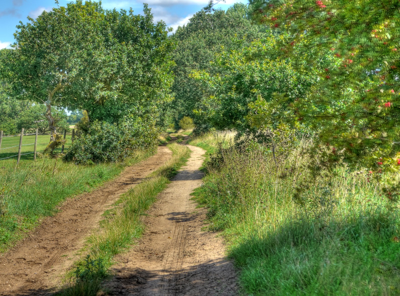
Cherry Hill Track, leading of from the Pillbox, although it was a bit sandy the sand had been compacted by tractors and the recent damp weather had helped. Again I used the edges where it got too sandy. Part of the trick is to maintain momentum, but if you are going too fast and the wheels really bog down you get thrown off the bike, too slow and you stop.

Once back on the road it was a short ride through to Tuddenham and I cycled along the Icknield Way Path. This starts as a road and has warnings about a bridge blocked to cars. There was a byway near the start of the road out of Tuddenham, but according to the map it seemed to stop in the middle of nowhere. The village does not seem to have much of an entry in Wikipedia, there was a WWII airfield there though. I did not actually notice where the bridge was, but the road quickly turned into a track running alongside the heather.

This is the view looking North along the track towards Cavenham Heath Nature Reserve through which the route passed. As it says on the website link - a typical bit of Breck heathland.

Here is the sign highlighting the area - "highlighting an unnatural heathland". (As it says on the sign heathlands were man-made around 5,000 years ago.)

Looking at the map I realise why I did not pay much attention to the bridge - I was busy taking photographs when I crossed the River Lark - which is where I presume the dodgy bridge was. In fact I might have taken a detour onto a footbridge - whilst typing this I will check my GPS track to see where exactly it went. Yes, my guess was right the route I took was diverted at the "road" bridge a little bit downstream to a footbridge and then back again. Here is the view to the West along the River Lark.

Here is the view to the East - there is a pipe that crosses the river, but zooming into the picture it looks as if the bridge is no longer there. As I carried along I passed 5 MTBers out for a Sunday ride - they were dressed for the part with helmets and bikes with suspension. I guess they must have been heading off the track - it was not that tricky, even on a hybrid bike.

At this point I followed the track through to Icklingham, another place that does not seem to feature much on Wikipedia or have much of a web presence, oops no it does have a Parish Council website. At this point I got a little lost - although not as lost as I got later on. The byway leads off on a bend in the road and there was a road that I took that said Private - but sometimes signs are put up even though there is a public right of way - they try to discourage cars using the tracks I guess. Here is a Streetview link to the private road, this link shows where I should have gone, to the right. Just off is this gateway - which is the way the track goes - the track has rather a nice name - Seven Tree's Road and passes Deadman's Grave. (No fun being alive in a grave though!)

After that brief detour along someones private road I was back on track - so far this had been really pleasant, great tracks, not too sandy, wonderful countryside, and pretty peaceful. That changed!
No comments:
Post a Comment