
After descending from the Gog Magogs, carefully slowing down at each "break" in the Cambridge Wandlebury cycle path I headed off around Addenbrooke's Hospital to pick up the permissive cycle path over the Cambridge/London railway line to Trumpington. This path is shown as a footpath on the Cambridge County Council Rights of Way map (CCC), but is actually a permissive cycle path and shown as such on the CCC Cycle map of Cambridge amongst other CCC maps others here. Today was Saturday so I did not expect to see any Cambridge Guided Busway (CGB) construction activity. There are two new bridges over the railway line, one for the CGB and one for a new access road to facilitate access from the M11, shown on this map. Building work is also progressing on the Hospital site as it expands from 70 to 140 acres. I think that this is the CGB bridge - but am not too sure - it only has a single span.

Further along the path after crossing railway line you also cross the CGB - I wonder if they will keep this footpath open when the bridge are operational? This is where the Addenbrooke's CGB spur joins the CGB between Trumpington and Cambridge Railway Station. I've not given it thought before - I wonder why this was built as "road" rather than concrete tracks, perhaps it makes the spur easier?

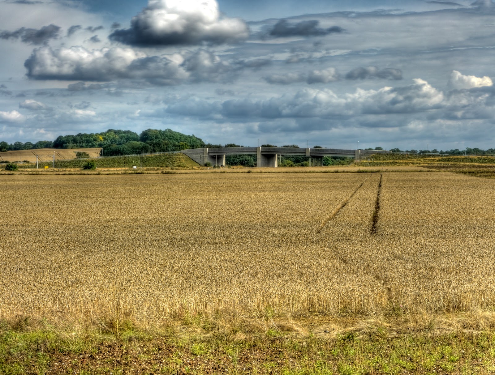
From the same spot this is the view of the access road bridge - it seems quite a bit bigger than the CGB bridge with three spans. Not all the fields have been harvested yet.
After cycling through Trumpington I headed for Grantchester where I turned off on Bridle Way - which surprise, surprise turns into a bridleway towards Barton. Just before the bridleway crossed the M11 I took a couple of pictures - this one looking back towards the University Library tower, standing 48m tall. This field has been harvested - it is just waiting to have the stubble ploughed in.

The field on the other side of the bridleway has been ploughed as well.
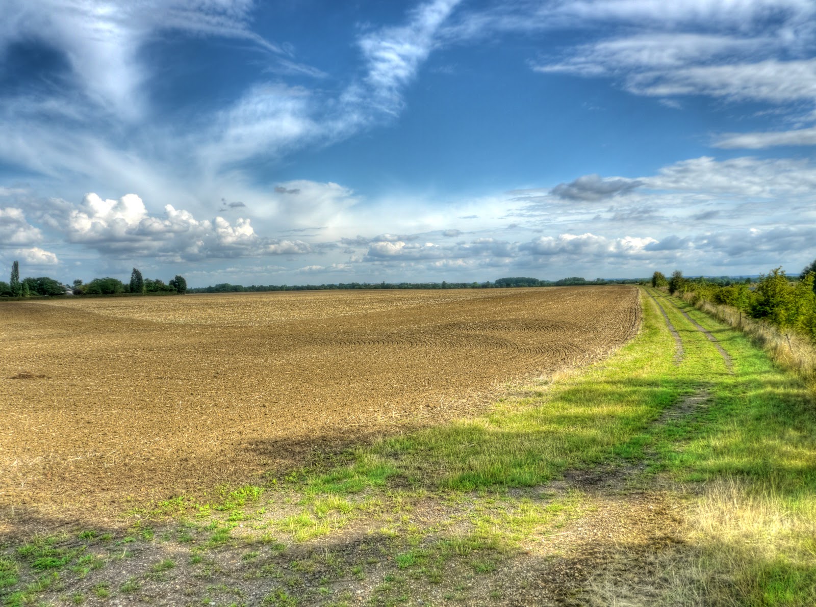
Just for completeness, a picture of the bridleway, stubble field to the left, ploughed field to the right and looking towards Grantchester.

As you can see from the map after passing through Barton on the Comberton Road I headed north along a byway and then back towards Cambridge through the Rifle Range. This picture was taken just before reaching the range - looking towards the route of the bridleway. - the line of the hedge in the background. It was at this point that on climbing back on the bike to cycle through the Rifle Range I felt a "tickle" at the top of my leg - as I put my hand down I found I was pulling a wasp away, which of course then stung me. Luckily I am not allergic (yet, anyway) to wasp of bee stings, I reckon to get stung around once a year, whilst cycling. It was not too bad, although it did sting for a couple of days.

The bridleway through the Range - along the left of the picture.

After cycling through the Coton Countryside Reserve, after crossing the M11 instead of cycling down the cycle way alongside the University I cycled along a bridleway running alongside the M11 towards the Madingley Road it was passable, but there were quite a few brambles hanging down. This is where it emerged onto the Madingley Road, I wonder why this one does not get a signpost?

As I had been off the bike for over a week I decided to pop over towards Horningsea and Quy. There were 20 cars in the Cycle lanes along Gilbert Road. What is the point of advisory cycle lanes I wonder - it only takes one motorist to ignore them and then the sheep mentality sets in and loads do it. I cycled along High Ditch Road and then over the A14 on the Low Fen Droveway. The bridge still has its drain covers missing. The burnt out car on the other side had been removed though. I'll say it again, they do a good job of removing burnt out cars in this part of the world. Near Snout Corner recent evidence of baling and look at the abundance of apples on the tree on the right. It only seems like yesterday that I was blogging about Fruity Byways although actually it was October 5th, 2009.

Despite all the rain most of the byway paths were barely muddy at all - this was the worst it got. Even the bike tyres stayed fairly clean.

Back on the Horningsea Road the new shared-use path still has its signs covered. I did pass one of the Ben Haywards Cycle shop people, on his bike of course, cycling home (I assume). Given how quickly the Wandlebury cycleway was built I am surprised that this one is taking so long. I guess it is because this is only a part of the route and the difficult bit will be how they get over the A14 as there is less space available on the bridge and more traffic to deal with. Even so, I am surprised that this section is not brought into use. I can't see the downside in making it available and it would seem that cyclists already are using it. Sometimes it worries me that these sorts of amenities have a lower priority than the publicity they will generate from a "grand opening" or am I just impatient and not taking the long-term view. Just think how wonderful the CGB will be when (if) it is finished!

I then looped back to Quy along the bridleway to the North of Horningsea (aka Harcamlow Way) and I passed some cyclists. It goes to show that there is a demand for routes that are "safe" or at least that reinforce the perception of safety. Here the fields have been combined as well.

The clouds did not look too promising though so instead of cycling to Lode I headed to Station Road (Quy) along the Drove Way.

This is taken just after the Drove Way dog-legs back to Station Road - rain falling in the near distance - the pylons lie the other side of Stow-cum-Quy Fen, about 1Km away. At this point I decided not too push my luck and headed for home - hoping to outrun the rain.

In the event I did get back before any serious rain - there were a few spots. As I passed through Lode I noticed that the Lode Road cycle path between Bottisham and Lode was being worked on. I will have to take a picture of it next time I go through that way - too much risk of rain this time.
I have also been checking out the CTC Cambridge rides and really must go on one of those - they seem to cover some interesting ground. I have also cleared it with Mission control - but I will have to make sure it does not clash with a Grand Prix!
This comment has been removed by a blog administrator.
ReplyDelete