Monday, July 30, 2012

Sunday–Summer Cycling–yes it really is Sunday this time!

Sunday, 22nd July 2012: The only trouble with Blogging is it is sometimes difficult keeping on top of things.  Most of my Posts aren’t really that topical. I might comment on the news or events, but in general a delay of a few days is neither here no there.

There are some things that are more topical and the flooding of the cycleway alongside the Cambridge Guided Busway from Cambridge to St Ives is just a little more topical. So my apologies that this is just over a week late. This is about a ride up to St Ives and back and the cycleway is clear, or rather was clear when I cycled there last week. I would assume it is still clear – but, yesterday we had quite a downpour in the middle of the afternoon so who knows.

I think it would be helpful to have depth poles to show the extent of flooding on the bits of the path where it does flood and some form of real-time warning system and/or webcams available for those using the route. The trouble is I feel that the County Council perceive the route as a leisure route and so don’t take it as seriously as it should be taken. There are signs put across the cycleway at St Ives and Swavesey, but they are not necessarily up to date. (Here is Environment Agency information about the River Ouse at St Ives – which gives some clues as to the possible flooding in the area.)

I looked for information on the Welney Washes to show how much better the information is for motorists – except they also seem to suffer from inaccurate information. One approach might be to provide video streams from the Guided Buses as they pass by the affected areas? And as this motorists found out when he popped out to Bar Hill for some pasta – diversions on the A14 because of road works turned a 16 mile trip into a 53 mile trip. The problem was not lack of information, but the need to provide a robust route for the haulage traffic that uses the A14.

Talking about the A14, no sooner has there been an announcement that it will get upgraded after all, than the concerns come out. As in “Put brake on rat-running through city” and “A14 upgrade cash ‘should have been spent on cycleways’”. If you look at the first link, people are now starting to realise that better roads will probably attract more cars and that toll roads might well squeeze more cars around the villages to avoid the tolls. Little thought also seems to have been given (or printed anyway) about the noise and air pollution that will result. Although if you look at various of the local websites there is much concern – e.g. Hilton.

The trouble is that conventional road thinking tends to go along the lines of make it bigger/wider or get rid of the lorries or get rid of the cars – depending on your point of view. We have become so wedded to the idea that we have the right to dash around in our little tin boxes that we don’t even think of the consequences – unless that new road will be blighting our house. When there is an accident on the A14 that causes gridlock we blame everyone else – yet we who use the road are the problem. It is our standard of driving and desire to drive that is the problem.

The trouble is there are just too many people who want to drive around and for whom the alternatives (for transport/leisure.haulage) are not sufficiently attractive.  The article that mentioned using the A14 cash for cycleways might have been tongue in cheek or wishful thinking – but surely it should have made us all think. To do the A14 upgrade the current budgeted cost is up to £1.5bn -  for that amount of cash the article indicates that 1,550 miles of segregated cycleways could be built in and around Cambridge – enough to “connect every house with every school, shop, workplace and leisure facility in the area”.

Actually I think that figure may be low and that £1.5bn could buy somewhat more cycle route – apparently the Addenbrooke’s Hospital to Great Shelford route cost £300,000 - £400,000 per kilometre Page 1-3).  Which implies that £1.5bn would get you 3750Km or 2,300 miles. Wouldn’t that be an amazing and life-transforming change for the citizens of Cambridgeshire? Haven't we learnt from the M25 – you get induced demand. Just think how great if parents felt happy that their kids were safe cycling to school – not to mention the health benefits.

Here in Cambridge “Bike paramedics such a success they’re staying” which kind of says it all.

The trouble is whilst bureaucratic systems help to maintain the status-quo they get stuck in the past – the time has come for an evolutionary approach to life and transport. What do I mean – well read this article “Residents baffled by speed bump on way out of village”. An example of the way in which bureaucracy can lead to crazy and wasteful choices.

It isn’t any surprise to me that Brits are happiest in the Shetlands and unhappiest in urban areas in South Wales, West Midlands and London. Yet we seem hell-bent on urbanising the place.

We often compare and contrast our situation with the US – a harbinger of things to come for us in the UK perhaps. Well they have a lot more space than we do and yet, apparently, “30% of commuters text and drive to work”. Also more US women are prone to road rage than men. I do feel that in my cycling experience, here in the UK that male drivers give less space and are less courteous than women drivers.

So on with the ride – I’ve already mentioned that it was to St Ives and back. I think that the changes to Gilbert Road have been very welcome and I feel that there have been a tangible improvement when cycling along that road. I was disappointed to see that bad habits are creeping back. Mind you this driver has also stopped on the zig-zag lines of a pedestrian crossing – so a doubly inconsiderate driver.  (Highway code rules 191 – 199 Pedestrian Crossings). The person he has stopped to talk to is a cyclist as well.

Gilbert Road, Cambridge – old bad habits coming back?

Here is the map – out through Girton and the old NC51 route and then a detour to Over after Longstanton, another detour through Fen Drayton Nature Reserve and then back from St Ives along the CGB cycleway. It is around 50Km/30 miles. Here is the Bike Route Toaster link.

Map of my route – a round trip to St Ives form Cambridge

A little further along Gilbert Road – more bad habits on display, destroy the grass and block the cycle lane – why don’t you.

The problem is that as more and more people share the roads then driving standards and courtesy has to improve – the trouble is standards seem to get worse as the traffic density increase.  A situation that leads to some extremes such as this 152mph BMW driver on a rural A-road. We also pay the price in terms of car insurance as it hits £1,000. Whilst I feel that cars have been made safer for the occupants the date is not so encouraging when you look at the data for pedestrians and cyclists.

The problem also is that, IMHO, driving is more tiring than it used to be, the required levels of concentration are higher. Whilst that may not have been a factor in this crash – driver fined for barrier crash (Ely level crossing) it doesn’t help. It does make me think that perhaps the way in which we deal with transgressions should be reconsidered. After all the goal is to improve road safety rather than punish people. Perhaps the “punishment” should require a driver to use a GPS system to monitor his or her driving.

Such is the pressure to catch people that it becomes the end in itself, rather than the way to improve road safety for all. Indeed it was that desire to get success through clocking up fines that led this PCSO astray and to issue false fixed penalty fines.

It can also lead to more serious problems – such as this case, where a police chief has been charged with perverting the course of justice, by allegedly getting his wife to “take the points”. Such is the importance of being able to drive in our society that it leads to real fear when the right to drive may be put at risk. All sorts of jobs ask for a clean driving licence. Whilst what he did was wrong, society has also lost someone who was commended for bravery. Was it a case of too much emphasis on measuring fines rather than safety?

I wonder if there is a way to change peoples behaviour. According to the DOT National Travel Survey for 2010 the average trip length is 7.0miles and 20% or trips of less than one mile in length were made by car. Again could we use GPS to prohibit a driver from making short journeys?  Yes, I know there are issues and problems – but we should be encouraging transgressors to change their behaviour – shouldn’t we.

Gilbert Road, Cambridge – old bad habits coming back?

After Gilbert Road my route took me over the A14. One of my current pet-hates is being tail-gated when driving. One piece of advice for drivers is the two-second rule, a rule of thumb. The trouble is it gets ignored. At 70mph (112Km/hr) you are travelling at just over 30metres every second (31), which implies that you should leave a 63m gap. (More in poor weather conditions). Which implies that you should leave a gap of around 15-16 car lengths.

Now a note of caution, here in the UK we have  recommended stopping distances in the Highway Code. At 70mph the distance travelling thinking about stopping is 21m and then as a guide, in good weather, with a reasonable road surface, brakes and tyres it takes a further 75m to stop. (24 car lengths – based upon the average car being 4m in length.)

So clearly for the two-rule to work you must pay attention to what is ahead of the vehicles in front and anticipate any problems.

So let’s just say that again – at minimum you should leave a gap of around 16 car lengths at 70mph, if not you are putting your own safety and that of those around you in danger. This is typically what you see on roads such as the A14.

The A14 seen from a bridge into Girton

Sixteen car lengths gap anyone?

The A14 seen from a bridge into Girton

These might not be travelling at the maxim, but you can see some cars maintain a reasonable gap and others who are completely oblivious it would seem.

The A14 seen from a bridge into Girton

I did not start this trying to bash motorist, however read any piece on cycling and motoring which has comments and you will get lots of negative comments about how all cyclists jump red lights and cycle on pavements.

Well this section of road near Oakington is prohibited to motor traffic except for some specific exceptions (buses, taxis, mopeds and invalid carriages and access). But of course just as there are some cyclists who don’t obey the rules there are some motorists who don’t obey the rules. Here is one now – apparently it has gotten worse.

Airport Road – Oakington – Prohibited to most motor traffic!

And here is another one – I’d barely stopped before they appeared. The trouble is that motor vehicles are intimidating to the legitimate road users when they appear where they are not supposed to be. Of course that is also one of the reasons why red-light jumping cyclists are hated by motorists. It is intimidating. However one thing that may car drivers seem to conveniently forget is that one also has to consider the impact of the transgression.

Bicycles cause very few serious accidents.

According to data in this BBC item: Is dangerous cycling a problem?

Pedestrian casualties 2001 – 2009:

  • Killed by cycled: 18
  • Seriously injured by cycles 434
  • Killed by cars: 3,495 ( x194)
  • Seriously injured by cars: 46,245 (x106)

Now any accident is bad, but the issue is that poor driving in a car is, on average, going to have a more serious consequence than poor driving on a bicycle. Therefore it is appropriate that the duty of care is higher for a motorist (and more so for a lorry driver and bus driver). It is also appropriate that the laws and levels of punishment reflect the likely consequences. (Here is a similar analysis by the CTC on the Dangerous Cycling Bill.) Another way of looking at this issue is to consider that on 2009, no pedestrians were killed by cyclists, 426 pedestrians were killed by collisions with motor vehicles. In 2008 52 cyclists were killed in collisions with motor vehicles and no drivers were killed in collisions with cyclists.

In my mind there are two issues here – one is that councils should make proper provision for cyclists and not at a whim mix them in with pedestrians when it suits or motor vehicles. The other is that the “crime” has to fit the potential level of danger.

So i was surprised to read that cycling and using a mobile phone has become such an issue in Cambridge. Let’s get it into our heads once and for all, using a motor vehicle and using a bicycle are totally different activities. I am not saying that cyclists should be above the law, far from it, however it is a good thing to encourage cycling, it is not a good thing to encourage motoring. One has inherent dangers the other really doesn’t (or shouldn’t)

Whilst on the subject of the Police and cycling they are using the law against riding furiously in London to crack down on Rickshaw drivers. There must be some fit rickshaw cyclists around.

Airport Road – Oakington – Prohibited to most motor traffic!

After that I sung up to Gravel Bridge Road, to get a view of the Guided Busway from the bridge. The CGB passes between the Communications tower and the Windmill.

Communications Tower and Windmill on Gravel Bridge Road

A little bit to the right there is also a water tower (between Hill Farm and Willingham Road.

Over Water Tower

Here is the view form the bridge – looking down towards St Ives.

Guided Busway – from Gravel Bridge Road

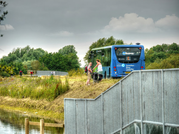
As you can see there is a good sprinkling of cyclist out.

Guided Busway – from Gravel Bridge Road

Even more were coming down from the Cambridge end.

Guided Busway – from Gravel Bridge Road

After that I cycled into Swavesey where Station Road splits into two – either side of the green area on the right of the picture. This looks as if it suffered a bit during the floods. It was only just passable on foot a week later.

Station Road, Swavesey, Flooded

I then detoured through the Nature Reserve at Fen Drayton – just by the entrance is a field of Elephant grass – it grows incredibly quickly.

Miscanthus next to the entrance to Fen Drayton Nature Reserve

This is the reserve Road – there are pot holes and loose gravel so it needs a little care. This time I almost slipped off my bike when swerving to miss a pothole and the back wheel skidded away.

Road into Fen Drayton Nature Reserve

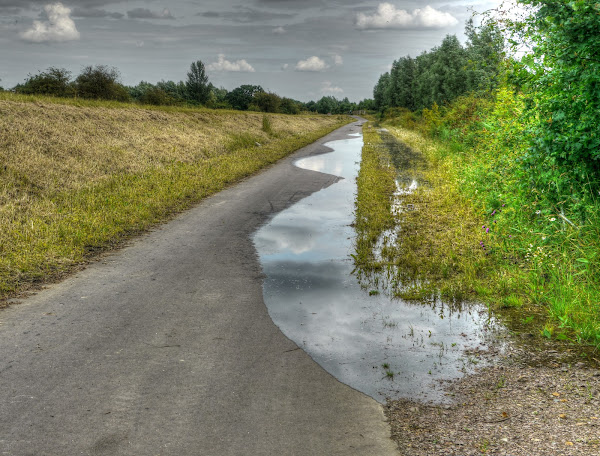
It was a straightforward ride through St Ives and back down the CGB cycle way. I wasn’t expecting to see flooding but there was a bit at the culvert just past the River Great Ouse bridge.

The flooding has receded on the CGB Cycleway

As it was such a nice day I stopped for a snack of Jaffa Cakes (another of my guilty secrets) at the “hide” by the Nature Reserve. Maisie (my bike) waited patiently for me admiring the wild flowers. it is near to Covell’s Bridge, and Where’s The Path has now been modified to refer to the correct OSM map tiles.

The view from the Nature Reserve Hide alongside the CGB, just before Covell’s Bridge

After getting up to set off – this chap roller-bladed by – but then looked as if he needed a rest. I was going to say that the pedestrians fear cyclists so much that they have started wearing helmets.

The Guided Bus network is going to extend to Peterborough – well CGB buses will get up there anyway. There aren’t plans to actually build more track. I haven’t mentioned the Olympics for a while well it turns out that all the reliable buses are being used down there – so we have been left with the Jalopies – which are breaking down. I’ve seen a Doubler Decker broken down in the last week as well.

As I mentioned there are Flood Warning Signs – although a little conservative. There are also signs on the poles with pull down flaps – although they were not in use?

Flood Warning on the CGB at Swavesey

The Cambridgeshire Steam Rally was also in full swing – they promoted the use of the Guided Busway to get there as well. This is a Sentinel Steam Wagon.

Sentinel Steam Wagon, Cambridgeshire Steam Rally 2012

As you might imagine after all the rain the farmers were taking advantage of the recent dry weather to to some haymaking.

Haymaking – July 2012 alongside the Guided Busway, Cambridgeshire

As a lad I used to help out with the stacking of hay bales when the local farmer used to do the fields around the house. In my young day they made small rectangular bales though – which I could just about manage to lift. We used to get to ride on top of the bales on the wagon as it was pulled out of the field. It wasn’t the safest thing perhaps, but no-one was hurt and we weren’t allowed to ride on top on the road.

Haymaking – July 2012 alongside the Guided Busway, Cambridgeshire

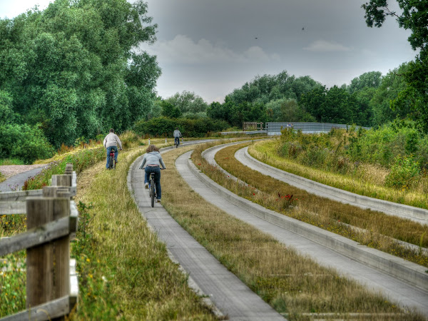
All in all I counted around 130-140 cyclists on the CGB cycleway whilst heading down to Cambridge.

Cyclists on the CGB Cycleway just after passing under the A14

And finally some wild flowers – I’ll leave identification as I haven’t got time at the moment.

Unknown Wild Flowers (to me)

The cycleway is definitely an amenity – which suggests that Cambridgeshire is a bit short on such things if you ask me.

Oops, almost forgot – pictures of the first ever wireless factory (Marconi) in a state of disrepair. Brunel’s bridges (and stuff) on the Great Western Railway have been given a listed status. And finally a neat project – pictures of 50 Main Street around various towns and cities in the US.

Friday, July 27, 2012

Saturday not Sunday–Summer Cycling

Saturday, 21st 2012: Sunday, 22nd July 2012: (Update – I got the day/date wrong- duh). As you might have deduced there was not a lot of cycling last week, partly the weather and partly because I felt a bit headachey for a few days. Nothing serious, just some minor lurgy brought into the house by one of the plague-carriers other family members. About the only thing it stopped me doing was cycling, so I compensated by watching bits of the Tour de France – and a jolly good tour it was too – well done to the Sky Team and Bradley.

Although I am afraid this doesn’t change my view about the Olympics – sport seems to have become way too commercial. But if society “thinks” it is ok for young men to get paid loads to kick a bit of leather around then who am I to complain – although I would still far rather see more kids engaged in physical activity, as they reckon that a third of 16-24-year olds suffer from back pain from spending so much time in front of the Television.

Whilst we cyclists might feel that although a huge amount could be done to improve the lot of cyclists it isn’t dangerous enough to put us off that is not what a lot of parents feel about their children cycling. A recent survey indicated that 52% of parents won’t allow their child to cycle unsupervised one they reach the age of 12 because of traffic danger. When I was a kid the deal was pass my Cycling Proficiency and then I was free to go of cycling – it was in my last year of Primary School. Mind you as I was also expected to start cycling to my new school after leaving Primary school – why, well ferrying kids to school just wasn’t what happened.

I was pleased to see that Prince William is concerned about the dearth of green spaces and its impact on children. The problem is land is scarce and so valuable so Councils see advantage in selling it off and no longer have to pay for its upkeep. The trouble is we seem to live in a world of sound bite politics. Despite winning the “Olympics” and a pledge "’to inspire young people around the world to choose sport’ Teachers spend 60% less time on sport. Probably because they are so busy responding to all the changes that keep getting thrown at them.

Instead we get government Ministers throwing their toys out of the pram because they have been told to use Public Transport rather than chauffeured cars to get to the Olympics. Also if you do go to the Olympics, you must not wear a Pepsi T-shirt otherwise you might get turned away. I presume that will only happen if the logo is visible.

Mind you I am still a week behind in my Posts, so less pontificating and more about my cycling. I have not been very adventurous recently – barely deviating from either Lodes Way of St Ives (via the CGB cycle way). This ride is no different. I went out to Wicken Fen via NCN 11 and the up from Burwell and back via the Lodes Way.

I do like to see the wild flowers growing on the verges alongside the roads and cycle paths. As the Summer moves on the plants in bloom also changes. Purple seems to be a popular wild flower colour and after passing Quy on route to Bottisham there are quite a few flowers in the verge between the road and the shared-use path. So I stopped to take a picture of this Knapweed – known as Lesser or Common Knapweed (Centaurea nigra), I think.

Common Knapweed

As you can see one of the other changes over the Summer is that land turns from a lush green to a harvest brown as the crops ripen in the fields.  Here is the Wadlow Wind Farm – not quite fully operations, but all the wind turbines are up now. (Seen from NCN51 near Quy).

Wadlow Wind Farm, NCN51 near Quy

There is some concern that Addenbrooke’s Hospital plans three more chimneys as part of a new energy centre which would generate heat, hot water and electricity whilst reducing carbon emissions by 47%. I have sympathy for that concern – but the challenge is that the Western world is wasteful of energy and we do need to sort out the climate issues. We can’t keep out heads in the sand and ignore it. It was recently reported that in the Antarctic a “grand canyon-sized rift was speeding ice-melt”.

Mind you in the countryside we have had such “blights” for ages – power the for conurbations has to travel over loads of rural England.

Electricity – heading to/from Burwell Sub-station

As the centre of the universe some power distribution there are various pylons marching in and out of Burwell.

Pylons Marching away from Burwell

I guess after a while you get used to them – and they can make for interesting pictures.

Pylons marching away from Burwell

Heading through Wicken Fen, along NCN11 past Monk’s Lode – some Rosebay Willowherb (Epilobium angustifolium or Fireweed or Chamerion angustifolium)growing alongside.

Rosebay Willowherb – Monk’s Lode, Wicken Fen

And after circling Wicken Fen and heading back along the Maltings Path this is the view looking towards Wicken Fen – this field will be ready pretty soon I reckon.

The back (or side) of Wicken Fen from the Maltings Path

After that it was a quick ride down the Lodes Way – stopping to look at some more man-made structure – these distribute electricity alongside Reach Lode.

Electricity poles alongside Reach Lode

Although I don’t feel that the weather has been very encouraging for cycling the crops in the fields seem to have done ok, these spuds along Split Drove/Headlake Drove are nicely in flower.

Potatoes in Flower along Lodes Way

A few field along some hay making or perhaps raking

Farmers work on Sundays Saturdays 

I cycled up Headlake Drove a bit to get a better vie of some late Oil Seed Rape.

Oil Seed Rape in flower in July (Lodes Way)

Another view of the spuds in flower

Potatoes in flower – Lodes Way

It will not be long before the field poppies have passed their best – still standing proud of the wheat though

Poppies in the fields, Lodes Way

Poppies in the fields, Lodes Way

As always, even on routes I know well there is something to see – I also passed quite a few cyclists out as well – speedy and family cycling.

Talking of cycling – here is Keira Knightley – looking fragrant on a bicycle and also some wonderful pictures of old railway stations now in decay and finally some vertiginous pictures looking down from skyscrapers in New York city. Oops, another picture of a “fire rainbow” in Scotland.

Wednesday, July 25, 2012

The Tins–wet, but not raining

Monday, 16th July 2012: There is a saying along the lines of beware what you wish for it may happen. Well last week seems to be non-stop rain. (Although it wasn’t really). As I sit here and get ready to pop down to London the sun is blazing down.

The trouble is the sun brings out the cyclists which means I could will be in for trouble trying to lock up my bike at the station. I am also wondering whether I should use some sunscreen – the answer is yes I will.  I am also going to cycle in shorts and change either in the Station or when I get to the meeting location, definitely no tie and I will wear a short-sleeved shirt. The temperature is pretty much getting up to 30oC, although at the moment my outside thermometer says 26.4oC

The last post was a Sunday and I forgot to mention The Archers. According to the DM – “Archers fans in revolt as tale of everyday folk turns in ‘Farmageddon’” – hopefully there will be some light at the end of the tunnel – or maybe they want to get rid of the oldie listeners?

The good news was that for this Post’s meeting I was able to catch a mid-morning train and return on a mid-afternoon train – so avoid rush hour and I was able to park my bike at Station cycles.

So you will be spared yet more pictures of the crappy cycle parking at Cambridge Railway Station – well until today’s trip makes it into a Post.  Although there has been a lot of rain and despite it being a gloomy day I didn’t get wet on my way to the Station – I had my trusty Cycle Cape with me just in case. I also wore a pair of convertible trousers. They have unzippable legs so you can use them as shorts and then zip the legs back on to look a little better dressed. I have several pairs.

everything went to plan on the way to the station, except I was delayed setting off – hence the lack of “in” pictures. Everything went to plan in London – I was reasonably early, zipped my “legs” on and strolled to my meeting. except when I looked down I realised I was wearing the legs from a pair of trousers that were a different colour. Oh well – the best laid plans. Perhaps people would consider it the latest fashion.

The way back was fine, one of the advantages of leaving my bike at Station cycles is that I don’t have to carry all my stuff with me – some of it can be left with the bike. This means a lighter load in London and it is quicker to leave and pick up, all for £1.50.

Things looked a little less hopeful on the way back – there seemed to be rain around. However my luck held and apparently what was a torrential shower had moved on from Cambridge. So I pushed my luck and too a scenic route home, via the Airport.

I went up The Tins route which is getting some more money (£275,000) to further? widen it and improve links with Orchard Park and the city centre. Here is The Tins at the Cherry Hinton end just before the Kathleen Elliott Way. There is a route through to railway Street (and then Yarrow Street) – although one I rarely use.

It always amuses me how large the gym car park is, on the route of The Tins. My son and his girlfriend were up for joining a gym – but the last time the apparently only went once or twice. I suggested borrowing my Tandem and cycling there a few times before joining to see whether they were really up for it. (They didn’t and they didn’t!). Talking about Tandems – some celebs show how not to ride one (they don’t carry three for a start.)

There were some large puddles around.

The Tins, Cambridge

Although I was taking a scenic route I didn’t hang around too much – the skies looked ominous. The normally dry ditch alongside the Airport was pretty full.

Unusually wet ditch – Cambridge Airport

A rather grey Airport Cycleway – no puddles and although it is one of the better shed-use paths around these parts – it is only just acceptably wide.

Airport Cycleway, Cambridge

And finally – some rather interesting Tunnels in London and New York and a plea for Cambridge’s green belt – which is probably about to get swallowed up.

Tuesday, July 24, 2012

Cycling to Nearly St Ives on the CGB–last week’s flooding

Sunday, 15th July 2012: I am a little bit slow in getting my posts out at the moment and since things like flooding are topical I posted a few pictures from this ride on Monday, 16th July (Cambridge and CGB flooding). I cycled along the Cam through town and then up through Girton on the old NCN51, which I followed until Gravel Bridge Road. When I reached Swavesey I joined the cycle way alongside the Guided Busway.  I cycled up the the first sign of trouble (floods) and after a bit of dithering decided I didn’t want to paddle and cycled back down the CGB to Cambridge. (here are some more FLOODING pictures from the Cambridge News.)

Cyclists on the NCN 11 to Upware alongside a brimming River Cam

It looks as if there was also an angling competition – I’ve not seen so many anglers along here for a while.

Anglers on the River Cam opposite Ditton Meadows

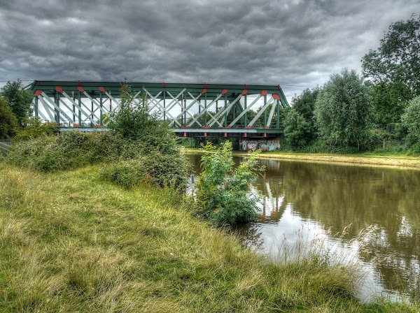
The King’s Lynn Cambridge Railway line as it passes over the River Cam.  NCN51 passed alongside the river under the line on a wooden bridge. A few years back I ended up in casualty after cycling (a bit too  fast) onto the wooden bridge, my wheels slipped away from me – fortunately nothing was broken.

River Cam flowing under the Cambridge to King’s Lynn railway Line

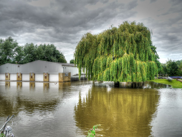
A bit further along and the River Cam had “burst” its banks – well on the side opposite Riverside anyway.

An Overflowing River Cam, Riverside, Cambridge

This is the view looking back down Riverside towards the Cambridge Museum of  Technology.

Cambridge Riverside – a brimming river

A little further along the River (on NCN 11 & 51) underneath the Victoria Avenue Bridge – I decided not to try it out detoured via the avenue of trees on Jesus Green.

NCN 11, 51 – flooded under Victoria Avenue Bridge, river Cam, Cambridge

As it happens the shared-use path through the avenue of trees on Jesus Green was also flooded. There were some convenient park benches should passers by wish to sit and paddle their feet at the same time.

A flooded Park Bench, Jesus Green, Cambridge

As you can see the shared-use path was also flooded although not so badly that you couldn’t cycle through it – it did deter pedestrians though.

Flooding – Jesus Green, Cambridge

Although we have had a fair bit of rain recently it was actually a very pleasant day. This is the view of the CGB form  Gravel Bridge Road.

The Guided Busway from the Gravel Bridge Road Bridge

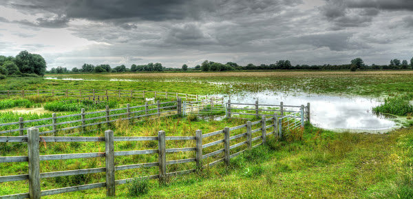
After passing the outskirts of Over and heading down to Swavesey I passed Mare Fen – I had expected it to be more flooded.

Mare Fen – Swavesey

Just as I was about to join the Guided Busway cycleway I noticed a “drop off” point for users of the Guided Busway. I guess that it demonstrates that the Guided Busway has attracted some local users who presumably drove before. Apparently the original plans had a Kiss and Ride, which was then dropped, it was re-instated this year.  I assume that the users of this facility will be relatively local so it is a pity that they are not cycle users. I count that as a failure to attract what should be “easy targets” to switch to cycle/guided bus as a means of transport.

It would be interesting to know why there is such an automatic response to favour car users. is it concern about cycling safety on country lanes, or cycle security at the P&R site, or…

Swavesey Guided Busway Drop-Off Point

After that I was surprised that the cycle way alongside th4e CGB was actually not as bad as I had expected – until I reached the Culvert. (Fairly close the the River Great Ouse. This was flooded.

Mind you some cyclists were getting through – by sticking to the edge of the cycleway where it is presumably slightly less deep.

Flooding on the Cycleway alongside the CGB

the problem is there are no depth markers – so it isn’t that clear quite how deep it is. As you can see you can just about make out the SLOW marking on the tarmac.

Flooding on the Cycleway alongside the CGB

Just in case you couldn’t here it is in close-up. You have to be a bit careful not to stray off the tarmac as well. I am surprised that there are not depth markers alongside that might help cyclists.

Flooding on the Cycleway alongside the CGB

As you might expect there were quite a few cyclists and walkers who chose to take to the tracks. Some cycled alongside, whilst others cycled on the tracks. (See how the buses have already marked the concrete.) I also saw a family with a pram take to the bank. Personally I think they are mad – buses move along this stretch of the track. You can see the bridge over the River Great Ouse to the right of the picture.

I think that Council should consider a walkway along the edge of the bank so that walkers and cyclists alike could avoid the floods. The trouble is the alternative routes for cyclists are longer. Why is it that cyclists and pedestrians get the short straw?

Cyclists avoiding the Flooding on the Guided Busway Cycleway

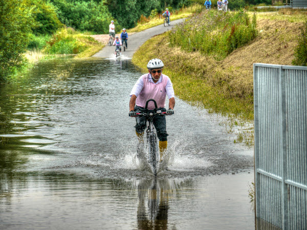
Although it was deep enough to get wet that didn’t deter some cyclists, who didn’t mind wet feet and getting a wet spray up the back.

Splashing through the flooded Cycleway on the CGB

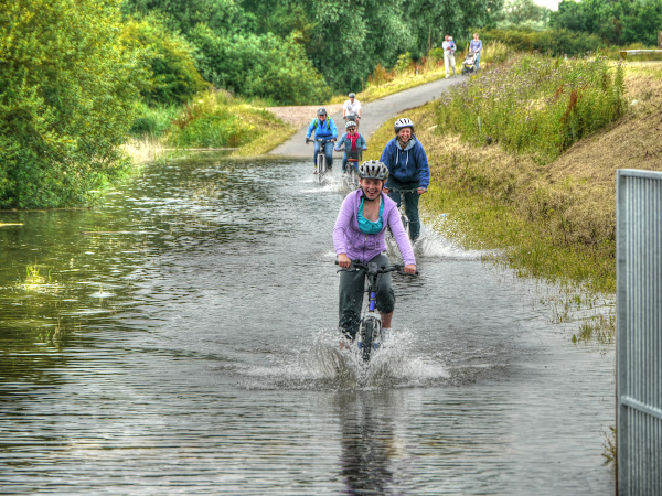
Here is a family out for a ride – all helmetted-up – they didn’t let it stop them.

Splashing through the flooded Cycleway on the CGB

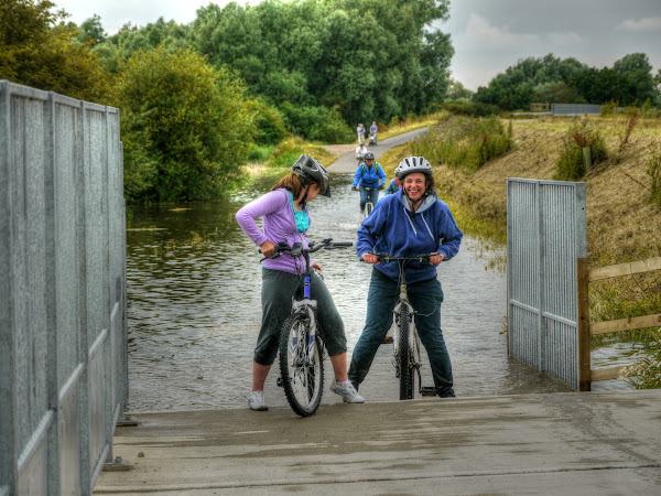
Although the ramp at the culvert required a bit of effort for those cycling at a sedate pace through the flooding.

Splashing through the flooded Cycleway on the CGB

the trouble with MTBs is that they don’t have mudguards and yet you have to maintain momentum when cycling through water – which throws it up.

Splashing through the flooded Cycleway on the CGB

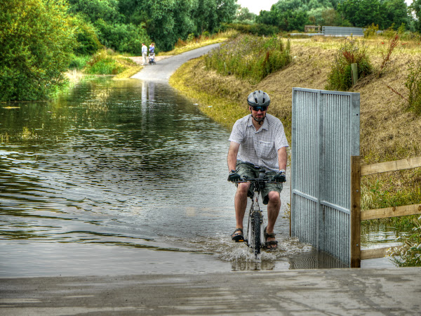
As I stood here a chap who had cycled up from Swavesey had a chat. We both decided discretion was the better part of valour. The shame is that this is the more picturesque part of the cycleway to visit.

I would have cycled through if I had been wearing my sandals.

Splashing through the flooded Cycleway on the CGB

So I headed back, this is one of the other areas that flood – although as you can see there is a dry line.

The partially flooded Cycleway on the CGB

Although this might look like a river it is actually a path alongside Moore lake (I think).

A Flooded Path from the CGB to Fenstanton

As you can see using the path high up on the bank does not give a lot of clearance. I definitely think a raised “bridge” on stilts would be beneficial here. It would stop walkers and cyclists from taking risks.

What happens when the Cycleway alongside the CGB floods?

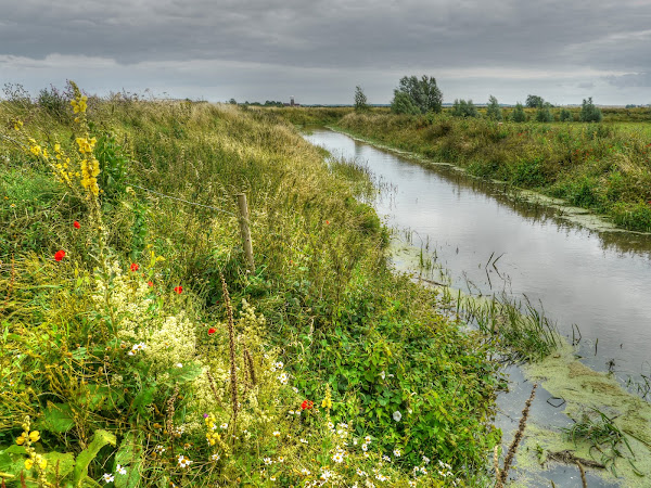
As you can see the brooks running past the CGB were all pretty full. To be honest I can’t remember which of the brooks this is – the one by Covell’s Bridge I think as you can see Hale Windmill in the distance. If it is then this is Covell’s Drain.

There has been a plea to Busway users after a raid near Oakington.

Covell’s Drain – Guided Busway

After that it was an uneventful, but most pleasant cycle back. This is what the River Cam looked like from the Green Dragon Bridge.

River Cam from the Green Dragon Bridge

It looked as full as it could be without actually spilling over too much. Unfortunately some parts of Cambridge were flooded, including parts of Girton. Lets hope they didn’t get tickets likes this Flood victim – I would like to think that our Councils are there to serve us – they don’t always seem to behave like that though

River Cam from the Green Dragon Bridge

I did cycle up this weekend as well (22nd July – it was completely clear – the post will follow.)