Wednesday, April 30, 2014

Cycling the cycle-able bits of Peddars Way–part 8–the END

Wednesday 2nd April 2014: (King’s Lynn and back to Cambridge)  When I reach a destination I tend to suddenly feel the miles in my legs. It isn’t so much the distance as reaching the goal.  The trouble in this case I sort of reached my goal. But I felt a bit cheated because I hadn’t managed to dip a wheel in the sea. It was also a bit cold and the sun was shut down by the clouds. I didn’t really know at the time – but I reckoned I had a good 32Km/20miles left before I got back to King’s Lynn.

So I turned around and pedalled at a reasonable pace in order to get a bit warmer. When I’d digitised the route I decided that I would use the two alternate routes between Ringsted and Sedgeford.  what I should have done is choose the  blue route up and then the NCN1 route back.  Since that would have made the journey back straighter. I didn’t though. So on the way back I found myself back on the some rougher tracks.

Fortunately they weren’t too sandy and the further south I went the more the sun managed to peep through the gloom.  Technically I was now back on the Peddars Way.  Except I wasn’t I have just noticed that the route I digitised went a step too far. I will correct the Bike Route Toaster Version – flip – it just shows I ought to pay more attention when digitising routes.  I turned off here and I should have turned off here.

Also according to the OS Map I shouldn’t have taken the short detour to Neat’s Ling (although that is the way shown on the OSM map).  Ah I see – the OSM version of the Peddars Way ride was the route I followed but from a rights of way point of view perhaps I should have taken a slightly different set of routes. So I am going to leave the BRT map alone. It currently follows the OSM Peddars way route.

Using Google Earth to look at the tracks in the area I think it makes sense. In fact it makes me thing that the Green dot route has been subverted just by Neat’s Ling.

The Alternate Peddars Way – near Neat’s Ling

What I will say though is the east-west track that returns the route to the road (and NCN1) was bl**dy awful – it had a surface of golf ball  size smooth round-ish stones. It one short piece of track it almost took away my will to live – well not really. But is was hard work, just when I didn’t need it.

After that despite my worried about yet another 30-odd kilometres to cycle it was quite pleasant. I knew it and so knew I was making progress. The sun was getting warmer and the distance soon rolled by.

Pretty soon and I was cycling  by the Sandringham Estate and then downhill onto Queen Elizabeth Way. At this point very little of the journey is on road. There is a shared–use path on the QE Way, Then you turn off along a bridleway that is a gravelled “road” to Castle Rising.  In fact it looks as if it was the course of the old road into Castle Rising. (A149). It crosses the Babingley River.

I took a picture of the Church of St Lawrence – a Norman cruciform church. I have unfinished business here – I want to take a better picture than this – but it will have to do for now.

Church of St Lawrence – Castle Rising

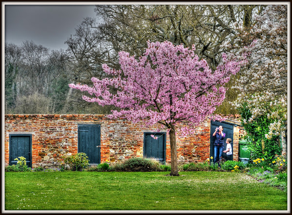
I probably ought to visit the Castle as well. However just across from the church was some glorious blossom – so fleeting that you have to take pictures when the opportunity arises. I think that garden is of the Old Trinity Hospital.

Castle Rising – when the blossoms out – take a picture

When I got through to King’s Lynn there was an awful moment, where the cycle route crosses the railway line. The barriers were down and I had visions of watching the train I should be on pull out of the station and cross right there in front of me.

It was a little thing but my heart lifted – it was the once an hour train pulling into King’s Lynn Station. Pretty good timing if I say so myself.

I bought my ticket. jammed my bicycle into a doorway and sat down and celebrated by having a few Jelly Babies washed down with some water. The King’s Lynn train does not have any dedicated cycle space. I did take a picture – but I was tired it was blurry – it didn’t make it into the Blog sorry.

It was all I could do do stay awake as the train rumbled down through to Cambridge. I had visions of waking up in King’s Cross. I managed to stay awake because a fellow passenger rambled on and on in a phone call to a colleague who was being promoted and this girl wasn’t sure where she might or might not get the deputy position…….. She got off at Downham Market – phew.

I also remembered to take a picture of the red bikes of Ely.  Boris eat your heart out – you can now Bike & Go from Ely, it will be £10 annually plus £3.80 for 24 hours use.

Bike & Go – Ely

It wasn’t long and the train rumbled into Cambridge.  I would definitely recommend that ride – it was great – although I probably wouldn’t go all the way to the golf course though. 

Monday, April 28, 2014

Cycling the cycle-able bits of Peddars Way–part 7

Wednesday 2nd April 2014: (Where’s The Sea)  By eye, Castle Acre is roughly half-way up the Peddars Way cycle route and the straightest bit seen on the map, well to get to the end of Peddars Way that is. However my journey didn’t end there. I then planned to cycle back to King’s Lynn to catch the train to Cambridge. Perhaps it was a good idea that I wasn’t paying to much attention to my progress – in my mind I had reduced the final leg quite considerably.

From the northern end of Peddars Way down to King’s Lynn station, via NCN1, was actually just under 34Km (21miles). Whereas the distance from Thetford Railway Station to the northern end of Peddars Way was 83Km/52 miles. Which means the last leg was about 30% of the station to station distance.

Whilst I could have planned the route more meticulously and worked out various distances along the way I did know the overall distance according to BikeRouteToaster – 116Km/72 miles. So I wasn’t too bothered I knew I could enjoy cycling that sort of distance. The real unknown was just how cycle-able the off-road bits were going to be. If things got really bad I could always cut directly across to King’s Lynn.  The spirit of adventure means leaving some things unknown until you get there – well when cycle around Norfolk.  I would do it differently in some parts of the world.

the first part of Peddars way out of Castle Acre follows the Massingham Road. As it follows the course of the Roman Road it is pretty straight.  There were more vehicles than some of the earlier roads – but it was by no means unpleasant and I didn’t feel harassed. Perhaps the pace of life really is slower in Norfolk.  (Here is a picture of the “Rush Hour at Castle Acre Ford”.)

I usually use the OSM maps for most of my navigational needs – however I do sometimes use the OS maps when I want more detail about rights of way. Just to the north-west of Castle Acre there are some strange patterns in the fields.  They do not appear  on the Where’s The Path old 25K OS map or the satellite view though.  I don’t know what they represent – but could be the way the land was apportioned for tenants of the Manor?

If you follow the route on the OS map you’ll see that it does undulate a bit. You leave Castle Acre at 53m above sea level which rises to 64m then drops to 56m then up to 84m. It is actually quite pleasant to climb a short hill and enjoy the ride down the other side.

As it turns out I missed out a small section of the off-road track and followed a small detour – however I didn’t realise it at the time – which seems rather weird. I don’t think I would have noticed if I hadn’t loaded both the route to follow and the route I took onto Google Earth.

I seem to have a blind spot when it comes to following routes off-road. Here is the section on the OSM map and here is the Streetview link. Here is the bit where the two traces re-join. I do wonder whether  my GPS locked onto the road when I took the byway because it looks familiar. But the mind can play strange tricks.

Problem solved – I have just checked and I did take the road route – because when I first digitised the route it did indeed follow the road and the detour. Which I didn’t notice at the time. However when I was playing on Bike Route Toaster I edited a few similar errors out of the map and this was one that got fixed.. So the BRT map is correct as far as I know and I did take the detour. So the red line is the route I originally plotted and followed, the blue line is the correct line to take and the one on BikeRouteToaster.

An unintended  Peddars Way Detour

After a relative short run of country lane it becomes a green dot road  at a 25K scale. It means “Other routes with public access (not normally shown in urban areas)”. This is what it looks like in Streetview. It undulates and at first gave me cause for concern – the track was rather sandy. Almost but not quite too sandy. I did find myself seeking out the firmer bits. The edge of the tracks up on the grass was usually the easiest to cycle on. The trouble is with sand is that my wheels dig in then I have to stop. Re-starting is hard and the whole thing is very energy-sapping.

This picture was taken where the Peddars Way crosses the Lynn Road on its way to Great Massingham. The track climbed up to 92m – which is mountainous for a flatlander like me. You can see it here on the OS map or here on the OSM map.

Now I don’t have GPS on my camera – what I do is use the uploaded GPS record of my route in Google Earth – when I stop there is usually a small gap in the trace – which shows where I was when I took the picture – simples.

Peddars Way – Crossing the Lyn Road to Great Massingham

Let me just mention once again – the weather was wonderful warm, but not too warm, the skies were blue, the fields were yellow. In the picture the wood at the end of the field is called Nut Wood. To the left is a bridleway that runs the other side of the hedgerow and past the wood to Little Massingham.  The next time I venture this way I am going to have to create my own route and try out some of the other tracks.

As you can see, the field is not so far along – which shows how far north I’d come – at this rate I’d be seeing snow soon.

Nut Wood seen from Peddars Way (nr Little Massingham)

Another of the Norfolk Songline sculptures, Just up the track according to my GPS trace. It is next door to a bridleway – whereas on the web there is a picture of this sculpture which shows it next to a bridleway . Yet on the map they have it marked here. I think I am correct – but you never know,

Norfolk Songline Sculpture – Peddars Way – Little Massingham

In fact as I think about it this picture was taken alongside the sculpture – there is the same bridleway sign. The reason I took the picture is because it highlights the wonderful abundance of off-road tracks in this part of the world. However it supports my view on where the Sculpture was.

Peddars Way – Little Massingham – Bridleway to Nut Wood

Along this part of the track there did seem to be some signs implying that the Peddars Way might be closed for repair – although the dates on the signs seemed to be wrong.  I really should have taken a picture or two to remind myself. However at the time it served as an annoyance and I figured whatever the repairs I would get around them.  You can’t just close a route without ensuring that there is a decent suitable alternative.

As it turned out the track was not closed and I didn’t have any problems. I did check the National Trails website before I set off mind – although I favour not knowing too much before I set off there are limits to my ignorance – honest.

The route did cross the A148 near Harpley Dams, but this one was relatively easy to cross, despite it being an A Road.  I didn’t realise that I has crossed the route of what had been the Midland and Great Northern Joint Railway. This was an odd line that seemed to bypass King’s Lynn with a marshalling yard to the south and South Lynn Station.

Apparently the nickname for the route M&GN line was “Muddle and Get Nowhere” which if you follow the track it seems to weave around a lot. After its closure the nickname became “Missed and Greatly Needed”. The closure of this line was in 1959 and preceded Beeching.

After crossing the A148 and a very brief stretch of “civilised” road the route becomes a green dot route again, phew (In this case more byway that road.) This bit of Peddars way seems to offer the best off-road for cycling – in that it is straight and long and seems to go on for miles and miles. In fact it not only seems to, it does.

The North Bit of Peddars Way – Glorious Off-road Cycling for Miles

If you look on the OSM map there are what appear to be three airfields nearby. The closest to Peddars Way is Great Massingham, then the disused RAF West Raynham and RAF Sculthorpe. RAF Great Massingham was a satellite airfield of RAF West Raynham.  According to this line Great Massingham still operates privately.  Read the bit at the bottom – the modern-day pilot comments on what it must have been like in war-time.  Here is a bit more on RAF Massingham from the village website. (Here is the WTP link as well.)

Finally a bit about RAF Sculthorpe, this was a second satellite airfield of RAF West Raynham,   the airfield remains in military hands – but is hardly used and much of the housing was sold off apparently.

So that leaves the question where were the two Ospreys that kept circling round and round and round flying from. Were they using RAF Sculthorpe as part of their training or flying from somewhere else. The Ospreys I mean are the Bell Boeing V-22 Osprey tiltrotor aiircraft. When you see them flying they make a strange sound – a cross between a normal propeller plane and a helicopter.  Also you wonder how they would land – since the propellers would scrape the ground. (They tilt – hence the term tiltrotor.

V-22 Osprey (one of two) flying above the Peddars Way, Norfolk

Being military aircraft the plane markings are not easily seen – well not with the lens I was using.

 V-22 Osprey (one of two) flying above the Peddars Way, Norfolk

I was going to caption this picture with a comment on it being a more normal Norfolk sight – farming the fields. However having looked at the list of airfields that there used to be in Norfolk (over 50) then they probably miss the sounds of planes flying overhead.  A few still exist with RAF Marham to the west of Peddars way.  They will be acquiring F-35 5th gen planes.

The countryside in Norfolk gently undulates, oh have I said that already.  This picture rather nicely illustrates it with a mix of fields, woods, hedgerows and a farmer working in the field. The farmer is using a GRIMME CS 150 soil separator, preparing his field for high quality potatoes.

Norfolk Farmer – preparing for spuds – Peddars Way

Those Osprey’s just kept on going around and around.  I am not sure where they are based, although they could be based at RAF Mildenhall (US Air Base) which has two and is getting 8 more in August this year. They aren’t cheap at $78million a pop.  Here is a YouTube video of one landing at STANTA – with sound.

 V-22 Osprey (one of two) flying above the Peddars Way, Norfolk

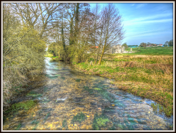
Eventually all good things come to an end and this off-road bit of Peddars Way then turned onto Fring Road. The Peddars way footpath continues but not for cyclists alas. Although there was one last ford to cycle through – although it looked more like a puddle really. So for walkers this is a crossroads.  A bit further along the OS map this stream seems to be connected to the River Heacham, actually it is the River Heacham.

Fring Crossroads – Peddars Way crosses the River Heacham

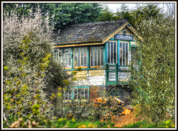
Once I reached Sedgeford I joined NCN1 – a route I have cycled a few times before. You climb up out of the village and down into a dip and a Signal Box comes into view – yet another abandoned Norfolk Railway Line. This one came in from King’s Lynn – with a spur up to Hunstanton and a line across through Burnham Market and then to Wells-Next-The-Sea where it then heads south.   The line was the West Norfolk Junction Railway.

Apparently Sedgeford never had a signal box when the line was operating – this was moved from Stow Bardolph and set up here. (Here is a picture of the platform).

Here is a picture of Sedgeford Railway Station taken in 1976, there isn’t a Signal Box

Sedgeford Signal Box

For my route to the sea I didn’t take the longer route, but instead followed the more direct route of NCN1 to Ringstead, I was going to take the longer route back. Now I had not been to Holme next the Sea before and it seemed the further North I went the murkier the weather got. It was almost cold enough that I had to put my jacket on. The sun had gone and it was grey.

There has been quite a lot of building in the area and barn conversions – I passed this house being built - £2.5m. I assume that quite a lot of the demand is for second homes – although this seems a lot to spend for a second home in the middle of nowhere.

As I was also feeling quite tired I lost the inspiration to take any pictures, for the record rather than for any particular sight. I did want a picture of the sea though. Unfortunately the Peddars Way ends up crossing a golf course. It is a byway and so a right of way to the beach – it didn’t feel very welcoming though so I stopped at the road bit.  Knowing what I know now, maybe I would have crossed – but I wasn’t wearing a cycle helmet and golf can be a dangerous sport.

I can see why people like playing golf near to the sea – but if I had been living in Holme-next-the-sea I would have felt a little peeved by having to cross a golf course every time I want to get to the beach.

Next time I think I would head across to Hunstanton.

Holme-Next-The-Sea – Peddars Way meets a Golf Course

Whilst looking on the web for stuff I came across this Blog. A cycle ride along Peddars Way, the other way.  They set of from Waterbeach Station and caught the train to King’s Lynn. They cycled up to Sandringham on NCN1 and then cut across to the Peddars Way on Ling House Road and from Ling House to the Peddars Way by green dot road. They managed to notice the Castle at Castle Acre and take loads more pictures.

Talking about exploring the byways – here is an interesting website Peaceful Byways – 12 cycle rides in West Norfolk.

And finally – for this post – Peddars Way on Flikr. (A walking/camping view.)

Finally to King’s Lynn and the train back to Cambridge.

Sunday, April 27, 2014

Cycling the cycle-able bits of Peddars Way–part 6

Wednesday 2nd April 2014: (Castle Acre and lunch)  I forgot to mention in Part 1, one of the other items I took with me on my journey was my MP3 player – I also made sure it was fully charged the night before. However I didn’t use it – even when on the train. I was too busy taking in the scenery and thinking about the route.

One feature of accident reports or should that be crash reports – if a cyclist involved in a crash is listening to music then it gets reported as was the case with this tragic report – “Killed cyclist ‘distracted’ by music”.  Yet in the case of a car driver being involved in a crash it never gets reported whether the driver was listening to the radio or their CD or MP3 player. So what is it about cycling that makes distraction by music so much more wrong? (I have not yet found a car crash report which mentioned whether the radio was on or not.)

On another topic – in my last post I mentioned how it was a shame that the rail network wasn’t as extensive as it used to be in Norfolk – because  it would be a great place to explore by a combination of train and bicycle.  Well here in Cambridgeshire we seem to be getting a BikeBus Explorer – a bus towing a cycle trailer to allow visitors to use bikes and buses to explore our lovely countryside, before it is all gone. It will run on Sundays and Bank Holidays – I will have to give it a go.

Back to the Peddars Way. After coming to the end of Procession Lane, a restricted byway, the country lanes were still great for cycling. In fact after rubbish dump railway bridge the route headed past Palgrave Hall and then onto a bridleway and then onto Southacre Road in short order. If anything I rather like the swapping it makes the journey more interesting. Providing the country lanes are rural that is.

In fact you get blasé about the scenery – I almost didn’t stop to take a picture of the cowslips growing along the Southacre Road.  Look – flipping Pylons getting into the picture again.

Cowslips – Southacre Road – Peddars Way

The ride into Castle Acre did not disappoint. Southacre Road became Big Wood Lane before the route turned down South Acre Road (unsuitable for motor vehicles) and onto Blind Lane and then Bailey Street.  There is also quite a change in elevation as you head towards Castle Acre – down and then back up again.

This is where I have to confess my ignorance – I thought this was the Castle – and I completely ignored the real Castle.  In fact this is the Castle Acre Priory.

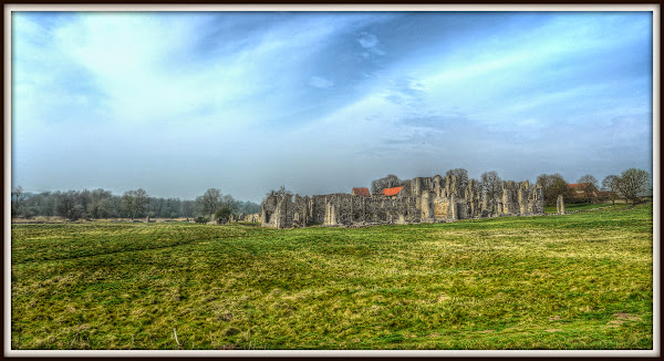
Castle Acre Priory – seen from the Peddars Way Route

Oops mustn’t forget the wildflowers along the verge – White Dead Nettle and Lesser Celandine.

Wild Flowers along Peddars Way – Castle Acre

There are road signs warning of the impending ford – it doesn’t seem to appear on the OSM map though although you can see the foot bridge alongside the bit where the River Nar disappears under South Acre Road.

I do cycle through Fords – but discretion and the fact that I had an unknown distance left to cycle made be cautions. In fact ordinarily .I would have waited for the car to move before taking pictures – but I was hungry.

South Acre Road – Fording the River Nar – Peddars Way

The is the view the other way with the Priory just peeping around the trees on the river bank. There has been work on conserving and restoring the river.

River Nar – Peddars Way - Castle Acre

Here is Maisie, my trusty Marin bike patiently waiting for me. If those handlebars were any wider the bike wouldn’t fit the bridge.  The bike is a hybrid in more ways than one. It started as a hybrid – but the frame cracked and it was replaced under the lifetime guarantee so it is a combination of two bikes.

Bridge over the River Nar and Maisie my trusty steed – Peddars Way – Castle Acre

As I cycled along the back streets one of the advantages of cycling was demonstrated to the folk in the red car I met at the Ford. I could easily stop to take this picture of Castle Acre Priory – they had no-where to stop and drove on past me thinking that’s a nice view.

Mind you I also failed to notice the Castle on the other side of the road! I can see why – I have just done a quick Streetview trip – there are houses blocking the view.

Castle Acre Priory – Peddars Way – Castle Acre

Although maybe this was a clue, a quick check and I was going to fit. Although the route was to the right I first cycled to the left. It was very picturesque and I was peckish. Nothing jumped out at me so I carried on along the route.

Bailey Gate – Castle Acre – Peddars Way

A turn or two more and I reached a Costcutter – my stomach reminded me that I needed to eat some food. So I stopped here and bought a cheese and potato pasty – which was really quite tasty, I also bought a sandwich – not so tasty – although maybe after eating the pasty I wasn’t so peckish. I also found myself drawn to buying something sweet. The trouble is my memory tells me how much I enjoyed bars of chocolate when I was a kid. I also like dark chocolate. So I also bought a dark chocolate kit-kat. It was underwhelming – I won’t be tempted again. I should probably just stick to decent quality chocolate.

I ate my picnic on a park bench just across the road. I swigged diet coke to wash it all down. Life was good – my stomach was full – the route had been wonderful and I had made progress. I could barely sit for a minute or two’s rest before setting off.

Nest stop – where’s the sea!

Cycling the cycle-able bits of Peddars Way–part 5

Wednesday 2nd April 2014: (Castle Acre here I come)  Forgive me, this Post will take the journey up to when I reach Castle Acre – but Castle Acre will appear in the next post. The more pictures I include in a Post the longer it take me to write them. By which I mean it take me longer to write one long post than the same information if I chop it up into three shorter posts. Once a Post goes beyond the length that I can write in one go then it takes longer to pick up the thread when I get back to it.

Talking about threads I note that North Pickenham Airfield was also a host to three PGM-17 Thor Nuclear missiles in the late 50s/early 60s. We certainly lived in some troubled times with nuclear missile sites scattered around the country. 

Also Castle Acre is a picturesque place and I took quite a few pictures and they made it into the list for inclusion in the Blog. On the way out of North Pickenham there was time for one last picture of the Wind Farm (well bits of it). This site shows some of the data associated with the Windfarm, including the amount of revenue generated.  It seems that it has been embedded in the distribution system, presumably for North Pickenham and the area rather than connected to the National Grid. 

I don’t live slap bang next door to a Wind Farm, but there is one that can be seen around Cambridge – Wadlow Wind Farm. However in my travels I do see quite a few of them here and there. So whilst I might be less happy if I lived right next door, I am not that bothered by them.  You can hear them making a sort of thrumming noise close up – but I think they look less untidy on the landscape than Electric Pylons which certainly seem to march all around the Fens near Cambridge.

However we have to do something about both Climate Change and our political dependence upon sourcing energy from other countries. With the recent Ukraine crisis it has become more important. Apparently coal is used to generate 40% of the UK’s electricity and Russian provides close to half of that coal.

Here is an interesting take on Wind Farms from someone who visited North Pickenham and was commenting on the then proposed, now built Cotton Wind Farm – near St. Neots.

There is also a Karting Centre there as well – Anglia Karting Centre.

North Pickenham Windfarm

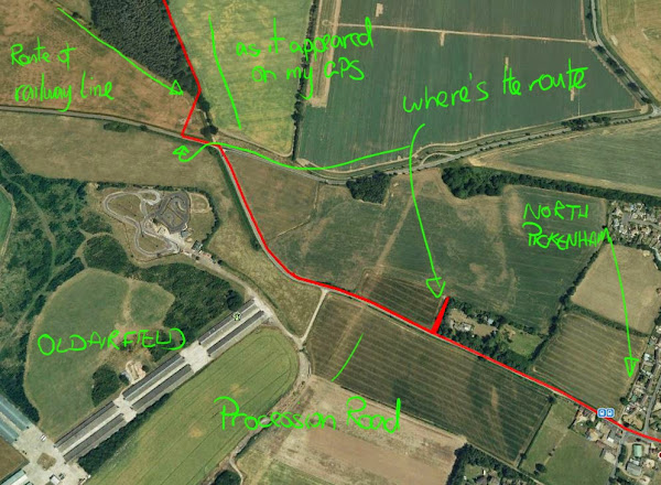
After the brief stop I started looking for the route – according to the trace on my GPS I drifted off the route as I cycled along the quaintly named Procession Lane. (Which I have misnamed on the screen shot below.)  I think I must have become too set on cycling on roads and forgotten that the whole point of this ride (for me) was to get some quality cycling time away from roads.

Attempting to find the Peddars Way route after passing though North Pickenham

This was the problem – when I digitised the route on BikeRouteToaster the auto-routing was playing up and wouldn’t always route along some tracks. (I have just tried it and it won’t route along the track part of Procession Lane). So I switched of the Auto routing and clicked along the path by eye at a fairly distant scale. Normally that does the trick. In fact sometimes I don’t notice that Auto routing can create some bizarre routes that I don’t want.

Manual Routing – Procession Lane – Peddars Way – with a zig-zag

This is the same satellite view – but with both the GPS recorded trace (red) and the digitised trace that I was supposed to be following in blue.  Neither is correct – the red trace shows my GPS locked to the road for part of the ride down Procession Lane (Restricted byway). Which is wrong – and to do with the GPS trying to give me turn instructions, I think. The trace I digitised has a kink which places the byway slightly to the East of where it should be.

It seems weird that such a small error should confuse me – but it did. I think it was the gate (seen here in Streetview)  that added to my confusion – especially as I thought that that route was somewhere else.  It all adds to the adventure though..

GPS – not always to be relied upon

A little way down the track and there seemed to be a railway bridge implying that a railway line ran overhead.  It did, once, it was the track from Swaffham to North Pickenham, although as was common the station was not in North Pickenham or Holme Hale but between the two and called Holme Hale Station – for pictures of the station go to the bottom of the page in the last link – the two on the left.

Clearly the railway builders felt it was important not to block the Peddars Way.  Although another reason might have been to minimise the changes in gradient – to the east the track ran through a cutting.

Bridge TJH25 Procession Lane - North Pickenham

I thought that with a name like Procession Lane there would be some interesting history behind the route – what with the it being Peddars Way and Procession Lane – but I could find nothing really. This website suggest it was to do with the ceremony of the beating of the bounds.

This part is now a restricted byway, but I found this correspondence regarding the use by horse and cart drivers.  Here is another of the Norfolk Songline sculptures, click the link for the words.

Norfolk Songline Sculpture – Procession Lane – Peddars Way

Procession Lane was a rather nice track with hedges either side. The sculpture was roughly half-way between the North Pickenham Road and the A47. Here it is – looking South. As you might imagine there are quite a few byways and bridleways in the area that cross the route.   It would be fun to spend a little more time in these parts exploring – it is a pity that what was once a quite extensive railway network has been cut back.  Then it would have been easier to get around by bike and train.

Procession Lane – Peddars Way – adjacent to a Norfolk Songline Sculpture

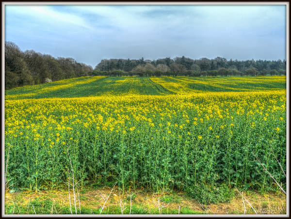
Norfolk is an agricultural place, with lots of chrome-yellow fields in the Spring. I know I said was not going to take too many pictures of them – but that was the last post. A little further along Procession Lane, before reaching the A47 I stopped to take this picture. It was the contrast of the vibrant plants in the field with the trees in the background yet to come into leaf.

At the time I selected this picture I had convinced myself that the field sloped, because the trees would have not been vertical – I am wondering whether I was wrong or would it have looked better if I had made the edge of the field horizontal and the trees leaning?

Blue Sky – Yellow Field – Procession lane – Peddars Way

As I was cycling along Procession Lane there was a vehicle blocking the route – a lorry. Oh dear – what was I going to meet – rural routes can encourage fly-tipping for instance. It turned out to be some pipes being laid along the edge of a field – the lorry was delivering them and a chap was digging a trench in the field (with a digger) and laying them.

Then I arrived at the A47 – it took absolutely ages getting across here. I did wonder whether it might have been quicker to cycle down the road towards the roundabout and then take the lane in order to swing round and back. Busy roads block rights of way – I am appalled at how cavalier road planners are – once a road gets above a certain level of traffic throughput then the road planners need to provide facilities for crossing or joining such roads, especially when it comes to vulnerable road users.

After crossing the A47 – Procession Lane then became a road – but not at all busy, it has one farm along it.

Yes, another chrome yellow field – what appealed to me was the way the trees faded away in the distance, there was a depth to them.  It was also had a hazy look, thinking back was it to do with the smog reaching Norfolk from the car-choked cities down south?.

Grey Sky – Yellow Field – Procession lane – Peddars Way

As I cycled long Procession lane I came upon yet another disused railway bridge. There must have been loads of railway lines around Norfolk, once, or I had done a 180o turn. The line was the Dereham and Lynn Branch Line. (Wikipedia called it the Lynn and Dereham Line).  This time the road was on the bridge and ran over the railway line.

This is the view from the bridge – clearly some people have found another use for the bridge/cutting, as a rubbish dump, it’s pathetic really.

Dereham and Lynn Railway Line – now a rubbish dump – Peddars Way, nr Swaffham

The view down the cutting, it has become pretty over grown – I guess old cuttings aren’t that useful to farmers, so they get left.  I would imagine that it is good for the wildlife.

Dereham and Lynn Railway Cutting near Swaffham – Peddars Way

Next stop Castle Acre – yes really this time.

Saturday, April 26, 2014

Cycling the cycle-able bits of Peddars Way–part 4

Wednesday 2nd April 2014: (Pedalling to  North Pickenham) After passing Illington Road you carry on on a track until Stonebridge. Where you can use a bit of shared-use  path before turning off along the Woodcock Road.  The Woodcock Road doesn’t really go anywhere – it used to take you to Tottington, a deserted village, now part of the Stanford Battle Area – 30,000 of British Army Training area.

After a while Woodcock Road becomes a no-through road for motor vehicles, and the quiet road becomes even quieter.  This is part of NCN13 a North-South cycle route from almost Colchester (according to the OSM) to where it joins NCN1 just after Gately.

In the picture, to the right, is the Great Hockham Road – straight on for the Peddars Way.

Woodcock Road becomes a no-through road - NCN`13 (Peddars Way)

As I mentioned the route passes alongside STANTA (Stanford Training Area). Although I have been this way a few times and indeed around other areas in Norfolk where you pass military training areas have yet to see a soldier training.

Perhaps they hide behind the trees whenever they see a cyclist. The trees do seem to line up in ranks.

Woodcock Road – NCN13 – Peddars Way – serried ranks of trees

Shortly after passing the no-through road sign the road forks – and the cycle route takes the one to the right along the forest track.

I rather like exploring and if I had lived in these parts as a kid there would have been a temptation to roam – which means I would have roamed. Now I am older I don’t fancy getting shot. Also I had my bike, but no bike lock so I wasn’t going to leave that lying around.

STANTA – NCN13 – Peddars Way

The track starts out almost road like – but becomes more of a track pretty quickly – not a bad track. There are farms around that use it.

NCN13 – Peddars Way – STANTA

The track does become even more track-like. I have been along here when there were large puddles – this time around it was dry. Those two pole presumably had a sign on them – not sure what it said though. This is close to Thompson Water – a man-made lake.  The route also lies on the Great Eastern Pingo TrailPingos were originally low hillocks formed of water beneath the soil surface during the last ice-age, 20,000 years ago. When the ice melted it left behind a depression.  You are never too old to learn and that is something I only found about about recently.

The potholes aren’t Pingos but the Sustrans map does warn you about the potholes on this stretch.

Also if you look at the Sustrans map it shows that NCN13 route carrying on to the Tottington Road and thence to Thompson. Whereas the OSM Cycle map shows the cycle route heading along a track to Marlpit Road.  The OS map also shows NCN13 as per the Sustrans route. As it happens although the OSM Cycle map marks its NCN13 route as a track it looks just like a road as you pass it. If you cycle along it, it becomes more track like though.

Great Eastern Pingo Trail aka NCN13 aka Peddars Way

Now I have to confess that I just programmed the route shown on the OSM Cycle map into my SatNav and followed it. When I hear a car driver say that after driving into the sea  it makes me think get a brain. Well when I got home I had a more detailed look at the map and I am confused. This bit might actually be a footpath rather than a shared-use path. Which of course I shouldn’t have cycled along.

The Norfolk Right of Way map shows it as a footpath, although the same map also shows the bit past Thompson Water as a footpath and yet it is cycle-able. Also towards the end of this route I think I saw a sign that at least some of it was a permissive bridleway. Although the picture I took of the scene isn’t quite clear enough. This is a very picturesque part of the Peddars Way though.

Peddars Way – just after passing Tottington Road

A little further along was one of the five sculptures designed by Tom Perkins to act as permanent waymarkers on the Peddars Way – A Norfolk Songline. This one starts – “Surveyors have made their lines on the land”. Its record is here.

One of the Norfolk Songline Sculptures along the Peddars Way

At the end of the wiggly bit – which drifts off the course of the Roman Road was this gate and that sign I mentioned that I am sure say it is a permissive bridleway.   Although I don’t normally take many pictures looking back the way I came, this one and the next one are both looking back (in pleasure).

Permissive Bridleway – next to Millhill Coverts

The track then turns left and take you to an official byway towards Capp’s Bush.  This view looks back the way I came – the byway is somewhat rustic.

Almost at Capp’s Bush and the Peddars Way

As you can see the track becomes more bridleway-like than byway.

Peddars Way – near Capp’s Bush

A quick look at the OSM map and Capp’s Bush is called Capps’ Buch. Shortly after that you end up having to cycle on a road – shock. Although as roads go this was a good ‘un.  It was quiet and rural – fine by me.

The weather was pleasantly warm without there being too much sun – a great cycling day.

Peddars Way on the Brandon Road

After a while of pleasant country lane this rather grand building came into view as I cycled along Caudle Road. It was Pickenham Hall (which I just looked up). It seems to have been in private ownership and was up for sale – but that was 11 years ago.  It is also a listed building with Arts and Crafts gardens.

The road was very rural, with high hedges in places,  but really good for cycling as there weren’t many cars around. I was feeling a bit peckish.  So the question was did I break out the Jelly Babies or should wait until I reach civilisation to find lunch – I didn’t break out the Jelly Babies. I did stop to take pictures though. Although I had to stop myself from taking too many pictures of yet more chrome-yellow fields under blue skies. The scenery was very rural – but I guess readers of this Blog already see a fair number of blue and yellow pictures already.

Yellow Fields – Blue Skies – Peddars Way between South and North Pickenham

I am not one for clock-watching when I travel, nor was I following my progress on a map. All I had was a small window on the world on my Edge 605 GPS that I used to ensure I took the right turnings as they came up.  The screen only gave a window of around 240m x 480m when viewed at a scale suitable for showing the detail.

So I didn’t really know what the time was or where I was in relation to Norfolk or progress on the journey. However in the distance I saw some signs of civilisation and also a Wind Farm. It was North Pickenham Wind Farm and apparently has 8x 1.8megawatt turbines.  The land around was previously an airfield -  RAF North Pickenham, an aerial view can be seen here.

Two Turbines – North Pickenham Wind Farm – Peddars Way

As it happens I didn’t spot anywhere convenient in North Pickenham to stop and pick up a snack – although I didn’t go out of my way to look. I just carried on through the village, climbing slightly.

I had to stop when I saw this chap – it looks rather like an alien out of Dr Who. It is a statue of an Anglo Saxon Warrior and George unveiled it. It has weather a bit from when it was installed. Here are some words about it – sorry their picture fails to load – but the text says that it was carved from a single piece of Elm from the South Pickenham Estates.

PICA – An Anglo Saxon Warrior – North Pickenham – Peddars Way

Next Stop Castle Acre