
Sunday, 3rd April: I seem to be catching up, with my Posts I am only three days behind and I didn’t cycle yesterday so have only two sets of pictures to add words to (including this one).
But I can’t miss an opportunity to report on the Cambridge misGuided Busway (CGB) out of sync with the Posting date. It was reported in the Cambridge News that the “Guided Busway ‘progress report’ sparks laughter from public gallery”. Well at least they (we) are getting something for our money. How can it have all gone so wrong? Apparently the Council and BAM Nuttall are now negotiating on a legal agreement which would allow the route to be handed over. I for one would be very suspicious that, if such an agreement is reached, it were to be confidential. Given that this is a development for the public good (out of public funds) then it would be wrong to tarnish it with the suspicion of a cover up. At the very least we must learn why such problems occurred and ensure that we learn for the next time.
A quick check on the Cambridgeshire County Council website has a CGB related Press Release: “Council Bosses offer solution to speed up BAM Nuttall handover”. It is not that clear quite what the solution is and who might benefit from it. Given the problems to date then I am not quite clear what BAM Nuttall has earned in fees and how the penalties might get paid back. The release talks about over £10million in damages, but there is also cost overrun. Will the CGB cost more than originally agreed and who pays and who will pay for the fixes.
Whilst £10m in damages would seem to be a huge amount of money I can’t help feeling that there is something else here. I don’t know how much profit BAM Nuttall expected to make from the contract, but the mounting damages do not seem to be helping to drive the problem to a resolution. Check out the whole sorry story on www.noguidedbus.com. As of today it reports the damages at £10,444,000 and the opening delay as 746 days. Rather usefully (for my reference) the same website indicates that work began on the CGB in March 2007. The means that the project has taken over twice as long as the original plan – that is bad in anybody's book. Despite the fashion for pointing fingers at others it would seem to me the the CCC also needs to take a look at its own processes as the body that commissioned the project.
There is still no opening date!
Whilst on bad news the Daily Mail reports that “Oil prices hit all-time high…” The average cost of diesel is 140.01p a litre. Whilst we might moan about the taxes and duties payable there are larger forces affecting the price – the supply and demand for oil and the weak pound. The difficult truth is that driving a car burns a lot of money and our society has stumbled into a huge level of car dependency. If we want to save money then we need to drive less and probably end up being even more time-poor in the short term.
They say that poor economic conditions correlate with an increase in crime. (In this Guardian article a reference is made to a report leaked in the Sunday Times in 2006 that 80% of a decrease in crime was due to economic factors. Well here in Cambridge “Police target the handlers as city bike thefts rocket”. Apparently the number of bikes thefts in the City of Cambridge has risen over the years: 2007-2,240 bikes, 2008-2,326 bikes, 2009-2,597 bikes and 2010 2,870 bikes. According to the last (2001) Census the City’s population was 108,863 people (including 22,153 students).
A quick check on the web and a BBC report (April 2007) noted a bicycle was stolen “every 71 seconds” with nearly 440,000 stolen in 2006 (in the England). Cambridge was in the top ten cycle theft hotspots then and I don’t suppose it has changed much since then. According to the same Census 25% of the residents cycle to work. Which implies that there are around 27,000 regular cyclists and 2,000 bike thefts would represent 7.4% of the regular biking population. Now I have deliberately taken a low number of bike thefts since I am using data from different years. It does suggest that the number of thefts is trending to a number that represents 1 in 10 of regular cyclist every year.
Now not all those bike thefts will be from that group of regular cyclists, but this is every year - it is a huge number.
Phew, that news was a bit heavy for a Sunday afternoon ride. There were reports that we might have showers, but that the East would be the least troubled by such things. With homework on the agenda for my daughter I popped out for a spin around the Fens. Here is the route – I know I don’t put all the Lodes Way routes in, they are basically all variations on a theme, but it is easier to refer to a map than to describe them sometimes. Here is the Bike Route Toaster link. The route length is around 56Km/35 miles and pretty much avoids roads apart from the a few country lanes.

There is a bit of road to cycle along after leaving NCN521 in Quy, but I generally leave the B1102 halfway along Quy and then take the Main Street and then down Albert Road to cross the B1102 to cycle along Station Road. The village is “blessed” with some interesting traffic calming measures. They probably do slow down the cars coming through the village, but since cars often roar away after stopping I am not convinced they would reduce the overall noise pollution.
As a cyclist I certainly welcome the through lane so that cyclists don’t get held up, but I found that just after passing the Traffic Island cars would sweep past the Island and in their hurry to get back onto the left side of the road in the face of oncoming traffic would quite happily pinch me against the kerb. I don’t suppose they do it intentionally but it happens more often that I would like and implies that the motorists are probably at the limit of their concentration dealing with the Calming Obstruction, on-coming traffic and a flipping cyclist.
The bird on the sign is a Jackdaw, I assume judging by the references to jackdaws on the village website. I assume they must nest in the tall trees.

After passing along Station Road and over the bridge over Quy Water I took the bridleway and the disused railway line behind Anglesey Abbey. This is the bridleway not too far from the road. It is almost single-track and good fun, but not quite MTB-ing.

Just before White Fen I popped up the track in the Oily Farm direction to see where the Planning Permission was being sought, It is in a small clump of trees on the other side the field from the Oily Farm buildings. More of less 0.6Km straight on this path.

After passing White Fen I took the Swaffham Bulbeck Lode byway up to Lythel’s Farm and then across to Long Drove and back to the Lodes Way. Apparently there is a Long Barrow 650m NNW of Lythel’s Farm (Monument 33384 – pdf). Along the byway was another field with plastic strips. If you look closely they are perforated.

This is the byway, with Swaffham Bulbeck Lode to the left.
Another field but the strips run in the other direction – it looks dark because the picture was taken looking towards the sun which has the effect of causing the camera to under expose the picture. Now I could have compensated for it, but I rather like the sun lighting up the strips of plastic as if it were late evening.

Instead of going over Reach Lode Bridge I headed off up the bridleway to Harrison’s Drove and then to Upware. As I mentioned a couple of days ago I saw some cyclists heading down alongside Burwell Lode form Upware so I thought I’d give it a go.
Not far from the road you come across this rather nice wooden bridge where Wicken Lode joins Burwell Lode.

This is the view back towards Upware from that wooden bridge. There are quite a few boats moored this side of the lock.

A close up of the bridge. It is quite steep and has wooden rungs set into it. However someone has also thoughtfully cut the rungs to make it easier for cyclists to get their bicycles up it. I didn’t cycle up, too much chance of meeting someone coming up the other side.

This is the view from the bridge along Wicken Lode towards Wicken Fen.

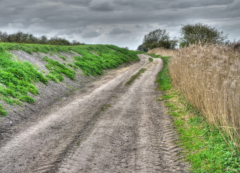
The bridleway was actually very pleasant for cycling along. It was peaceful, the surface was fairly firm (good to firm) and a different perspective of an area I often cycle around.

After a while the Lodes users have a choice – Burwell or Reach Lode.

Cyclists and walkers (and horse riders) don’t have the same choice the Lode doesn’t have any bridges at this point. If I’d wanted to go to Reach I should have made that choice at Upware. I have just had a look at the CCC Rights of Way Map and realised that the route of the bridleway is not as I thought. I assumed it carried on down alongside the lode. The map shows it following the bank of Wicken Lode just after the wooden bridge where it them meets Harrison’s Drove (beware there are two – this is the other one!!!). Ah well apologies – I can’t believe that this was not a bridleway surely horses must have pulled boats along here in the “olden days”.

The footpath passes High Bridge (Cock Up bridge) on its way to Burwell. I stopped on the footbridge (but left my bike below to take some pictures. I passed this longboat on its way down from Upware – I think I won that race pretty easily. Although I am not sure he knew he was in a race.

As you can see this is the same picture as above but without the same zoom factor. Rather worryingly it looks as if there is rain coming down off in the distance.

I looped around Wicken Fen, heading out on the Maltings Path and back via the main entrance and NCN51. I rarely meet other people on the Maltings Path which is surprising since it makes a pleasant circular walk around Wicken and Wicken Fen. I did meet two people today though – both on their bicycles.
This picture was taken on my way out of Wicken Fen, not long before turning off towards Burwell. We should be seeing some leaves on these trees soon.

I then cycled along NCN51 through to Reach ( a rather nice brief history) and up Green Lane (a byway round the back of the village. By this point it had started raining and as I climbed the hill at the back (Church Hill) I got wetter and wetter. By now I had decided it was too late to put on my rain jacket – I am always a bit slow when it comes to those decisions unfortunately.
As I climbed up to where the byway then heads down towards Barston Bridge there was some glorious sunshine ahead and yet the rain seemed to get heavier and heavier. I finally did stop thinking how unfair it was and then turned around to see a complete rainbow. It was too large to take as one picture this is made from two. You can just about see that in places it was a double rainbow.

This was taken form the same point but I zoomed in a little – perhaps I should cycle back and look for the crock of gold At this point the rain eased off – hooray and so I had a drink and some jelly babies to celebrate.

The skies remained pretty dark though – this is the view back along the byway towards Swaffham Prior. You can just about make out the two windmills on the hill.

.I took a picture of the ends of the rainbow just in case I wanted to go looking for the crock of gold. You can see how wide the strips of the rainbow are when you see the electricity pylons alongside being dwarfed.

The other end of the rainbow somewhere near Wicken Fen I reckon.

The track then goes downhill towards the road - Barston Drove which heads off along another road - Little Fen Drove. Barston Drove continues circling around the village of Reach, but as a track, in the direction of Swaffham Prior.
As I got closer to Swaffham Prior a picture to show how it was built along a ridge with Fosters Mill to the left. According to this link the “bulky concrete tower” was built in 1939.
Whilst checking on Swaffham Prior stuff on the web I found this web link with pictures of one of the two churches’ windows.

A bit further round – yet another rather pleasant track. Although with the recent rain I found my tyres picking up a layer of mud, and then sprinkling it back over me. At first I wondered what it was and where was it coming from. But very sticky mud it was and so after reaching the road I rode through a few puddles to give my wheels a wash.

I generally use the shared-use footpath on the way out of Bottisham (part of NCN51) but did notice this pothole and resolved to report it. I haven’t quite but will do. To get its exact position I will refer to my GPS.

Mustn’t forget to report the pothole!
No comments:
Post a Comment