
Friday, 6th May: Just to recap this is Part 3 of 5 posts covering my day trip by bike from Cambridge to Peterborough to March, to Wisbech, to Downham market and then back to Cambridge.
The reason it is has taken some time to appear is that it got caught up in the recent Google Blogspot problems. Although I created a draft Post along with the pictures I wanted to use in it, I didn’t get around to writing the words until a few days later. Then not long after I had finished the Post and published it Blogspot ran into some bother and in the end they (Google) reverted to a previous backup of Blogspot. This meant that a whole load of previously written and published Posts from Bloggers around the world then went missing, not just mine.
They then locked out any changes (made it read-only) so that they could fix whatever the problems were and then restore the missing Posts. Except that it would seem that a fair number of Posts never did get restored. After waiting and waiting with the occasional drip-feed of information and then filling a special reporting form yesterday I have still not got any idea whether the missing Post can be retrieved. So I am rewriting it which is both weird and very tiresome. This time around I will make sure that I have got a local copy and not rely on the cloud. In the general scheme of things it ought to be easier to write the second time around as well. (I am just re-reading it and no it wasn’t easier to write!)
Here is the Bike Route Toaster link (BRT) to the map shown below. The summary of the distance suggests 220Km/137miles, however I did take a couple of wrong turns and my actual distance was 228Km/142.5 miles, a bit further than planned because in the end I followed Sustrans routes and as you can see the Peterborough to Wisbech section involves going an extra bit further north before heading back down to Cambridge.
This Post covers the bit from Stilton to the point where NCN63 crosses the Greenwich Meridian. Quite a chunk of the cycle route is on the Green Wheel an 80Km/ 50 mile network of cycleways, footpaths and bridleway around Peterborough. It was created as part of a Millennium project.

Part 2 finished just after crossing the A1(M) just before the Norman Cross roundabout. Just after crossing the A1(M) on a small bridge you come to a roundabout and take the first exit along a short bit of road, before going off-road again. The actual track goes off to the left through the concrete bollards and not up the hill to the right.
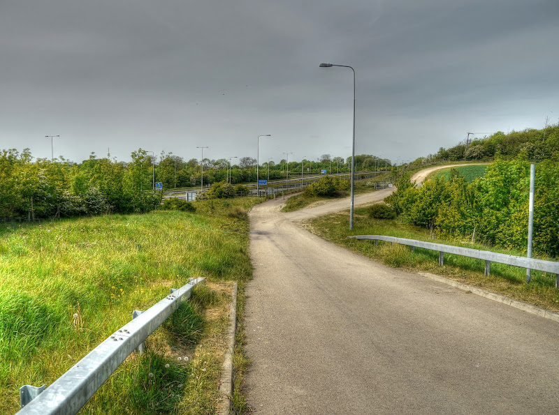
After a short distance you come out onto the A15 a busy road leading off the Norman Cross Roundabout to Peterborough on. The Sustrans map shows an “almost route” from Stilton to the Norman Cross Roundabout but it stops just before the roundabout? The route I took emerges just by a Bus Stop with a sign indicating that you should cross the road (to follow the route). I can’t remember quite what time I arrived there, mid to late morning I think, however I got off and crossed by foot and it wasn’t easy, that is a fast road.
After crossing the road this is the sign indicating where to go next. You can see from the sign that Peterborough is to the left (and the way I’d come from to the right) and the route was signed as NCN12. Well I tried to go through that gate you can see by the red pole, but it was locked and Sustrans routes don’t normally require you to climb over locked gates. (I know, there is the footbridge along Lodes Way which is almost as bad.)
As you can see I parked my bike to try and work out what was going on. In the end I resorted to the map, I had to go back down towards the roundabout. I think that Peterborough sign could have been better angled to actually point in the correct direction. If you follow that last link you will see a column with an Eagle on top. It was unveiled by the Duke of Wellington on April 2005. Norman Cross was the site of a prisoner of war camp built in 1979 by the Admiralty to house prisoners from the Napoleonic Wars and could take 7,000 prisoners (with 500 guards).
The Eagle monument was erected in 1914 to commemorate the 1,770 prisoners who died in the camp and then in 1990 the column was demolished and the Eagle stolen. This is the second Eagle and was provided by an appeal in 2005. There is an organisation: Friends of Norman Cross set up in 2008 who seem to involve themselves with the “upkeep”. Here is the Friends Timeline page, there was a Time Team dig in 2009.
Back to the cycle ride - it turned out that I had to head for New Road a frontage road running parallel to the A1(M) with access to an Hotel and actually the route of the old Roman Road. The Hotel (Premier Inn) could be a useful place to stay when doing credit card cycle-touring in the area. There is an incomplete loop of Sustrans routes from Peterborough to Oakham (NCN63) down to Northampton (NCN64 and NCN6), and Milton Keynes (NCN6) and Bedford (NCN51) and then to Brampton and back that looks interesting.

The frontage road eventually headed under the A1(M) to Haddon. As it happens the bit from Haddon was part of NCN53 - Corby to Peterborough. The last time I had cycled this way to Peterborough I had gotten lost and ended up cycling into Peterborough on NCN53 from Haddon rather than the bit I had just come along.
At this point there was a choice, I could carry on along NCN12 to Peterborough (2 miles) although where it meets NCN53 it seems to acquire the numbers NCN53 and NCN21 on the OSM cycle map. The alternative was to follow the Green Wheel along NCN12 and NCN21 (6 miles to the city centre). This was the route I had planned to take. It avoided cycling through the centre of Peterborough. Much as I like cycling along Sustrans routes some of the urban ones can be a little challenging to follow and not that picturesque.

The route followed a bridleway which was not the flattest of surfaces, but was not that bad on my Marin – what it did do though was open out in glorious countryside. That is just so much nicer than cycling along country lanes I think.

As I cycled along there was almost a feel of the Serengeti – apart from the lack of mountains (in the picture in the link) this one could be almost identical! (well alright not quite.) Yaxley is not that far way and yet you wouldn’t know it.

After a while the green fields gave way to endless yellow fields stretching off into the horizon, with the odd tree along the track. There was quite a pungent smell in the air from the oilseed rape which I don’t mind but some people believe that it causes runny eyes and a wheezy chest.

This is that last tree at a higher zoom level. I like to think that it has been there as a marker along the path, until it grew large enough that passing carts hard to give it more space which led to the path having to jog around it.

It turns out that I was skirting a significant private development owned by O+H Group London. It is 2,500 acres of brownfield land being developed on the South side of Peterborough. Apparently they will leave 50% of it as open space and plan to build over 7,000 homes and provide over 12,000 jobs. There are even self-build plots available. It also has its own website yourhampton.net
There have been paths added that don’t appear on the Sustrans Map and I came to a “T-junction” (near Madam White’s Covert). A quick look at the map and I realised I needed to head right. (Left was into the centre). There was a convenient Information Board nearby with the Green Wheel Map on it and a “Your are here” red arrow, but it didn’t show the new track so there is still development taking place.

The route skirts a large lake where I passed several other cyclists, although they had MTBs, did they know something I didn’t? It then crossed the London Road (the A15 between Norman Cross and Peterborough). Whilst looking at the map there is a Pickpocket Bridge near by, just after crossing the road. The track never gets too bad, although it is more rough and ready than super-smooth surface. There are quite a few pits when seen from the Google Satellite map.
The route crosses over the East Coast Main Railway Line on Haddons Footbridge, seen here. It would seem to be a spot for train spotters to view various types of rail traffic, check the link for some views of trains from the bridge. You then enter Crown Lakes Country Parks (although the link on that page leads to an “Account suspended” message).
Two large brick-pits were flooded and then the area was transformed with the planting of over 75,000 indigenous trees and shrubs – it spans over 87 acres. It would seem to be a popular place for taking dogs (as well as cyclists).

The route then passes through Farcet, briefly joining the road before heading once more onto off-road tracks. It runs for a way after Farcet alongside the River Nene (old course). Which you can see here. the wind-turbines in the distance are part of the McCain’s largest UK Chip Factory and are designed to help cut their electricity bills by up to 60%. There are three 80m wind turbines and can produce up to 3 mega watts of power each. By comparison the King’s Lynn Power Station, a Combined Cycle Gas power station can produce up to 325MW - I have taken picture of it on cycle rides along NCN11.

The route does at one point head back towards Peterborough towards Stanground alongside the King’s Dike where you reach this signpost and head once again to the East, phew. The sign indicates that Whittlesey is 4 miles away and the City Centre 1.5miles in the other direction. I can’t quite make out what the writing on the sign says next to the directions. Something along the lines of “This is one of 1000 Mileposts funded by the Royal Bank of Scotland to mark the Millennium and the creation of the National Cycle Network”. I cheated I could read some of it and did a Google search for the rest.
The route joins up with NCN63 just after it crosses the Shanks Millennium Bridge. To be honest I can’t have been paying it much attention because I did not notice it. (Note the route I was on did not cross the bridge, although I have crossed it before. Here is the picture I took that time around (you can click it, or right click it, get a larger version):


The route skirts around Hanson Kings Dyke Brick Words on an off-road track until you get into Whittlesey. I say track actually some of it has a good surface. In fact as I cycled along here there was a van coming in the other direction. I prepared for my best Paddington Bear hard-stare to indicate my extreme displeasure. When as I got closer I realised it was a Police Van and the driver pulled right across to let me by. Thank you that driver. Not all police drivers are that considerate of cyclists I feel. I have had one or two give me very little room on country lanes when passing me.
I guess they need to Police all areas, perhaps they ought to use MTBs though. If I was trying to evade the Police chasing me in a van I would just head off down one of the side tracks that they couldn’t follow me on.

As you can see this Information Board which is a little further along the path has been vandalised and I also saw others that had been ripped out of the ground. You can see that there is a “You are here” red arrow – the rest of it seems to be an advert for the Environmental Agency. Actually looking at the l”You are here” it seems that I had yet to reach Shanks Millennium Bridge at this point – oh well, that’s what comes of having to re-write the Post after Blogspot lost it.

Whittlesey looks a nice place and I think I stopped to get a drink (two bottles, one isotonic and one fizzy) on my way through. As usual I drank the isotonic one on the spot. It was actually quite a warm day and I tried to pay attention to my levels of hydration.
One of the good things about this part of the world (the Flatlands) is there aren’t too many hills. In addition the route seems to be never too far from a railway station. On these longer cycle rides I do carry tools with me, but my fall-back in these situations would be to catch the train. In this case it is the Peterborough to Ely line (Great eastern Line as was)
Strangely the railway station is called Whittlesea an alternate spelling. Indeed they also have the Whittlesea Straw Bear Festival – I wonder if Paddington Bear goes to it? The next one is the 13th to the 15th of January, 2012. The population is around 15,000. Apparently the name derives from the Whittle’s Ea which means Whittle’s Island. The town was on a high patch of land surrounded by marshy fens before the drainage.
Once out of the town the route goes off-road again (first along a byway called New Road – a track!), then along a bridleway running for a short distance alongside the aforementioned railway line to Ely.

You then reach a decision point there is a fine-weather route and a wet-weather route. No surprises the wet-weather route follows the road and the fine-weather route heads out along another byway. This is that byway, it heads toward Coates and at one end of the byway it seems to be called Lake Drove. The last time I cycled along this track I broke a spoke and for part of the journey into March wondered why there seemed to be a wiggle as I cycled. When I realised I stopped and decided I couldn’t do much about it as I did not have any spokes with me and in any case I am absolutely rubbish at trueing wheels. That time around I did think I might have to let the train take the strain, but it did not deteriorate any further and the next day I took it into Ben Hayward Cycles who replaced the spoke and got the wheel true again.
This time I didn’t have any spoke problems although I did encounter a motorcyclist coming the other way – he gave me room, but threw up a fair bit of dust. The track was not too badly rutted, it had a fair number of dips and bumps though.

Near to Coates you turn right then a short way after left along Cross Drove. Actually in both cases you turn onto Cross Drove. Both tracks, that cross each other at ninety degrees, seem to be called Cross Drove. It was certainly true that they were in the shape of a cross. The OSM Cycle map does not hint at this currently though. These tracks do appear on the Google map though – well three legs of them cross anyway. – This is the north-south Cross Drove. You turn left along a similar track once you reach the buildings (a piggery?) on the right.
The second Cross Drove has a slightly less pleasant cycling surface and when I reached the end of Cross Drove to cycle along the March Road I met a couple of lads mending a puncture.
They had taken the train down from Durham to Peterborough and wanted to cycle around the Coast over the weekend. Their plan was to stay in Wells next the Sea overnight (on NCN63 and NCN1) and then cycle down RR30 to Lowestoft or perhaps Felixstowe, I am not quite sure. It turns out that this was their second puncture of the morning so after checking they didn’t need any assistance I wished them good luck and carried on
.

On the March road the route followed a saw-tooth pattern after first crossing Twenty Foot River using Beggar’s Bridge which crossed the river diagonally. The wind was blowing up but was not too bad, certainly not as bad as I had feared. I stopped at Duncombe’s Corner (the top of the saw tooth in the middle) to have a drink and a jelly baby or two and to take some pictures. This is the view looking back down the road the way I had just come.
I decided that I would stop and have a longer rest and some food when I reached March on some convenient bench in a park or suchlike. There is something psychologically satisfying about reaching a target at a place as opposed to just stopping through exhaustion. I also decided to have a look at the map to perhaps plan a shorter route. The NCN63 route to Wisbech requires you to go North again, whilst Cambridge is in the South.
Whilst having a drink I did find that one of the bottle lids had come a little loose and so I sprayed myself with lemon squash. When I put the bottle back into its cage I also discovered that the bottle cage was loose. In fact both bottle cages had loose screws. So I used my multi-tool to tighten them up and then checked a few other bolts around the bike.

I then had to cross the railway line three times, two at oblique angles, taking care not to get a wheel jammed. There was nothing coming though so I allowed myself to drift over the road. I then reached a painted END at the side of the road. How peculiar I thought why end the route here? Was it some quirk of the funding that it could only contribute to a certain distance from Peterborough.
Strangely there were also two cycle racks, I twigged that I had arrived at the Greenwich Meridian. Here it is.

For the next exciting episode see Part 4… which has already been written but only once. (I did use my browsing history for the day to make finding the links a lot easier though.)
The cycle route around Peterborough is one of it's largest appeals. Love the photography of the route though. It's not one I've managed to take since I don't get a great deal of time for cycling these days.
ReplyDelete