
Today I was meeting someone over in Moulton (Suffolk) in the middle of the day. So it was a good excuse to take a roundabout route even though the Sustrans 51 route passing from Cambridge to Ipswich also passes through Moulton and is quite pleasant. A look at the map to see what interesting ways there were showed some by-ways near Red Lodge. One route headed South-East where it passed under the A14. Whilst another route headed East to Herringswell before dropping South to the A14 to the same point as the other by-way. There is always a risk that by-ways can become virtually uncycle-able which can throw timing to the wind - so I decided to set out and keep an eye on the time and make a decision closer to Moulton.
In fact I had intended to leave the house earlier and head up to Prickwillow, home of the Prickwillow Engine Museum to the East of Ely and then cycle down alongside the River Lark to West Row - but I things to get done and left later than hoped. It seemed colder so I wore socks under my sandals and a fleece and vest - in the event the weather was very pleasant for cycling - warm enough and with some occasional bursts of warm sunshine. As I was running late I picked up a bag of jelly babies for a lunchtime snack along with a couple of bottles of orange squash, with no ice. Adding ice would have delayed my start even more.
In the end I took the slightly shorter route and ignored Herringswell - no matter somewhere to visit the next time I visit the area. The route I did take is shown below on the OSM Cycle map. On the way back I followed Sustrans 51 to Reach and then detoured up Reach Lode to check out the Lodes Way Bridge being built there.
Also I apologise to those of you looking at my Blog on a low-bandwidth connection. I use quite high-resolution pictures, so that you can right click on them and see in a new window at a large magnification. I had not realised how this might slow the download - I have a high bandwidth connection and had not really thought about it. (Apart from the time I was travelling in Cambodia and found it was taking so long to download my posts that I reduced the resolution!) I will look at whether I can use two different resolutions - although as I use an off-line Blog Editor it might be tricky.

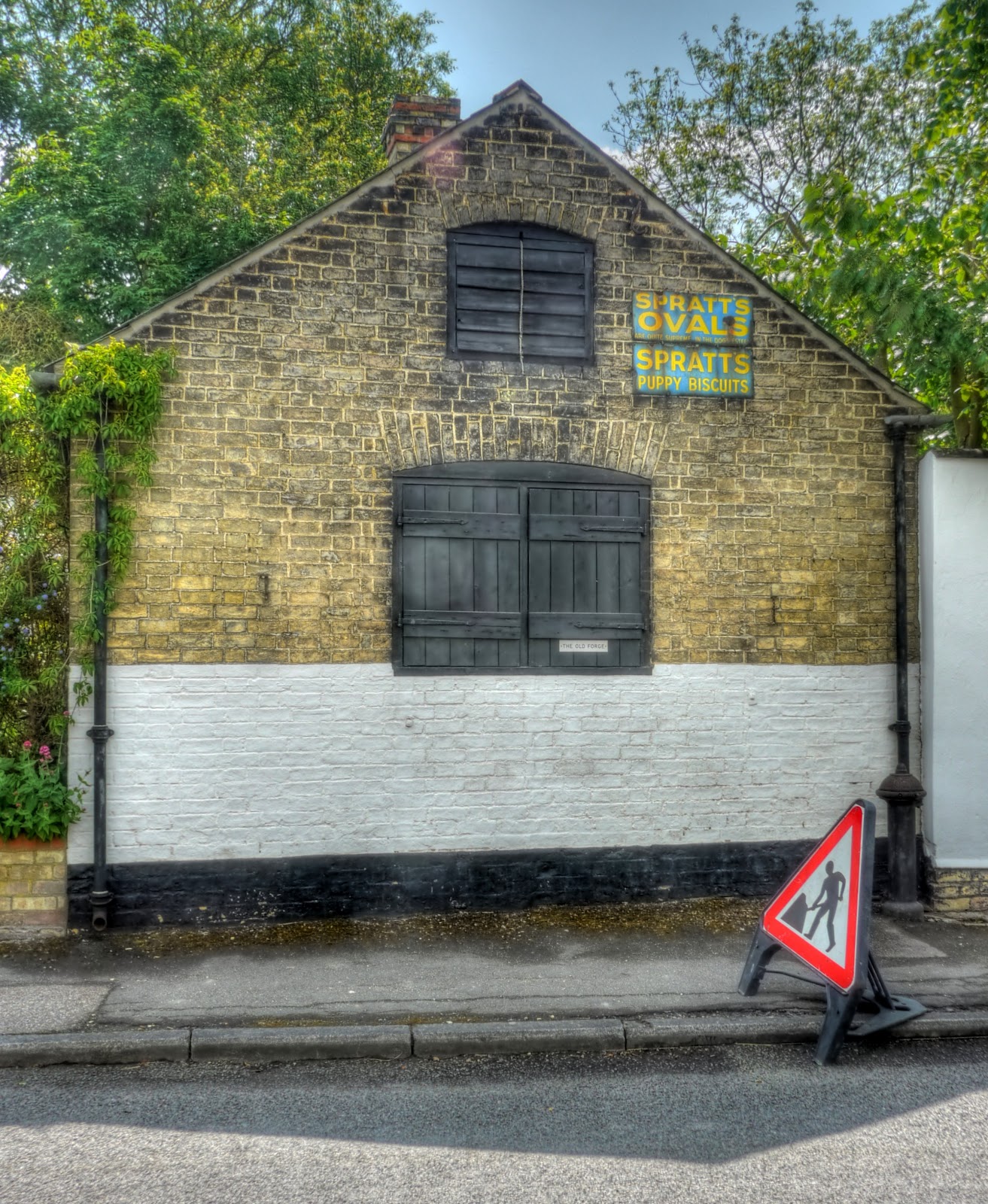
I had not planned on stopping and taking too many pictures early on, since I have already taken many pictures of the area and was running out of time. However this old advertising sign on The Old Forge caught my eye - and I had only gotten to Swaffham Prior.
Reach passed by without stopping, but there are several Sustrans routes (11 and 51) through Burwell, on the direct route from Reach to the Exning leg there is a piece of Urban decay in a Rural setting. I have often thought about stopping to take a picture - the clouds behind seemed like a dramatic backdrop for the crumbling factory.

At the junction on the Swaffham Road, before a dog- leg onto the Heath Road I noticed this plaque. This was the entrance to the Burwell Railway Station on the Cambridge to Mildenhall line (1848 - 1932). It is all that is left - there is little evidence of the line around this area.

I managed to hold back on taking pictures until I was in Snailwell. On the Snailwell Short Road into Snailwell I found the road closed after passing Plantation Stud Cottages. Road closures are a hassle in a motor vehicle - they can be terrible for a cyclist. There was no indication of why or what a diversionary route might entail so I carried on. Nine times out of ten it is usually ok to pass with a bicycle. In this case BT were doing some work in the road with trees and telegraph poles. I asked and they said yes, a bt of courtesy goes a long way - so I snaked past the various vehicles and was in Snailwell. I stopped to take some pictures of the fields, trees and clouds - you can't tell from the map - but it looks like there are a lot of trees around here. This picture was taken on Short Road (it lost the Snailwell when it reached the village) next to Snailwell Stud (perhaps that is where the name ended up!)

The trees look like a serrated edge, seen looking back down the road.

Alongside Snailwell Stud there is a footpath and a rather nice brick wall. The footpath comes out near the Church (on Church Lane).

Heading out of Snailwell, on the same road the picturesque views of the country continue - if you look hard enough you can see the field in the background in the middle of the picture being irrigated. One of many fields I passed out cycling - although we had rain overnight farmers can't really afford to take chances with the weather when operating on tight margins.

The road itself was very straight with an interesting by-way heading off back over to Newmarket to the right. The by-way seems to have its own bridges over the A14 and Cambridge/Ipswich Railway Line. As I was now heading to Chippenham the road was now called the Chippenham Road - you can see why they number roads in the UK - it is much less confusing. Although the road was straight it was not very busy and cars did give me space when they overtook. The road then junks around Chippenham Park before arriving at the village of Chippenham.

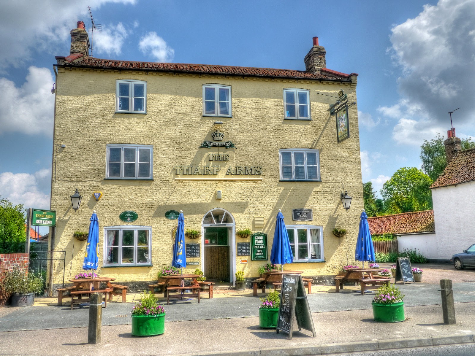
One of the first sights as I entered the village - it looks to be a nice pub - the Tharp Arms, an interesting name. Apparently the name comes from the Tharp Family who still live at Chippenham park - the name on the pub is relatively new until the late Nineteenth Century it was called the Hope Inn. What I missed in this picture is the strange roof-line - follow the (pub) link to see a different picture of the pub and find out who is pertinacious! (A free copy of my book to the first commenter to get the right answer, when I write the book.)
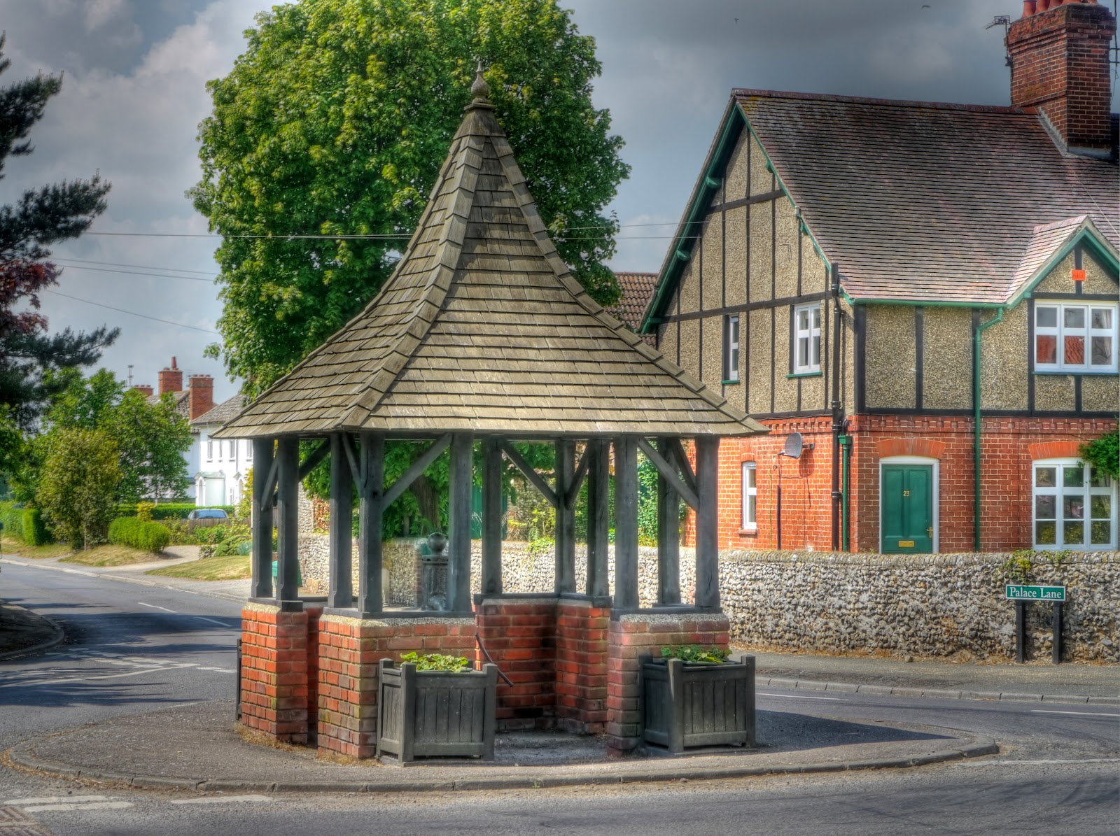
Opposite the pub
I then headed of up the Badlingham Road to Badlingham Manor stopping briefly to take this picture of the River Kennet on its way to Moulton. Just after passing the river there was a Bridle-way to Red Lodge - but I wanted to keep moving and had already decided upon the route. Checking the map afterwards I should have taken it not the the road parallel to it was bad - but the bridle-way would have been better.

Red Lodge is an interesting place. It used to be on the main road from Cambridge to Norwich and looked rather like a glorified "truck stop". Oh yes - they also have a Karting Centre and Off-Roading centre called Wildtracks - both great fun. A dual-carriageway bypassed the town - but only just and I think it rather hit the place economically. However since then there appears to have been a huge amount of new housing built and the place is getting bigger by the day. There is also a Pub called the Red Lodge - painted red as you might expect. (Note the link did not when when I wrote this - you can view the cached and not very informative version - perhaps it will be back later.) the by-way I took is a turning to the right just past the pub. The by-way sign is not very visible, in fact I did not see it when cycling, I only noticed on the Google Streetview of Turnpike Road - the road looks more like a turn off onto an industrial site. As I passed there were various vehicles flattening the "road".

After passing a car scrap yard the path then passes through some woodland before briefly before passing along a road and then back onto the track. The route is pretty straight. It is marked on the OS maps - just not yet on the OSM maps. (The recent edition of the Cambridge Cycling Campaign Newsletter has some information on the cyclestreet Mapping project which uses the OSM map.
I like the idea of pigs being allowed to live in the open (or rather I dislike the idea of factory farming) - where I grew up it was mainly cattle farming (with some sheep) so living here in East Anglia I like to see the pigs out in the fields - sunbathing!

This route then went past Kentford Heath, which in June 1647 was the HQ for the Parliamentary Army during the Civil War. The countryside is typical of this area - known as Breckland with sandy and flinty tracks, stunted pine trees and yellow gorse bushes. Once again the track was perfectly OK on my Hybrid although I had to take a little more care not to get caught in a sand trap - but these tracks were not as bad as some in Thetford Forest (also part of Breckland).

The track then met a road just by the A14. Apparently the Yards used to house old aeroplane scrap. I also passed a Policeman giving his dog a bit of exercise in the field next the the A14. After that I climbed up - well climbed for the Flatlands up to around 90m - fortunately I did not suffer from altitude sickness. The jelly babies probably helped - when I was in Peru we were told to drink the local Inca Cola as the sugar helps to combat the altitude sickness - mind you 5000m is a little higher than 90m.
The views were good though - when everything else is less than 90m you can see for some distance. This is a picture looking North.

This tree standing along between two fields stood out - you can also see that the land is more rolling out towards the South East, which is where this picture looks towards. The previous picture shows how flat the Fens are.

This cottage is on the outskirts of Gazeley, just by a Windmill - although I did not actually see the mill - The cottage is called Gazeley Mill Cottage - another picture that I will have to remember to re-take as some stage.

After the heights of Gazeley my route joined up with Sustrans 51 (heading back to Cambridge). At Moulton (the village after Gazeley) the road drops steeply down a small country lane, where some care is needed the drop is around 50m and you arrive at the Packhorse Bridge in Moulton. As you can see in the picture the locals need 4x4s to drive up and down such steep hills. Although the road drops it is into a valley and you then have to climb again before another down hill to Newmarket.
I then learnt a lot about the various interesting places to cycle, on and off-road in the Cambridgeshire area - so there are still plenty of places to explore.

There are some large studs with some fine houses all around the Newmarket area - this is Warren Hill House - which as the name suggests as back up a hill almost as high as the hill the other side of Moulton at 88m.

The route then drops down into Newmarket past various gallops where the racehorses are exercised in the mornings.

Instead of taking Sustrans 51 back I headed through Exning onto a No Through Road call North Road which led to a byway known as Haycroft Lane - shown here in this picture. The gap between the hedges is quite wide - but the path is pretty much a single track so I assume that it is not used by farm traffic. After crossing the Ness Road the track is called Howlem Balk and after a left turn onto North Street meets up with Sustrans 11 and then Sustrans 51.

At Reach, as it was such a pleasant day I took to the tracks rather than the roads and surprised a deer which hopped over the fence, it ran a short distance and then turned and stared at me for a while - I turned to make sure I was not cycling into a rut and when I looked back it had vanished.

The other surprise was that there was a crane being erected on the Reach Lode Bridge site. Quite a few trucks had brought in the bits and a bunch of people were busy sorting it out and putting it together.

Although they had added to hardcore to the side of Headlake Drove there were also dips in the road that had temporarily been filled with sand. These work with large lorry tyres - but a thin bicycle tyre tends to dig in and throw the cyclist off - so I had to avoid them.

Further along on on the same road, but a part used regularly by the traffic between Upware and Swaffham Prior, they had packed the edge of the road with sand and put down plastic mats to help widen the road for the crane carrying lorries. The van here in the picture is one of the construction vans it shows how wide the lorries must have been.

I must say I am impressed with how BAM Nuttall seem to be getting on with this build. I wonder when they will swing the bridge into place - presumably next week.
some very fine photographs here.
ReplyDeleteThank you.
DeleteJamie