
After what seems like ages of either not having the time or the inclination today (Wednesday) I felt I had to get out on my bike and "explore". Not that I was planning a cycle trip to the Amazon or having a crack at beating the round the world cycle record. No, although it can mean cycling in some interesting parts of the world I only had a few hours to spare and so it meant having a look at the Cambridgeshire map. I generally use three - where's the path, the OSM Cyclemap and Streetmap, they all have their strengths and weaknesses and using the combination I plan where to cycle. I try to find routes that incorporate byways and bridleways and country lanes in a loop. Generally byways are easier to cycle along than bridleways. Bridleways allow passage on foot, by horse, leading a horse and by bicycle - although there is no requirement to facilitate cycling and they can be a bit of a challenge sometimes. Mind you not all Byways, which are the next level up in terms of quality are that much easier to cycle along. The Wikipedia link provides some insight into the way the law has tried to reconcile the situation - the rights do not always equate to what you see on the ground though. The "cycle-ability" varies greatly with the time of year and the recent weather as well though.
One of the challenges is finding a route that looks interesting, reasonably long and one I have not cycled along before. One good thing about the Cambridge Guided Busway (CGB) is that it provides a fast traffic-free route out of Cambridge. For me the CGB benefits from being reasonably straight, especially compared with other cycle routes. You only have to look at the map below to see that the CGB route cuts out a lot of the wiggles compared with the Sustrans 51 route below it. What's more the route does not have too many junctions. It is consistent, generally of the same width and surface quality without too many potholes. It is also sufficiently wide for cyclists to be able to pass each other without slowing down and also to pass other pass users, safely without slowing down. All in all it allows a cyclist to settle into a rhythm, in fact non-cyclists just don't realise important a good rhythm is to a fast efficient journey by bike. Stop-start cycling is incredibly energy-sapping - which I think is the reason that so many cyclists are prepared to take the risk of red-light jumping.
According to the weather forecast showers were predicted, but the East would have fewest - as it was quite warm I just wore shorts and t-shirt and sandals. I did put a thin rain-jacket in my bag - to provide a bit of warmth if it did rain too much. I did not bother with sunglasses either. I did take some bottles of lemon squash to drink - but did not bother with ice - it was humid but over-cast. the route I picked was this one. I used the CGB to get out of Cambridge, but turning off before reaching the tricky and dangerous bits of the cycle path where it flooded earlier in the year.It was a good call - I made good progress despite the slow light-controlled crossings.
It would be interesting to know what priority the traffic lights controlling the road crossings have. Those using the path have to push a button to get the lights to react - at the moment anyway. Actually I must pay more attention, they do seem to have sensors on top of the crossings lights/poles which presumably could detect pedestrians and cyclists and switch the lights automatically.There are some crossings in Cambridge which seems to take for ever to react. (The lights where Sustrans 51 crosses the Horningsea Road is one such slow to react crossing.)
The route then crossed the A14 at Fenstanton and I was able to find mainly off-road tracks for the majority of the route until getting back into Cambridge. Next time I head out that way I will take an off-road route from Hilton to Cambourne via Elsworth. It took a little while choosing the route as I did want to cycle the bridleways between Conington and Lolworth but the Bar Hill/A14/M11 area is not so easy to navigate on a bike. However another possibility looks to be a path between Lolworth and Bar Hill and then to Dry Drayton for another time.

Since I have taken quite a few photographs along the route of the CGB I did not plan on taking too many before reaching the turn-off to Fenstanton. I did stop to have a look at the footpath connecting Swavesey and Over though. Unlike the bridleway from Over to the CGB this footpath has been provided with a proper crossing and a decent bridge over the stream. It is only a footpath though. This picture looks back from the bridge to the CGB - there is plenty of signage I guess that the existence of the right of way across the CGB is what made the difference?
At this point I also realised that I had not started my GPS recording - my Speedometer was working though - the advantage of a belts and braces approach.

The view on the other side of the wooden bridge, it crosses two streams and is quite a construction. The footpath heads North up to Over past what appears to be an Orchard. It is a pity this could not have been upgraded to a bridleway.

One of the streams crossed by the bridge, the CGB is to the right you can see the Communications Tower and Windmill which are either side of the CGB.

It might just be that I wasn't very observant before but it seems as if the contractors have been getting their paint pots out. (Although it might be tape.). There are minimalist stripes around the metal guide-in tracks to ensure that the buses engage properly with the concrete tracks. There are similar minimalist strips on the vehicle barriers across the cycle path. Interesting, we have a Council promoting the use of cycle helmets for safety reasons, but does not see any contradiction in sticking poles across a cycle path with a single visibility stripe.

I did not notice the tree on the "Beleaguered busway" either. In fact I slightly over-shot the turn-off - I was enjoying the pace and simplicity of the track. The clue was that the CGB cycle-path started getting very bumpy and, in my view, more than a bit tricky. I turned off onto the Holywell Ferry Road and briefly re-joined Sustrans 51 in Fen Drayton before turning off on the outskirts of Fenstanton and crossing the A14. At this point my bike started feeling a bit wobbly - as if the rear wheel had a puncture. In fact I was so pre-occupied with the bike problems I also overshot the left turn towards Conington. What stopped me from heading off in the wrong direction was a puncture. The tyres take a bit of punishment from the routes I take. The paths have quite a bit of sharp flint on them and unfortunately it seems that a previous cut had allowed another bit of flint to get stuck into the tyre and cause a slow puncture. I did think that I might just keep pumping up the tyre but the leak started getting faster. So I stopped and took the wheel off and pulled out the inner tube - the puncture was easy to find - it was quite close to a previous patch. I glued another patch on and then scrutinised the tyre digging out any bits of flint stuck in the tyre. I then matched up the most likely tyre-hole with the puncture in the inner tube. There is nothing more annoying than fixing a puncture only to find that the actually reason for the puncture has not been removed. (Actually there are loads of mor e annoying things - but you know what I mean.)
The pump I carry is also pretty small and it takes quite a while to pump the wheel back up to the right pressure. You can just about make out the pump near the wheel in the picture. The yellow and blue box contains a spare inner tube - just in case the damage to the inner tube in the wheel was irreparable. Taking the wheel out was easy - putting it back in pumped up was more difficult and I had to release the brake blocks. It took ages to re-connect them. (They are V-brakes and you can pull the cable out of one side so they open up.)

Once I had fixed the puncture I checked the map and it was then that I realised that I had overshot the turn to Conington. So I set off the right way this time, with a bit of trepidation. There is always a moment of concern that the puncture might not have been fixed or that there might be other punctures.
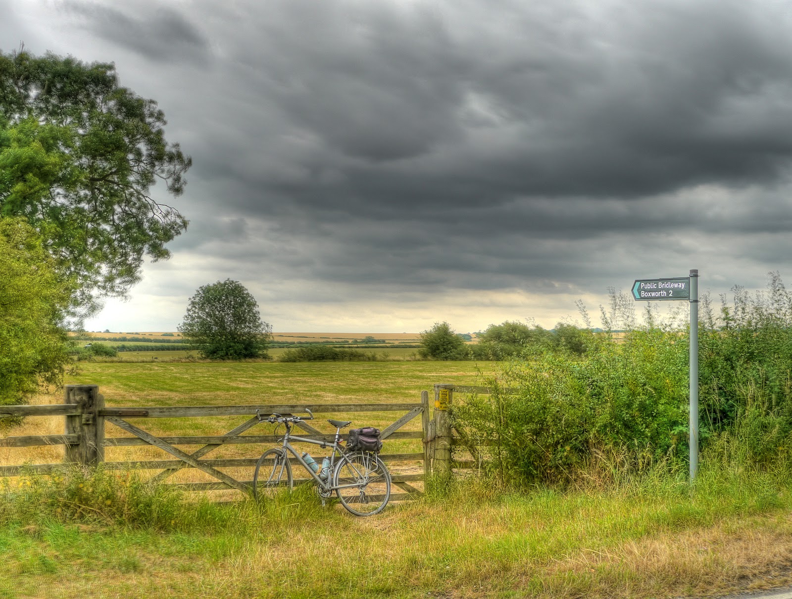
The Bridleway was well signposted - through a gate, in fact the sign looked new. The path pointed off along the side of a field, it was pretty reasonable, bumpy but tolerable. In fact the only tricky thing was it was so dry that there were lengthwise cracks in the track that looked as if they could "swallow" a wheel. At this point I could also hear the ominous rumblings of Thunder off in the distance and dark clouds ahead of me.
As I followed the bridleway I could hear bangs coming from the next field - almost like shotguns being fired. I have occasionally come across shoots - it is slightly disconcerting to see a line of men (well they looked like men) advancing across a field with shotguns. In this case it turned out to be a man putting in a fence alongside the hedge. He was using a thumper to bank the fence posts in and a staple gun to fix the barbed wire to the posts. I assume that they are going to use the field for livestock. when I detoured past him it suddenly became much bumpier - the bridleway really was slightly flatter than the rest of the field.
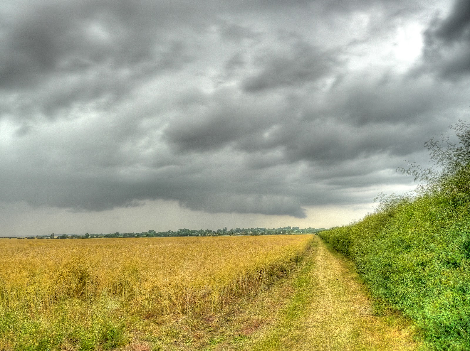
At this point the clouds seemed to be getting closer and I could feel spots of rain - there was time for a quick photograph of the path before I put the rain-jacket on my camera case. I did think about putting my rain-jacket on - but I was warm enough. Sometimes it is better to get wet my Lycra shorts and cycling t-shirt dry pretty quickly. (Which is why cycling gear works for me - comfortable and practical.)
It was a pleasant and open ride across the fields through to Boxworth - you just have to ignroe the rain. The A14 was at a slightly lower elevation, I was at around 40m, 20m or so higher than the A14 and I could see the vehicles passing by in the distance. The worry I did have was weather, what should I do about the thunder and lightening which was now getting very close and there was I at the top of a hill. Is it safer on the bike, which has rubber tyres or am I slightly elevated and therefore more likely to get struck by lightening as the "high point". On many of the road routes I take there are places to shelter (bus shelters, phone boxes) but you don't get phone boxes in the middle of fields. I did wonder whether my phone would still work if I got hit by lightening and was still conscious but I figured there was not much I could do so I carried on getting wetter. No point in worrying about something beyond my control. Cycling into Boxworth I passed a farm with lots old farm equipment lining the track. If it had not been raining I would have had to stop and take some photographs. Cycling out of Boxworth I passed Manor House Farm - with some rather nice buildings, grounds and ponds, again I would have taken picture - but the rain.
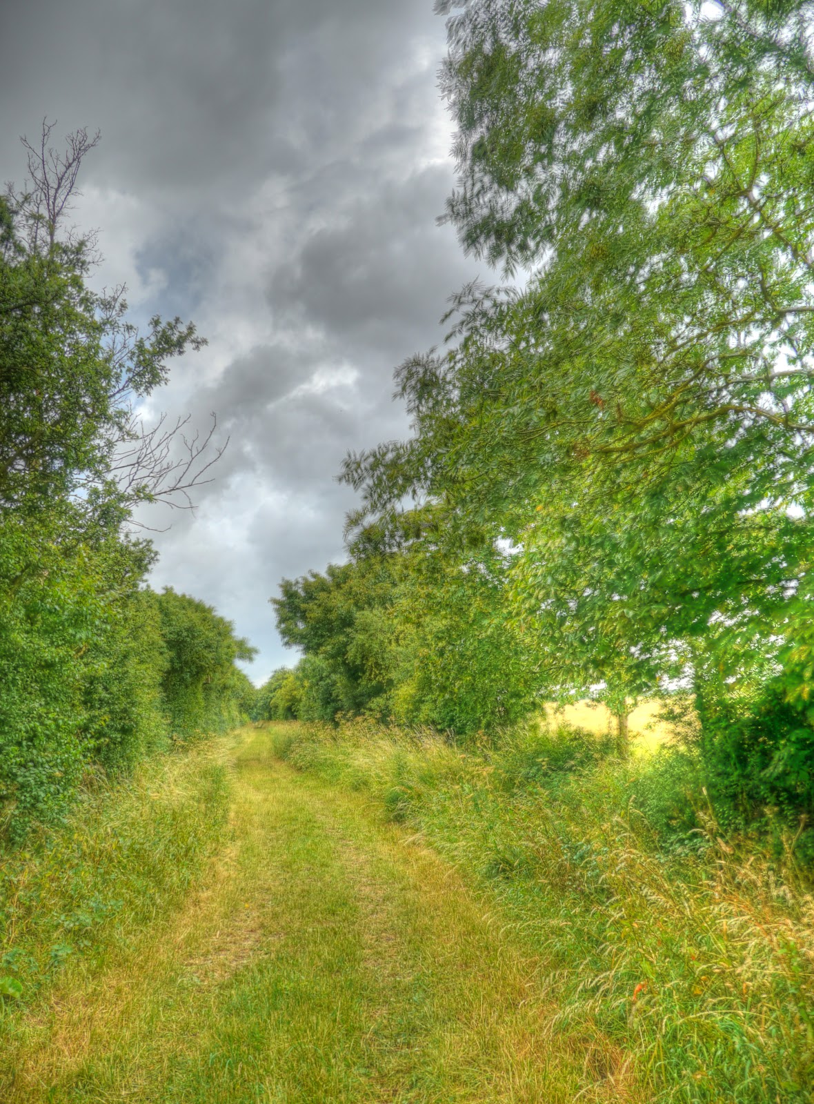
Although the route was a bridleway it was pretty good on a bike. Once I reached Lolworth I turned right and headed upwards to a byway to Childerley. Actually the first half of the route is a byway and the second half a bridleway. Fortunately it stopped raining and I had not been zapped by lightening so I took a few more pictures. This is the byway out of Lolworth (heading South). This is basically a green road - not super smooth but a lovely route to be cycling along.

The byway reached a "crossroads" where a foot path crossed this track and this track became a bridleway. My bike is parked on the sign.

Mind you at this point the path looked pretty much the same - I did find that where the path was previously hard, dry mud there was now a slightly damp sticky muddy coating which started sticking to the wheels.
The dark clouds were still in evidence - although at this point they were behind me so I pushed on. The route then passed through a field. There were some signs "warning" about the cows in the field - although when I cycled through they were on the other side of the filed and paid no attention to me. The signs were more about keeping dogs on leads really. The path then went through Childerley past Childerley Hall. I've been this way before so with the rain in the air I did not hang about to take pictures. The roads through Childerley looked as if they had been recently re-surfaced. My route then headed off along a farm track (bridleway) up a "hill". This track was a mud track - and this time around a sticky damp mud track. As I cycled along the tyres picked up more and more mud - in the end I cycled along the grassy bit in the middle every now and then to try and clear the mud. As I cycled past Bird's Pastures Farm a Landrover came up behind me so I moved off the track and got a friendly thumbs up from the farmer. Clearly this chap has no issue with passing cyclists. There are some bridlepaths up to Knapwell that I passed that I want to explore another time.

After passing the farm the route became a byway again - and passed through a thin strip of woodland where I managed to avoid getting stingled before coming out near a bridge across the A428 leading to Bourn. I then carried on into Bourn before coming up to a sign conveniently pointing the way to the bridleway through to Coton (with a few wiggles on the way.) I did manage to get a fly in my eye just after the bridge but managed to scrape it out before reaching the new path. That's what you get for not wearing sunglasses.
On the way through to Caldecote I passed a gentleman sitting in the grass having a smoke - he did not acknowledge my "afternoon" though. The clouds were now looking dramatic rather than solid grey and I seemed to have dried off after the second soaking.
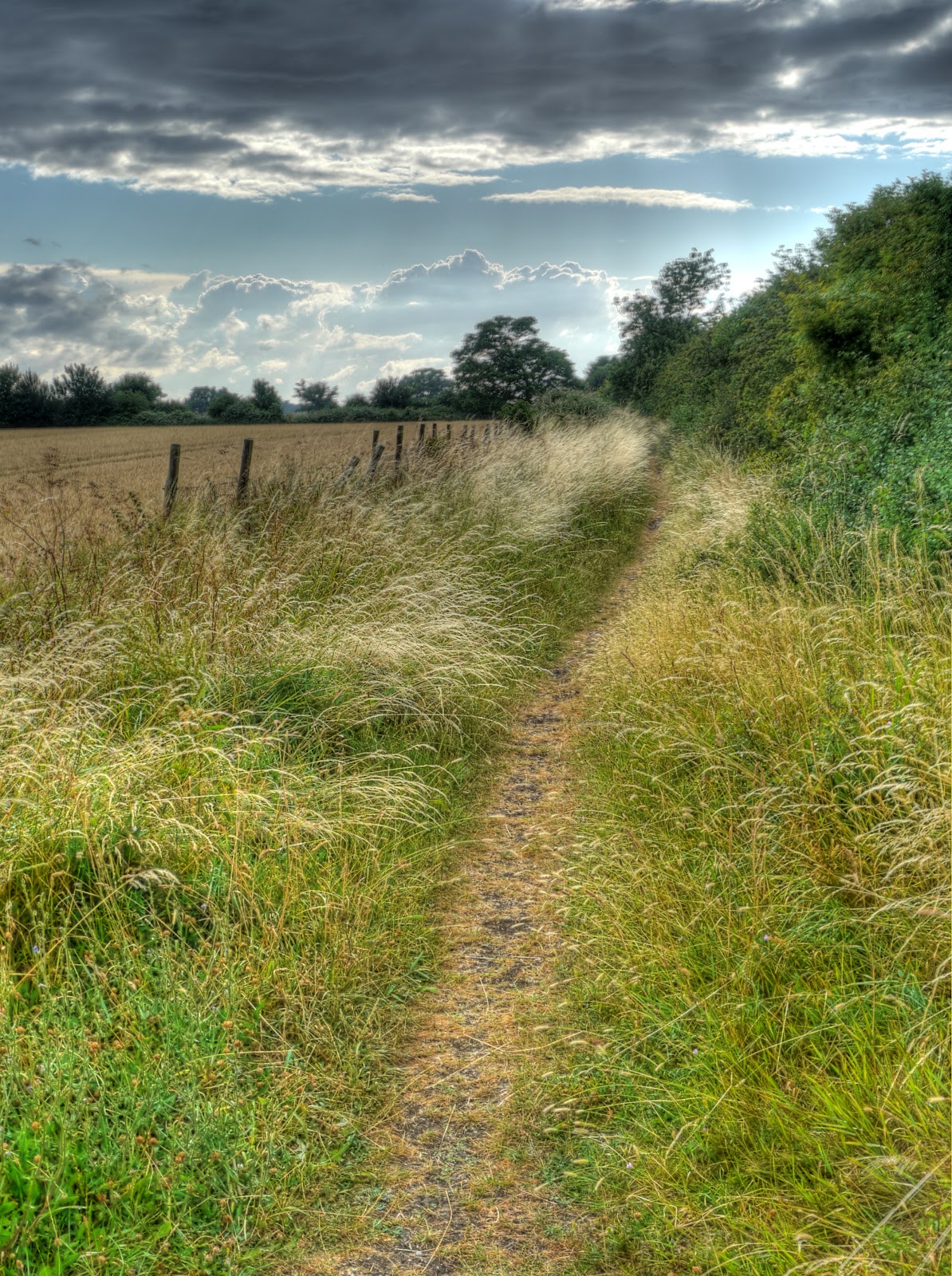
The same view but at a wider angle - not a bad path to cycle along - you had to watch out for the occasional rabbit hole though.

The same point but instead of looking back this was looking forward to Caldecote.

After Caldecote the path narrowed considerably, to the point where I could not see the ground-surface. This track in the picture is where it widened out. I spent my time hauling on the handlebars as the front got bounced around trying to avoid cycling into the bushes . I also had to avoid overhanging brambles and I got stingled a few times by the vegetation encroaching the path. Although I had dried out after the rain I now got soaked by all the wet branches and leaves around me. This bit of the journey turned out to be the hardest part of the route. I should have relaxed my grip on the steering really - I felt a few aches in my shoulders when I got home from fighting the bars.
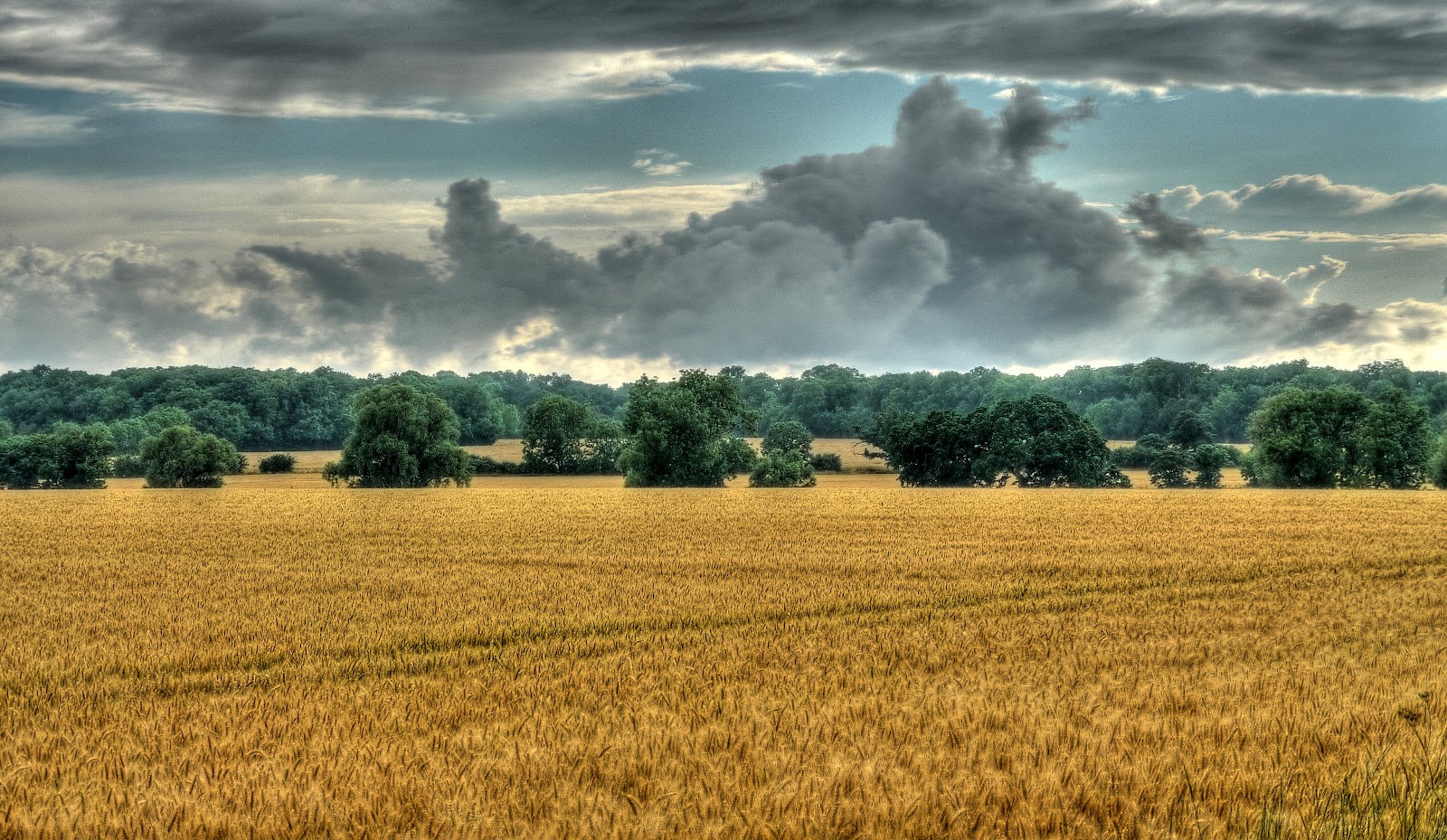
The dark clouds had lifted by now and there were a few blue patches appearing in the sky.

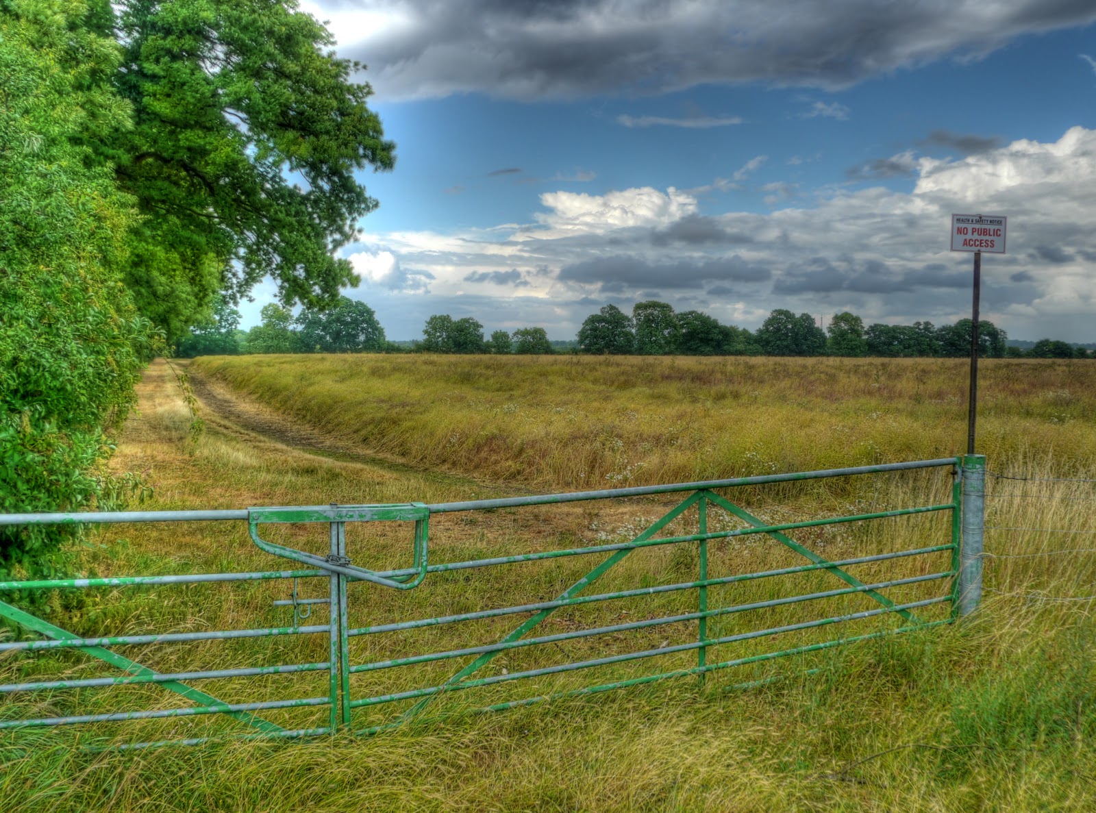
This picture and the last were taken from the same spot on the path. What intrigued me was the sign by the gate - NO PUBLIC ACCESS and above it "HEALTH & SAFETY NOTICE". I took the picture to remind myself to look at the map to see what exactly might require a H&S notice in a field - a deep lake, a sewage plant? A small plane also flew overhead, quite low as if it had just taken off. I am still not sure about the reason for H&S I did find the place where the plane took of from though - Common Farm or Northfield Farm depending upon the scale of map used - just off Long Road. Am I being cynical or is this a farmer misusing a sign to legitimately keep walkers off his fields. Now it could be that he shoots in the field from time to time, but Health and Safety. There is a footpath on the other side of the field in this picture (the other side of the far hedge) so this might be a method of stopping people taking a short-cut?
The path narrowed again - but not as bad as before and passed through a patch of trees - Starve Goose Plantation. The path dog-legged left then right through the trees - it was quite dark in the woods and I did find the tree roots a little tricky - to the point where I thought that I should have worn a cycle helmet - but I hung on and managed not to fall off. After Starve Goose Plantation the track is called Port Way before crossing Long Road and into another patch of woodland onto Whitwell Way where it passes the top of a Danger Area (there is a rifle range nearby.) The track passes Whitwell Farm and Whitwell Farm Cottages before Whitwell way becomes a road in Coton.

I carried on through Coton along The Footpath (aka the Harcamlow Way) a shared use path with a small bridge over the M11. There I passed a group of 12-15 riders who looked as if they might be heading the way I came from. They were quite a mixed group in terms of ages and bikes, a group of like-minded riders out for an evening spin perhaps. The path then becomes the Coton path - - I think I could get the hang of this path/road naming lark eventually. I stopped to take this picture of some of the newer University Buildings - I think the building in the middle is the Mott Building.

To complete my loop I cycled along Gilbert Road which has now been slated for safety improvements. This is the third time this week. On Tuesday I counted 13 vehicles parked in the "advisory" cycle lanes in the morning and 15 in the evening. Today there were also 15. I made sure to adopt an assertive position cycling along the road and pulled well out to overtake the parked cars, looking behind me of course. It felt a bit like I was in a pantomime exaggerating for effect - it works though.
This comment has been removed by a blog administrator.
ReplyDelete